View on map
© MapLibre | OpenStreetMap contributors
1%
2%
4%
6%
8%
10%
12%
15%
20%

Driesweg & Paashofweg from Dunberg

3.0
1 review/story | Elevation profile | 3 photos
Tips nearby
Driesweg & Paashofweg from Dunberg
transparant thumb
transparant thumb
transparant thumb
transparant thumb
transparant thumb
Your achievable time
Calculating based on your best performances...
Relaxed
Maximum
W/kg
W/kg
W/kg
Analyze your climbing performance
Detailed insight into your climbing performance & automatically check off climbs
Based on your best performances.
Your best attempt:
Number of attempts:
Elevation profile Driesweg & Paashofweg from Dunberg

Statistics

Difficulty points 18
Length 1.2 mi
Average gradient 2.5%
Steepest segment 8%
Total ascent 154 ft
Feedback about this climb?
Show climbs nearby Export to GPS device

Driesweg & Paashofweg from Dunberg is a climb in the region Hageland. It is 1.2 mi long and bridges 154 ft of vertical ascent with an average gradient of 2.5%, resulting in a difficulty score of 18. The top of the ascent is located at 308 ft above sea level. Climbfinder users shared 1 review/story of this climb and uploaded 3 photos.

Road names: Driesweg & Paashofweg
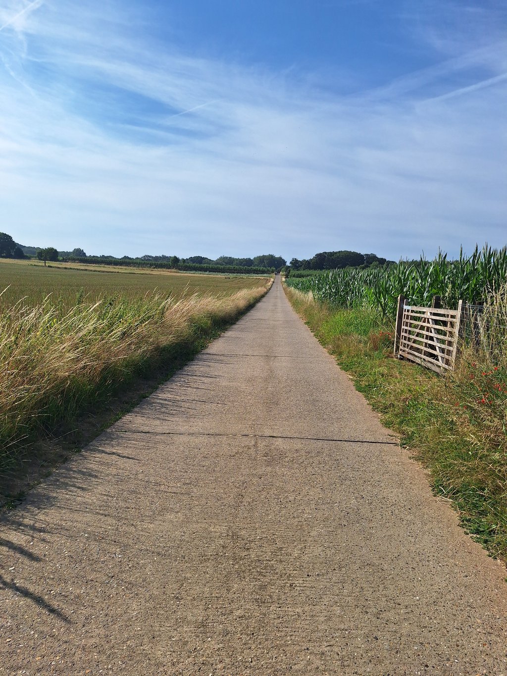
3.0 by Andre
This is an automatic translation, the original language is: Dutch.
Fairly long and pleasant climb. The hardest part is in the beginning when the road is quite steep and the road surface is quite rough and does not run well and with a headwind (south wind) it is a struggle. Once the steep part is done you can shake your legs a bit in a short downhill until you have to turn right at the t-junction and it goes uphill again in a beautiful environment where apart from a few hikers and cyclists you have the realm for yourself. This climb is on the cycling network an... read more

Photos (3)

Driesweg & Paashofweg from Dunberg
transparant thumb
transparant thumb
transparant thumb

Your uploads (max 4)

Welcome! Please activate your account if you would like to share something. Look for the verification email in your inbox.

If you want to upload your photos, you need to create an account. It only takes 1 minute and it's completely free.

  • Receive free climbfinder goodies for your reviews & photos.
  • Create a bucket list and check off conquered climbs.
  • Add missing climbs.
Continue with GoogleContinue with Google Continue with FacebookContinue with Facebook Continue with AppleContinue with Apple Sign up with email
By signing up you agree to our terms of service and confirm that you have read our privacy & content policy.

Reviews (1)

5.0
4.0
3.0
2.0
1.0
Andre
5 y 3.0
This is an automatic translation, the original language is: Dutch. Show original

Fairly long and pleasant climb. The hardest part is in the beginning when the road is quite steep and the road surface is quite rough and does not run well and with a headwind (south wind) it is a struggle.
Once the steep part is done you can shake your legs a bit in a short downhill until you have to turn right at the t-junction and it goes uphill again in a beautiful environment where apart from a few hikers and cyclists you have the realm for yourself. This climb is on the cycling network and the steep part is between node 20 and 66.

Tamelijke lange en aangename klim. Het zwaarste stuk zit hem in het begin dat aardig steil bergop gaat en het wegdek is tamelijk ruw en loopt niet goed en bij tegenwind ( zuidenwind ) is het harken en stoempen .
Eens het steile stuk gedaan is kan je de benen wat losschudden in een kort bergafje tot je aan de t-splitsing naar rechts moet en het weer rustig bergop loot in een mooie omgeving waar je buiten enkele wandelaars en fietsers het rijk voor jou alleen hebt. Deze beklimming ligt op het fietsknooppunten net en het steile deel is tussen knooppunt 20 en 66 .

Dashboard

Climbing times

5 mph 00:14:10
7 mph 00:10:01
9 mph 00:07:48
12 mph 00:05:52

Road surface condition

0% 100% 0%
Based on 1 vote
Share your knowledge. What was the road condition during your ascent?

Traffic

100% 0% 0%
Based on 1 vote
Your experience counts. How much traffic did you encounter during the climb?

Frequently Asked Questions

You don't need special gearing for Driesweg & Paashofweg from Dunberg. The slope isn't long or steep enough to require much shifting down. You can conquer this climb on power alone. However, a compact gearing system with a smallest front chainring of 34 and largest rear sprocket of 28 or 30 is always nice if you enjoy cycling uphill. This helps maintain a smooth cadence.

Driesweg & Paashofweg from Dunberg is not tough enough to be assigned a mountain category. This means that even untrained cyclists can reach the top without any problems on this climb.

Driesweg & Paashofweg from Dunberg is 1.2 mi long.

The average gradient of Driesweg & Paashofweg from Dunberg is 2.5%.

Driesweg & Paashofweg from Dunberg has a steepest segment with an average gradient of 8%.

The summit of Driesweg & Paashofweg from Dunberg is at 308 ft.

At a slow pace of 5 mph, it takes about 00:14:10 to climb Driesweg & Paashofweg from Dunberg. At 7 mph the time is 00:10:01, and at 9 mph 00:07:48. For the fastest cyclists, 00:05:52 is an achievable time.

Driesweg & Paashofweg from Dunberg is located in the region Flemish Brabant in Belgium.

This page is better in the app

Climbfinder app
Climbfinder
(Free)
Open