View on map
© MapLibre | OpenStreetMap contributors
1%
2%
4%
6%
8%
10%
12%
15%
20%

Côte d'Olincthun from Rupembert

2.0
3 reviews | Elevation profile | 5 photos
Tips nearby
Côte d'Olincthun from Rupembert
transparant thumb
transparant thumb
transparant thumb
Your achievable time
Calculating based on your best performances...
Relaxed
Maximum
W/kg
W/kg
W/kg
Analyze your climbing performance
Detailed insight into your climbing performance & automatically check off climbs
Based on your best performances.
Your best attempt:
Number of attempts:
Elevation profile Côte d'Olincthun from Rupembert

Statistics

Difficulty points 21
Length 0.2 mi
Average gradient 7.5%
Steepest segment 12.5%
Total ascent 79 ft
Feedback about this climb?
Show climbs nearby Export to GPS device

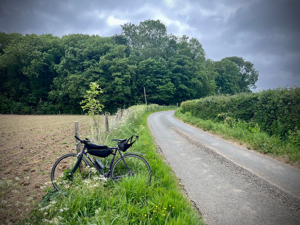
Côte d'Olincthun from Rupembert is a climb in the region Caps et Marais d'Opale. It is 0.2 mi long and bridges 79 ft of vertical ascent with an average gradient of 7.5%, resulting in a difficulty score of 21. The top of the ascent is located at 312 ft above sea level. Climbfinder users shared 3 reviews of this climb and uploaded 5 photos.

Road names: Route d'Olincthun
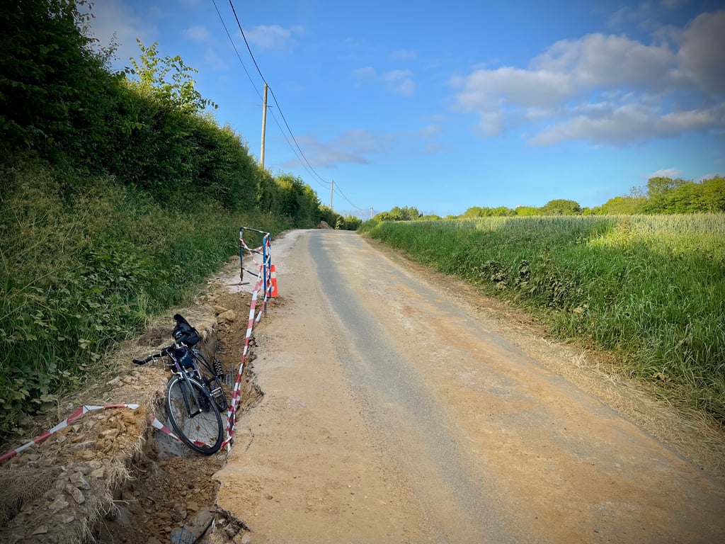
2.0 by Cromagnon
This is an automatic translation, the original language is: French.
Back to the little lump trying to intimidate us with its 12%. The trouble is, it can't hold them for very long.... What's more, the road is now under construction, so it's littered with gravel.... read more

Photos (5)

Côte d'Olincthun from Rupembert
transparant thumb

Your uploads (max 4)

Welcome! Please activate your account if you would like to share something. Look for the verification email in your inbox.

If you want to upload your photos, you need to create an account. It only takes 1 minute and it's completely free.

  • Receive free climbfinder goodies for your reviews & photos.
  • Create a bucket list and check off conquered climbs.
  • Add missing climbs.
Continue with GoogleContinue with Google Continue with FacebookContinue with Facebook Continue with AppleContinue with Apple Sign up with email
By signing up you agree to our terms of service and confirm that you have read our privacy & content policy.

Reviews (3)

5.0
4.0
3.0
2.0
1.0
Cromagnon
1 y 2.0
This is an automatic translation, the original language is: French. Show original

Back to the little lump trying to intimidate us with its 12%.
The trouble is, it can't hold them for very long....
What's more, the road is now under construction, so it's littered with gravel.

Retour sur la petite bosse qui essaie de nous intimider avec ses 12%.
Le souci c’est qu’elle ne parvient pas à les tenir bien longtemps…
De plus, la route est désormais en travaux, donc jonchée de gravillons.

Côte d'Olincthun from Rupembert
Dashboard
Cromagnon
1 y 2.0
This is an automatic translation, the original language is: French. Show original

In Rupembert, we learn that there is a milk route. In Rupembert, we learn that Rupembert is on this milk route. Sometimes I think things are done well. What other route could Rupembert have been on?
This climb is really short but it tries to impress us with 12%.
It quickly runs out of steam.
Well, what more is there to say? I confess I don't know...

À Rupembert, on apprend qu’il existe une route du lait. À Rupembert, on apprend que Rupembert figure sur cette route du lait. Parfois, je me dis que les choses sont bien faites. Sur quelle autre route aurait-on pu placer Rupembert ?
Cette montée est vraiment courte mais elle tente de nous impressionner avec du 12%.
Elle s’essouffle vite.
Bon, que dire de plus ? J’avoue que je ne sais pas…

Côte d'Olincthun from Rupembert
Dashboard
Leon
4 y 2.0
This is an automatic translation, the original language is: Dutch. Show original

Nice little mountain sprint. Nothing more and nothing less. You don't ride a special detour, but it is a nice little hill to test your explosiveness.

Kort leuk bergsprintje. Niks meer en niks minder. Je rijdt er niet speciaal voor om, maar het is best een geinig heuveltje om je explosiviteit eens uit te testen.

Dashboard

Climbing times

5 mph 00:02:24
7 mph 00:01:42
9 mph 00:01:19
12 mph 00:01:00

Road surface condition

100% 0% 0%
Based on 1 vote
Share your knowledge. What was the road condition during your ascent?

Traffic

100% 0% 0%
Based on 1 vote
Your experience counts. How much traffic did you encounter during the climb?

Frequently Asked Questions

You don't need special gearing for Côte d'Olincthun from Rupembert. The slope isn't long or steep enough to require much shifting down. You can conquer this climb on power alone. However, a compact gearing system with a smallest front chainring of 34 and largest rear sprocket of 28 or 30 is always nice if you enjoy cycling uphill. This helps maintain a smooth cadence.

Côte d'Olincthun from Rupembert is not tough enough to be assigned a mountain category. This means that even untrained cyclists can reach the top without any problems on this climb.

Côte d'Olincthun from Rupembert is 0.2 mi long.

The average gradient of Côte d'Olincthun from Rupembert is 7.5%.

Côte d'Olincthun from Rupembert has a steepest segment with an average gradient of 12.5%.

The summit of Côte d'Olincthun from Rupembert is at 312 ft.

At a slow pace of 5 mph, it takes about 00:02:24 to climb Côte d'Olincthun from Rupembert. At 7 mph the time is 00:01:42, and at 9 mph 00:01:19. For the fastest cyclists, 00:01:00 is an achievable time.

Côte d'Olincthun from Rupembert is located in the region Caps et Marais d'Opale in France.

This page is better in the app

Climbfinder app
Climbfinder
(Free)
Open