View on map
© MapLibre | OpenStreetMap contributors
1%
2%
4%
6%
8%
10%
12%
15%
20%

Côte de Solières

2.2
5 reviews | Elevation profile | 0 photos
Your achievable time
Calculating based on your best performances...
Relaxed
Maximum
W/kg
W/kg
W/kg
Analyze your climbing performance
Detailed insight into your climbing performance & automatically check off climbs
Based on your best performances.
Your best attempt:
Number of attempts:
Elevation profile Côte de Solières

Statistics

Difficulty points 42
Length 1 mi
Average gradient 4.7%
Steepest segment 7.3%
Total ascent 259 ft
Feedback about this climb?
Show climbs nearby Export to GPS device

Côte de Solières is a climb in the region Valleys of the Meuse, Sambre and Orneau. It is 1 mi long and bridges 259 ft of vertical ascent with an average gradient of 4.7%, resulting in a difficulty score of 42. The top of the ascent is located at 781 ft above sea level. Climbfinder users shared 5 reviews of this climb and uploaded 0 photos.

Road name: Rue Eugène Malherbe

2.0 by Vortexus67
This is an automatic translation, the original language is: French.
Horrible road with windy areas, but it's great to do!... read more

Photos (0)

transparant thumb
transparant thumb
transparant thumb
transparant thumb
transparant thumb
transparant thumb

Your uploads (max 4)

Welcome! Please activate your account if you would like to share something. Look for the verification email in your inbox.

If you want to upload your photos, you need to create an account. It only takes 1 minute and it's completely free.

  • Receive free climbfinder goodies for your reviews & photos.
  • Create a bucket list and check off conquered climbs.
  • Add missing climbs.
Continue with GoogleContinue with Google Continue with FacebookContinue with Facebook Continue with AppleContinue with Apple Sign up with email
By signing up you agree to our terms of service and confirm that you have read our privacy & content policy.

Reviews (5)

5.0
4.0
3.0
2.0
1.0
Vortexus67
1 Mo 2.0 via the Climbfinder app
This is an automatic translation, the original language is: French. Show original

Horrible road with windy areas, but it's great to do!

Route horrible avec zone assez exposé au vent mais est cependant chouette a réalisé

Dashboard
LarsG13
9 Mo 3.0
This is an automatic translation, the original language is: Dutch. Show original

Road is not equally good everywhere but is not too bad, climb is doable and has no real outliers.

Weg ligt niet overal even goed, maar is niet al te slecht, klim is goed te doen en heeft geen echte uitschieters.

Dashboard
gaugau7
11 Mo 3.0
This is an automatic translation, the original language is: French. Show original

Not a very difficult climb, but the surface is in poor condition. Despite this, it is also included in the Cotacol ranking.

Ascension pas très difficile, mais avec un revêtement en mauvais état. malgré tout, elle est aussi reprise dans le classement des Cotacol

Dashboard
Sun7Night
1 y 1.0 00:08:41 (7.2 mph)
This is an automatic translation, the original language is: French. Show original

I don't recommend this coast because :
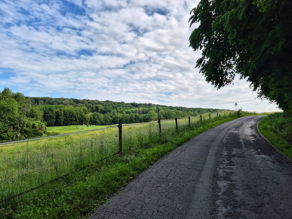
the road surface is terrible
if you have the wind in your face, because it's in a nowhere protected area
and the gradients are really not crazy

Je ne recommande pas cette côte car :
le revêtements de la route est exécrable
car si vous avez le vents de face car c'est dans un endroit nulle part protégée
et les pourcentages ne sont vraiment pas fou

Dashboard
gille01
2 y 2.0
This is an automatic translation, the original language is: Dutch. Show original

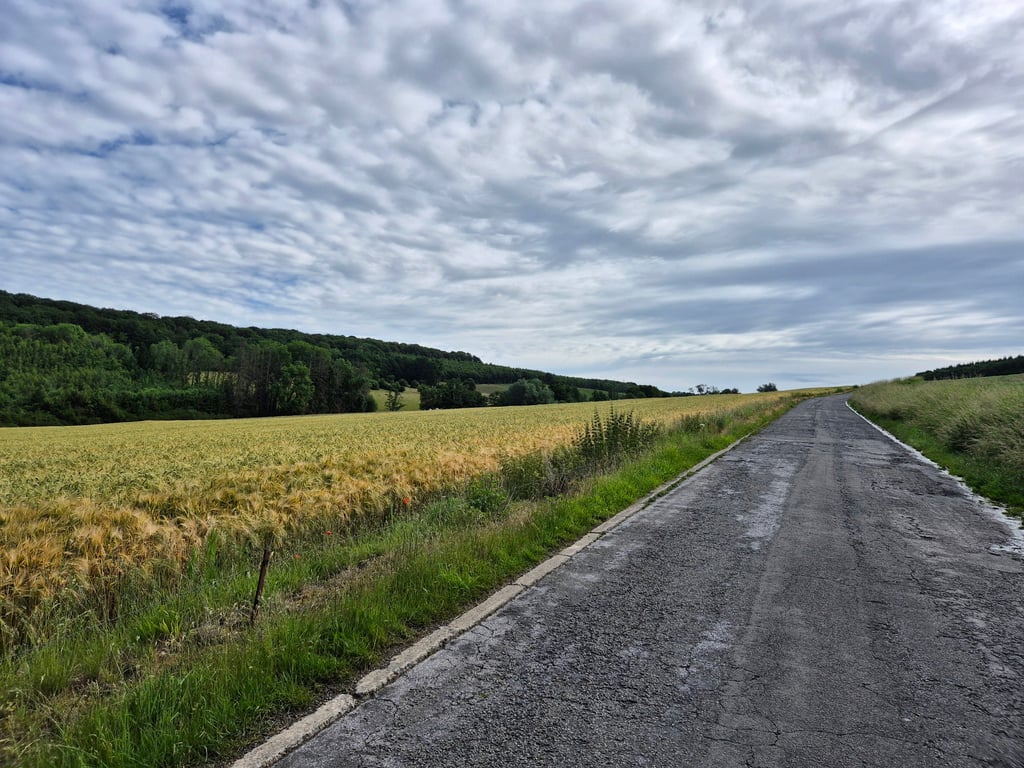
I definitely do not recommend this climb. It really is a rotten thing that doesn't run at all. Nowhere does it get steep but the
road surface is abominable!

Ik raad deze klim zeker niet aan. Het is echt een rotding dat voor geen meter loopt. Steil wordt het nergens maar het
wegdek is abominabel!

Dashboard

Climbing times

5 mph 00:12:35
7 mph 00:08:54
9 mph 00:06:56
12 mph 00:05:13

Road surface condition

0% 0% 100%
Based on 1 vote
Share your knowledge. What was the road condition during your ascent?

Traffic

100% 0% 0%
Based on 1 vote
Your experience counts. How much traffic did you encounter during the climb?

Frequently Asked Questions

Côte de Solières can be cycled from 2 sides. Roupiamont / Bois de Grand Henimont via La Sarte à Ben is the most popular side, but the summit can also be reached via Côte de Solières.

You don't need special gearing for Côte de Solières. The slope isn't long or steep enough to require much shifting down. You can conquer this climb on power alone. However, a compact gearing system with a smallest front chainring of 34 and largest rear sprocket of 28 or 30 is always nice if you enjoy cycling uphill. This helps maintain a smooth cadence.

Côte de Solières falls into the 5th category. With good fitness, you can ride it up with speed and power. If you have less training, shift down and climb smoothly.

Côte de Solières is 1 mi long.

The average gradient of Côte de Solières is 4.7%.

Côte de Solières has a steepest segment with an average gradient of 7.3%.

The summit of Côte de Solières is at 781 ft.

At a slow pace of 5 mph, it takes about 00:12:35 to climb Côte de Solières. At 7 mph the time is 00:08:54, and at 9 mph 00:06:56. For the fastest cyclists, 00:05:13 is an achievable time.

Côte de Solières is located in the region Namur Province in Belgium.

This page is better in the app

Climbfinder app
Climbfinder
(Free)
Open