View on map
© MapLibre | OpenStreetMap contributors
1%
2%
4%
6%
8%
10%
12%
15%
20%

Côte de Saive

3.0
1 review/story | Elevation profile | 4 photos
Tips nearby
Côte de Saive
Côte de Saive
Côte de Saive
Côte de Saive
transparant thumb
transparant thumb
transparant thumb
transparant thumb
Your achievable time
Calculating based on your best performances...
Relaxed
Maximum
W/kg
W/kg
W/kg
Analyze your climbing performance
Detailed insight into your climbing performance & automatically check off climbs
Based on your best performances.
Your best attempt:
Number of attempts:
Elevation profile Côte de Saive

Statistics

Difficulty points 18
Length 0.6 mi
Average gradient 3.8%
Steepest segment 6%
Total ascent 128 ft
Feedback about this climb?
Show climbs nearby Export to GPS device

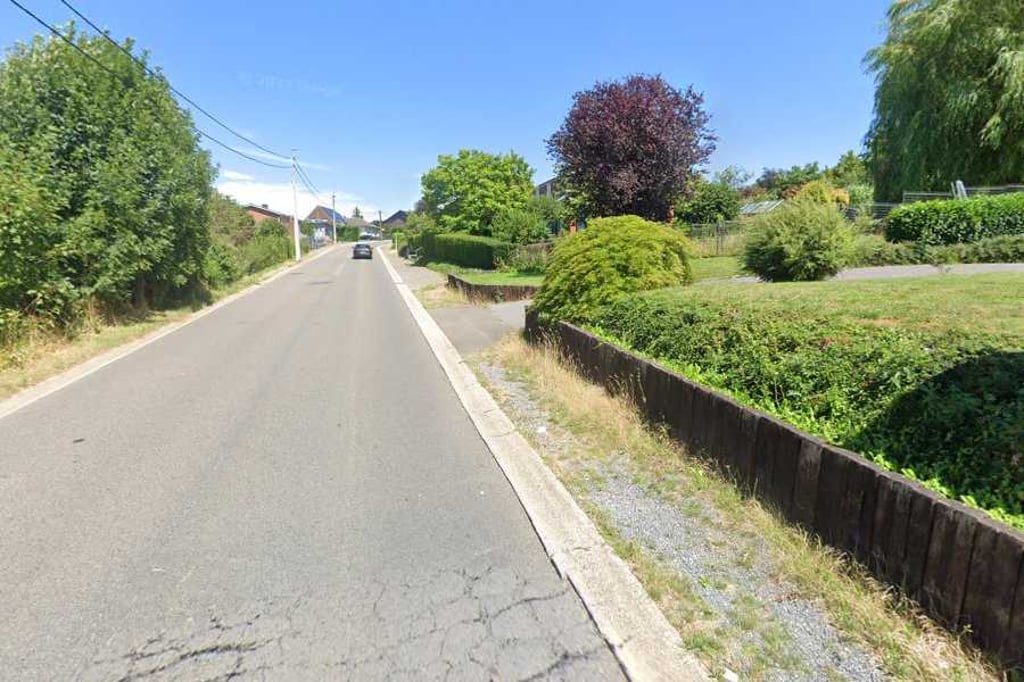
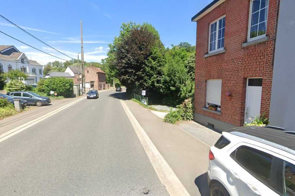
Côte de Saive is a climb in the region Pays de Herve. It is 0.6 mi long and bridges 128 ft of vertical ascent with an average gradient of 3.8%, resulting in a difficulty score of 18. The top of the ascent is located at 607 ft above sea level. Climbfinder users shared 1 review/story of this climb and uploaded 4 photos.

Road name: Rue sur les Heids

3.0 by BikerJohan
This is an automatic translation, the original language is: Dutch.
Not too difficult one-kilometre climb from Saive to Barchon. You first descend from Saive into the La Julienne valley after which the climb begins. The first part goes up in a tight gradient. Then it flattens out to false flat until the top. You ride alternately between buildings and open fields. Just before the roundabout on the south side of the E40 motorway, you are at the top.... read more

Photos (4)

Côte de Saive
Côte de Saive
Côte de Saive
Côte de Saive
transparant thumb
transparant thumb

Your uploads (max 4)

Welcome! Please activate your account if you would like to share something. Look for the verification email in your inbox.

If you want to upload your photos, you need to create an account. It only takes 1 minute and it's completely free.

  • Receive free climbfinder goodies for your reviews & photos.
  • Create a bucket list and check off conquered climbs.
  • Add missing climbs.
Continue with GoogleContinue with Google Continue with FacebookContinue with Facebook Continue with AppleContinue with Apple Sign up with email
By signing up you agree to our terms of service and confirm that you have read our privacy & content policy.

Reviews (1)

5.0
4.0
3.0
2.0
1.0
BikerJohan
1 y 3.0
This is an automatic translation, the original language is: Dutch. Show original

Not too difficult one-kilometre climb from Saive to Barchon. You first descend from Saive into the La Julienne valley after which the climb begins. The first part goes up in a tight gradient. Then it flattens out to false flat until the top. You ride alternately between buildings and open fields. Just before the roundabout on the south side of the E40 motorway, you are at the top.

Niet te moeilijke klim van een kilometer vanuit Saive naar Barchon. Je daalt van uit Saive eerst een stuk af naar het dal van La Julienne waarna de klim begint. Het eerste deel loopt in een strak stijgingspercentage omhoog. Daarna vlakt het tot de top af naar vals plat. Je rijdt afwisselend tussen bebouwing en open veld. Vlak voor de rotonde aan de zuidkant van de E40 ben je op de top.

Dashboard

Climbing times

5 mph 00:07:42
7 mph 00:05:27
9 mph 00:04:14
12 mph 00:03:11

Road surface condition

0% 0% 0%
Based on 0 votes
Share your knowledge. What was the road condition during your ascent?

Traffic

0% 0% 0%
Based on 0 votes
Your experience counts. How much traffic did you encounter during the climb?

Frequently Asked Questions

Côte de Saive can be cycled from 3 sides. Chefneux via Rue de Légipont is the most popular side, but the summit can also be reached via Côte de Saive & Barchon via Rue Justin Sauvenier.

You don't need special gearing for Côte de Saive. The slope isn't long or steep enough to require much shifting down. You can conquer this climb on power alone. However, a compact gearing system with a smallest front chainring of 34 and largest rear sprocket of 28 or 30 is always nice if you enjoy cycling uphill. This helps maintain a smooth cadence.

Côte de Saive is not tough enough to be assigned a mountain category. This means that even untrained cyclists can reach the top without any problems on this climb.

Côte de Saive is 0.6 mi long.

The average gradient of Côte de Saive is 3.8%.

Côte de Saive has a steepest segment with an average gradient of 6%.

The summit of Côte de Saive is at 607 ft.

At a slow pace of 5 mph, it takes about 00:07:42 to climb Côte de Saive. At 7 mph the time is 00:05:27, and at 9 mph 00:04:14. For the fastest cyclists, 00:03:11 is an achievable time.

Côte de Saive is located in the region Liège Province in Belgium.

This page is better in the app

Climbfinder app
Climbfinder
(Free)
Open