View on map
© MapLibre | OpenStreetMap contributors
1%
2%
4%
6%
8%
10%
12%
15%
20%

Côte de Saint-Salvayre from Alet-les-Bains

5.0
1 review/story | Elevation profile | 3 photos
Tips nearby
Côte de Saint-Salvayre from Alet-les-Bains
transparant thumb
transparant thumb
transparant thumb
transparant thumb
transparant thumb
Your achievable time
Calculating based on your best performances...
Relaxed
Maximum
W/kg
W/kg
W/kg
Analyze your climbing performance
Detailed insight into your climbing performance & automatically check off climbs
Based on your best performances.
Your best attempt:
Number of attempts:
Elevation profile Côte de Saint-Salvayre from Alet-les-Bains

Statistics

Difficulty points 511
Length 6.4 mi
Average gradient 6.2%
Steepest segment 10.8%
Total ascent 2100 ft

Short recap

6 hairpin turns
#11 toughest climb of Aude
#17 most elevation gain of Aude
#36 longest climb of Aude
#73 average steepest climb of Aude
Feedback about this climb?
Show climbs nearby Export to GPS device

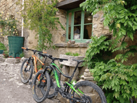
Côte de Saint-Salvayre from Alet-les-Bains is a climb in the region Aude. It is 6.4 mi long and bridges 2100 ft of vertical ascent with an average gradient of 6.2%, resulting in a difficulty score of 511. The top of the ascent is located at 2628 ft above sea level. Climbfinder users shared 1 review/story of this climb and uploaded 3 photos.

Road names: Rue de l'Ancienne Mairie, Rue Calvière, Chemin de Ronde & Chemin de Saint-Salvaire
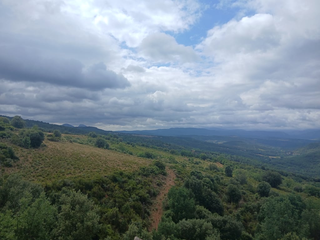
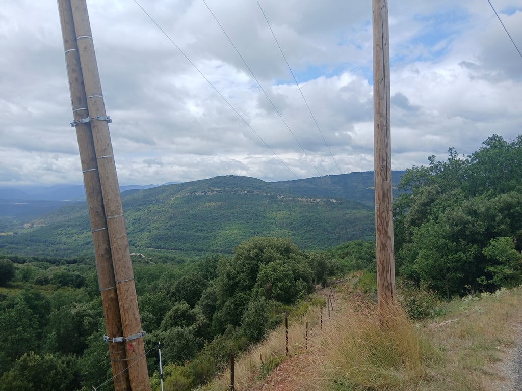
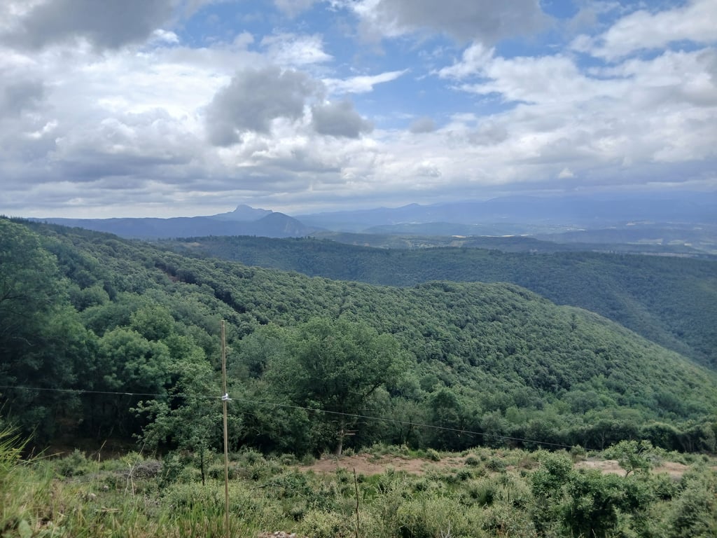
This is an automatic translation, the original language is: French.
A fairly long, steep climb, but with magnificent scenery and a 360-degree view of the Aude'a must-do, with very little traffic and a road in good condition.... read more

Photos (3)

Côte de Saint-Salvayre from Alet-les-Bains
transparant thumb
transparant thumb
transparant thumb

Your uploads (max 4)

Welcome! Please activate your account if you would like to share something. Look for the verification email in your inbox.

If you want to upload your photos, you need to create an account. It only takes 1 minute and it's completely free.

  • Receive free climbfinder goodies for your reviews & photos.
  • Create a bucket list and check off conquered climbs.
  • Add missing climbs.
Continue with GoogleContinue with Google Continue with FacebookContinue with Facebook Continue with AppleContinue with Apple Sign up with email
By signing up you agree to our terms of service and confirm that you have read our privacy & content policy.

Reviews (1)

5.0
4.0
3.0
2.0
1.0
Antoine_Forcellini
10 Mo 5.0
This is an automatic translation, the original language is: French. Show original

A fairly long, steep climb, but with magnificent scenery and a 360-degree view of the Aude'a must-do, with very little traffic and a road in good condition.

Un ascension assez longue plutôt raide mais avec un paysage magnifique une vue à 360 degrés sur l'Aude à faire absolument, très peu de circulation et une route en bon état.

Côte de Saint-Salvayre from Alet-les-Bains
Dashboard

Climbing times

5 mph 01:17:44
7 mph 00:55:02
9 mph 00:42:53
12 mph 00:32:13

Road surface condition

0% 100% 0%
Based on 1 vote
Share your knowledge. What was the road condition during your ascent?

Traffic

100% 0% 0%
Based on 1 vote
Your experience counts. How much traffic did you encounter during the climb?

Frequently Asked Questions

Côte de Saint-Salvayre can be cycled from 3 sides. Côte de Saint-Salvayre from Alet-les-Bains is the most popular side, but the summit can also be reached via Côte du Planditou from Château de Belcastel & Côte du Planditou from Missègre.

Côte de Saint-Salvayre from Alet-les-Bains is a challenging ascent. For this type of climbing, we recommend mountain gearing, specifically a compact system. This means a small front chainring of 34 teeth, combined with a rear cassette where, depending on your level, strength, and experience, you choose a sprocket with 30, 32, or even 34 teeth. Remember that a smooth cadence is always more efficient!

Côte de Saint-Salvayre from Alet-les-Bains is a serious climb and falls into the 2nd category. With a good basic fitness level, even without much cycling experience, you can complete this climb just fine. However, a bike with climbing gears is a must. Without experience or training, it will be really tough – but that’s part of the challenge!

Côte de Saint-Salvayre from Alet-les-Bains is 6.4 mi long.

The average gradient of Côte de Saint-Salvayre from Alet-les-Bains is 6.2%.

Côte de Saint-Salvayre from Alet-les-Bains has a steepest segment with an average gradient of 10.8%.

The summit of Côte de Saint-Salvayre from Alet-les-Bains is at 2628 ft.

At a slow pace of 5 mph, it takes about 01:17:44 to climb Côte de Saint-Salvayre from Alet-les-Bains. At 7 mph the time is 00:55:02, and at 9 mph 00:42:53. For the fastest cyclists, 00:32:13 is an achievable time.

Côte de Saint-Salvayre from Alet-les-Bains is located in the region Aude in France.

This page is better in the app

Climbfinder app
Climbfinder
(Free)
Open