View on map
© MapLibre | OpenStreetMap contributors
1%
2%
4%
6%
8%
10%
12%
15%
20%

Côte de Manhay

2.5
2 reviews | Elevation profile | 1 photo
Tips nearby
Côte de Manhay
transparant thumb
transparant thumb
transparant thumb
transparant thumb
transparant thumb
transparant thumb
transparant thumb
Your achievable time
Calculating based on your best performances...
Relaxed
Maximum
W/kg
W/kg
W/kg
Analyze your climbing performance
Detailed insight into your climbing performance & automatically check off climbs
Based on your best performances.
Your best attempt:
Number of attempts:
Elevation profile Côte de Manhay

Statistics

Difficulty points 38
Length 1.2 mi
Average gradient 4.1%
Steepest segment 5.9%
Total ascent 266 ft
Feedback about this climb?
Show climbs nearby Export to GPS device

Côte de Manhay is a climb in the region Heart of the Ardennes. It is 1.2 mi long and bridges 266 ft of vertical ascent with an average gradient of 4.1%, resulting in a difficulty score of 38. The top of the ascent is located at 1719 ft above sea level. Climbfinder users shared 2 reviews of this climb and uploaded 1 photo.

Road names: N30 & Bellaire
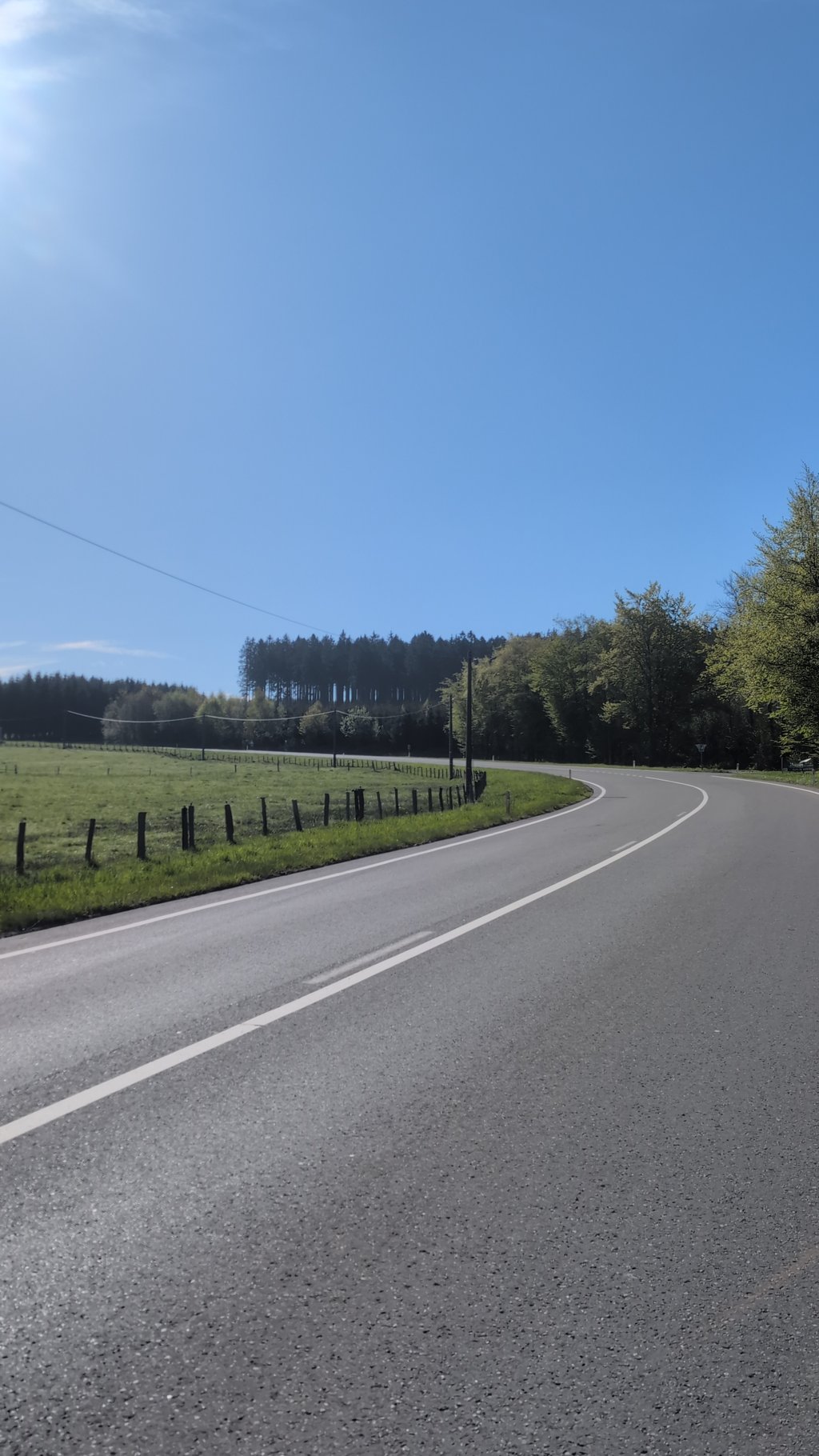
This is an automatic translation, the original language is: Dutch.
7/10 A nice climb because you look so nicely over the meadows. The road surface is good but it is an N road. Fine to ride :)... read more

Photos (1)

Côte de Manhay
transparant thumb
transparant thumb
transparant thumb
transparant thumb
transparant thumb

Your uploads (max 4)

Welcome! Please activate your account if you would like to share something. Look for the verification email in your inbox.

If you want to upload your photos, you need to create an account. It only takes 1 minute and it's completely free.

  • Receive free climbfinder goodies for your reviews & photos.
  • Create a bucket list and check off conquered climbs.
  • Add missing climbs.
Continue with GoogleContinue with Google Continue with FacebookContinue with Facebook Continue with AppleContinue with Apple Sign up with email
By signing up you agree to our terms of service and confirm that you have read our privacy & content policy.

Reviews (2)

5.0
4.0
3.0
2.0
1.0
JurneSleddens
1 Mo 3.0
This is an automatic translation, the original language is: Dutch. Show original

7/10 A nice climb because you look so nicely over the meadows. The road surface is good but it is an N road. Fine to ride :)

7/10 Een mooie beklimming omdat je zo mooi over de weides kijkt. Het wegdek is goed maar het is wel een N-weg. Fijn om te rijden :)

Côte de Manhay
Dashboard
_superver
1 y 2.0
This is an automatic translation, the original language is: Dutch. Show original

This cote is another climb located on the major provincial road N30. Having previously climbed out of the Ambleve valley near Aywaille via the Cote de Werbomont, we now continued our climb from Manhay. The Werbomont brought us into this village, famous for its war museum and accompanying tank. The road is again in good condition but can be slightly crowded. Apart from that, car traffic is polite. People do know cyclists here. Apart from the crowds, it is pleasant riding through the forest with occasional nice views of the Ardennes.

In Liège Bastogne Liège, this is obviously not a significant slope, but for the ordinary cycling tourist, with the other cote's already in the legs, it is quite an effort anyway. The constant ascent may already create some desire for a small refreshment, which we will encounter on the Baraqe Fraiture.

Deze cote is wederom een beklimming gelegen op de grote provinciale weg N30. Na eerder al het dal van de Ambleve bij Aywaille te zijn uitgeklommen via de Cote de Werbomont, vervolgen we onze beklimming nu vanuit Manhay. De Werbomont bracht ons in dit dorpje, bekend om zijn oorlogsmuseum en bijbehorende tank. De weg is wederom in goede staat maar kan enigszins druk zijn. Los daarvan is het autoverkeer beleefd. Men kent de fietsers hier wel. Afgezien van de drukte is het aangenaam door het bos rijden met zo nu en dan een mooi uitzicht over de Ardennen.

In Luik Bastenaken Luik is dit uiteraard geen helling van betekenis, maar voor de gewone wielertoerist is het met de andere cote's al in de benen toch al een behoorlijke inspanning. Door de constante stijging kan er al enig verlangen ontstaan naar een kleine versnapering, die we tegen zullen komen op het Baraqe Fraiture.

Dashboard

Climbing times

5 mph 00:14:57
7 mph 00:10:35
9 mph 00:08:15
12 mph 00:06:11

Road surface condition

100% 0% 0%
Based on 1 vote
Share your knowledge. What was the road condition during your ascent?

Traffic

0% 100% 0%
Based on 1 vote
Your experience counts. How much traffic did you encounter during the climb?

Frequently Asked Questions

Côte de Manhay can be cycled from 3 sides. Côte de Manhay is the most popular side, but the summit can also be reached via Côte de Manhay via Sur les Famis & Côte de Malempré from Malempré.

You don't need special gearing for Côte de Manhay. The slope isn't long or steep enough to require much shifting down. You can conquer this climb on power alone. However, a compact gearing system with a smallest front chainring of 34 and largest rear sprocket of 28 or 30 is always nice if you enjoy cycling uphill. This helps maintain a smooth cadence.

Côte de Manhay falls into the 5th category. With good fitness, you can ride it up with speed and power. If you have less training, shift down and climb smoothly.

Côte de Manhay is 1.2 mi long.

The average gradient of Côte de Manhay is 4.1%.

Côte de Manhay has a steepest segment with an average gradient of 5.9%.

The summit of Côte de Manhay is at 1719 ft.

At a slow pace of 5 mph, it takes about 00:14:57 to climb Côte de Manhay. At 7 mph the time is 00:10:35, and at 9 mph 00:08:15. For the fastest cyclists, 00:06:11 is an achievable time.

Côte de Manhay is located in the region Heart of the Ardennes in Belgium.

This page is better in the app

Climbfinder app
Climbfinder
(Free)
Open