View on map
© MapLibre | OpenStreetMap contributors
1%
2%
4%
6%
8%
10%
12%
15%
20%

Côte de Gaillarmont from Chênée

1.7
3 reviews | Elevation profile | 4 photos
Tips nearby
Côte de Gaillarmont from Chênée
transparant thumb
transparant thumb
transparant thumb
transparant thumb
Your achievable time
Calculating based on your best performances...
Relaxed
Maximum
W/kg
W/kg
W/kg
Analyze your climbing performance
Detailed insight into your climbing performance & automatically check off climbs
Based on your best performances.
Your best attempt:
Number of attempts:
Elevation profile Côte de Gaillarmont from Chênée

Statistics

Difficulty points 79
Length 1.6 mi
Average gradient 5%
Steepest segment 10.5%
Total ascent 430 ft
Feedback about this climb?
Show climbs nearby Export to GPS device

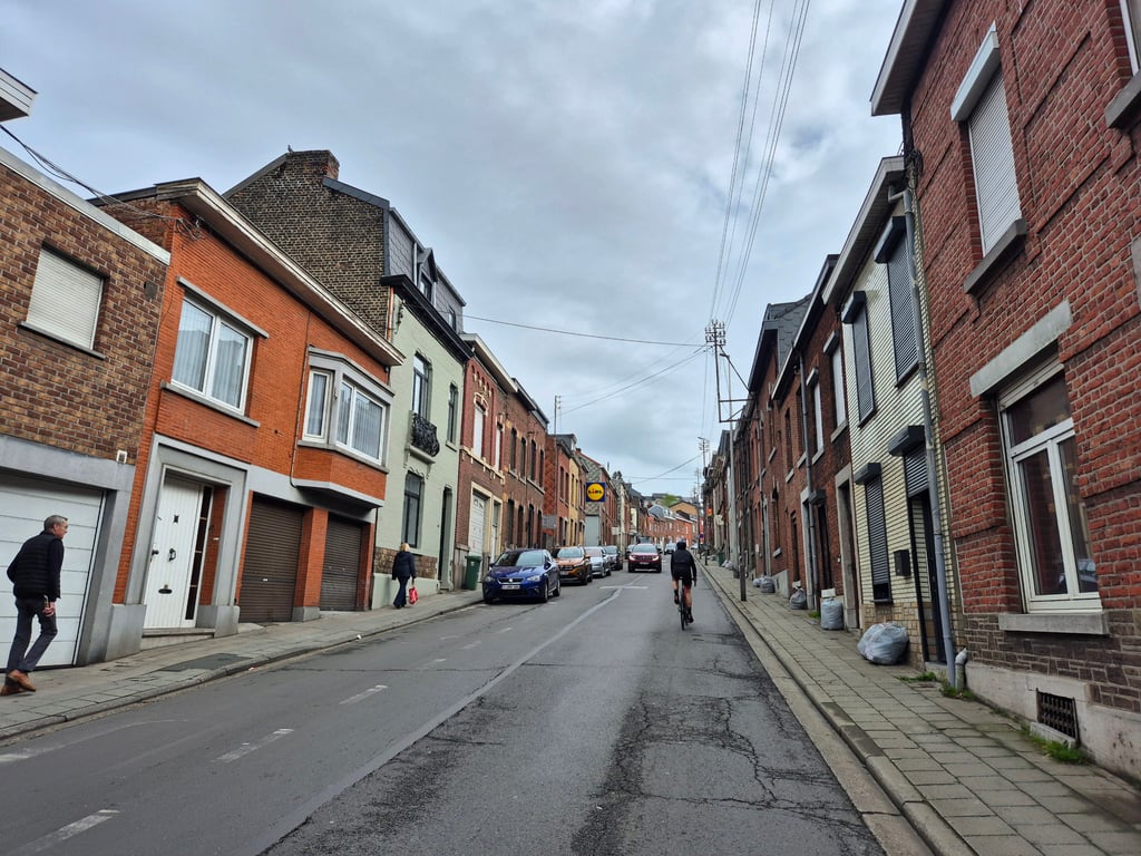
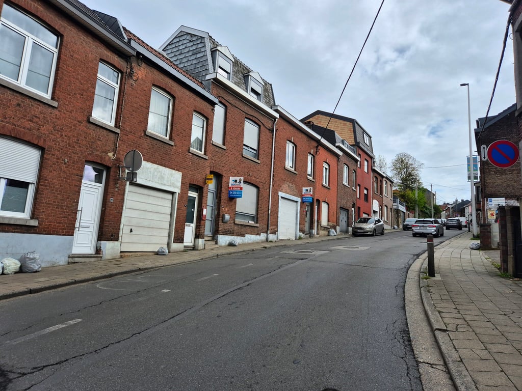
Côte de Gaillarmont from Chênée is a climb in the region Pays de Herve. It is 1.6 mi long and bridges 430 ft of vertical ascent with an average gradient of 5%, resulting in a difficulty score of 79. The top of the ascent is located at 656 ft above sea level. Climbfinder users shared 3 reviews of this climb and uploaded 4 photos.

Road names: Rue Neuve, Rue de Gaillarmont & Rue Sur L'Ile
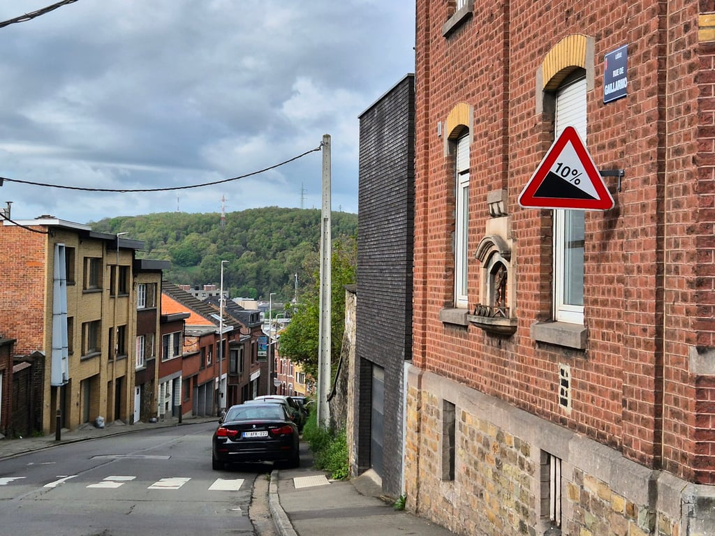
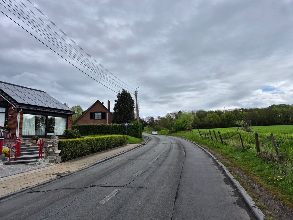
2.0 by Jarin
This is an automatic translation, the original language is: Dutch.
The first steep section ticks 10%, but after an initial larger junction, the climb then flattens out. This is a busy thoroughfare, so there are nicer alternatives to get to Beyne-Heusay. Cotacol collectors, however, will thus have to conquer this climb (#162) anyway. Fortunately, it gets a little more rural and quiet at the top.... read more

Photos (4)

Côte de Gaillarmont from Chênée
transparant thumb
transparant thumb

Your uploads (max 4)

Welcome! Please activate your account if you would like to share something. Look for the verification email in your inbox.

If you want to upload your photos, you need to create an account. It only takes 1 minute and it's completely free.

  • Receive free climbfinder goodies for your reviews & photos.
  • Create a bucket list and check off conquered climbs.
  • Add missing climbs.
Continue with GoogleContinue with Google Continue with FacebookContinue with Facebook Continue with AppleContinue with Apple Sign up with email
By signing up you agree to our terms of service and confirm that you have read our privacy & content policy.

Reviews (3)

5.0
4.0
3.0
2.0
1.0
Jarin
1 Mo 2.0 via the Climbfinder app
This is an automatic translation, the original language is: Dutch. Show original

The first steep section ticks 10%, but after an initial larger junction, the climb then flattens out. This is a busy thoroughfare, so there are nicer alternatives to get to Beyne-Heusay. Cotacol collectors, however, will thus have to conquer this climb (#162) anyway. Fortunately, it gets a little more rural and quiet at the top.

Het eerste steile stuk tikt 10% aan, maar na een eerste grotere kruising vlakt de klim daarna af. Het betreft een drukke verkeersader, dus er zijn mooiere alternatieven om naar Beyne-Heusay te komen. Cotacol-verzamelaars zullen deze klim (#162) echter dus toch moeten bedwingen. Gelukkig wordt het aan de top wat landelijker en rustiger.

Côte de Gaillarmont from Chênée
Dashboard
JurneSleddens
10 Mo 1.0
This is an automatic translation, the original language is: Dutch. Show original

Steep start, ugly surroundings and therefore not recommended. But then again, climbing in Liege is not always pretty hehe ;)

Steil begin, lelijke omgeving en daardoor geen aanrader. Maarja klimmen in Luik is niet altijd fraai he ;)

Dashboard
Tryphon_04
2 y 2.0
This is an automatic translation, the original language is: French. Show original

It's an uninteresting climb, with lots of cars and a straight road, and the gradients are nothing special.

C'est une montée sans grand intérêt, il y a pas mal de voitures et la route est rectiligne, les pourcentages n'ont, eux n'ont plus, rien d'exceptionnel.

Dashboard

Climbing times

5 mph 00:19:45
7 mph 00:13:59
9 mph 00:10:53
12 mph 00:08:11

Road surface condition

0% 0% 0%
Based on 0 votes
Share your knowledge. What was the road condition during your ascent?

Traffic

0% 0% 0%
Based on 0 votes
Your experience counts. How much traffic did you encounter during the climb?

Frequently Asked Questions

You don't need special gearing for Côte de Gaillarmont from Chênée. The slope isn't long or steep enough to require much shifting down. You can conquer this climb on power alone. However, a compact gearing system with a smallest front chainring of 34 and largest rear sprocket of 28 or 30 is always nice if you enjoy cycling uphill. This helps maintain a smooth cadence.

Côte de Gaillarmont from Chênée is a 4th-category climb. A sprint to the top is usually not an option, and untrained riders will definitely feel it in their legs. For trained cyclists, it is a great training climb.

Côte de Gaillarmont from Chênée is 1.6 mi long.

The average gradient of Côte de Gaillarmont from Chênée is 5%.

Côte de Gaillarmont from Chênée has a steepest segment with an average gradient of 10.5%.

The summit of Côte de Gaillarmont from Chênée is at 656 ft.

At a slow pace of 5 mph, it takes about 00:19:45 to climb Côte de Gaillarmont from Chênée. At 7 mph the time is 00:13:59, and at 9 mph 00:10:53. For the fastest cyclists, 00:08:11 is an achievable time.

Côte de Gaillarmont from Chênée is located in the region Liège Province in Belgium.

This page is better in the app

Climbfinder app
Climbfinder
(Free)
Open