View on map
© MapLibre | OpenStreetMap contributors
1%
2%
4%
6%
8%
10%
12%
15%
20%

Côte de Brume from Basse-Bodeux

4.0
4 reviews | Elevation profile | 5 photos
Tips nearby
Côte de Brume from Basse-Bodeux
transparant thumb
transparant thumb
transparant thumb
Your achievable time
Calculating based on your best performances...
Relaxed
Maximum
W/kg
W/kg
W/kg
Analyze your climbing performance
Detailed insight into your climbing performance & automatically check off climbs
Based on your best performances.
Your best attempt:
Number of attempts:
Elevation profile Côte de Brume from Basse-Bodeux

Statistics

Difficulty points 125
Length 1 mi
Average gradient 8.1%
Steepest segment 13%
Total ascent 446 ft

Short recap

Beautiful scenery
Hidden gem
#24 toughest climb of Haute Ardenne
#42 most elevation gain of Haute Ardenne
#83 longest climb of Haute Ardenne
#48 average steepest climb of Valleys of the Vesdre, de l'Amblève et de l'Ourthe
Feedback about this climb?
Show climbs nearby Export to GPS device

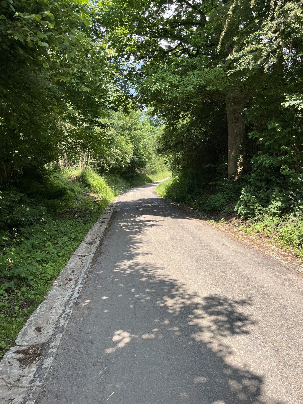
Côte de Brume from Basse-Bodeux is a climb in the region Haute Ardenne. It is 1 mi long and bridges 446 ft of vertical ascent with an average gradient of 8.1%, resulting in a difficulty score of 125. The top of the ascent is located at 1581 ft above sea level. Climbfinder users shared 4 reviews of this climb and uploaded 5 photos.

Road name: Rue Mionfosse

This is an automatic translation, the original language is: French.
A curious ascent in an almost straight line, quite steep, on a very lightly used road that could be in better condition. The contrast between the road to the Ancienne Barrière, which is wide, nickel-polished, gently sloping and fairly busy, and the one you take at the start, is spectacular.... read more

Photos (5)

Côte de Brume from Basse-Bodeux
transparant thumb

Your uploads (max 4)

Welcome! Please activate your account if you would like to share something. Look for the verification email in your inbox.

If you want to upload your photos, you need to create an account. It only takes 1 minute and it's completely free.

  • Receive free climbfinder goodies for your reviews & photos.
  • Create a bucket list and check off conquered climbs.
  • Add missing climbs.
Continue with GoogleContinue with Google Continue with FacebookContinue with Facebook Continue with AppleContinue with Apple Sign up with email
By signing up you agree to our terms of service and confirm that you have read our privacy & content policy.

Reviews (4)

5.0
4.0
3.0
2.0
1.0
Franck_Pastor
11 Mo 3.0
This is an automatic translation, the original language is: French. Show original

A curious ascent in an almost straight line, quite steep, on a very lightly used road that could be in better condition. The contrast between the road to the Ancienne Barrière, which is wide, nickel-polished, gently sloping and fairly busy, and the one you take at the start, is spectacular.

Curieuse montée en ligne presque droite, étroite, assez raide, sur une route très peu fréquentée qui pourrait être en meilleur état. Le contraste entre la route vers l'Ancienne Barrière, large, nickel, en pente douce et assez fréquentée, qu'on emprunte au début, est spectaculaire.

Dashboard
JHC
11 Mo 5.0 via the Climbfinder app
This is an automatic translation, the original language is: Dutch. Show original

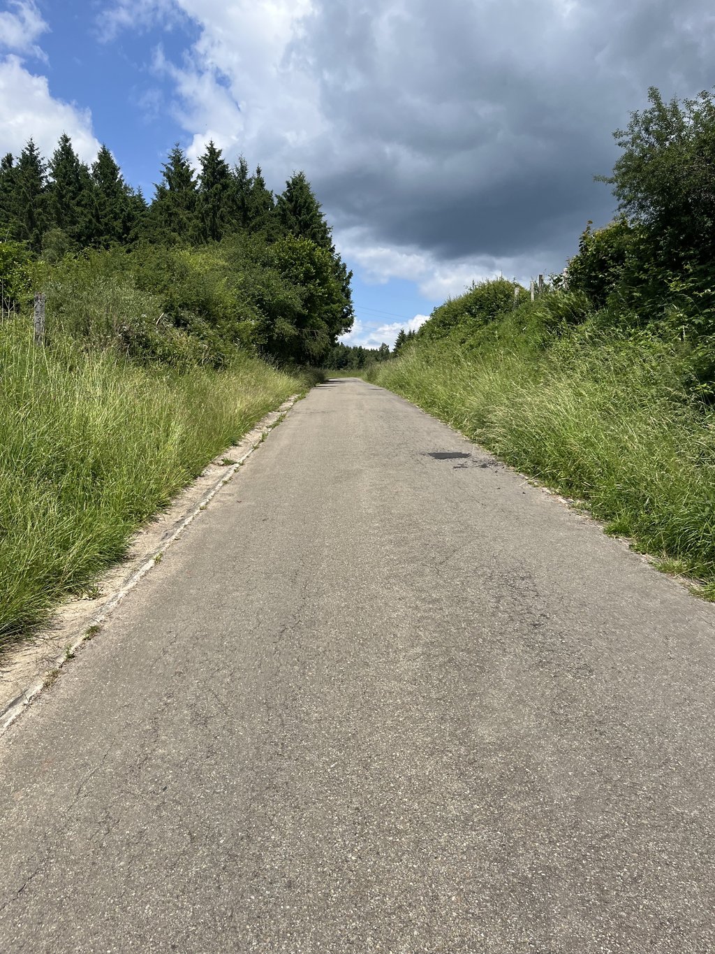
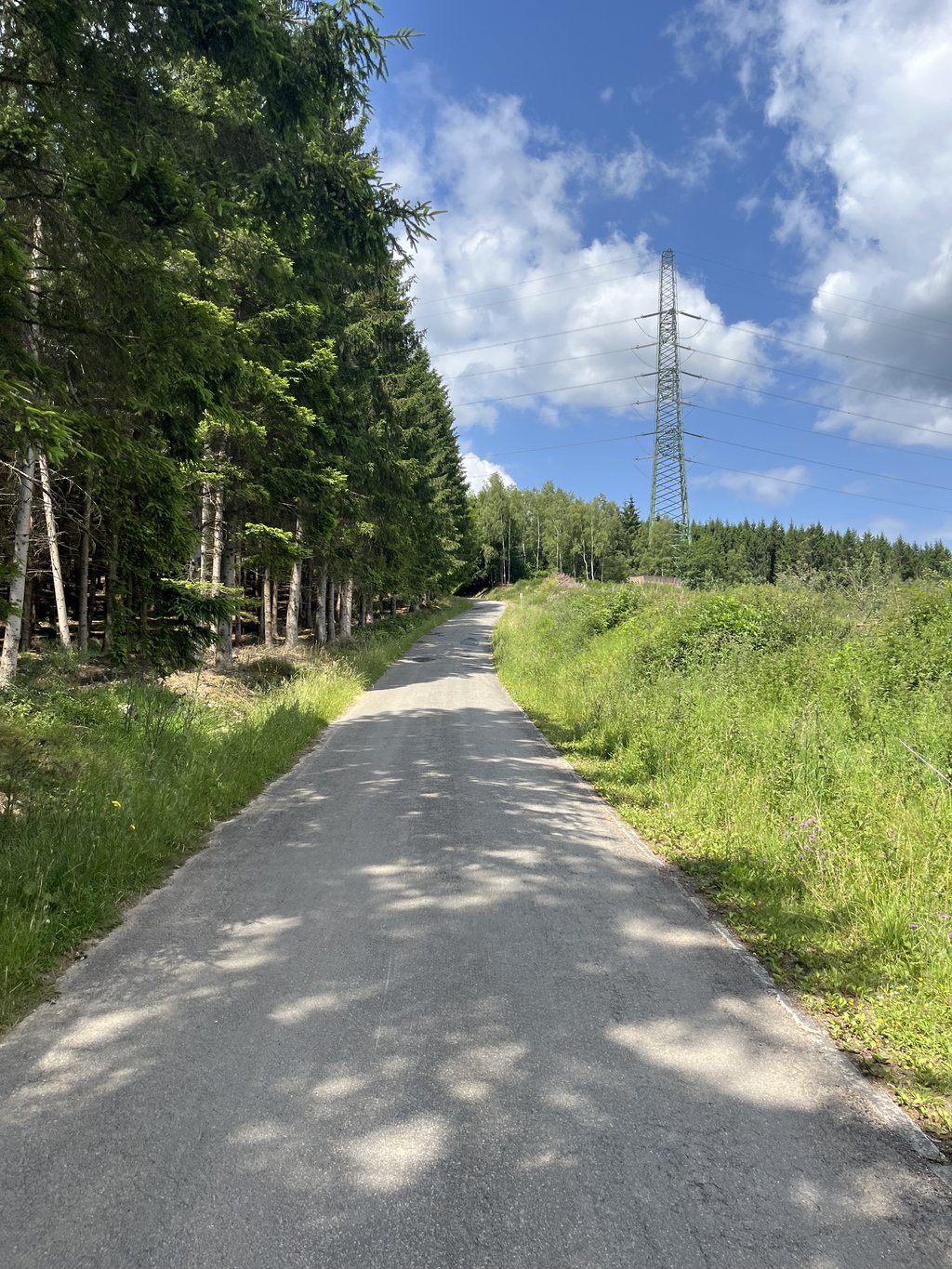
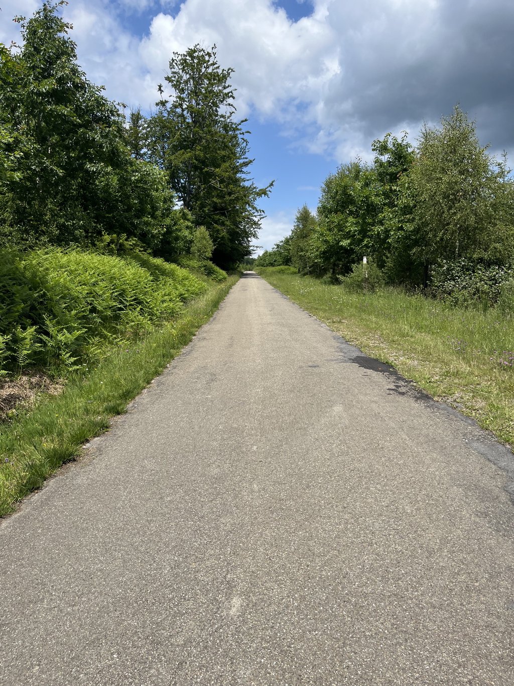
If this is the last climb of the day (which it was for me) this is going to hurt nicely. It's a beautiful forest path, the long straight section is something to be proud of. After this, a wall looms and it's hard work for a while. Enjoyment, despite the lactic acid.

Als dit de laatste klim van de dag is (wat hij voor mij was) dan gaat dit lekker zeer doen. Het is een prachtig bospad, het lange rechte stuk is iets waar je je op kan verkijken. Hierna doemt een muur op en is het even flink aanzetten. Genieten, ondanks het melkzuur.

Côte de Brume from Basse-Bodeux
Dashboard
Ossie158
4 y 4.0
This is an automatic translation, the original language is: Dutch. Show original

Nice quiet climb to the forest. hurts after many km's but has no real steep pieces.
In the forest especially the shadow was good (it was 26°C) and at the top you have now and then between the high bushes a view of the beautiful undulating valley.

Leuke rustige beklimming naar het bos. doet pijn na veel km's maar heeft geen echt steile stukken.
in het bos deed vooral de schaduw deugd (het was 26°C) en boven heb je tussen de hoge struiken af en toe zicht op het mooie golvende dal.

Dashboard
Random
nellis
12 y
This is an automatic translation, the original language is: Dutch. Show original

Finally I know the name of this great calf biter! I regularly drove the route des sommets lienne (beautiful route by the way) and on this beautiful forest road I always almost fell off my bike ;-)

Eindelijk weet ik de naam van deze geweldige kuitenbijter! Met regelmaat de route des sommets lienne gereden (prachtige route overigens) en op dit mooie bosweggetje viel ik altijd bijna van mijn fiets ;-)

Dashboard

Climbing times

5 mph 00:12:33
7 mph 00:08:53
9 mph 00:06:55
12 mph 00:05:12

Road surface condition

17% 83% 0%
Based on 6 votes
Share your knowledge. What was the road condition during your ascent?

Traffic

100% 0% 0%
Based on 6 votes
Your experience counts. How much traffic did you encounter during the climb?

Frequently Asked Questions

You don't need special gearing for Côte de Brume from Basse-Bodeux. The slope isn't long or steep enough to require much shifting down. You can conquer this climb on power alone. However, a compact gearing system with a smallest front chainring of 34 and largest rear sprocket of 28 or 30 is always nice if you enjoy cycling uphill. This helps maintain a smooth cadence.

Côte de Brume from Basse-Bodeux is a 4th-category climb. A sprint to the top is usually not an option, and untrained riders will definitely feel it in their legs. For trained cyclists, it is a great training climb.

Côte de Brume from Basse-Bodeux is 1 mi long.

The average gradient of Côte de Brume from Basse-Bodeux is 8.1%.

Côte de Brume from Basse-Bodeux has a steepest segment with an average gradient of 13%.

The summit of Côte de Brume from Basse-Bodeux is at 1581 ft.

At a slow pace of 5 mph, it takes about 00:12:33 to climb Côte de Brume from Basse-Bodeux. At 7 mph the time is 00:08:53, and at 9 mph 00:06:55. For the fastest cyclists, 00:05:12 is an achievable time.

Côte de Brume from Basse-Bodeux is located in the region Haute Ardenne in Belgium.

This page is better in the app

Climbfinder app
Climbfinder
(Free)
Open