View on map
© MapLibre | OpenStreetMap contributors
1%
2%
4%
6%
8%
10%
12%
15%
20%

Côte de Bouxhmont from Charneux

3.0
4 reviews | Elevation profile | 8 photos
Tips nearby
Côte de Bouxhmont from Charneux
Your achievable time
Calculating based on your best performances...
Relaxed
Maximum
W/kg
W/kg
W/kg
Analyze your climbing performance
Detailed insight into your climbing performance & automatically check off climbs
Based on your best performances.
Your best attempt:
Number of attempts:
Elevation profile Côte de Bouxhmont from Charneux

Statistics

Difficulty points 54
Length 1.4 mi
Average gradient 4.5%
Steepest segment 10.4%
Total ascent 328 ft

Short recap

Beautiful scenery
Feedback about this climb?
Show climbs nearby Export to GPS device

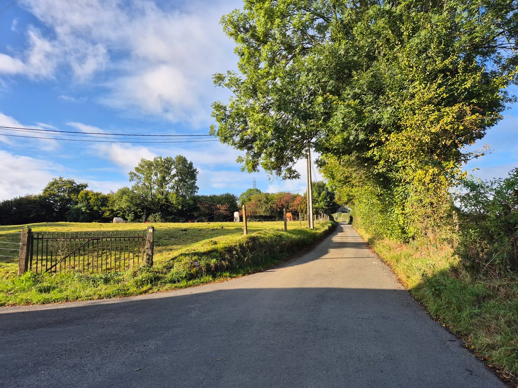
Côte de Bouxhmont from Charneux is a climb in the region Pays de Herve. It is 1.4 mi long and bridges 328 ft of vertical ascent with an average gradient of 4.5%, resulting in a difficulty score of 54. The top of the ascent is located at 1043 ft above sea level. Climbfinder users shared 4 reviews of this climb and uploaded 8 photos.

Road name: Bouxhmont
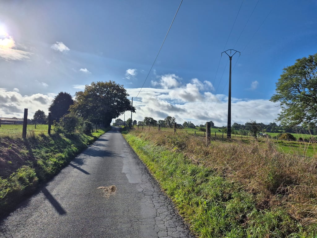
3.0 by BikerJohan
This is an automatic translation, the original language is: Dutch.
Nice climb of over 2 kilometres in the area between Val-Dieu and Herve/Battice. For the first ample kilometre, the climb is not too bad. Towards km 1½ you get a steeper stretch of 200 metres in front of your wheels, which then quickly flattens out again towards the top. Dosing on this climb is recommended.... read more

Photos (8)

Côte de Bouxhmont from Charneux
transparant thumb
transparant thumb
transparant thumb
transparant thumb

Your uploads (max 4)

Welcome! Please activate your account if you would like to share something. Look for the verification email in your inbox.

If you want to upload your photos, you need to create an account. It only takes 1 minute and it's completely free.

  • Receive free climbfinder goodies for your reviews & photos.
  • Create a bucket list and check off conquered climbs.
  • Add missing climbs.
Continue with GoogleContinue with Google Continue with FacebookContinue with Facebook Continue with AppleContinue with Apple Sign up with email
By signing up you agree to our terms of service and confirm that you have read our privacy & content policy.

Reviews (4)

5.0
4.0
3.0
2.0
1.0
BikerJohan
10 Mo 3.0
This is an automatic translation, the original language is: Dutch. Show original

Nice climb of over 2 kilometres in the area between Val-Dieu and Herve/Battice. For the first ample kilometre, the climb is not too bad. Towards km 1½ you get a steeper stretch of 200 metres in front of your wheels, which then quickly flattens out again towards the top. Dosing on this climb is recommended.

Leuke klim van ruim 2 kilometer in het gebied tussen Val-Dieu en Herve/Battice. De eerste ruime kilometer loopt de klim niet eens zo slecht. Richting km 1½ krijg je een steiler stukje van 200 meter voor de wielen wat daarna richting top ook even snel weer afvlakt. Doseren op deze klim is aan te raden.

Dashboard
Fedor
3 y 3.0
This is an automatic translation, the original language is: Dutch. Show original

Nice and quiet tarmac road through rural landscape that climbs fairly steadily at not too high percentages. This suddenly changes when you keep to the right and the road suddenly becomes a lot steeper and you have to work hard. The steep part is short after which it is soon cycling out. Here and there beautiful views to the back, especially at the top of the steep section.

Leuk en rustig asfaltweggetje door ruraal landschap wat redelijk gestaag omhoog loopt aan niet al te hoge percentages. Dat verandert ineens als je rechts aanhoudt waar de weg ineens een stuk steiler wordt en je even aan de bak moet. Het steile stuk is maar kort waarna het al snel uitfietsen wordt. Her en der mooie uitzichten naar achteren, vooral bovenaan het steile stuk.

Côte de Bouxhmont from Charneux
Dashboard
Opdeberg
4 y 3.0
This is an automatic translation, the original language is: Dutch. Show original

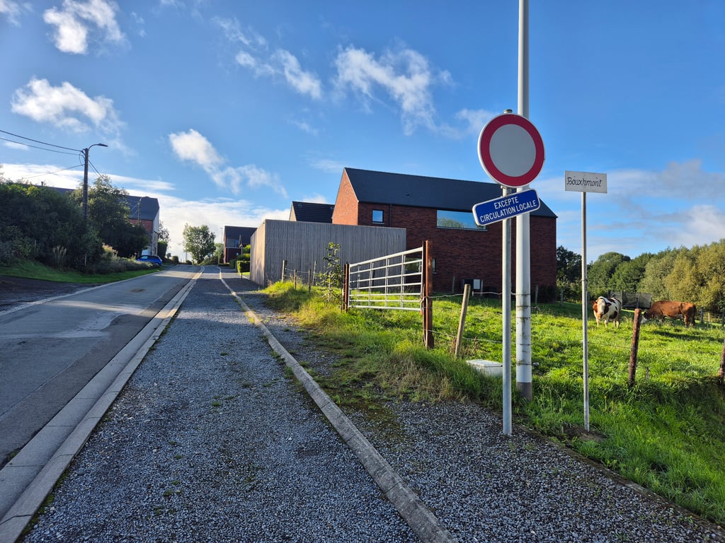
This is one of the many climbs south to the ridge of Battice. It is a long climb with steeper parts, especially when passing the hamlet Bouxhmont. Good classification.

Dit is een van de vele klimmen zuidelijke naar de kam van Battice. Het is een lange klim met steilere stukken, met name bij het doorrijden van het gehucht Bouxhmont. Goed indelen.

Dashboard
PelotonDesArdennes
5 y 3.0
This is an automatic translation, the original language is: Dutch. Show original

Nice alternative for the Côte de Charneux. Quiet narrow road

Mooi alternatief voor de Côte de Charneux. Rustig smal weggetje

Dashboard

Climbing times

5 mph 00:16:28
7 mph 00:11:39
9 mph 00:09:05
12 mph 00:06:49

Road surface condition

0% 0% 0%
Based on 0 votes
Share your knowledge. What was the road condition during your ascent?

Traffic

0% 0% 0%
Based on 0 votes
Your experience counts. How much traffic did you encounter during the climb?

Frequently Asked Questions

Côte de Bouxhmont can be cycled from 3 sides. Côte de Bouxhmont from Charneux is the most popular side, but the summit can also be reached via Côte de Charneux & Côte de Bouxhmont from Val de Bouxhmont.

You don't need special gearing for Côte de Bouxhmont from Charneux. The slope isn't long or steep enough to require much shifting down. You can conquer this climb on power alone. However, a compact gearing system with a smallest front chainring of 34 and largest rear sprocket of 28 or 30 is always nice if you enjoy cycling uphill. This helps maintain a smooth cadence.

Côte de Bouxhmont from Charneux falls into the 5th category. With good fitness, you can ride it up with speed and power. If you have less training, shift down and climb smoothly.

Côte de Bouxhmont from Charneux is 1.4 mi long.

The average gradient of Côte de Bouxhmont from Charneux is 4.5%.

Côte de Bouxhmont from Charneux has a steepest segment with an average gradient of 10.4%.

The summit of Côte de Bouxhmont from Charneux is at 1043 ft.

At a slow pace of 5 mph, it takes about 00:16:28 to climb Côte de Bouxhmont from Charneux. At 7 mph the time is 00:11:39, and at 9 mph 00:09:05. For the fastest cyclists, 00:06:49 is an achievable time.

Côte de Bouxhmont from Charneux is located in the region Liège Province in Belgium.

This page is better in the app

Climbfinder app
Climbfinder
(Free)
Open