View on map
© MapLibre | OpenStreetMap contributors
1%
2%
4%
6%
8%
10%
12%
15%
20%

Côte d'Andrimont

2.8
4 reviews | Elevation profile | 16 photos
Tips nearby
Côte d'Andrimont
Côte d'Andrimont
Côte d'Andrimont
Côte d'Andrimont
Côte d'Andrimont
Côte d'Andrimont
Côte d'Andrimont
Côte d'Andrimont
Your achievable time
Calculating based on your best performances...
Relaxed
Maximum
W/kg
W/kg
W/kg
Analyze your climbing performance
Detailed insight into your climbing performance & automatically check off climbs
Based on your best performances.
Your best attempt:
Number of attempts:
Elevation profile Côte d'Andrimont

Statistics

Difficulty points 80
Length 1.2 mi
Average gradient 5.6%
Steepest segment 11.2%
Total ascent 361 ft
Feedback about this climb?
Show climbs nearby Export to GPS device

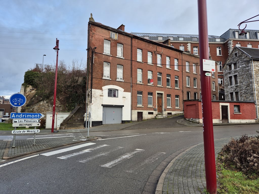
Côte d'Andrimont is a climb in the region Pays de Herve. It is 1.2 mi long and bridges 361 ft of vertical ascent with an average gradient of 5.6%, resulting in a difficulty score of 80. The top of the ascent is located at 961 ft above sea level. Climbfinder users shared 4 reviews of this climb and uploaded 16 photos.

Road names: Rue d'Andrimont & Rue Sous le Chateau

2.0 by Jarin
This is an automatic translation, the original language is: Dutch.
A long climb over a wide but also fairly busy road. There are nicer climbs to this plateau from Dison so that's why I would recommend that one earlier. .... read more

Photos (16)

Côte d'Andrimont
Côte d'Andrimont
Côte d'Andrimont
Côte d'Andrimont
Côte d'Andrimont
Côte d'Andrimont
Côte d'Andrimont
Côte d'Andrimont
Côte d'Andrimont
Côte d'Andrimont
Côte d'Andrimont
Côte d'Andrimont
Côte d'Andrimont
Côte d'Andrimont
Côte d'Andrimont
Côte d'Andrimont
transparant thumb
transparant thumb

Your uploads (max 4)

Welcome! Please activate your account if you would like to share something. Look for the verification email in your inbox.

If you want to upload your photos, you need to create an account. It only takes 1 minute and it's completely free.

  • Receive free climbfinder goodies for your reviews & photos.
  • Create a bucket list and check off conquered climbs.
  • Add missing climbs.
Continue with GoogleContinue with Google Continue with FacebookContinue with Facebook Continue with AppleContinue with Apple Sign up with email
By signing up you agree to our terms of service and confirm that you have read our privacy & content policy.

Reviews (4)

5.0
4.0
3.0
2.0
1.0
Jarin
6 Mo 2.0 via the Climbfinder app
This is an automatic translation, the original language is: Dutch. Show original

A long climb over a wide but also fairly busy road. There are nicer climbs to this plateau from Dison so that's why I would recommend that one earlier. .

Een lange klim over een brede maar ook redelijk drukke weg. Er zijn vanuit Dison mooiere beklimmingen naar dit plateau dus daarom zou ik die eerder aanraden. .

Côte d'Andrimont
Côte d'Andrimont
Côte d'Andrimont
Côte d'Andrimont
Dashboard
BikerJohan
1 y 3.0
This is an automatic translation, the original language is: Dutch. Show original

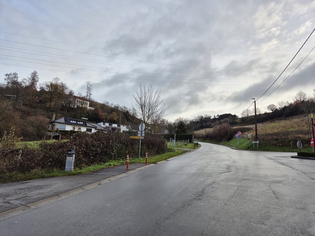
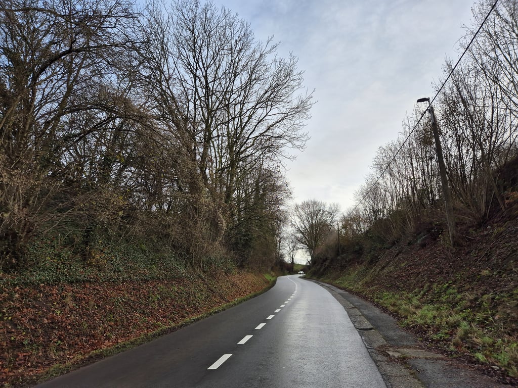
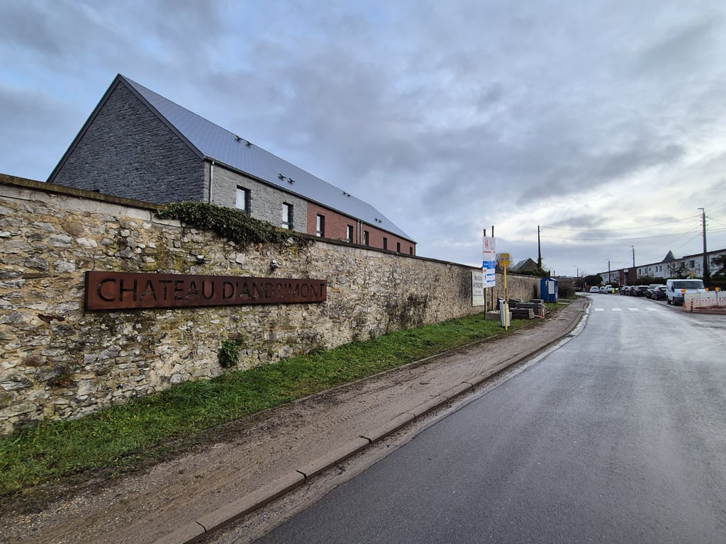
Climb 2 kilometres from the centre of Dison to Andrimont. From the roundabout on Rue Trauty, turn onto Rue d' Andrimont and start the climb. If you are between the houses just a few hundred metres into the climb, you will see that it gets steeper and remains so until you are a kilometre along the way. When you come out from between the houses the steepest part of the climb is almost over and then it flattens out until you reach Andrimont.

Klim van 2 kilometer vanuit het centrum van Dison naar Andrimont. Vanaf de rotonde op Rue Trauty draai je Rue d' Andrimont op en start de klim. Als je tussen de huizen net een paar honderd meter op de klim zit zie je dat het steiler wordt en dat blijft zo tot je een kilometer onderweg bent. Als je tussen de huizen vandaan komt zit het steilste deel van de klim er bijna op en vlakt het vervolgens af tot in Andrimont.

Dashboard
jjtbsomhorst
2 y 3.0
This is an automatic translation, the original language is: Dutch. Show original

If you don't expect this one and you turn off the roundabout, it can loom as a big task. Because it has a faint curve in it, it looks worse than it is. It's just a matter of keeping pedalling. At some point you can settle down again and then you know you're there.

Als je deze niet verwacht en je draait de rotonde af dan kan dit als een grote opgaven opdoemen. Omdat er een flauw bochtje in zit lijkt deze erger dan dat ie is. Het is alleen kwestie van doortrappen. Op een bepaald moment kun je weer tot rust komen en dan weet je dat je er bent.

Dashboard
Fedor
2 y 3.0
This is an automatic translation, the original language is: Dutch. Show original

Longer climb that at first runs relaxed between houses. Further on, you suddenly see the road go up and you soon enter the green where the road curves with a few bends towards Andrimont. There it soon flattens out and it's cycling out to the end.

Langere klim die eerst relaxed tussen de huizen loopt. Verderop zie je de weg ineens omhoog gaan en ga je al gauw het groen in waar de weg met enkele bochten richting Andrimont loopt. Daar vlakt het al snel af en is het uitfietsen tot het eind.

Côte d'Andrimont
Côte d'Andrimont
Côte d'Andrimont
Côte d'Andrimont
Dashboard

Climbing times

5 mph 00:14:39
7 mph 00:10:22
9 mph 00:08:05
12 mph 00:06:04

Road surface condition

0% 0% 0%
Based on 0 votes
Share your knowledge. What was the road condition during your ascent?

Traffic

0% 0% 0%
Based on 0 votes
Your experience counts. How much traffic did you encounter during the climb?

Frequently Asked Questions

You don't need special gearing for Côte d'Andrimont. The slope isn't long or steep enough to require much shifting down. You can conquer this climb on power alone. However, a compact gearing system with a smallest front chainring of 34 and largest rear sprocket of 28 or 30 is always nice if you enjoy cycling uphill. This helps maintain a smooth cadence.

Côte d'Andrimont is a 4th-category climb. A sprint to the top is usually not an option, and untrained riders will definitely feel it in their legs. For trained cyclists, it is a great training climb.

Côte d'Andrimont is 1.2 mi long.

The average gradient of Côte d'Andrimont is 5.6%.

Côte d'Andrimont has a steepest segment with an average gradient of 11.2%.

The summit of Côte d'Andrimont is at 961 ft.

At a slow pace of 5 mph, it takes about 00:14:39 to climb Côte d'Andrimont. At 7 mph the time is 00:10:22, and at 9 mph 00:08:05. For the fastest cyclists, 00:06:04 is an achievable time.

Côte d'Andrimont is located in the region Liège Province in Belgium.

This page is better in the app

Climbfinder app
Climbfinder
(Free)
Open