Tips nearby


Combelouviere from Grand Coeur is a climb in the region Savoie. It is 7.6 mi long and bridges 2674 ft of vertical ascent with an average gradient of 6.6%, resulting in a difficulty score of 649. The top of the ascent is located at 4193 ft above sea level. Climbfinder users shared 5 reviews of this climb and uploaded 12 photos.
Road names: Route de Saint-Oyen & D 213
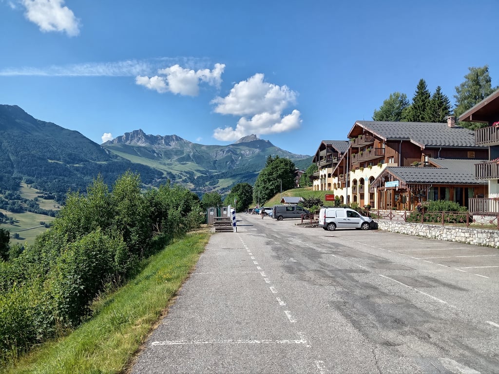
3.0 by CromagnonThis is an automatic translation, the original language is: French.My struggle in the rain to get up to Valmorel paid off! By staying on the D94, I'll also have climbed the path to Combelouvière! A decent road with little traffic. Nice bends. Doucy is a very pleasant village. At the top, a fine view of Valmorel, where I thought I was going... When I realised that I'd made a mistake on the route, I understood better why I was telling myself as I pedalled that the gradients were more serious than those I liked to identify on the profile of Valmorel!... read more
Welcome! Please activate your account if you would like to share something. Look for the verification email in your inbox.
If you want to upload your photos, you need to create an account. It only takes 1 minute and it's completely free.
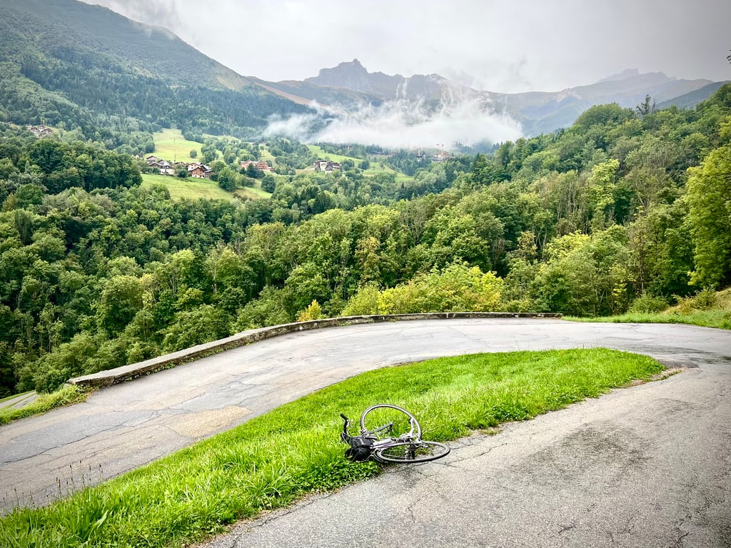
A nice climb, partly through the woods. A beautiful view toward Méribel once you get a little higher up. I didn't complete the entire climb; I took a turn earlier to head back down to the valley.
Mooie klim, gedeeltelijk door het bos. Prachtig uizicht richting Meribel als je wat hoger komt. Niet de hele klim gedaan, een afslag eerder genomen om terug te keren naar het dal.
Climbed this 31/05/26
To be avoided in midsummer as the road is bathed in sunlight very early on. The road is often in good condition, although some places are bad. Careful on the way down
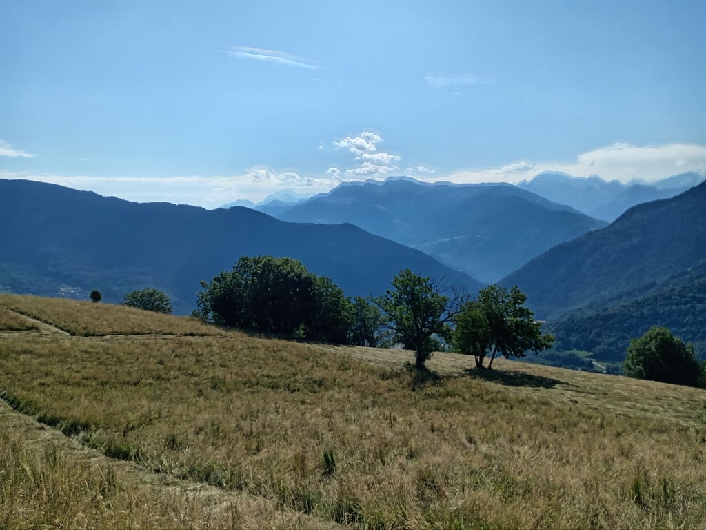
This climb is easier than Valmorel, even if it is more irregular. The gradients are reasonable and never too steep. The view from the summit is splendid.
I'd recommend it as training for harder work in the area.
Ascension faite ce 31/05/26
A éviter en plein été car la route est baignée par le soleil très tôt. Route souvent en bon état quoique certains endroits sont mauvais. Prudence à la descente
Cette montée est plus facile que Valmorel, même si elle est plus irrégulière. Les pourcentages sont raisonnables et jamais trop difficiles. La vue au sommet est splendide
Je la recommande comme un entraînement pour faire plus dur dans le coin.
My struggle in the rain to get up to Valmorel paid off! By staying on the D94, I'll also have climbed the path to Combelouvière! A decent road with little traffic. Nice bends. Doucy is a very pleasant village. At the top, a fine view of Valmorel, where I thought I was going...
When I realised that I'd made a mistake on the route, I understood better why I was telling myself as I pedalled that the gradients were more serious than those I liked to identify on the profile of Valmorel!
Ma galère sous la pluie pour grimper à Valmorel aura eu du bon ! En restant sur la D94, j’aurai aussi gravi la montée vers Combelouvière !
Route correcte et peu fréquentée. Jolis virages. Doucy est un village bien sympathique. Là-haut, belle vue sur Valmorel où je croyais monter…
Après avoir réalisé mon erreur de trajet, j’ai mieux compris pourquoi je me disais en pédalant que les pourcentages étaient plus sérieux que ceux que j’avais identifier sur le profil de Valmorel !
Climbed with Éric on 2 July 2025, some 20 years after the first Climbfinder climb.
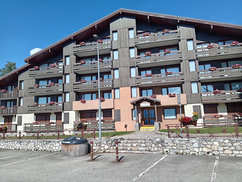
The climb starts at the Rond-Point on the outskirts of Aigueblanche, on the left you go towards Valmorel and on the right towards Combelouvière.
It's a climb not to be taken lightly, even if the average percentage isn't one of the highest, the length of 12.3km and some of the more arduous sections do take their toll on the thighs.
In hot weather, you need to set off very early because, despite the many shaded sections, the sun is out in the morning on this mountain slope. Note the fresh drinking water reservoir on the Doucy crossing.
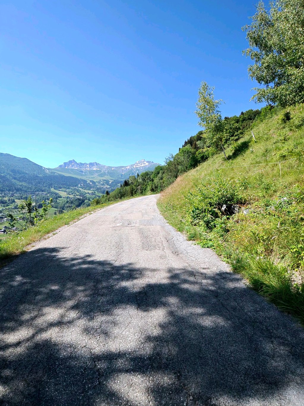
The state of the road (despite the fact that it is suitable for racing bikes) is not always impeccable, with alternating stretches of very good, good and bad road. This is not a problem on the climb, given the low speed, but you need to be extra vigilant on the descent, especially in the shady areas.
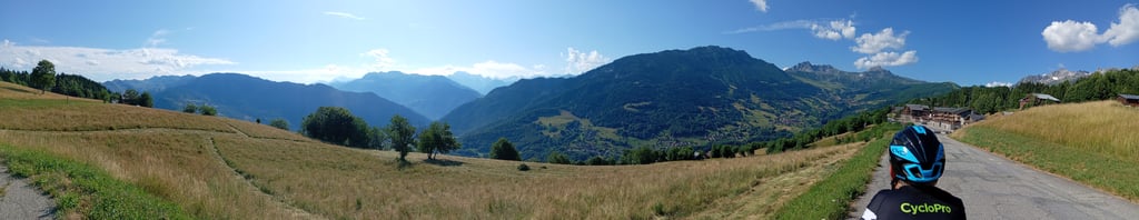
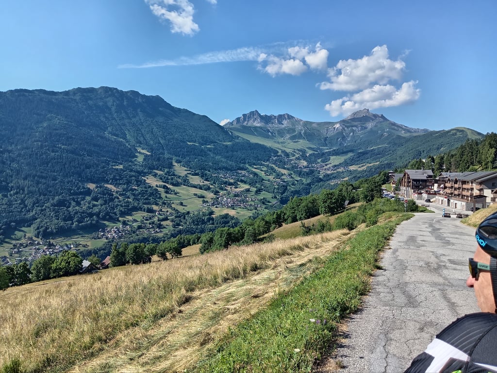
The scenery is magnificent, with views of the high peaks of the Vanoise, some of which are still covered in snow despite this never-ending heatwave. You can also see the village of Les Avanchers and the resort of Valmorel a little higher up.
I recommend this climb for all cycling fans who come on holiday to the area.
And finally, I'm going to tell you about the history of this route that only a few old-timers know about:
It has seen some of the greatest champions (Eddy Merckx, Raymond Poulidor, Joop Zoetemelk and many others and even Jeannie Longo...That's an understatement) because this is the old version of the ascent of the Col de La Madeleine, until 1985-1986 when numerous landslides destroyed the section that linked Combelouvière downhill to the Hameau de la Thuile just below Celliers.
By the way, if you go as far as the end of the Rte, a closed section still exists and can be seen on the Climbfinder map. It stops just before the Torrent d'eau rousse, whereas before it went as far as La Thuile.
Ascension effectuée avec Éric le 2 juillet 2025 environ 20 ans après la première quand Climbfinder n'existait pas.
La montée commence au Rond-Point à la sortie de Aigueblanche à gauche vous partez sur Valmorel et à droite sur Combelouvière.
C'est une ascension à ne pas prendre à la légère même si le pourcentage moyen n'est pas des plus élevés , la longueur de 12,3km ainsi que certains passages ardus finissent par peser dans les cuisses.
En période chaude il faut partir très tôt car malgré de nombreux passages ombragés , le soleil est présent dès le matin sur ce versant de montagne, à noter un bassin d'eau fraîche et potable dans la traversée de Doucy.
L'état de la route ( malgré quelle soit praticable en vélo de course ) n'est pas toujours impeccable, alternance de portions très bonnes, bonnes et aussi dégradées, ce n'est pas gênant dans la montée vu la faible vitesse, mais il faut redoubler de vigilance dans la descente surtout dans les zones ombragées.
Les paysages sont magnifiques avec des vues sur les hauts sommets de la Vanoise encore blanc de neige pour certains malgré cette canicule qui n'en finie pas ,on aperçoit aussi le village des Avanchers et la station de Valmorel un peu plus haut.
Je conseille cette ascension pour tout les amateurs de cyclisme qui viennent en vacances aux alentours.
Et pour finir je vais vous raconter l'histoire de cette route que seulement quelques anciens connaissent :
Elle a vu passée les plus grands champions ( Eddy Merckx, Raymond Poulidor, Joop Zoetemelk et bien d'autres et même Jeannie Longo...c'est peu dire ) car c'est l'ancienne version de l'ascension du Col de La Madeleine, Jusqu'en 1985-1986 années où de nombreux éboulements ont eus raisons de La portion qui reliait en descente Combelouvière au Hameau de la Thuile juste en dessous de Celliers.
D'ailleurs si vous poussez jusqu'au final de la Rte , une portion ( fermée ) existe toujours, on peut l'apercevoir sur la carte Climbfinder , elle s’arrête juste avant le passage du Torrent d'eau rousse alors qu'avant elle allait jusqu'à la Thuile.
| 5 mph | 01:32:13 |
| 7 mph | 01:05:17 |
| 9 mph | 00:50:53 |
| 12 mph | 00:38:13 |
This page is better in the app