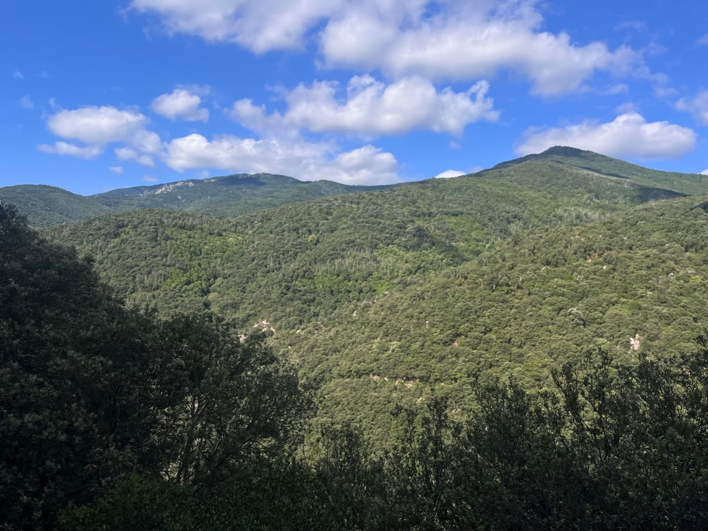
View on map
© MapLibre | OpenStreetMap contributors
1%
2%
4%
6%
8%
10%
12%
15%
20%

Coll de Manrella from Maureillas Las Illas

4.0
3 reviews | Elevation profile | 4 photos
Tips nearby
Coll de Manrella from Maureillas Las Illas
transparant thumb
transparant thumb
transparant thumb
transparant thumb
Your achievable time
Calculating based on your best performances...
Relaxed
Maximum
W/kg
W/kg
W/kg
Analyze your climbing performance
Detailed insight into your climbing performance & automatically check off climbs
Based on your best performances.
Your best attempt:
Number of attempts:
Elevation profile Coll de Manrella from Maureillas Las Illas

Statistics

Difficulty points 360
Length 7.6 mi
Average gradient 4.9%
Steepest segment 10.3%
Total ascent 1939 ft

Short recap

Beautiful scenery
7 hairpin turns
#41 toughest climb of Pyrénées-Orientales
#40 most elevation gain of Pyrénées-Orientales
#30 longest climb of Pyrénées-Orientales
#85 average steepest climb of Pyrénées-Orientales
Feedback about this climb?
Show climbs nearby Export to GPS device

Coll de Manrella from Maureillas Las Illas is a climb in the region Pyrénées-Orientales. It is 7.6 mi long and bridges 1939 ft of vertical ascent with an average gradient of 4.9%, resulting in a difficulty score of 360. The top of the ascent is located at 2352 ft above sea level. Climbfinder users shared 3 reviews of this climb and uploaded 4 photos.

Road names: Rue des Évadés de France, D 13, Route de Manrell, Impasse du Prat Paillisse, Route de La Vajol & Coll de Manrella
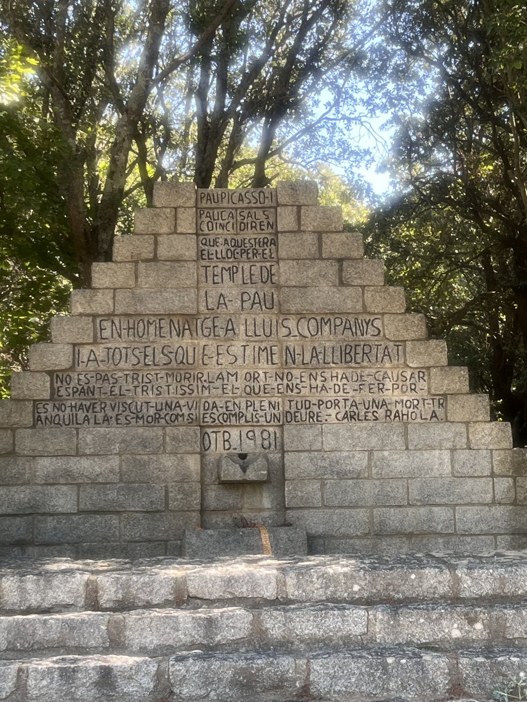
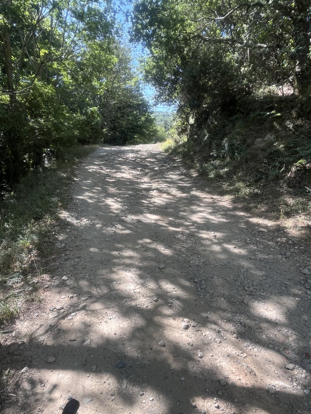
4.0 by _superver
This is an automatic translation, the original language is: Dutch.
Very anonymous transition through the French-Spanish border. You don't really realise that this is really the Pyrenees after all. The climb is partly gravel at the end. Fortunately, it is not super steep, so you get to the top fairly easily. There are not very many views. You really sneak away from France through the forest. At the top is a monument. This is followed by a magnificent descent to Figueres.... read more

Photos (4)

Coll de Manrella from Maureillas Las Illas
transparant thumb
transparant thumb

Your uploads (max 4)

Welcome! Please activate your account if you would like to share something. Look for the verification email in your inbox.

If you want to upload your photos, you need to create an account. It only takes 1 minute and it's completely free.

  • Receive free climbfinder goodies for your reviews & photos.
  • Create a bucket list and check off conquered climbs.
  • Add missing climbs.
Continue with GoogleContinue with Google Continue with FacebookContinue with Facebook Continue with AppleContinue with Apple Sign up with email
By signing up you agree to our terms of service and confirm that you have read our privacy & content policy.

Reviews (3)

5.0
4.0
3.0
2.0
1.0
MichelL73
10 Mo 4.0 via the Climbfinder app

Nice climb even better decent. The last ~3km are not what they seem on the graph, very punchy very steep short bursts of about 50m at 10-12% but fun nontheless.

Coll de Manrella from Maureillas Las Illas
Dashboard
Croketador
11 Mo 4.0 via the Climbfinder app
This is an automatic translation, the original language is: French. Show original

A beautiful, hidden spot for gravel lovers.

Un bel endroit caché et top pour les amoureux du gravier.

Dashboard
_superver
1 y 4.0
This is an automatic translation, the original language is: Dutch. Show original

Very anonymous transition through the French-Spanish border. You don't really realise that this is really the Pyrenees after all. The climb is partly gravel at the end. Fortunately, it is not super steep, so you get to the top fairly easily. There are not very many views. You really sneak away from France through the forest. At the top is a monument.
This is followed by a magnificent descent to Figueres.

Zeer anonieme overgang via de Frans Spaanse grens. Je hebt niet echt door dat dit toch echt de Pyreneeën zijn. De klim is op het einde gedeeltelijk gravel. Gelukkig is het niet supersteil, waardoor je redelijk makkelijk bovenkomt. Erg veel uitzicht is er niet. Je sluipt echt weg uit Frankrijk door het bos. Bovenop de top is een monument.
Hierna volgt een magnifieke afdaling naar Figueres.

Coll de Manrella from Maureillas Las Illas
Dashboard

Climbing times

5 mph 01:31:18
7 mph 01:04:38
9 mph 00:50:22
12 mph 00:37:50

Road surface condition

0% 0% 100%
Based on 1 vote
Share your knowledge. What was the road condition during your ascent?

Traffic

100% 0% 0%
Based on 1 vote
Your experience counts. How much traffic did you encounter during the climb?

Frequently Asked Questions

Coll de Manrella can be cycled from 3 sides. Coll de Manrella from Jonquera is the most popular side, but the summit can also be reached via Coll de Manrella from Maçanet de Cabrenys & Coll de Manrella from Maureillas Las Illas.

You don't need special gearing for Coll de Manrella from Maureillas Las Illas. The slope isn't long or steep enough to require much shifting down. You can conquer this climb on power alone. However, a compact gearing system with a smallest front chainring of 34 and largest rear sprocket of 28 or 30 is always nice if you enjoy cycling uphill. This helps maintain a smooth cadence.

Coll de Manrella from Maureillas Las Illas is a serious climb and falls into the 2nd category. With a good basic fitness level, even without much cycling experience, you can complete this climb just fine. However, a bike with climbing gears is a must. Without experience or training, it will be really tough – but that’s part of the challenge!

Coll de Manrella from Maureillas Las Illas is 7.6 mi long.

The average gradient of Coll de Manrella from Maureillas Las Illas is 4.9%.

Coll de Manrella from Maureillas Las Illas has a steepest segment with an average gradient of 10.3%.

The summit of Coll de Manrella from Maureillas Las Illas is at 2352 ft.

At a slow pace of 5 mph, it takes about 01:31:18 to climb Coll de Manrella from Maureillas Las Illas. At 7 mph the time is 01:04:38, and at 9 mph 00:50:22. For the fastest cyclists, 00:37:50 is an achievable time.

Coll de Manrella from Maureillas Las Illas is located in the region Pyrénées-Orientales in France.

This page is better in the app

Climbfinder app
Climbfinder
(Free)
Open