View on map
© MapLibre | OpenStreetMap contributors
1%
2%
4%
6%
8%
10%
12%
15%
20%

Col le Viarès from Saint Roman de Malegarde

2.7
3 reviews | Elevation profile | 4 photos
Tips nearby
Col le Viarès from Saint Roman de Malegarde
transparant thumb
transparant thumb
transparant thumb
transparant thumb
Your achievable time
Calculating based on your best performances...
Relaxed
Maximum
W/kg
W/kg
W/kg
Analyze your climbing performance
Detailed insight into your climbing performance & automatically check off climbs
Based on your best performances.
Your best attempt:
Number of attempts:
Elevation profile Col le Viarès from Saint Roman de Malegarde

Statistics

Difficulty points 118
Length 1.7 mi
Average gradient 6.3%
Steepest segment 9.7%
Total ascent 574 ft

Short recap

Beautiful scenery
5 hairpin turns
#75 toughest climb of Vaucluse
#80 most elevation gain of Vaucluse
#44 average steepest climb of Vaucluse
Feedback about this climb?
Show climbs nearby Export to GPS device

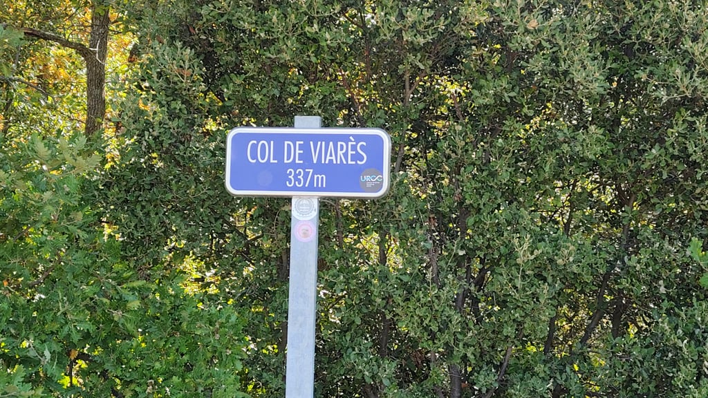
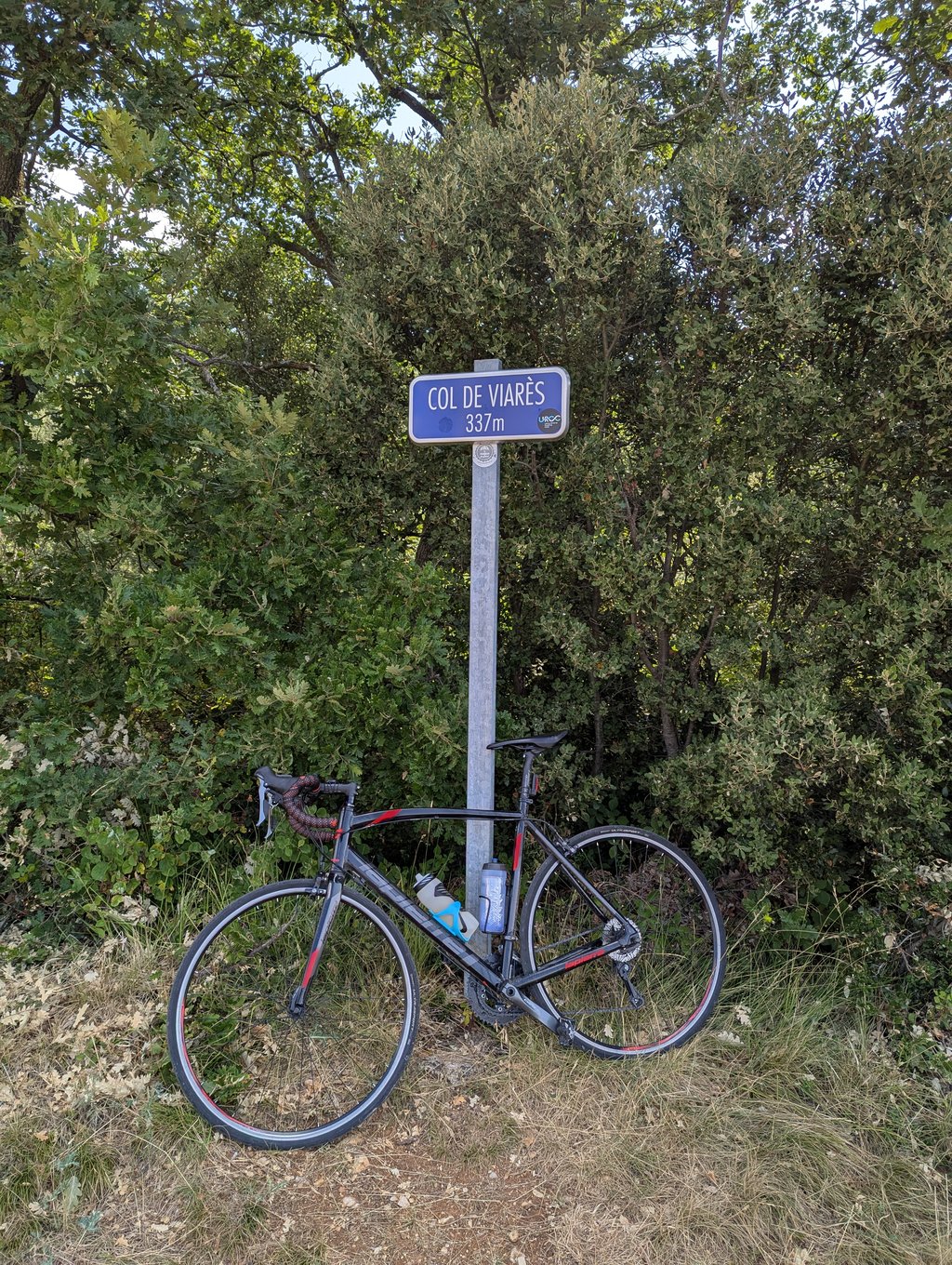
Col le Viarès from Saint Roman de Malegarde is a climb in the region Vaucluse. It is 1.7 mi long and bridges 574 ft of vertical ascent with an average gradient of 6.3%, resulting in a difficulty score of 118. The top of the ascent is located at 1106 ft above sea level. Climbfinder users shared 3 reviews of this climb and uploaded 4 photos.

Road names: Rue de la Coste & Route de Rasteau
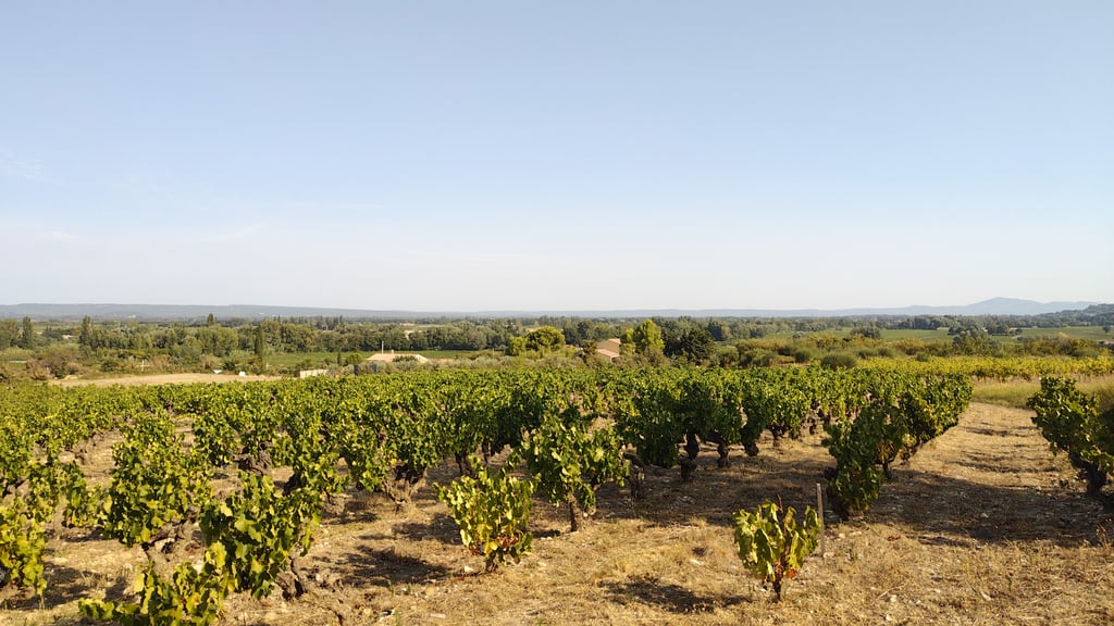
2.0 by ThierryvdW
This is an automatic translation, the original language is: Dutch.
Not a super difficult climb. Some nice houses vineyards along the route. Very nice views halfway up... read more

Photos (4)

Col le Viarès from Saint Roman de Malegarde
transparant thumb
transparant thumb

Your uploads (max 4)

Welcome! Please activate your account if you would like to share something. Look for the verification email in your inbox.

If you want to upload your photos, you need to create an account. It only takes 1 minute and it's completely free.

  • Receive free climbfinder goodies for your reviews & photos.
  • Create a bucket list and check off conquered climbs.
  • Add missing climbs.
Continue with GoogleContinue with Google Continue with FacebookContinue with Facebook Continue with AppleContinue with Apple Sign up with email
By signing up you agree to our terms of service and confirm that you have read our privacy & content policy.

Reviews (3)

5.0
4.0
3.0
2.0
1.0
ThierryvdW
9 Mo 2.0 via the Climbfinder app
This is an automatic translation, the original language is: Dutch. Show original

Not a super difficult climb. Some nice houses vineyards along the route. Very nice views halfway up

Geen supermoeilijke beklimming. Paar mooie huizen wijngaarden langs de route. Erg mooi uitzicht halverwege

Dashboard
The_Climbinator
11 Mo 3.0
This is an automatic translation, the original language is: French. Show original

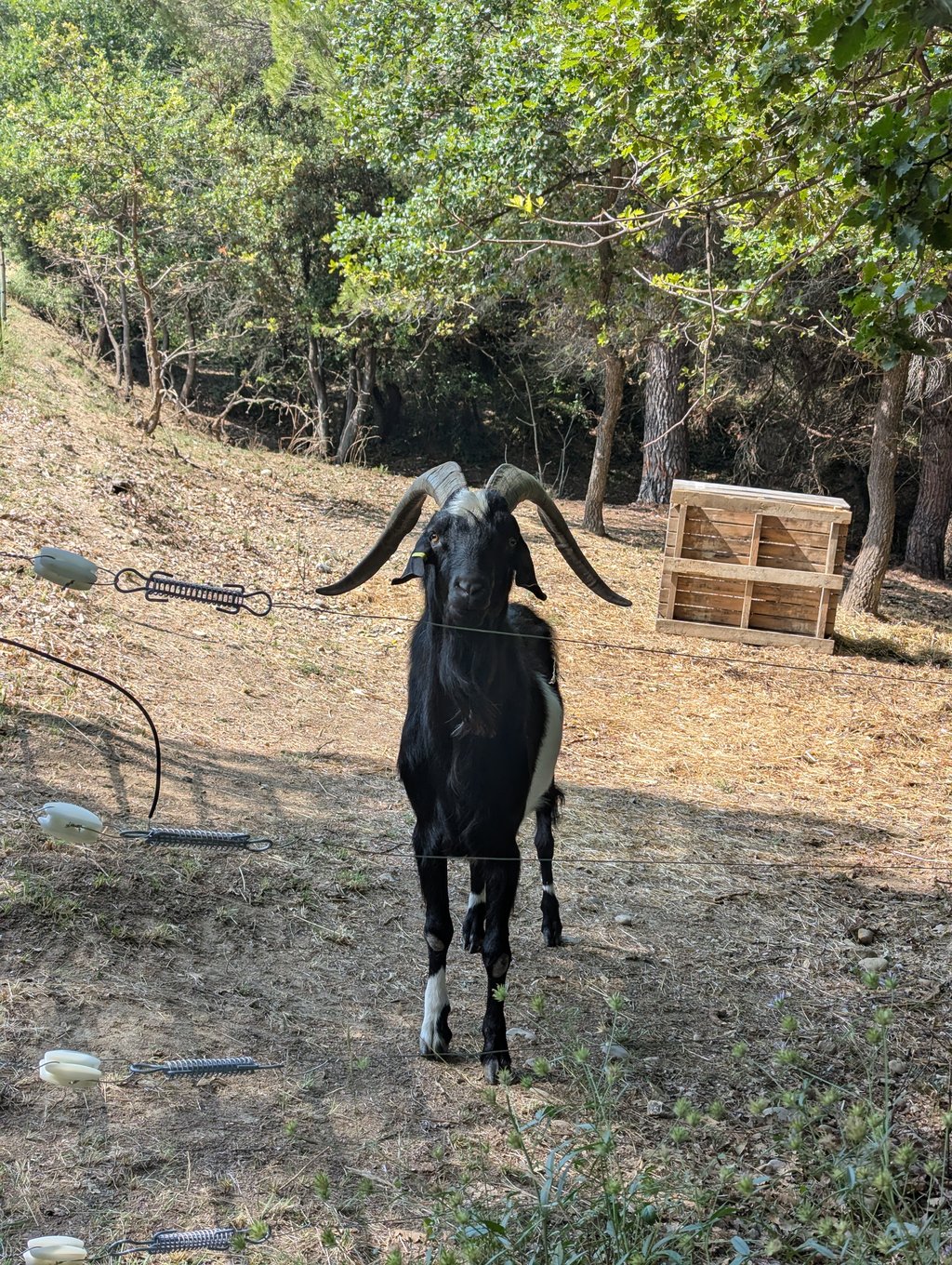
It's an irregular climb with gradients of over 8% on three occasions. It's not long or particularly difficult, but be careful not to burn out too soon. The section of road goes deeper and deeper into the forest and you'll have the chance to see the local goats.

Il s'agit d'une ascension irrégulière avec des pourcentages à plus de 8% à trois reprises. Elle n'est pas longue ni particulièrement difficile, mais attention à ne pas se cramer trop tôt. Le segment de route s'enfonce de plus en plus dans la forêt et vous aurez la possibilité des voir les chèvres du coin.

Col le Viarès from Saint Roman de Malegarde
Dashboard
robvh
1 y 3.0
This is an automatic translation, the original language is: Dutch. Show original

Start the climb via the grand rue, then it is much steeper

Begin de klim via de grand rue, dan is hij veel steiler

Dashboard

Climbing times

5 mph 00:20:40
7 mph 00:14:38
9 mph 00:11:24
12 mph 00:08:34

Road surface condition

88% 13% 0%
Based on 8 votes
Share your knowledge. What was the road condition during your ascent?

Traffic

100% 0% 0%
Based on 9 votes
Your experience counts. How much traffic did you encounter during the climb?

Frequently Asked Questions

Col le Viarès can be cycled from 2 sides. Col le Viarès from Saint Roman de Malegarde is the most popular side, but the summit can also be reached via Col le Viarès from Rasteau.

You don't need special gearing for Col le Viarès from Saint Roman de Malegarde. The slope isn't long or steep enough to require much shifting down. You can conquer this climb on power alone. However, a compact gearing system with a smallest front chainring of 34 and largest rear sprocket of 28 or 30 is always nice if you enjoy cycling uphill. This helps maintain a smooth cadence.

Col le Viarès from Saint Roman de Malegarde is a 4th-category climb. A sprint to the top is usually not an option, and untrained riders will definitely feel it in their legs. For trained cyclists, it is a great training climb.

Col le Viarès from Saint Roman de Malegarde is 1.7 mi long.

The average gradient of Col le Viarès from Saint Roman de Malegarde is 6.3%.

Col le Viarès from Saint Roman de Malegarde has a steepest segment with an average gradient of 9.7%.

The summit of Col le Viarès from Saint Roman de Malegarde is at 1106 ft.

At a slow pace of 5 mph, it takes about 00:20:40 to climb Col le Viarès from Saint Roman de Malegarde. At 7 mph the time is 00:14:38, and at 9 mph 00:11:24. For the fastest cyclists, 00:08:34 is an achievable time.

Col le Viarès from Saint Roman de Malegarde is located in the region Vaucluse in France.

This page is better in the app

Climbfinder app
Climbfinder
(Free)
Open