Tips nearby


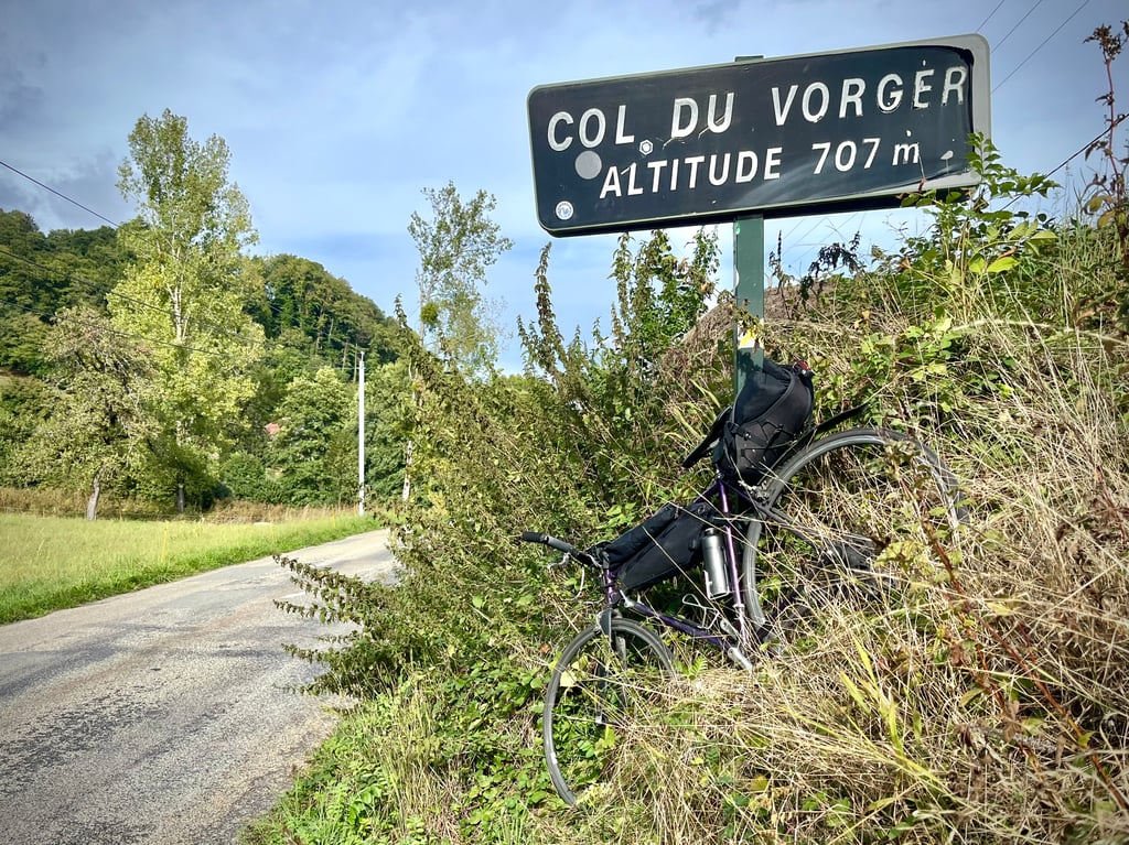
Col du Vorger from Albertville is a climb in the region Annecy. It is 4 mi long and bridges 1257 ft of vertical ascent with an average gradient of 5.9%, resulting in a difficulty score of 309. The top of the ascent is located at 2349 ft above sea level. Climbfinder users shared 4 reviews of this climb and uploaded 8 photos.
Road names: Route de Chevronnet & Route d'Allondaz
3.0 by CromagnonThis is an automatic translation, the original language is: French.A nice little pass. Not difficult and short. The locals have decided to make the most of it by putting up their own kilometre signs, complete with drawings by local artists or children. It's very cute. The road is excellent and almost deserted. The first part climbs quite steeply, and then you are lulled into a peaceful stroll at the end. The landscapes of the Bauges massif are quite gentle and elegant.... read more

Welcome! Please activate your account if you would like to share something. Look for the verification email in your inbox.
If you want to upload your photos, you need to create an account. It only takes 1 minute and it's completely free.
A nice little pass. Not difficult and short.
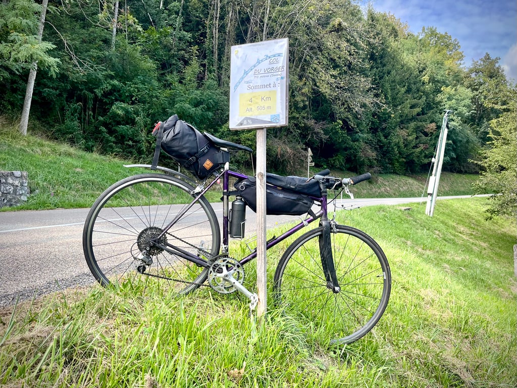
The locals have decided to make the most of it by putting up their own kilometre signs, complete with drawings by local artists or children. It's very cute.
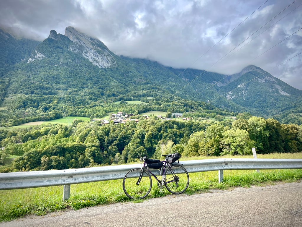
The road is excellent and almost deserted. The first part climbs quite steeply, and then you are lulled into a peaceful stroll at the end. The landscapes of the Bauges massif are quite gentle and elegant.
Un petit col bien sympathique. Pas difficile et court.
Les habitants ont décidé de le mettre en valeur en posant leurs propres panneaux kilométriques, assortis de dessins d’enfants. Chaque pancarte présente son dessin spécifique. C’est très mignon.
La route est excellente et quasi déserte. La première partie grimpe plutôt sérieusement puis on est bercé par la fin qui devient une balade paisible. Les paysages du massif des Bauges sont assez doux et élégants.
First ascent of 2024 to test my mountain pedalling.
I took a few photos especially for ClimbFinder.
Première ascension de l'année 2024 pour tester mon coup de pédale de montagnard.
J'ai fait quelques photos spécialement pour ClimbFinder.
A brief warm-up before tackling a fairly tricky section, this climb is well signposted with cycling information panels that are a little unusual in that they feature a schoolboy's drawing.
There are no miraculous views from this side.
It can be an alternative to the ascent to the Fort de L'Alpettaz situated a little higher up and allows you to make a loop by descending through Marthod: https://climbfinder.com/fr/montees/l-alpettaz-marthod
Un brève échauffement avant l'attaque d'une partie assez compliquée, cette ascension est achalandée avec des panneaux d'informations cyclistes un peu particuliers puisque agrémentés d'un dessin d'écolier.
Pas de points de vue miraculeux de ce côté.
Elle peut être une alternative à la montée au Fort de L'Alpettaz situé un peu plus haut et permet de faire une boucle en descendant par Marthod : https://climbfinder.com/fr/montees/l-alpettaz-marthod
| 5 mph | 00:48:50 |
| 7 mph | 00:34:34 |
| 9 mph | 00:26:57 |
| 12 mph | 00:20:14 |
This page is better in the app