Tips nearby


| 6 hairpin turns |
| #3 toughest climb of Grand Est |
| #9 most elevation gain of Grand Est |
| #55 longest climb of Grand Est |
| #52 average steepest climb of Upper Rhine |
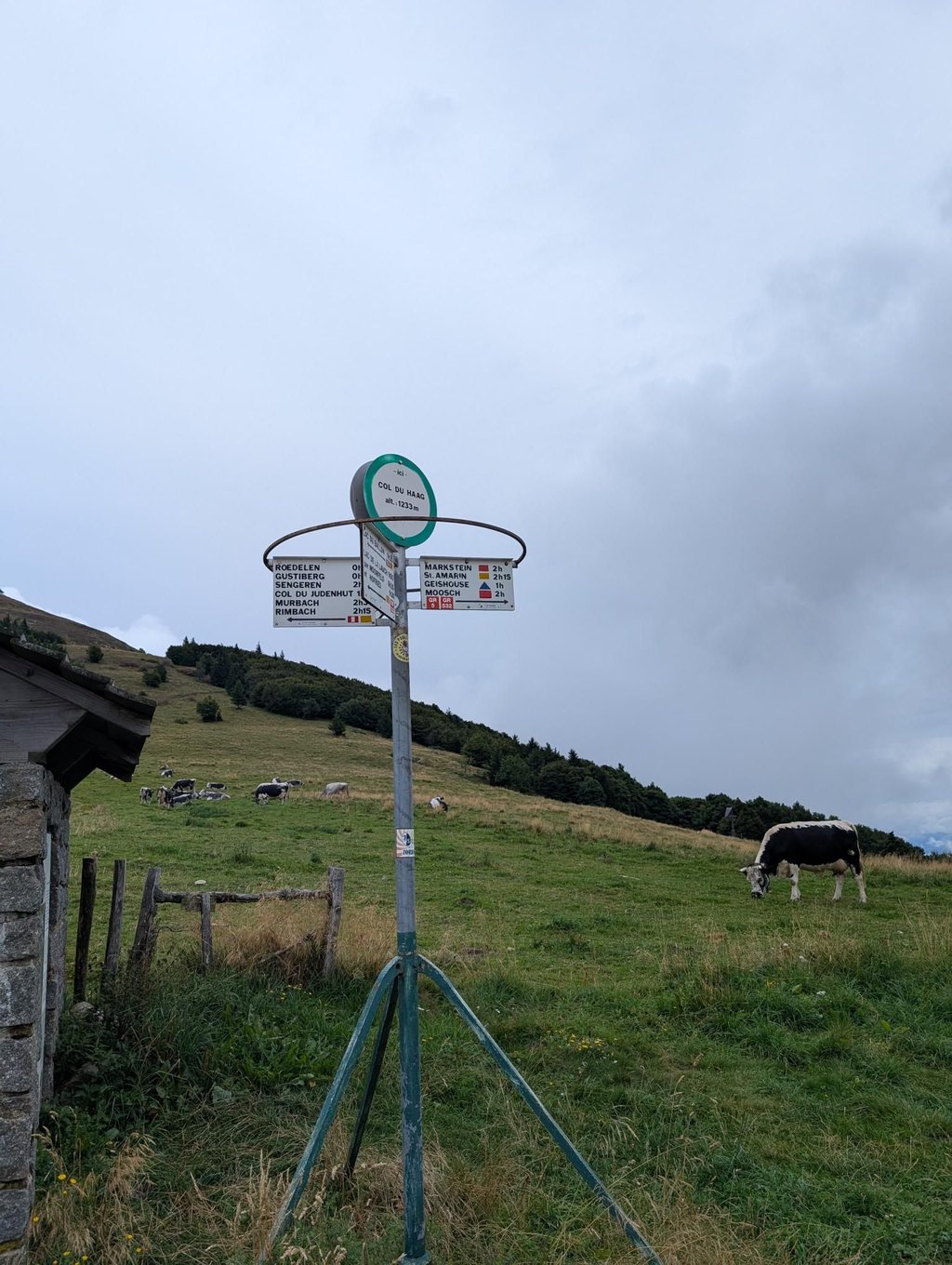
Col du Haag from Saint-Amarin is a climb in the region Upper Rhine. It is 7 mi long and bridges 2792 ft of vertical ascent with an average gradient of 7.5%, resulting in a difficulty score of 809. The top of the ascent is located at 4042 ft above sea level. Climbfinder users shared 4 reviews of this climb and uploaded 6 photos.
Road names: Rue Georges Clemenceau, Place du Maréchal Foch, Vogelbach, Rue du Fistelhaeuser, Kleinweg, Rue de Saint-Amarin, Rue des Champs, Rue du Ballon, Abas-Weg & Route de Geishouse
5.0 by DembouzThis is an automatic translation, the original language is: French.The hardest climb I've ever done in the Vosges. Between the 15% walls in Saint Amarin, the seemingly endless climb to Geishouse or the last wall after the totem pole. If you're looking for pain do it. Perhaps the view of the grand ballon will cheer you up.... read more
Welcome! Please activate your account if you would like to share something. Look for the verification email in your inbox.
If you want to upload your photos, you need to create an account. It only takes 1 minute and it's completely free.
A tough but beautiful climb that will serve as the finale of Stage 14 of this year’s Tour de France. I recently rode the entire stage and finished with the Col du Haag.
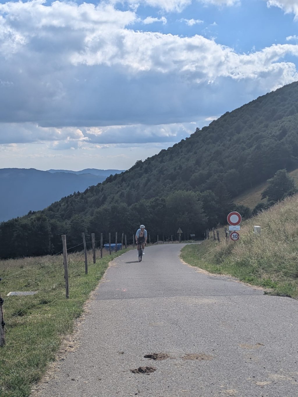
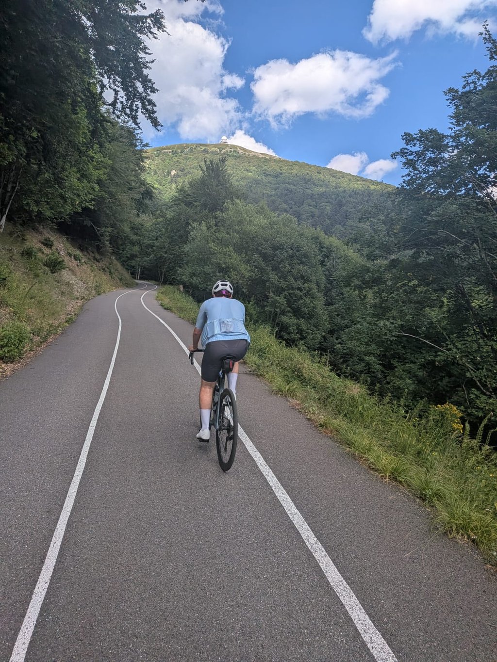
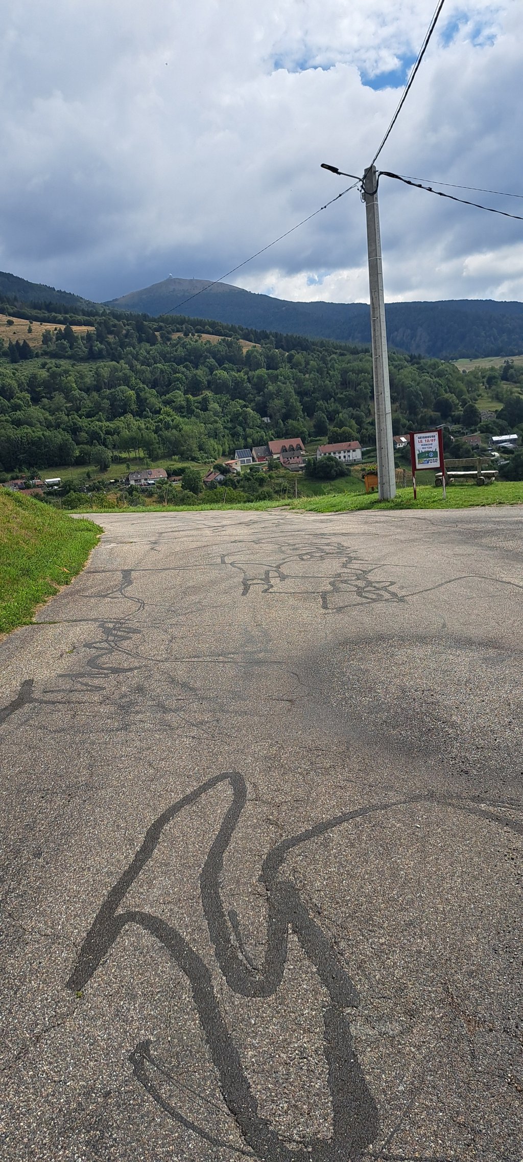
Starting from Saint-Amarin, you’re immediately confronted with the reality of the climb: between the houses, a steep wall awaits, dealing an immediate blow to your morale. After that, the gradients remain steep as the road winds through wooded countryside toward Geishouse. Once in Geishouse, there’s a short descent. Then the actual climb to the Col du Haag begins. This section is completely car-free: perfect asphalt with separate lanes for cyclists and hikers. The climb itself runs through the forest, so you’ll often be cycling in the shade. It’s challenging, but never excessively difficult. Every now and then, you’ll catch a glimpse of the Grand Ballon through the trees, which gives you extra motivation to keep going.
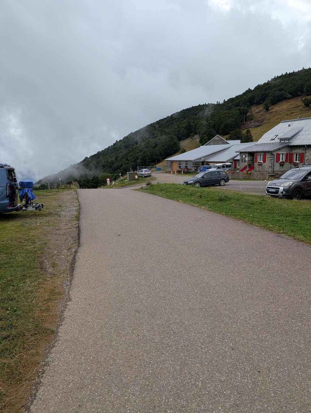
At the top of the Col du Haag, you have two options: left toward the Le Markstein ski resort, or right to the summit of the Grand Ballon. For the latter, you’ll need to climb another 1.4 km and gain about 110 meters in elevation.
Een zware maar mooie klim die dit jaar het slot zal vormen van Tour de France-rit 14. Ik reed onlangs de volledige rit en sloot af met de Col du Haag.
Vanuit Saint-Amarin word je meteen met de neus op de feiten gedrukt: tussen de huizen wacht een steile muur die je moraal direct een eerste tik geeft. Daarna blijven de percentages stevig, terwijl de weg zich door een bosrijke omgeving richting Geishouse slingert. Eenmaal in Geishouse volgt een korte afdaling. Vervolgens begint de eigenlijke klim naar de Col du Haag. Dit gedeelte is volledig autovrij: perfect asfalt en voorzien van afzonderlijke rijstroken voor fietsers en wandelaars. De klim zelf loopt door het bos waardoor je vaak in de schaduw fietst. Hij is stevig, maar nooit overdreven zwaar. Af en toe krijg je tussen de bomen door al een glimp van de Grand Ballon, wat extra motivatie geeft om door te zetten.
Boven op de Col du Haag heb je twee opties: links richting het skistation Le Markstein, of rechts naar de top van de Grand Ballon. Voor die laatste moet je nog 1,4 km klimmen en ongeveer 110 hoogtemeters overwinnen.
Very, very hard, the hardest in the region. A word of advice: don't plan the climb at the end of the route, otherwise it will seem interminable :-) From Geishouse onwards, there's a small road closed to cars, with an impeccable surface, but you won't come across many people other than those as crazy as you are.
Très très dur, ce qu'il y a de + dur dans la région. Petit conseil, ne prévoyez pas la montée en fin de parcours sinon cela vous semblera interminable :-) A partir de Geishouse, petite route interdite aux voitures, revêtement impeccable mais vous ne croiserez pas grand monde hormis des gens aussi fous que vous
The hardest climb I've ever done in the Vosges. Between the 15% walls in Saint Amarin, the seemingly endless climb to Geishouse or the last wall after the totem pole. If you're looking for pain do it. Perhaps the view of the grand ballon will cheer you up.
Montée la plus dure que j'ai pu faire dans les Vosges. Entre les murs de 15% dans Saint Amarin, la montée vers Geishouse qui semble interminable ou le dernier mur après le totem. Si vous cherchez de la douleur faites la. La vue sur le grand ballon pourra peut être vous remonter le moral.
Very steep climb. The start, in Saint-Amarin, is a wall to begin the climb. The gradients then remain high until you reach Geishouse. There is then a short descent and a climb to the Col du Haag. The route is magnificent, with beautiful scenery and the Grand Ballon appearing through the trees from time to time. Watch out for chamois, which you may come across on this little-travelled route. The last ramp before the pass is very tough, especially at the start where you go from a rolling 4% section to a tight 12% bend very quickly. It's a magnificent shady climb with very little traffic.
Montée très raide. Le début, dans Saint-Amarin, est un mur pour commencer l'ascension. Ensuite les pourcentages restent élevés jusqu'à Geishouse. Par la suite, on trouve une petite descente et la montée jusqu'au col du Haag. La route est magnifique avec de beaux paysages et le Grand Ballon qui apparaît à travers les arbres de temps à autres. Attention aux chamois que l'on peut croiser sur cette route peu fréquentée. La dernière rampe avant le col est très dure surtout avec son début où l'on passe d'une partie roulante de 4% à un virage serré de 12% très rapidement. C'est une magnifique ascension ombragée avec très peu de circulation.
| 5 mph | 01:24:59 |
| 7 mph | 01:00:10 |
| 9 mph | 00:46:53 |
| 12 mph | 00:35:13 |
This page is better in the app