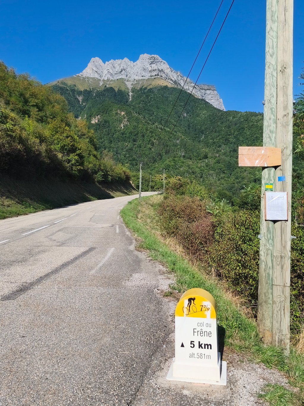
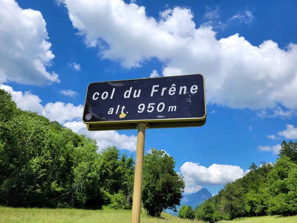
Col du Frêne from Saint Pierre d'Albigny is a climb in the region Annecy. It is 4.8 mi long and bridges 1818 ft of vertical ascent with an average gradient of 7.2%, resulting in a difficulty score of 483. The top of the ascent is located at 3150 ft above sea level. Climbfinder users shared 6 reviews of this climb and uploaded 14 photos.
Road name: Route du col du Frêne
5.0 by Ivoderks1979This is an automatic translation, the original language is: Dutch.Wonderful climb! Little traffic and in my opinion much nicer than the better known climbs around Annecy. I did it together with the Col de Tamie and the Leschaux towards Annecy and the valley between this col and Leschaux is really the best part of the route.... read more

Welcome! Please activate your account if you would like to share something. Look for the verification email in your inbox.
If you want to upload your photos, you need to create an account. It only takes 1 minute and it's completely free.
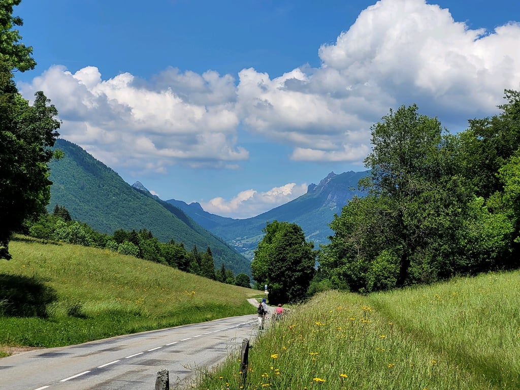
A great starting point for exploring the heart of the Bauges; a beautiful road that offers lovely views throughout the climb. The numerous hairpin turns help you regain momentum, which is no small help, because while the climb isn’t monstrous, it is demanding.
Un beau tremplin pour accéder au coeur des Bauges, une belle route qui offre de jolis points de vue tout au long de l'ascension. Les nombreux lacets aident à la relance, ce qui n'est pas du luxe car sans être monstrueuse, la pente est exigeante.
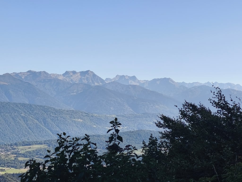
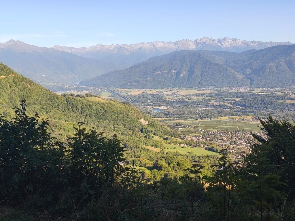
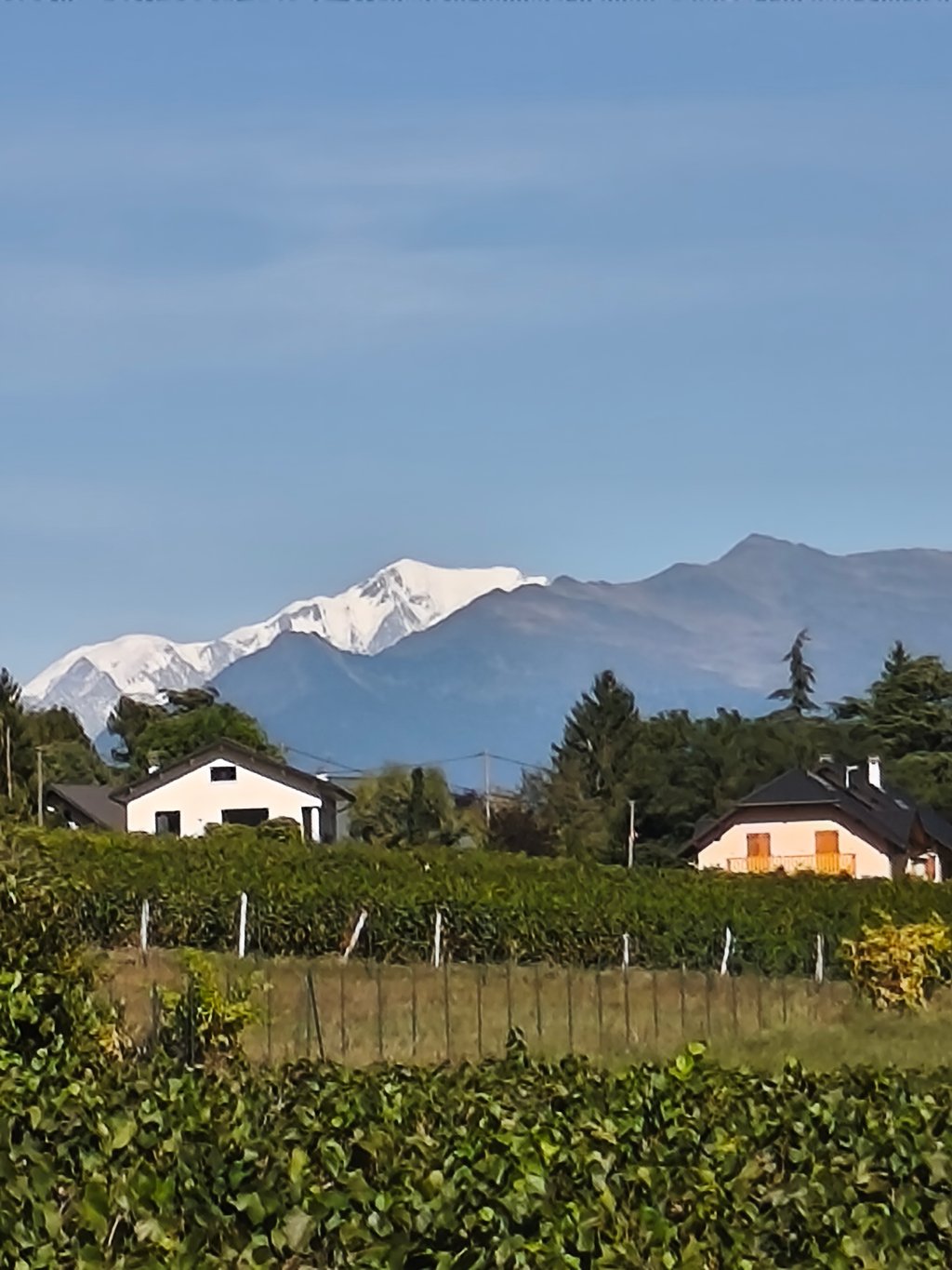
Superb, very pleasant climb, not very long and steep just right for me. It's a good, winding road, generally fairly quiet and with a steady gradient. The first half is in the open and then into the forest. There are many fine viewpoints along the way, which takes you to the foot of the imposing Dent d'Arclusaz. You can admire the Lauzière, Belledonne, Grand Arc, Chartreuse in the distance, and even the Vercors in good visibility. I even caught a brief glimpse of Mont Blanc at the foot of the climb!
Superbe montée très agréable, pas très longue et pentue juste comme il faut pour moi. Bonne route en lacets, généralement assez calme et au pourcentage régulier. On est à découvert dans sa première moitié puis en forêt. Il y a de beaux points de vue très souvent long du parcours, qui s'effectue au pied de l'imposante Dent d'Arclusaz. On peut admirer la Lauzière, Belledonne, le Grand Arc, la Chartreuse au loin, et même le Vercors par bonne visibilité. J'ai même pu apercevoir brièvement le Mont Blanc au pied de l'ascension!
I started this climb from the voie verte, starting at the bridge over the railway and then Rte du General Curial instead of Rte du General Curial. Climbfinder has the col start in the centre of St Pierre d'Albigny but then you leave out 2.2km of climb (!!!) So in the end you end up with 9.9km of climbing.
It is still very early in the year but it is sunny and a pleasant 15° in the valley, at the summit it is 10°C. As I am doing this climb during the afternoon, there is some traffic but not heavy or disruptive. My intention was to do the climb at a leisurely pace. I am still in my preparation for the real thing later in the year. Because of this, I never had any problems, all sections were easily digested. Afterwards, back on the same road I started the descent and rode quite a bit more into the valley to get to the intended number of km's of the day.
I often do this col on my bike too, very nice with all the curves, good tarmac and regularly beautiful views.
Ik heb deze beklimming aangevat vanaf de voie verte, start aan de brug over de spoorweg en dan Rte du General Curial ipv Climbfinder die de col laat starten in het centrum van St Pierre d'Albigny maar dan laat je 2,2km klim links liggen (!!) Dus uiteindelijk op 9,9 km klimmen uitgekomen. en een +-150 hoogtemeters extra. Je kan ook kiezen om de klim aan te vatten vanaf de rotonde aan Lac de Carouge maar de weg die ik genomen heb is een pak rustiger.
Het is nog heel vroeg op het jaar maar het is zonnig en een aangename 15° in het dal, op de top is het 10°C. Omdat ik tijdens de middag deze klim doe, is er wel wat verkeer maar niet druk of storend. Mijn voornemen was om de klim in een rustig tempo te doen. Ik zit nog in mijn voorbereiding op het echte werk later op het jaar. Hierdoor nooit problemen gehad, alle stukken werden makkelijk verteerd. Nadien terug via dezelfde weg de afdaling ingezet en nog een flink eind in het dal gereden om aan het beoogde aantal km's van de dag te geraken.
Met de moto doe ik deze col ook vaak, zeer leuk met al het bochtenwerk, goed asfalt en regelmatig mooie vergezichten.
My first pass of the 2022 season, I struggled a bit in the steepest parts, I did it at least 15 years ago and I did it again for Climbfinder.
Not so easy as that, alternating gentle slopes with rough passages which breaks the rhythm, the final is quite complicated.
No cyclos bollards at this time of the year because in most of the passes they are dismantled before winter to avoid being crushed by the snow removal machines.
Note that the foot of the pass is almost at the Carouge lake at the exit of the D1006 and not at St Pierre D'Albigny as indicated on the profile, Total 9,4KM 746M of difference in altitude which makes 7,9 on average.
Have a good ride
Mon premier col de la saison 2022, j'ai un peu galéré dans les plus forts pourcentages, je l'avais fait il y a au moins 15 ans et je l'ai refait pour Climbfinder.
Pas si facile que ça, alternances de faibles pentes avec des passages rudes ce qui casse le rythme, le final est assez compliqué.
Pas de borne cyclos à cette époque de l'année car dans la majorité des Cols elles sont démontées avant l'hiver pour éviter d'être broyées par les engins de déneigement.
A signaler que le pied du col se situe quasiment au lac de Carouge à la sortie de la D1006 et non pas à St Pierre D'Albigny comme indiqué sur le profil, Total 9,4KM 746M de dénivelé ce qui fait 7,9 en moyenne.
Bonne route
Nice climb with beautiful views. Reasonably wide road, but little traffic. Good road surface. I came from the direction of Saint-Jean-de-Murienne. You then cross the fairly wide valley and climb via the Col du frene right into the Masif des Bauges. Beautiful area by the way.
Leuke klim met mooi uitzicht. Redelijk brede weg, maar toch weinig verkeer. Goed wegdek. Ik kwam uit de richting van Saint-Jean-de-maurienne. Je steekt dan het redelijk brede dal over en klimt via de Col du frene zo het Masif des bauges in. Prachtig gebied overigens.
Wonderful climb! Little traffic and in my opinion much nicer than the better known climbs around Annecy. I did it together with the Col de Tamie and the Leschaux towards Annecy and the valley between this col and Leschaux is really the best part of the route.
Prachtige klim! Weinig verkeer en in mijn ogen veel mooier dan de bekendere klimmen rondom Annecy. Ik heb m gepakt icm met de Col de Tamie en de Leschaux richting Annecy en het dal tussen deze col en Leschaux is echt het topstukje van de route.
| 5 mph | 00:57:44 |
| 7 mph | 00:40:52 |
| 9 mph | 00:31:51 |
| 12 mph | 00:23:56 |
This page is better in the app