Tips nearby


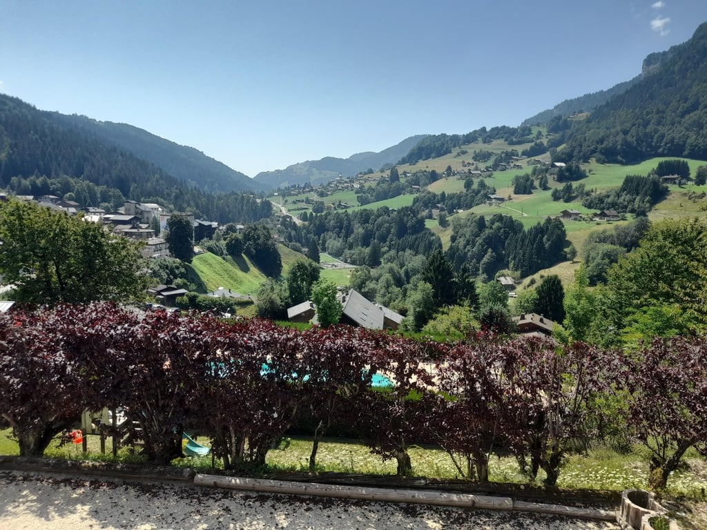
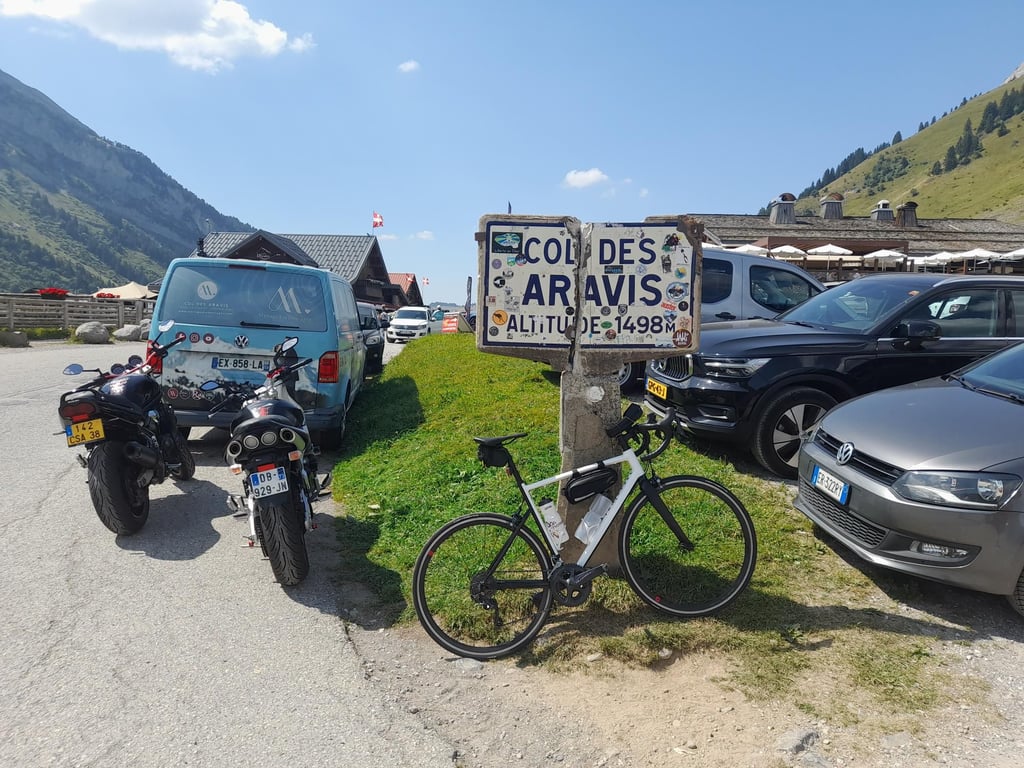
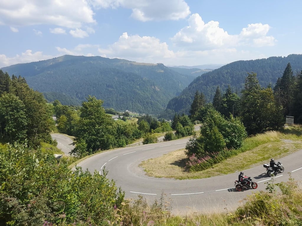
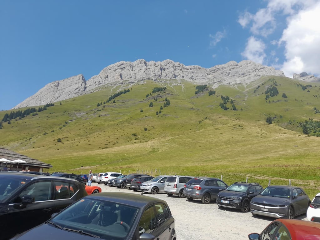
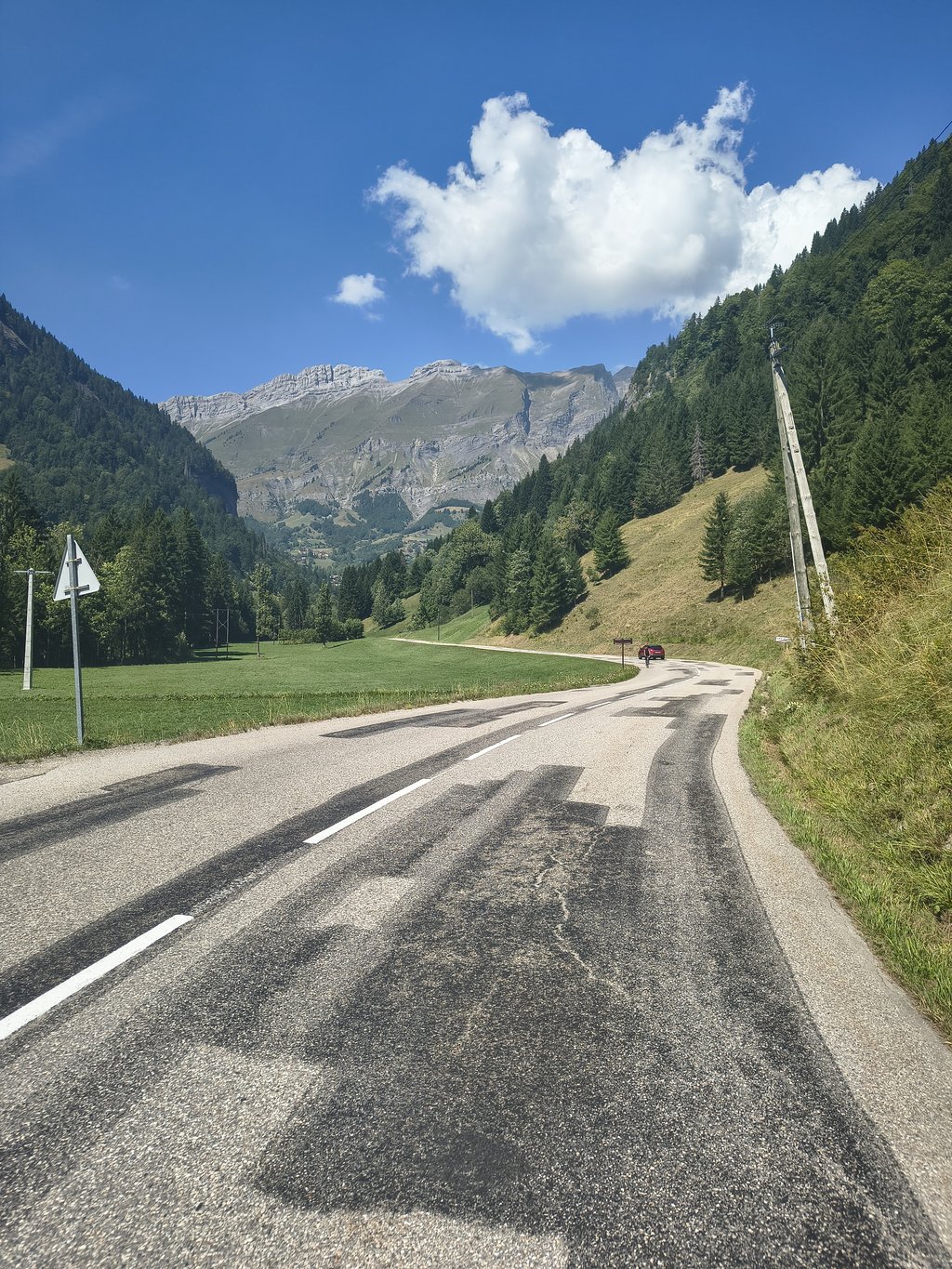
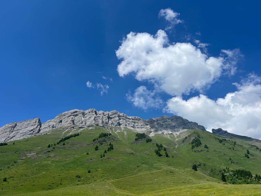
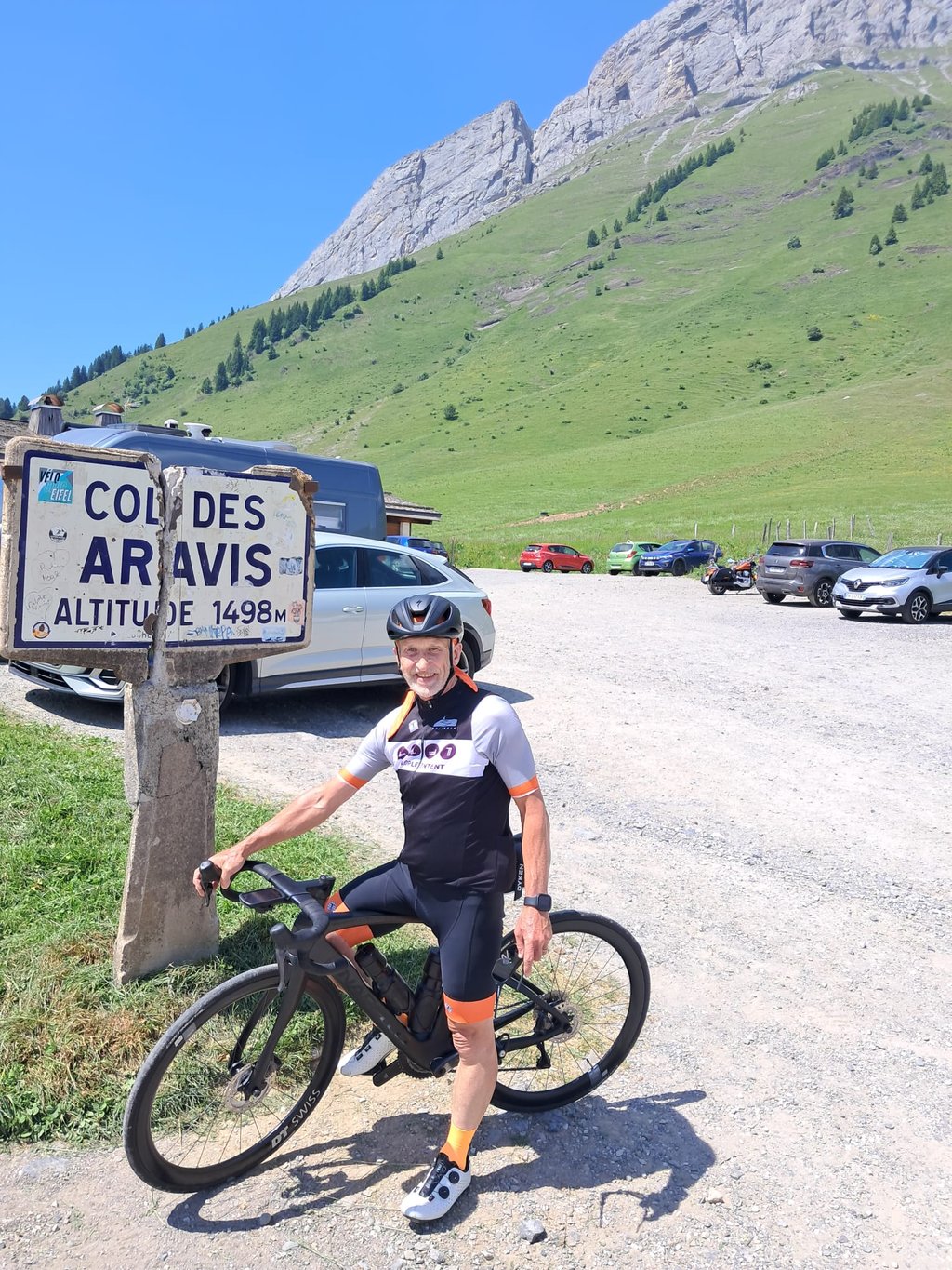
Col des Aravis from Flumet is a climb in the region Annecy. It is 7.2 mi long and bridges 2001 ft of vertical ascent with an average gradient of 5.3%, resulting in a difficulty score of 413. The top of the ascent is located at 4875 ft above sea level. Climbfinder users shared 6 reviews of this climb and uploaded 20 photos.
Road name: D909
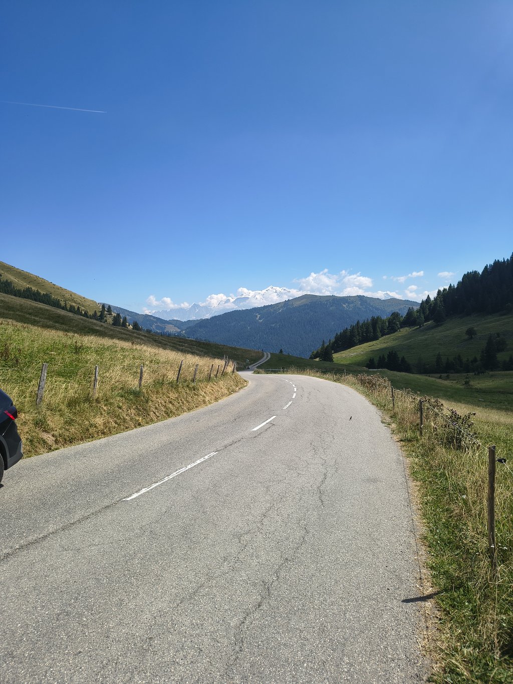
5.0 by djrochouThis is an automatic translation, the original language is: French.A very nice climb, with beautiful scenery, mostly in the open, but you gain altitude as you go, so the air gets cooler and cooler. Beware of the heavy traffic on summer weekends. You can see Mont Blanc from the summit on a clear day.... read more
Welcome! Please activate your account if you would like to share something. Look for the verification email in your inbox.
If you want to upload your photos, you need to create an account. It only takes 1 minute and it's completely free.
A very nice climb, with beautiful scenery, mostly in the open, but you gain altitude as you go, so the air gets cooler and cooler. Beware of the heavy traffic on summer weekends. You can see Mont Blanc from the summit on a clear day.
Très belle montée, avec de beaux paysages, en grande partie à découvert mais on prend de l'altitude au fur et à mesure donc l'air est de plus en plus frais. Attention la circulation peut y être importante les week-end d'été. On peut voir le Mont Blanc au sommet par temps clair.
The shortest variant of the Col des Aravis. It is therefore also the steepest variant although this is not too bad because starting point Flumet is higher than the starting point of the other variants. Throughout the climb you can see where you are going. The landscape is beautiful but does not change. Except just before the summit because then you have a phenomenal view of Mont Blanc in clear weather. The trickiest part is when you wind through the village of La Giettaz but don't expect much more than 8%. The road surface is fine and this side is also great for descending.
De kortste variant van de Col des Aravis. Het is daarom ook de steilste variant al valt dit redelijk mee doordat startpunt Flumet hoger ligt dan het beginpunt van de andere varianten. Gedurende de hele klim kan je zien waar je naartoe gaat. Het landschap is mooi maar verandert niet. Behalve vlak voor de top want dan heb je bij helder weer een fenomenaal uitzicht op de Mont Blanc. Het lastigste stuk is wanneer je kronkelt door het dorpje La Giettaz maar veel meer dan 8% moet je niet verwachten. Het wegdek is prima en deze kant is ook heel geschikt om af te dalen.
Nice climb. Certainly not difficult and with beautiful scenery. Between Flumet and La Clusaz it you little car traffic but from there the descent does get busier. Especially towards Thônes it is sometimes even dangerously busy. Towards Saint-Piere-en-Faucigny it is much quieter and the descent is also much nicer (at 24KM it is very long though).
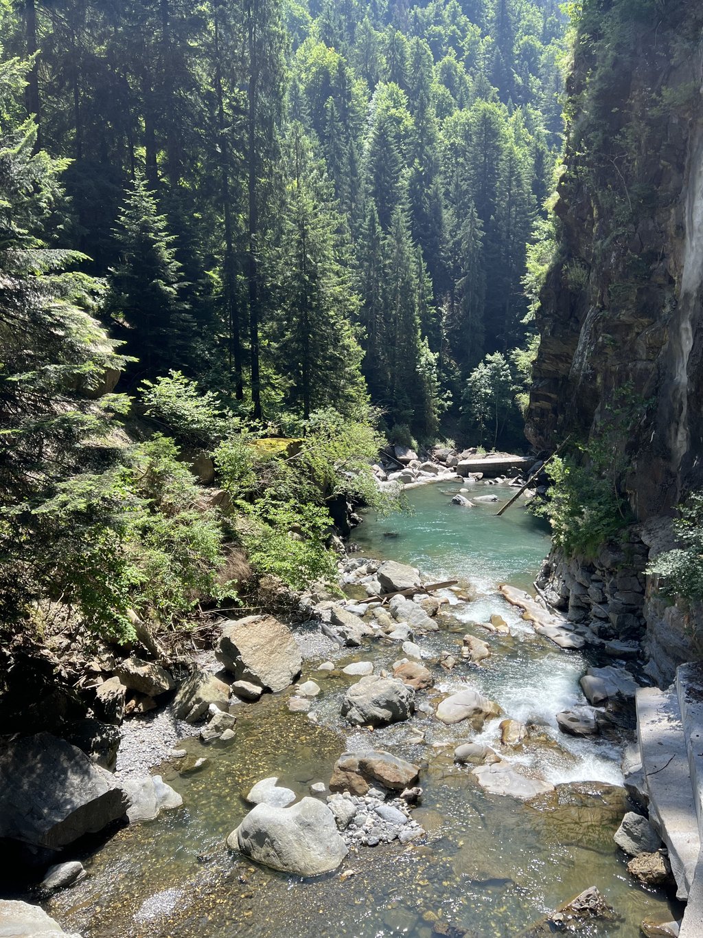
Tip: start from Ugine via Les Gorges du Borne. Beautiful not too busy road that goes slowly up along the river Borne with beautiful views of the river and the gorge...
Mooie klim. Zeker niet lastig en met mooie landschappen. Tussen Flumet en La Clusaz het je weinig autoverkeer maar vanaf daar wordt de afdaling wel drukker. Zeker naar Thônes is het soms zelfs gevaarlijk druk. Richting Saint-Piere-en-Faucigny is het veel rustiger en is de afding ook vele malen mooier (met 24KM wel heel erg lang)
Tip: start vanuit Ugine via Les Gorges du Borne. Mooie niet al te drukke weg die langzaam omhoog loopt langs de rivier de Borne met prachtige zichten op de rivier en de kloof...
A shortish relaxing climb featuring brief tunnels, arcades, waterfalls and blooming Alpine meadows. Drizzle/rain and mist today just added to the atmosphere.
Nice climb towards Col des Aravis. The first part from Flumet to La Giettaz is bit up and down through a forest with a few small short tunnels. From the village you go up winding between houses and at times steep. Just before the summit it flattens out a bit again.
Leuke klim richting Col des Aravis. Het eerste stuk van Flumet tot La Giettaz is beetje op en af door een bos met een paar kleine korte tunnels. Vanaf het dorp ga je slingerend tussen de huizen naar boven en bij vlagen steil. Net voor de top vlakt het weer wat af.
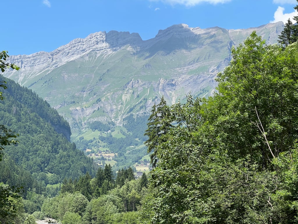
The real start of the climb is just before the village, across the little bridge. From there on, it really rises, more runners for this and even a bit of a descent. From the village it is very beautiful. You wind your way up along the houses until the last few kilometres. The wind can be a spoilsport if you are unlucky. At the top, a very nice view of a number of higher peaks around the mountain pass.
De echte start van de klim ligt vlak voor het dorp over het brugje. Vanaf daar stijgt het echt, hiervoor meer lopers en zelfs een stukje dalen. Vanaf het dorp is het wel zeer mooi. Je slingert hier tot de laatste paar kilometer langs de huizen omhoog. De wind kan hier wel een spelbreker zijn als je pech hebt. Boven een heel mooi uitzicht op een aantal hogere toppen rondom de bergpas.
| 5 mph | 01:26:38 |
| 7 mph | 01:01:20 |
| 9 mph | 00:47:48 |
| 12 mph | 00:35:54 |
This page is better in the app