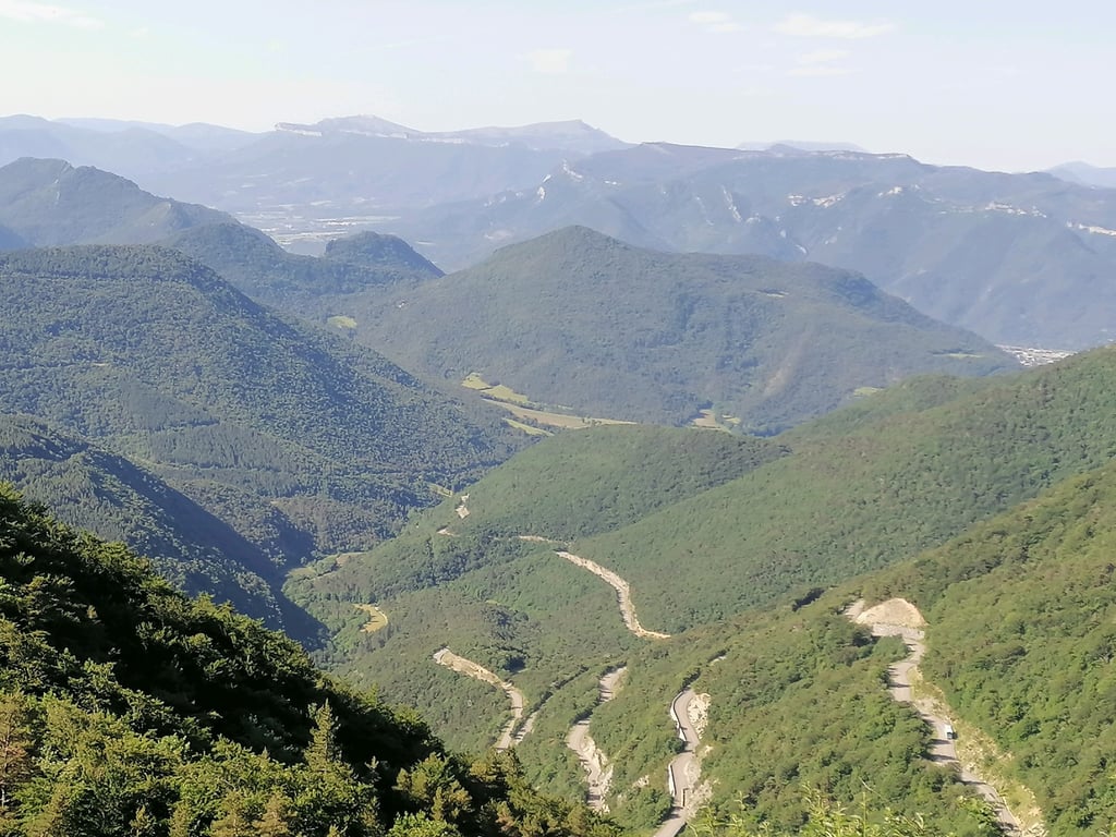
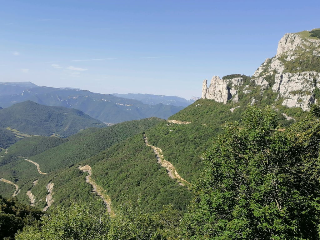
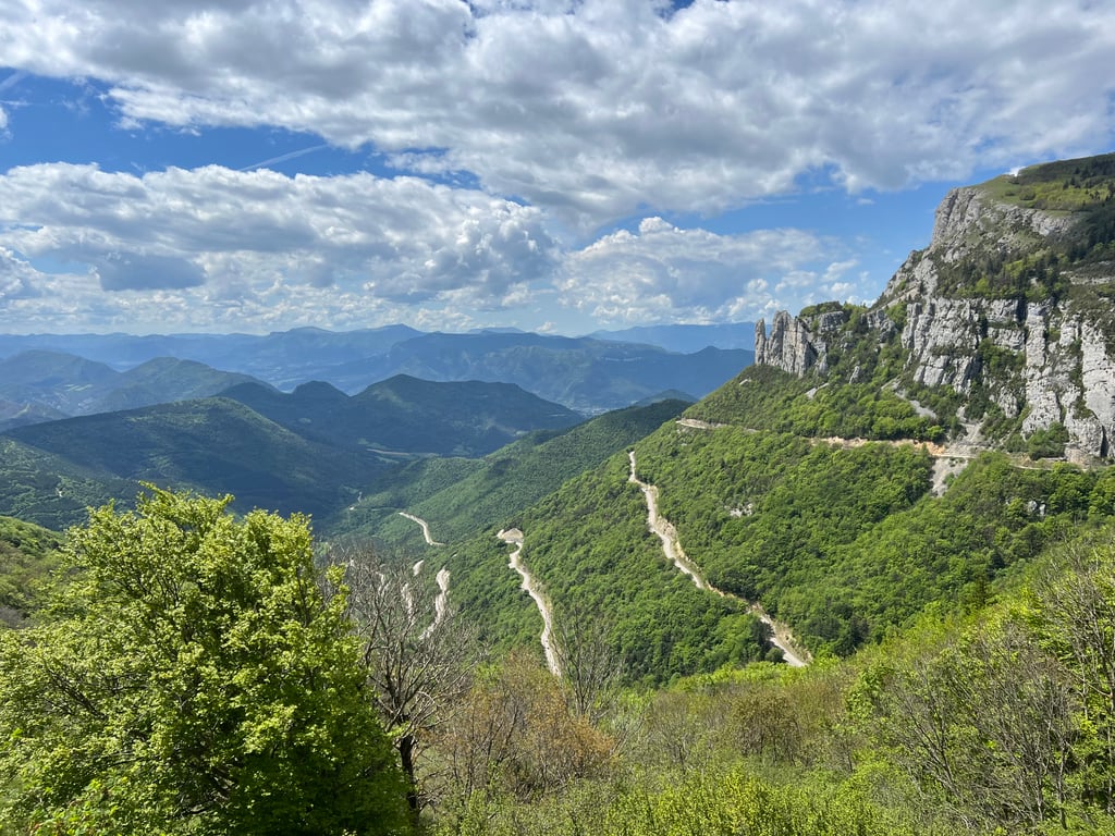
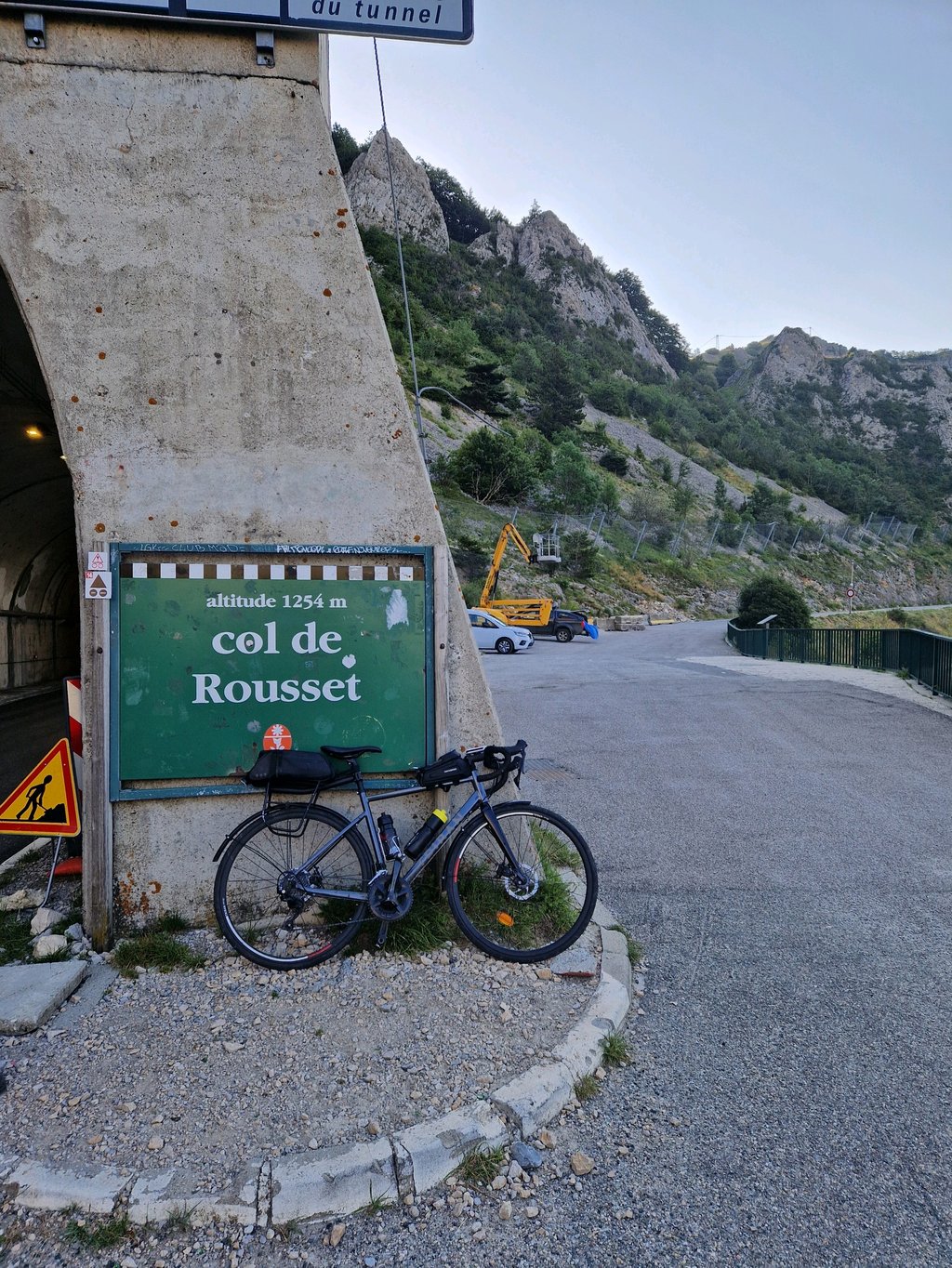
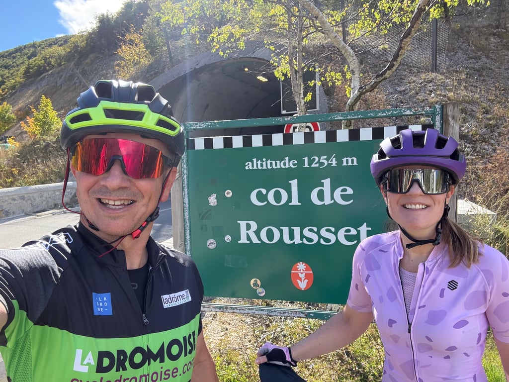
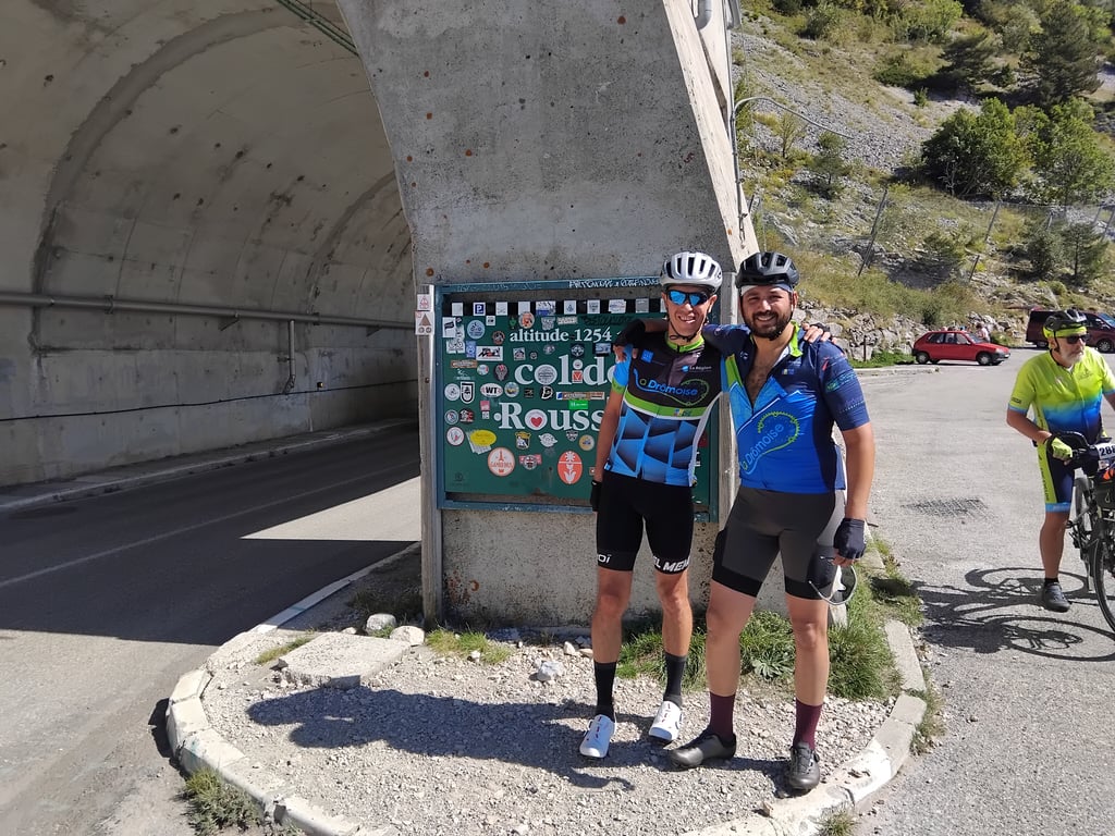
Col de Rousset from Die is a climb in the region Vercors. It is 12.1 mi long and bridges 2828 ft of vertical ascent with an average gradient of 4.4%, resulting in a difficulty score of 446. The top of the ascent is located at 4098 ft above sea level. Climbfinder users shared 25 reviews of this climb and uploaded 32 photos.
This is an automatic translation, the original language is: French.
Show original
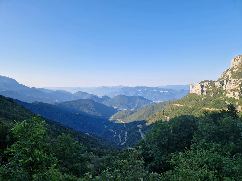
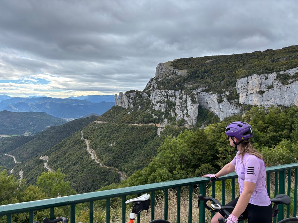
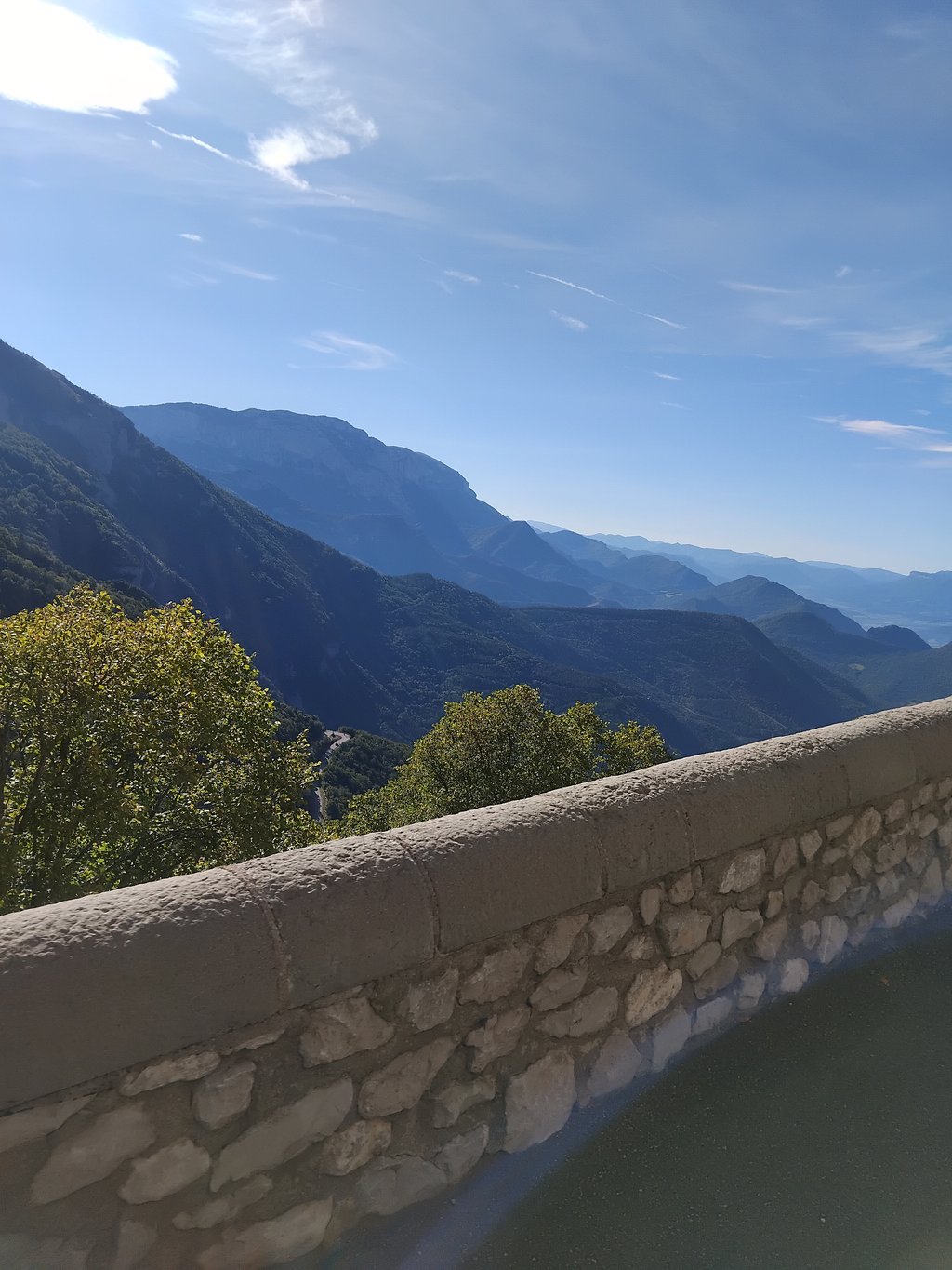
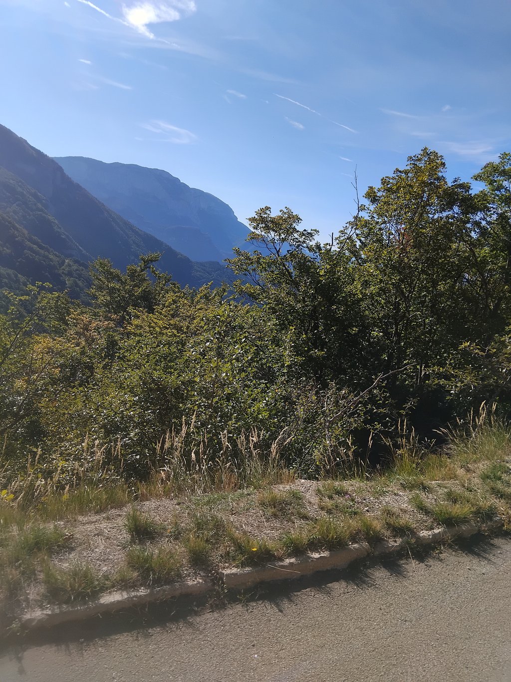
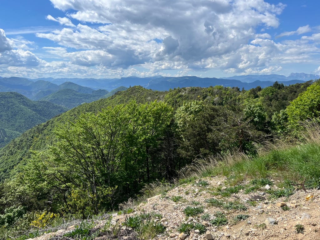
It's a long, linear climb, with plenty of bends and the cliff in front of us. The panorama at the top is also magnificent. The surface is top-notch and the road wide enough for bikes and cars.
Cette montée, grande et linéaire, laisse apercevoir tous ses virages et la falaise devant nous. Le panorama en haut en également magnifique. Le revêtement est top et la roite assez large pour vélos et voitures.
This is an automatic translation, the original language is: Dutch.
Show original
Nice climb to do if you're in the area. Lots of nice views. On the day I rode up, there were relatively many motorbikes though, after noon it was a lot quieter.
Mooie klim om te doen als je in de buurt bent. Veel mooie uitzichten. Op de dag dat ik naar boven ben gereden waren er wel relatief veel motoren, na het middaguur was het een stuk rustiger.
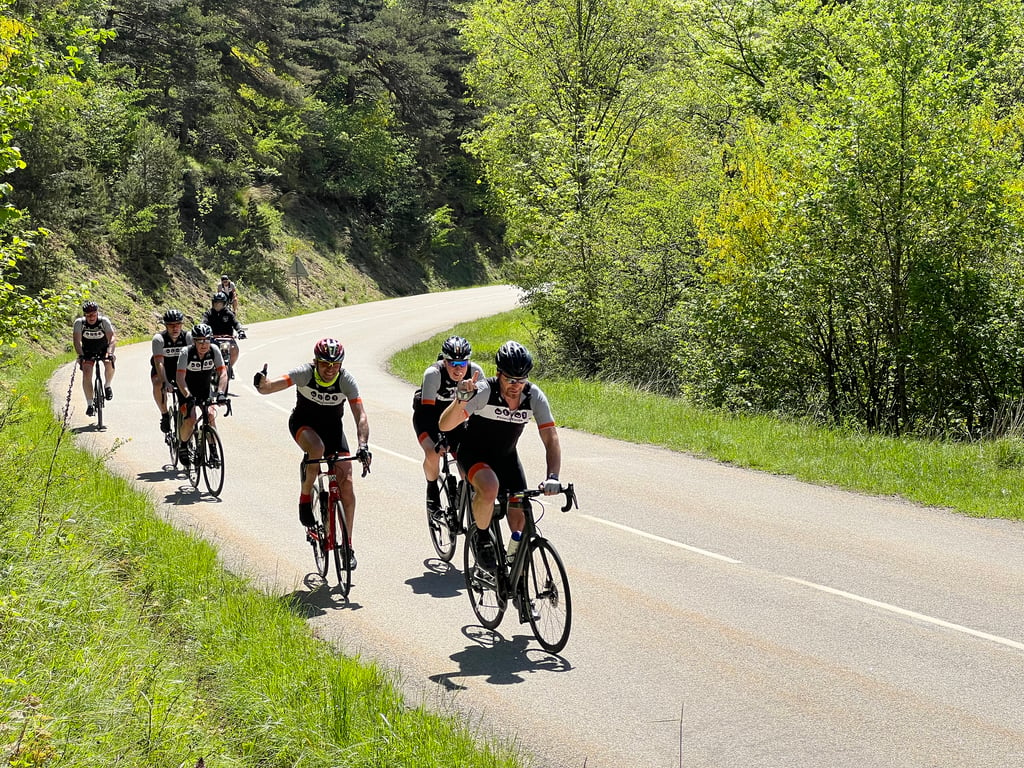
lovely 20km 5% climb the whole way! ends just before a tunnel. nice gentle series of hairpins. unfortunately bucketting rain all the way down to fully enjoy the downhill and no pics of hairpins! quiet, almost no traffic. ridden from Die. 27/5/2024.
This is an automatic translation, the original language is: Dutch.
Show original
Beautiful climb, really pedalling up some kilometres. Super nice road surface and great views. A real must if you are in the area. It can be quite crowded though. I did it fairly early in the morning, before it got too hot.
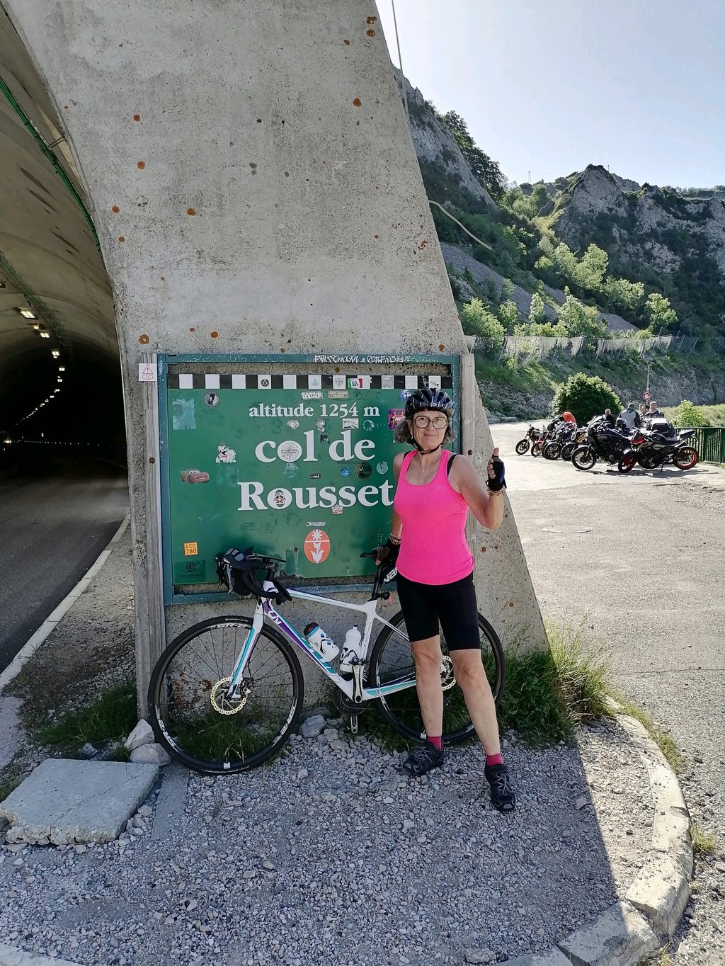
In the tunnel at the top (tip:bring lights!) there were works, but waited a while for the traffic lights and was fine with the cars's driving along through the tunnel.
Mooie klim, echt even wat kilometers omhoog trappen. Super mooi wegdek en mooie uitzichten. Een echte must als je in de buurt bent. Het kan wel vrij druk zijn. Ik heb hem redelijk vroeg in de ochtend gedaan, voordat het te warm werd.
In de tunnel bovenop (tip:neem lampjes mee!) waren werkzaamheden, maar even op de verkeerslichten gewacht en was prima met de auto's mee te rijden door de tunnel.
This is an automatic translation, the original language is: Dutch.
Show original
Perfect climb to start the day, nowhere too steep, great road surface and plenty of spots with great views. Traffic not too bad, but you're bound to encounter groups of bikers. I fortunately not too many. The ideal climb to enter the Vercors massif.
Perfecte klim om de dag mee te beginnen, nergens te steil, prima wegdek en genoeg plekken met prachtige vergezichten. Verkeer valt mee, maar je komt vast wel groepen motorrijders tegen. Ik gelukkig niet te veel. De ideale klim om het Vercors massief te betreden.
This is an automatic translation, the original language is: Dutch.
Show original
From Die it is about 20 km to the top, after about 3 km there is a short descent and from km 16 it really goes up. Nowhere really steep, beautiful views and lots of enjoyment during this climb.
Vanuit Die is het een kleine 20 km tot de top, na een km of 3 is er een korte afdaling en vanaf km 16 gaat het echt omhoog. Nergens echt steil, mooie uitzichten en veel genieten tijdens deze klim.
This is an automatic translation, the original language is: Dutch.
Show original
Very nice to do. 20km a 5%. You can paddle here or choose to pedal. Many hairpin bends which attracts many bikers but the view is more than worth it.
Erg lekker om te doen. 20km a 5%. Je kan hier heerlijk peddelen of ervoor kiezen om te stoempen. Veel haarspeldbochten wat veel motorrijders aantrekt maar het uitzicht is het meer dan waard.
This is an automatic translation, the original language is: Dutch.
Show original
Very nice steady climb. Good road surface and wide road. In short, ideal riveting work, by the length still a nice challenge. Once up phenomenal views.
Hele mooie gelijkmatige klim. Goed wegdek en brede weg. Kortom ideaal klinkwerk, door de lengte nog wel een mooie uitdaging. Eenmaal boven fenomenaal uitzicht.
This is an automatic translation, the original language is: Dutch.
Show original
The Col de Rousset is a beautiful climb that gradually goes up the mountain. The climb is not very heavy in percentages, but with almost 20 kilometres it is quite long. On the day I did the climb, it was sweltering hot with no wind at all. Still, you can 'bump' it up quite a bit because it is never very steep.
The road is of good quality, although you have to share the road with motorcyclists who also come to the hairpin bends. If you are at the top you cycle through a tunnel of 700 meters to get to the ski village. In the ski village you can treat yourself to water, refreshments or a good lunch.
The climb has markings to the top with signs every kilometer indicating the upcoming percentage. Both left and right of the road are these markings whereby the left side lags one kilometer behind the right side. The right hand side with the metal signs is the right one.
De Col de Rousset is een prachtige klim die rustigjesaan de berg op loopt. De klim is niet heel zwaar in percentages, maar met een kleine 20 kilometer is ie aardig aan de lengte. Op de dag dat ik de klim deed was het zinderend heet met geen zuchtje wind. Toch kan je deze klim aardig ‘opstoempen’ omdat hij nooit erg steil is.
De weg is van goede kwaliteit, hoewel je de weg wel moet delen met motorrijders die ook op de haarspeldbochten af komen. Als je boven bent fiets je door een tunnel van 700 meter om in het skidorp te komen. In het skidorp kan je jezelf trakteren op water, prikkelfris of een goede lunch.
De klim is voorzien van markeringen naar de top met bordjes die elke kilometer het aankomend percentage aangeven. Zowel links als rechts van de weg staan deze markeringen waarbij de linkerkant een kilometer achterloopt op de rechterkant. De rechterkant met de metalen bordjes is de juiste
This is an automatic translation, the original language is: Dutch.
Show original
Very nice steady climb. The road surface is super. (So climb time, time to adjust this) However, the col starts just outside Die (and not just from Chamaloc.) and is therefore, with a small dip just outside Chamaloc, 19.4 km long.
Heel fijne gelijkmatige klim. Het wegdek is super. (Dus Klimtijd, tijd om dit aan te passen) De col begint echter net buiten Die (en niet pas vanaf Chamaloc.) en is daardoor, met een kleine dip net buiten Chamaloc, 19,4 km lang.
This is an automatic translation, the original language is: Dutch.
Show original
First real Col I've conquered, apart from some small pustules in the Dutch landscape. I was not very well prepared, so I feared the worst. However, with my 20 year old steel horse it turned out to be very doable. After one kilometer I had the right speed and could continue my climb. I even had a bit left for a final sprint. Super for beginner, and I think also for advanced cyclist a nice challenge. Views are fantastic, and asphalt just new (2017).
Eerste echte Col die ik heb bedwongen, buiten wat kleine puisten in het Nederlandse landschap. Had me niet enorm goed voorbereid, dus vreesde het ergste. Met mijn stalen ros van 20 jaar oud bleek het echter prima te doen. Na een kilometer had ik het juiste tempo er in en kon ik rustig doorklimmen. Had zelfs nog wat over voor een eindsprint. Super voor beginner, en denk ook voor gevorderde fietser een leuke uitdaging. Uitzichten zijn fantastisch, en asfalt net nieuw (2017).
This is an automatic translation, the original language is: Dutch.
Show original
Yesterday I rode up on my own. Went up at the same time as a large group of packed and strapped grim Englishmen (60 and 70+) on top enjoyed the good humored humorous Englishmen that slowly trickled in. Today I rode the col de la chaudiere, which I found much heavier, drank more than 1.5 bidons empty, but it was close to 30 degrees, hardly any shade. In 3 weeks time I will turn 59!
Gisteren in mijn eentje omhooggereden. Ging tegelijkertijd omhoog met grote groep bepakte en bezakte kranige engelsen (60 en 70!plussers) bovenop genoten van de Langzaam binnendruppelende goed gehumeurde humoristische Engelsen. Vandaag de col de la chaudiere gereden, vond ik veel zwaarder, ruim 1,5 bidon leeggedronken, maar het was wel tegen de 30 graden, nauwelijks schaduw. Over 3 weken word ik 59!
This is an automatic translation, the original language is: Dutch.
Show original
I have done the col de la chaudiere 5 times and it is quite tough with its moments and indeed little shade from Bourdeaux. From Saillanz you have more shade and it is more regular but steeper. It is also a mountain where Pinot occasionally went to train.
De col de la chaudiere heb ik al 5 keer gedaan en is best wel pittig met zijn momenten en inderdaad weinig schaduw vanuit Bourdeaux. Vanuit Saillanz heb je meer schaduw en is hij regelmatiger maar wel steiler. Het is ook een berg waar Pinot af en toe ging trainen.
This is an automatic translation, the original language is: Dutch.
Show original
Just done the Rousset. From Die there are signs saying sommet 20 km. Per km markings on the road surface. Not steep, but hot and even climb with 8 hairpin bends. Beautiful descent.
Net de Rousset gedaan. Vanuit Die staan er borden waarop staat sommet 20 km. Per km markering op het wegdek. Geen steile, wel warme en gelijkmatiege klim met 8 haarspeldbochten. Mooie afdaling.
You don't need special gearing for Col de Rousset from Die. The slope isn't long or steep enough to require much shifting down. You can conquer this climb on power alone. However, a compact gearing system with a smallest front chainring of 34 and largest rear sprocket of 28 or 30 is always nice if you enjoy cycling uphill. This helps maintain a smooth cadence.
Col de Rousset from Die is a serious climb and falls into the 2nd category. With a good basic fitness level, even without much cycling experience, you can complete this climb just fine. However, a bike with climbing gears is a must. Without experience or training, it will be really tough – but that’s part of the challenge!
Col de Rousset from Die is 12.1 mi long.
The average gradient of Col de Rousset from Die is 4.4%.
Col de Rousset from Die has a steepest segment with an average gradient of 8.6%.
The summit of Col de Rousset from Die is at 4098 ft.
At a slow pace of 5 mph, it takes about 02:26:14 to climb Col de Rousset from Die. At 7 mph the time is 01:43:31, and at 9 mph 01:20:40. For the fastest cyclists, 01:00:36 is an achievable time.
Col de Rousset from Die is located in the region Drôme in France.