View on map
© MapLibre | OpenStreetMap contributors
1%
2%
4%
6%
8%
10%
12%
15%
20%

Col de Morbieux from Saulxures

2.8
4 reviews | Elevation profile | 7 photos
Tips nearby
Col de Morbieux from Saulxures
transparant thumb
Your achievable time
Calculating based on your best performances...
Relaxed
Maximum
W/kg
W/kg
W/kg
Analyze your climbing performance
Detailed insight into your climbing performance & automatically check off climbs
Based on your best performances.
Your best attempt:
Number of attempts:
Elevation profile Col de Morbieux from Saulxures

Statistics

Difficulty points 247
Length 3.3 mi
Average gradient 6.4%
Steepest segment 11.1%
Total ascent 1109 ft
Feedback about this climb?
Show climbs nearby Export to GPS device

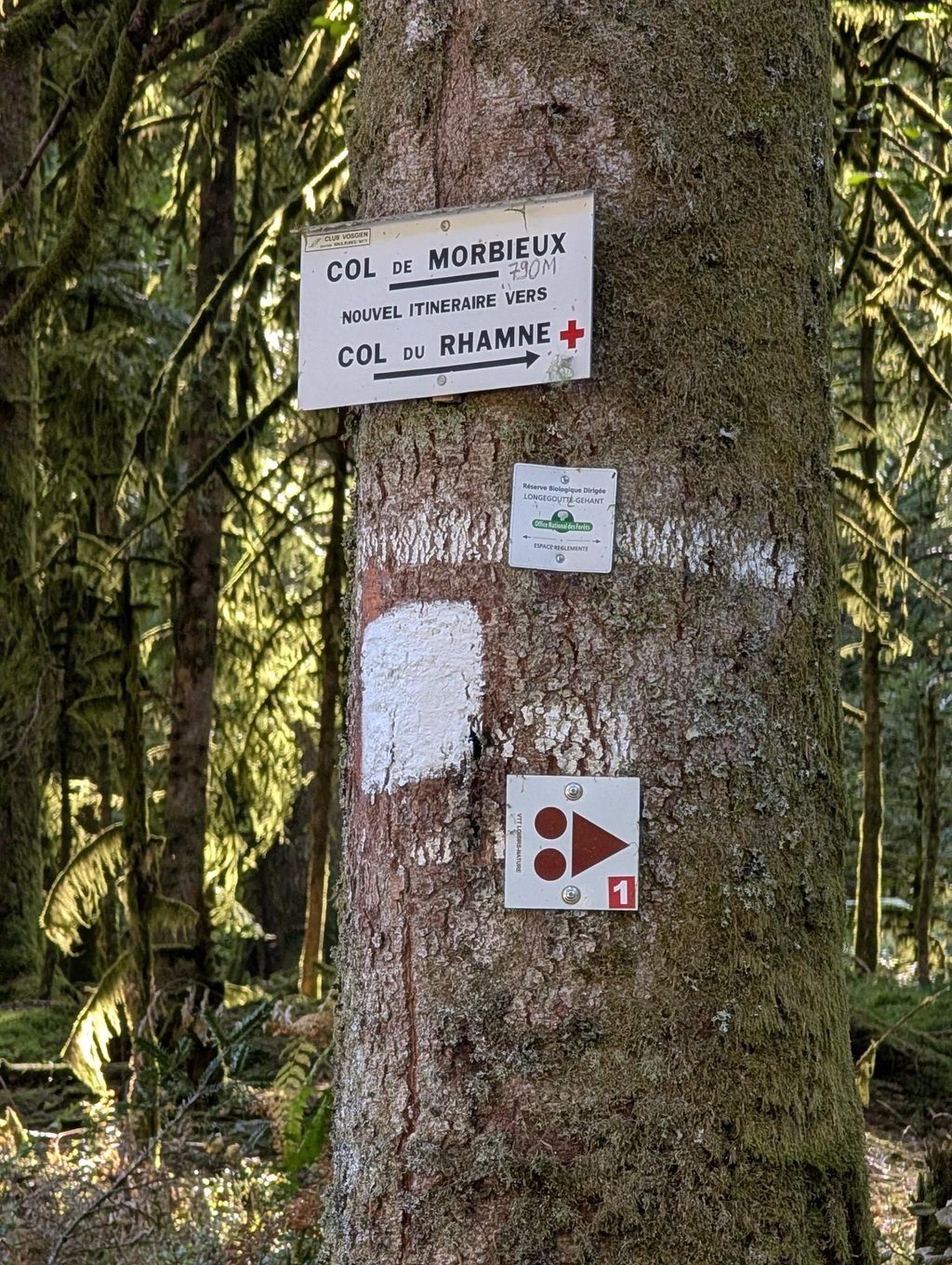
Col de Morbieux from Saulxures is a climb in the region Vosges. It is 3.3 mi long and bridges 1109 ft of vertical ascent with an average gradient of 6.4%, resulting in a difficulty score of 247. The top of the ascent is located at 2628 ft above sea level. Climbfinder users shared 4 reviews of this climb and uploaded 7 photos.

Road name: Route de Morbieux

4.0 by dwelleke
This is an automatic translation, the original language is: Dutch.
I don't understand the lower scores below, while the comments are mostly positive. Indeed a very nice and quiet col among the trees. No vistas but definitely worth integrating into your ride.... read more

Photos (7)

Col de Morbieux from Saulxures
transparant thumb
transparant thumb
transparant thumb
transparant thumb
transparant thumb

Your uploads (max 4)

Welcome! Please activate your account if you would like to share something. Look for the verification email in your inbox.

If you want to upload your photos, you need to create an account. It only takes 1 minute and it's completely free.

  • Receive free climbfinder goodies for your reviews & photos.
  • Create a bucket list and check off conquered climbs.
  • Add missing climbs.
Continue with GoogleContinue with Google Continue with FacebookContinue with Facebook Continue with AppleContinue with Apple Sign up with email
By signing up you agree to our terms of service and confirm that you have read our privacy & content policy.

Reviews (4)

5.0
4.0
3.0
2.0
1.0
dwelleke
1 y 4.0
This is an automatic translation, the original language is: Dutch. Show original

I don't understand the lower scores below, while the comments are mostly positive. Indeed a very nice and quiet col among the trees. No vistas but definitely worth integrating into your ride.

Ik begrijp de lagere scores hieronder niet, terwijl de commentaar voornamelijk positief is. Inderdaad een zeer mooie en rustige col tussen de bomen. Geen vergezichten maar wel zeker de moeite om deze te integreren in je rit.

Dashboard
TimCyclist
2 y 3.0
This is an automatic translation, the original language is: Dutch. Show original

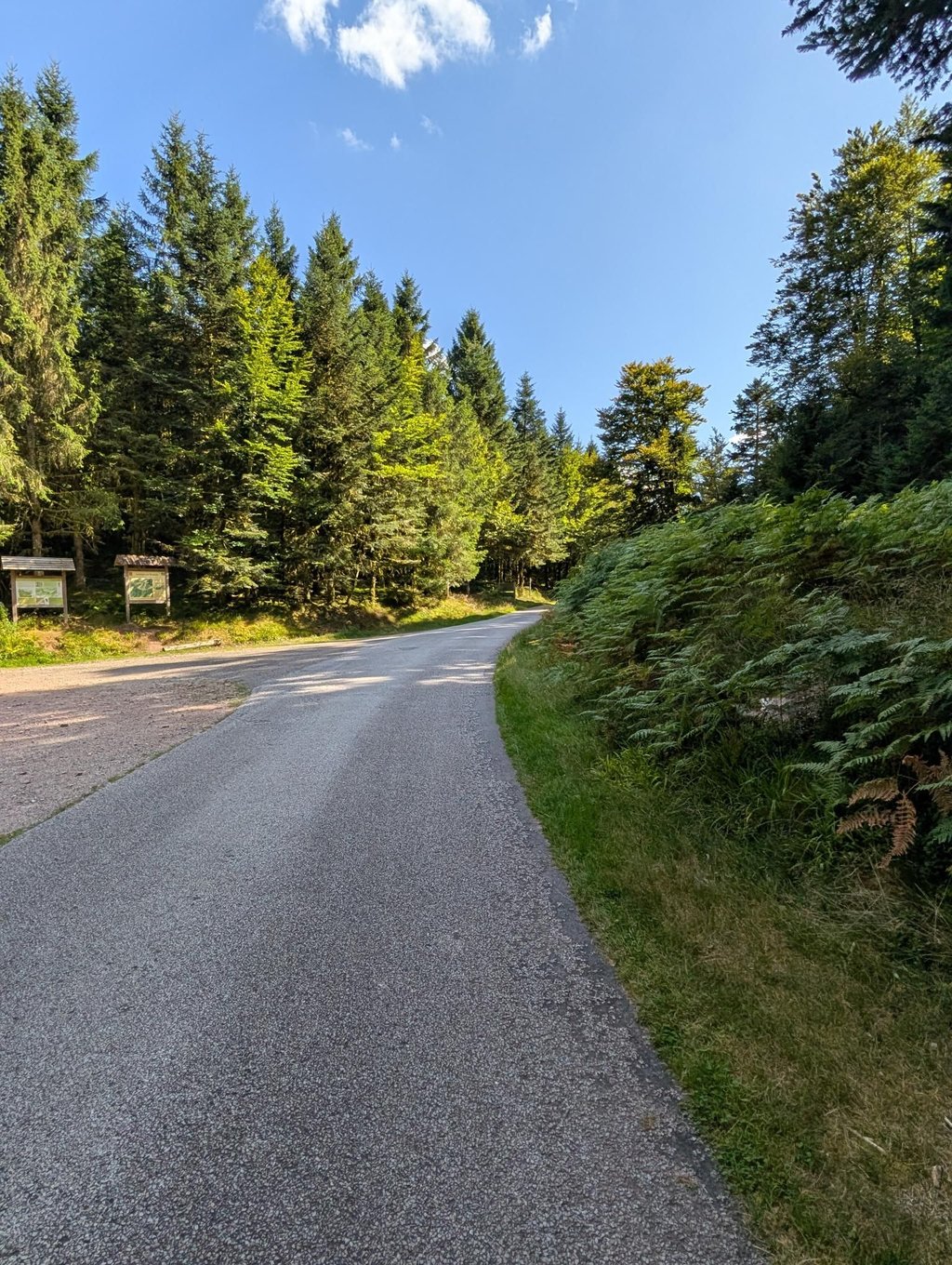
Nice, steady climb through a beautiful forest. A narrower road, on which you won't encounter any traffic. Recommended on warm, sunny days. Asphalt is OK. Descent just about.

Part of the fondo in May 2024.

Leuke, gelijkmatige klim door een mooi bos. Een smallere weg, waarop je geen verkeer tegen gaat komen. Aanrader op warme, zonnige dagen. Asfalt is oké. Afdaling net aan.

Onderdeel van de fondo in mei 2024.

Dashboard
sjoerd-brandsma
3 y 2.0
This is an automatic translation, the original language is: Dutch. Show original

The climb goes largely through the forest, which is nice when it is warm. In both the climb and the descent to Ramonchamp, the road surface is moderate to poor.

Klim loopt grotendeels door het bos, dat is prettig als het warm is. Zowel in de klim, als in de afdaling naar Ramonchamp is het wegdek matig tot slecht.

Dashboard
Ejprins
4 y 2.0
This is an automatic translation, the original language is: Dutch. Show original

This side is the easy side, asphalt is a bit less but good to cycle. Nice climb without crazy percentages, goes up evenly.

Deze kant is de makkelijke kant, asfalt is wat minder maar goed te fietsen. Mooie klim zonder gekke percentages, loopt gelijkmatig omhoog.

Col de Morbieux from Saulxures
Dashboard

Climbing times

5 mph 00:39:28
7 mph 00:27:57
9 mph 00:21:46
12 mph 00:16:21

Road surface condition

0% 83% 17%
Based on 6 votes
Share your knowledge. What was the road condition during your ascent?

Traffic

100% 0% 0%
Based on 6 votes
Your experience counts. How much traffic did you encounter during the climb?

Frequently Asked Questions

Col de Morbieux can be cycled from 2 sides. Col de Morbieux from Saulxures is the most popular side, but the summit can also be reached via Col de Morbieux from Ramonchamp.

Col de Morbieux from Saulxures is a challenging ascent. For this type of climbing, we recommend mountain gearing, specifically a compact system. This means a small front chainring of 34 teeth, combined with a rear cassette where, depending on your level, strength, and experience, you choose a sprocket with 30, 32, or even 34 teeth. Remember that a smooth cadence is always more efficient!

Col de Morbieux from Saulxures is a 3rd-category climb. Almost anyone can handle this climb, as long as you have a bike with climbing gears. If you have little training, you will probably need to shift down significantly. For experienced riders, Col de Morbieux from Saulxures is not a problem.

Col de Morbieux from Saulxures is 3.3 mi long.

The average gradient of Col de Morbieux from Saulxures is 6.4%.

Col de Morbieux from Saulxures has a steepest segment with an average gradient of 11.1%.

The summit of Col de Morbieux from Saulxures is at 2628 ft.

At a slow pace of 5 mph, it takes about 00:39:28 to climb Col de Morbieux from Saulxures. At 7 mph the time is 00:27:57, and at 9 mph 00:21:46. For the fastest cyclists, 00:16:21 is an achievable time.

Col de Morbieux from Saulxures is located in the region Vosges in France.

This page is better in the app

Climbfinder app
Climbfinder
(Free)
Open