View on map
© MapLibre | OpenStreetMap contributors
1%
2%
4%
6%
8%
10%
12%
15%
20%

Col de Montségur from Lavelanet

3.5
2 reviews | Elevation profile | 1 photo
Tips nearby
Col de Montségur from Lavelanet
transparant thumb
transparant thumb
transparant thumb
transparant thumb
transparant thumb
transparant thumb
transparant thumb
Your achievable time
Calculating based on your best performances...
Relaxed
Maximum
W/kg
W/kg
W/kg
Analyze your climbing performance
Detailed insight into your climbing performance & automatically check off climbs
Based on your best performances.
Your best attempt:
Number of attempts:
Elevation profile Col de Montségur from Lavelanet

Statistics

Difficulty points 385
Length 5.1 mi
Average gradient 5.8%
Steepest segment 14.2%
Total ascent 1555 ft

Short recap

Beautiful scenery
#52 toughest climb of Ariège
#56 most elevation gain of Ariège
#57 longest climb of Ariège
Feedback about this climb?
Show climbs nearby Export to GPS device

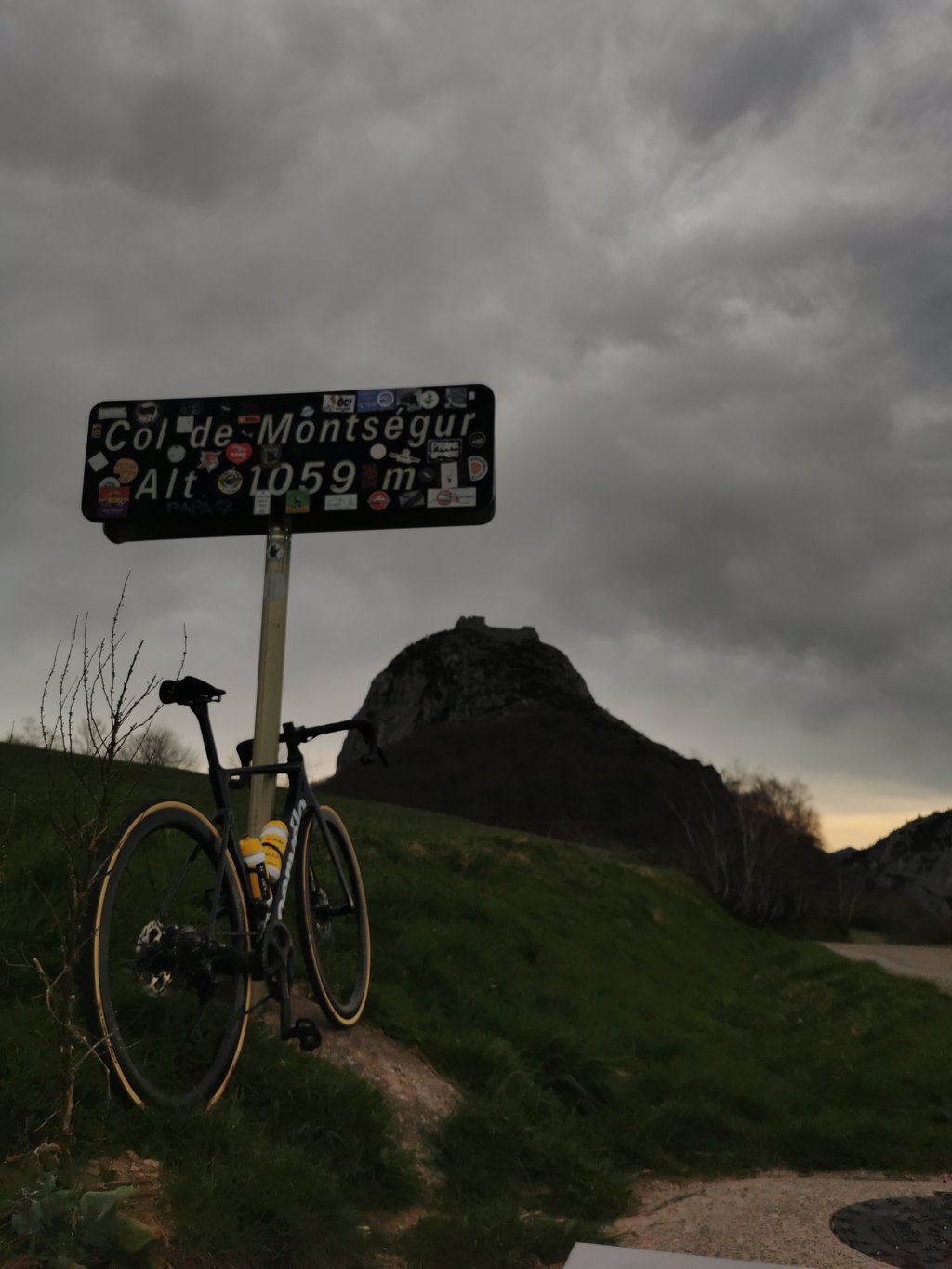
Col de Montségur from Lavelanet is a climb in the region Ariège. It is 5.1 mi long and bridges 1555 ft of vertical ascent with an average gradient of 5.8%, resulting in a difficulty score of 385. The top of the ascent is located at 3451 ft above sea level. Climbfinder users shared 2 reviews of this climb and uploaded 1 photo.

Road name: D9

3.0 by MaxenceG
This is an automatic translation, the original language is: French.
I wouldn't recommend it at the start of a high percentage outing but with a beautiful view from the summit. Ideal for a split session.... read more

Photos (1)

Col de Montségur from Lavelanet
transparant thumb
transparant thumb
transparant thumb
transparant thumb
transparant thumb

Your uploads (max 4)

Welcome! Please activate your account if you would like to share something. Look for the verification email in your inbox.

If you want to upload your photos, you need to create an account. It only takes 1 minute and it's completely free.

  • Receive free climbfinder goodies for your reviews & photos.
  • Create a bucket list and check off conquered climbs.
  • Add missing climbs.
Continue with GoogleContinue with Google Continue with FacebookContinue with Facebook Continue with AppleContinue with Apple Sign up with email
By signing up you agree to our terms of service and confirm that you have read our privacy & content policy.

Reviews (2)

5.0
4.0
3.0
2.0
1.0
MaxenceG
10 Mo 3.0 via the Climbfinder app
This is an automatic translation, the original language is: French. Show original

I wouldn't recommend it at the start of a high percentage outing but with a beautiful view from the summit. Ideal for a split session.

Je deconseille au debut d'une sortie avec des fort pourcentage mais avec une belle vue au sommet . Ideal pour une sceance de fractionné .

Dashboard
SimNono
1 y 4.0
This is an automatic translation, the original language is: French. Show original

the real climb starts at montferrier, where it's short but steep. at the top there's a fine view of the castle

la vraie montée commence à montferrier, là c'est court mais raide. en haut belle vue sur le château

Dashboard

Climbing times

5 mph 01:01:18
7 mph 00:43:24
9 mph 00:33:49
12 mph 00:25:24

Road surface condition

100% 0% 0%
Based on 2 votes
Share your knowledge. What was the road condition during your ascent?

Traffic

100% 0% 0%
Based on 2 votes
Your experience counts. How much traffic did you encounter during the climb?

Frequently Asked Questions

Col de Montségur can be cycled from 2 sides. Col de Montségur from Belesta is the most popular side, but the summit can also be reached via Col de Montségur from Lavelanet.

You don't need special gearing for Col de Montségur from Lavelanet. The slope isn't long or steep enough to require much shifting down. You can conquer this climb on power alone. However, a compact gearing system with a smallest front chainring of 34 and largest rear sprocket of 28 or 30 is always nice if you enjoy cycling uphill. This helps maintain a smooth cadence.

Col de Montségur from Lavelanet is a serious climb and falls into the 2nd category. With a good basic fitness level, even without much cycling experience, you can complete this climb just fine. However, a bike with climbing gears is a must. Without experience or training, it will be really tough – but that’s part of the challenge!

Col de Montségur from Lavelanet is 5.1 mi long.

The average gradient of Col de Montségur from Lavelanet is 5.8%.

Col de Montségur from Lavelanet has a steepest segment with an average gradient of 14.2%.

The summit of Col de Montségur from Lavelanet is at 3451 ft.

At a slow pace of 5 mph, it takes about 01:01:18 to climb Col de Montségur from Lavelanet. At 7 mph the time is 00:43:24, and at 9 mph 00:33:49. For the fastest cyclists, 00:25:24 is an achievable time.

Col de Montségur from Lavelanet is located in the region Ariège in France.

This page is better in the app

Climbfinder app
Climbfinder
(Free)
Open