Tips nearby


| Hidden gem |
| 4 hairpin turns |
| #54 average steepest climb of Annecy |
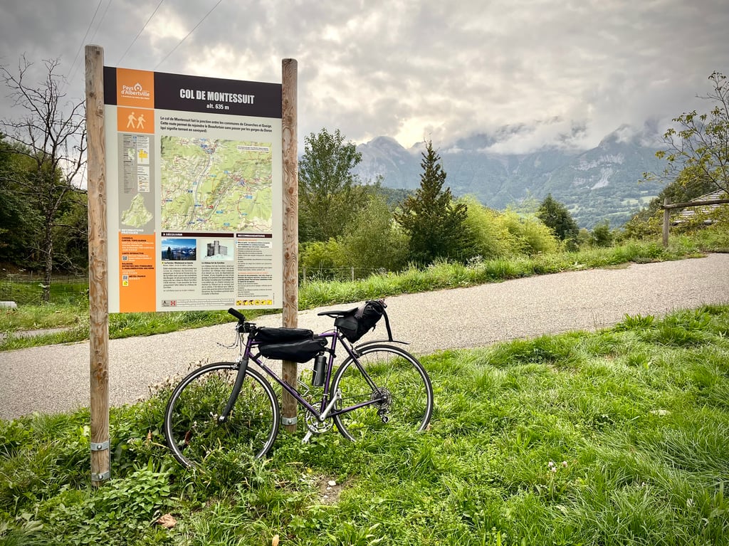
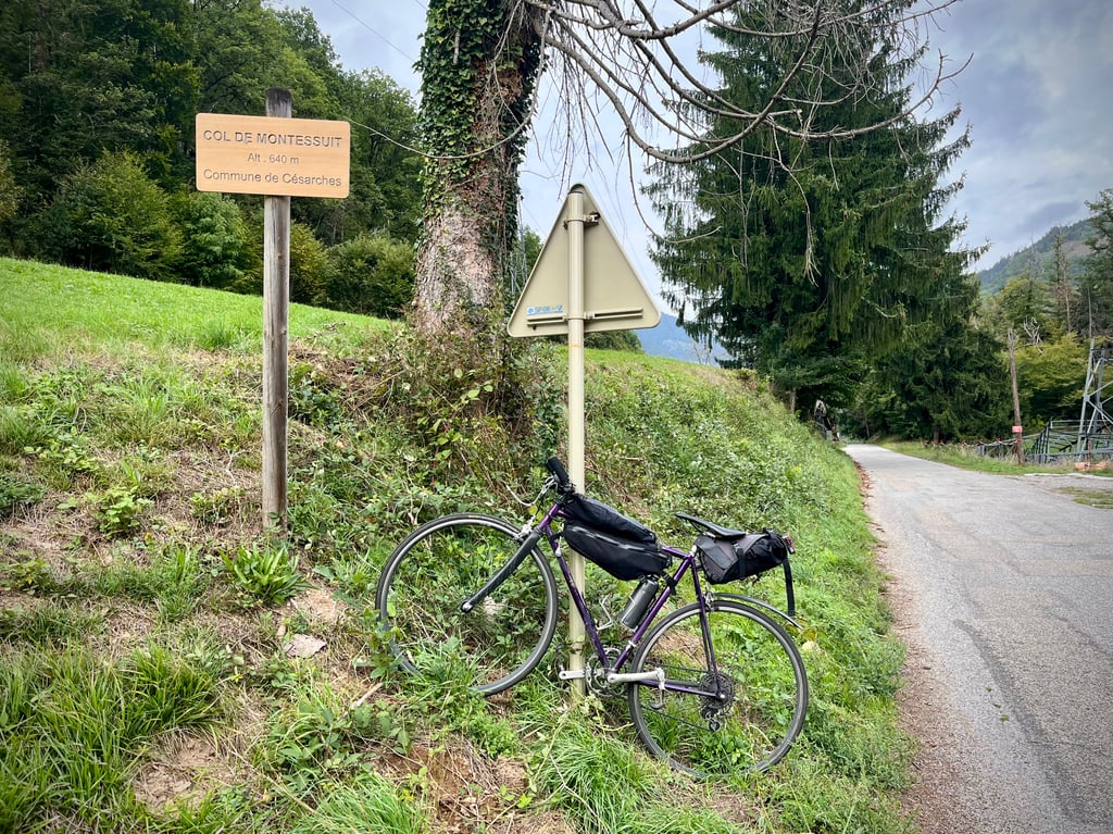
Col de Montessuit is a climb in the region Annecy. It is 2.4 mi long and bridges 981 ft of vertical ascent with an average gradient of 7.6%, resulting in a difficulty score of 273. The top of the ascent is located at 2162 ft above sea level. Climbfinder users shared 2 reviews of this climb and uploaded 4 photos.
Road name: D118
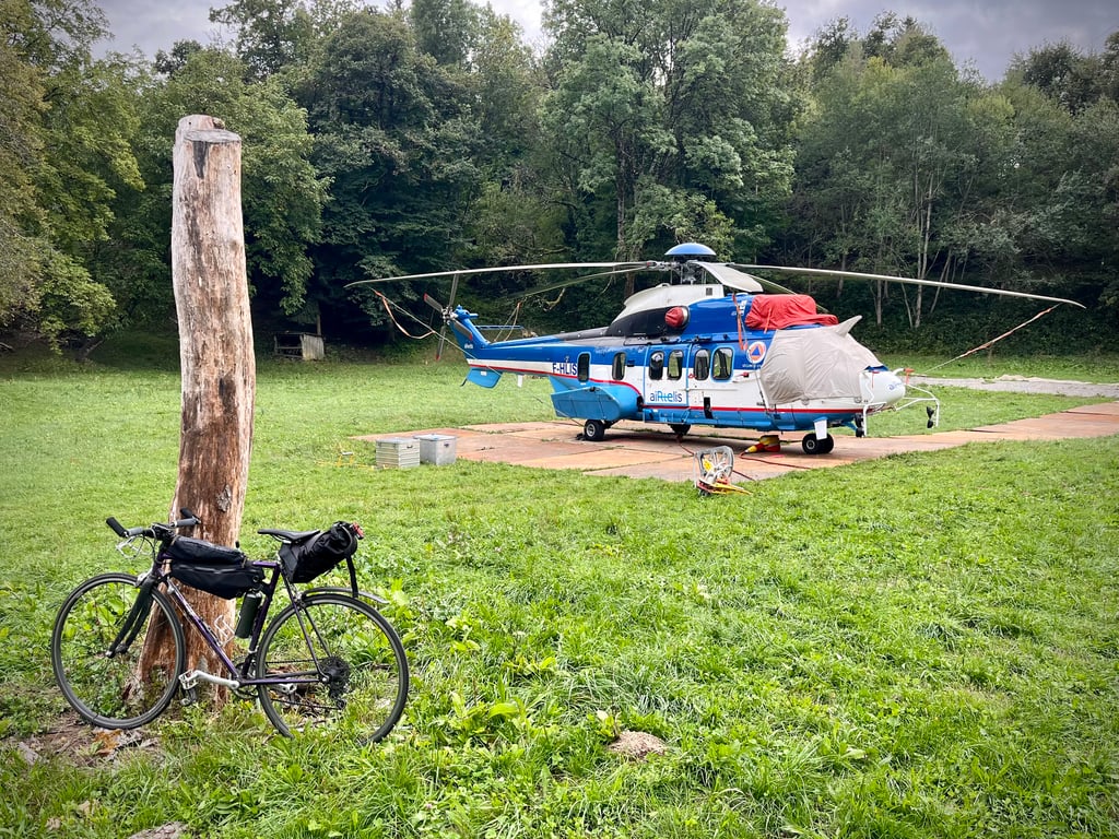
2.0 by CromagnonThis is an automatic translation, the original language is: French.There's nothing breathtaking here, apart from the rare pleasure of climbing such short passes in the Alps! The road is perfect up to Césarches, then deteriorates somewhat after the village. The bends in the clean road are very nice. It climbs decently, with a few short steep sections. No traffic. Unusual scenery. Nothing too crazy up there. Well, this helicopter was involved in some electrical work in the mountains. Nearby, the Col du Vorger is much prettier.... read more
Welcome! Please activate your account if you would like to share something. Look for the verification email in your inbox.
If you want to upload your photos, you need to create an account. It only takes 1 minute and it's completely free.
There's nothing breathtaking here, apart from the rare pleasure of climbing such short passes in the Alps!
The road is perfect up to Césarches, then deteriorates somewhat after the village.
The bends in the clean road are very nice. It climbs decently, with a few short steep sections.
No traffic. Unusual scenery.
Nothing too crazy up there. Well, this helicopter was involved in some electrical work in the mountains.
Nearby, the Col du Vorger is much prettier.
Rien d’époustouflant ici, si ce n’est le plaisir rare de grimper des petits cols si courts dans les Alpes !
La route est parfaite jusqu’à Césarches, puis se dégrade quelque peu après le village.
Les virages de la route propre, la première partie de la montée, sont très réussis. Ça monte décemment avec quelques petits raidards.
Pas de circulation. Paysages pas exceptionnels.
Là-haut, rien de bien dingue non plus. Enfin, si, cet hélicoptère qui participait à des travaux d’aménagement électrique dans la montagne.
Tout près, le col du Vorger est nettement plus mignon.
Pass that allows you to go from the Arly valley to the Beaufortain on the road that joins Albertville to Beaufort.
I did it several times, the graph is quite accurate, not very long but with some steep passages.
Col qui permet de passer de la vallée de L'Arly au Beaufortain sur la route qui joint Albertville à Beaufort.
Je l'ai fait plusieurs fois, le graphique est assez fidèle, pas très long mais avec des passages bien pentus.
| 5 mph | 00:29:32 |
| 7 mph | 00:20:54 |
| 9 mph | 00:16:17 |
| 12 mph | 00:12:14 |
This page is better in the app