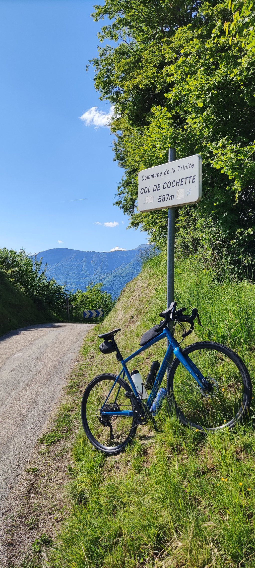
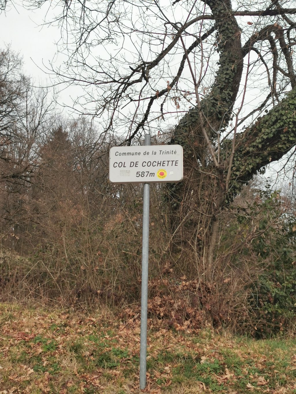
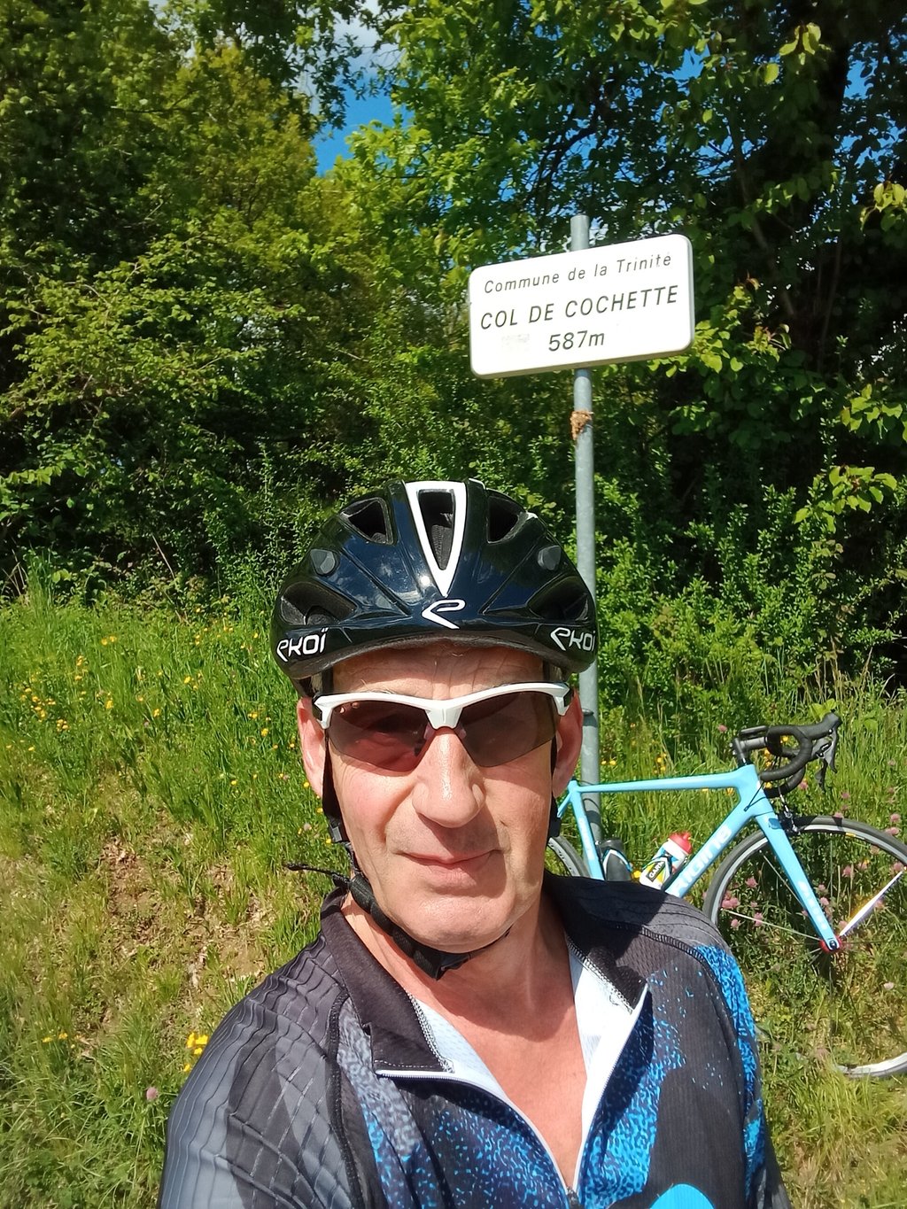
Col de la Cochette from Villard-d'Héry is a climb in the region Savoie. It is 1.3 mi long and bridges 476 ft of vertical ascent with an average gradient of 6.7%, resulting in a difficulty score of 117. The top of the ascent is located at 1913 ft above sea level. Climbfinder users shared 3 reviews of this climb and uploaded 3 photos.
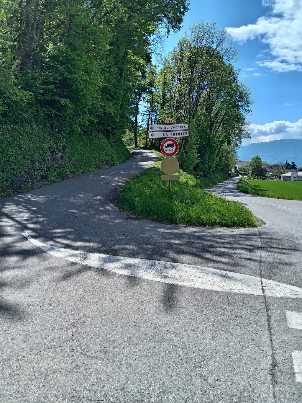
Road names: Route de Cochette & Route du Col
2.0 by Cordoba110This is an automatic translation, the original language is: Dutch.Not too long climb without major difficulties. Little traffic.... read more
Welcome! Please activate your account if you would like to share something. Look for the verification email in your inbox.
If you want to upload your photos, you need to create an account. It only takes 1 minute and it's completely free.
Not too long climb without major difficulties. Little traffic.
Niet te lange klim zonder grote moeilijkheden. Weinig verkeer.
Officially, the foot of the pass is at Villard D'Héry, but you can start the ascent from the Val Coisin road at the start of the D33, which makes for a 4.9km climb with an average gradient of 6.5.
It's a pass I rarely climb, the Climbfinder profile is close to reality, the tarmac is good and there's very little traffic.
It's in the shade on the first part then clear on the 2nd.
A % a little above 15 near the summit otherwise nothing special.
Officiellement le pied du col se situe à Villard D'Héry mais on peut commencer l'ascension en venant de la RTe du Val Coisin vraiment au début de la D33 ce qui fait une montée de 4,9km avec un pourcentage moyen de 6,5.
C'est un col que je fais rarement , le profil Climbfinder est proche de la réalité, le bitume est bon et il y a très peu de circulation.
À l'ombre dans la première partie puis dégagé sur la 2ème.
un % un peu au dessus de 15 proche du sommet sinon rien de spécial.
Small road in the forest with very little traffic, easier here than on the south side. While you're at it, go as far as Hauteville to see the carp at the washhouse.
Petite route dans la forêt et très peu fréquentée, plus facile ici que par le versant sud. Tant qu'à faire allez jusqu'à Hauteville voir les carpes du lavoir
| 5 mph | 00:16:12 |
| 7 mph | 00:11:28 |
| 9 mph | 00:08:56 |
| 12 mph | 00:06:43 |
This page is better in the app