| 5 hairpin turns |
| #72 average steepest climb of Isère |
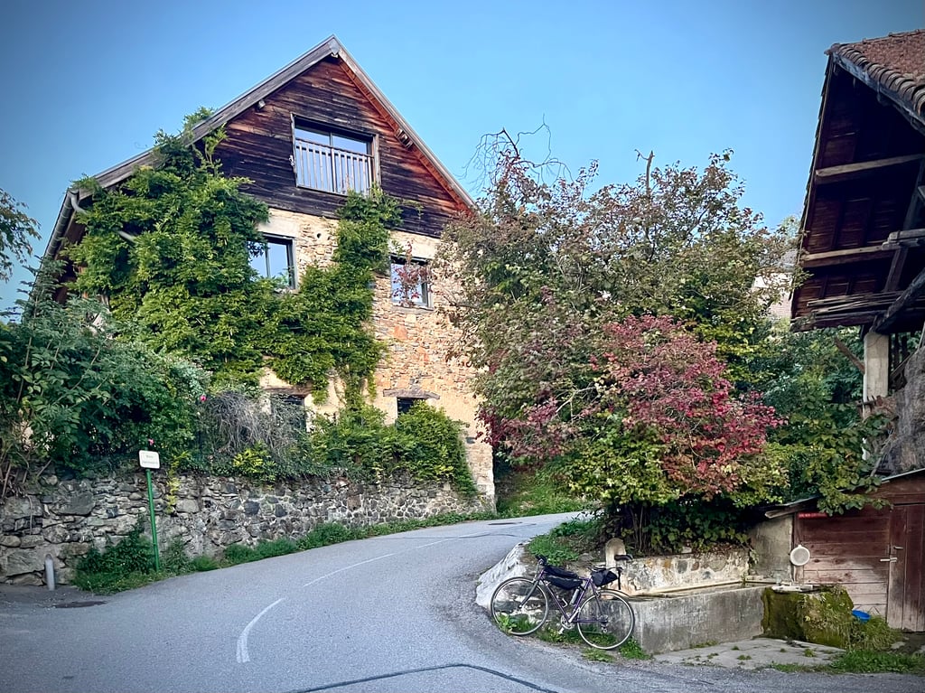
Col de la Coche from Le Sonnant d'Uriage is a climb in the region Grenoble. It is 2.8 mi long and bridges 1289 ft of vertical ascent with an average gradient of 8.6%, resulting in a difficulty score of 393. The top of the ascent is located at 2375 ft above sea level. Climbfinder users shared 4 reviews of this climb and uploaded 12 photos.
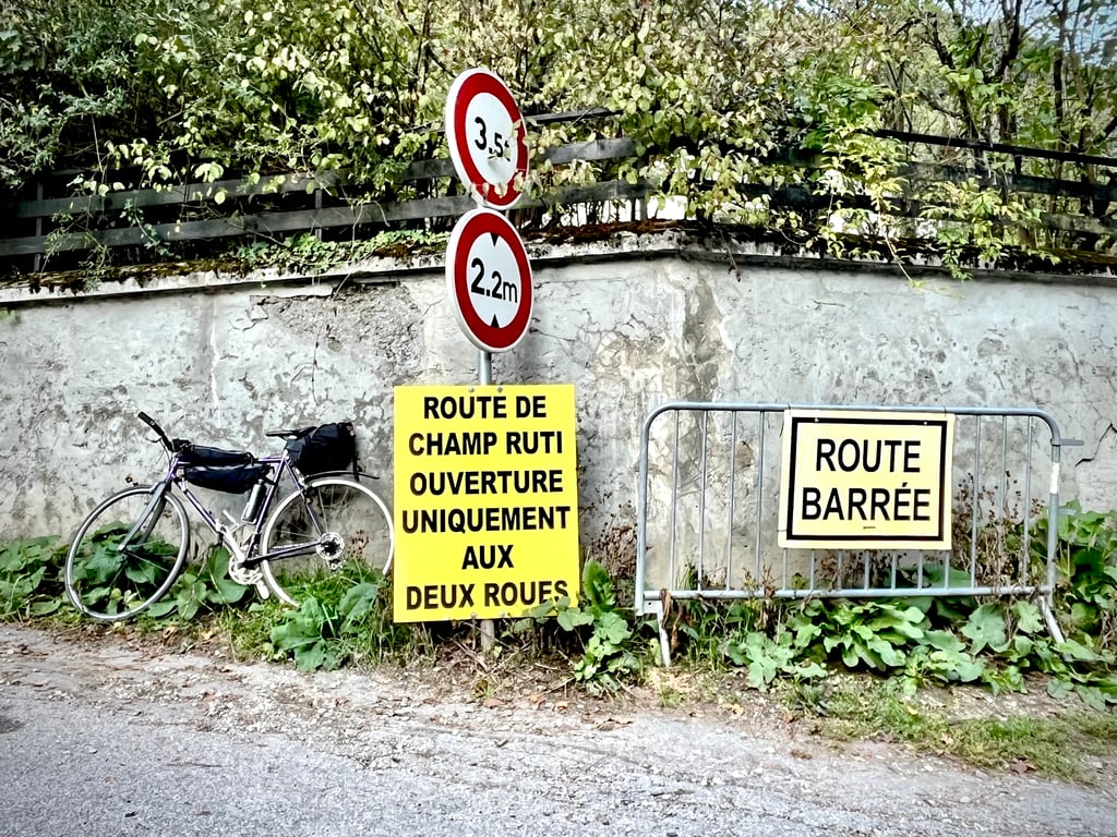
Road names: Route de Champ Ruti & Route de Venon
3.0 by sergenavetatThis is an automatic translation, the original language is: French.Made on 10 June 2025. Coming from Uriage, this climb allows you (but at what price) to avoid the heavy traffic on the Rte de Gières to reach the valley. At this time, only 2-wheelers are allowed, but the area is calm, fairly shaded and the tarmac is in good condition. The slope is steep from the start, but steady, with a slight flat area and a slight descent from St Nizier de Moucherotte allowing a little recovery before the start of the very tough final section with passages at 15%. I di... read more
Welcome! Please activate your account if you would like to share something. Look for the verification email in your inbox.
If you want to upload your photos, you need to create an account. It only takes 1 minute and it's completely free.
Made on 10 June 2025.
Coming from Uriage, this climb allows you (but at what price) to avoid the heavy traffic on the Rte de Gières to reach the valley.
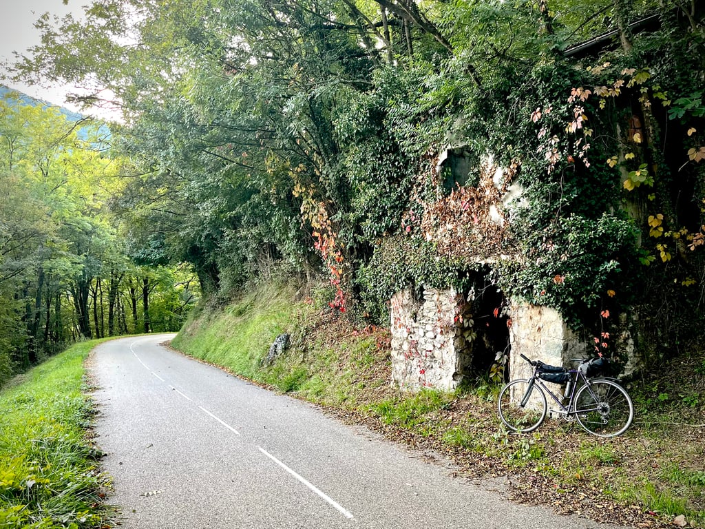
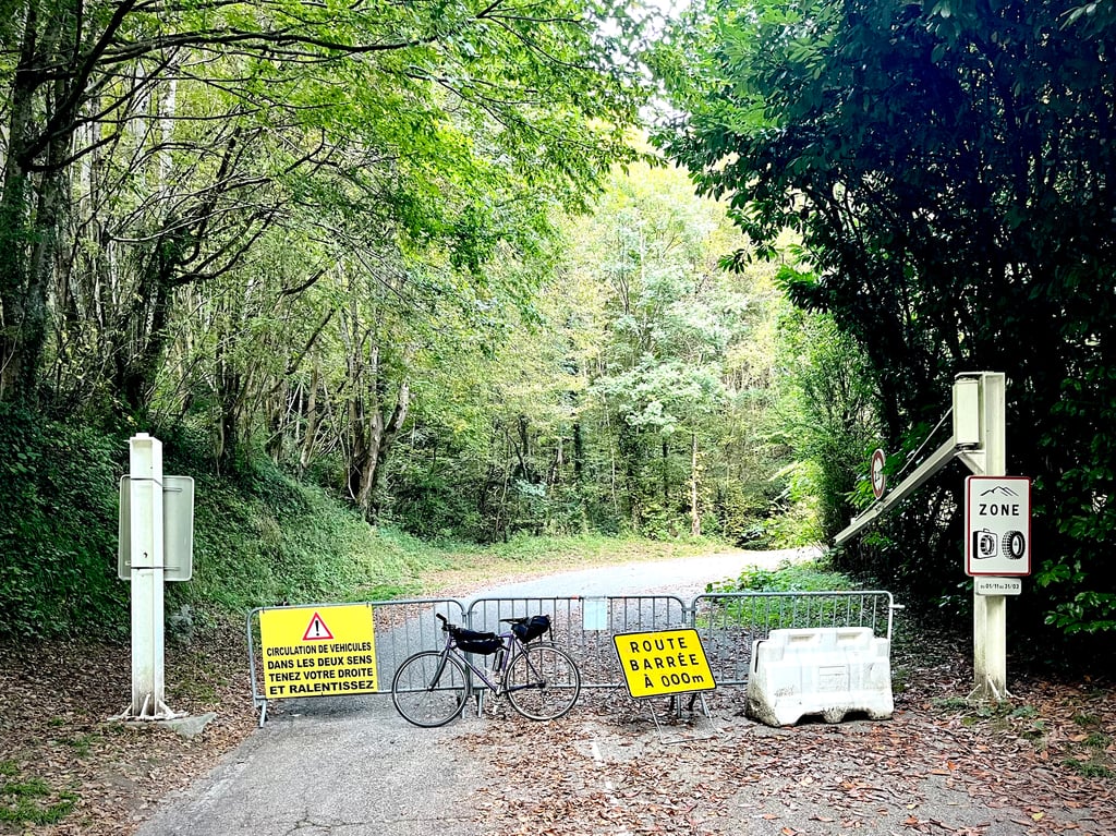
At this time, only 2-wheelers are allowed, but the area is calm, fairly shaded and the tarmac is in good condition.
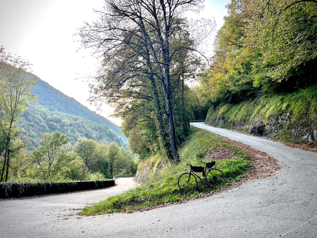
The slope is steep from the start, but steady, with a slight flat area and a slight descent from St Nizier de Moucherotte allowing a little recovery before the start of the very tough final section with passages at 15%.
I didn't see any signpost indicating any kind of Col, although the OSM maps clearly indicate it. Weird!
Fait le 10 juin 2025.
En venant d'Uriage cette ascension permet ( mais à quel prix ) d'éviter la grande circulation de la Rte de Gières pour rejoindre la vallée.
À cette date seul les 2 roues sont autorisés, l'endroit est calme, assez ombragé et le bitume en état correct.
La pente est sévère dès l'entame, mais régulière, léger replat et légère descente à partir de St Nizier de Moucherotte permet une petite récup avant l'entame du final très costaud avec passages à 15%.
Pas vu de panneau indiquant un quelconque Col, pourtant les cartes OSM il est bien signalé. Bizarre!
It's a climb I've made today for the first time... at least according to the itinerary shown here, because in fact I've climbed it several times in my youth, but only up to km 3, at Saint-Nizier-d'Uriage, after which I always went to the right, towards Pinetou du Faux.
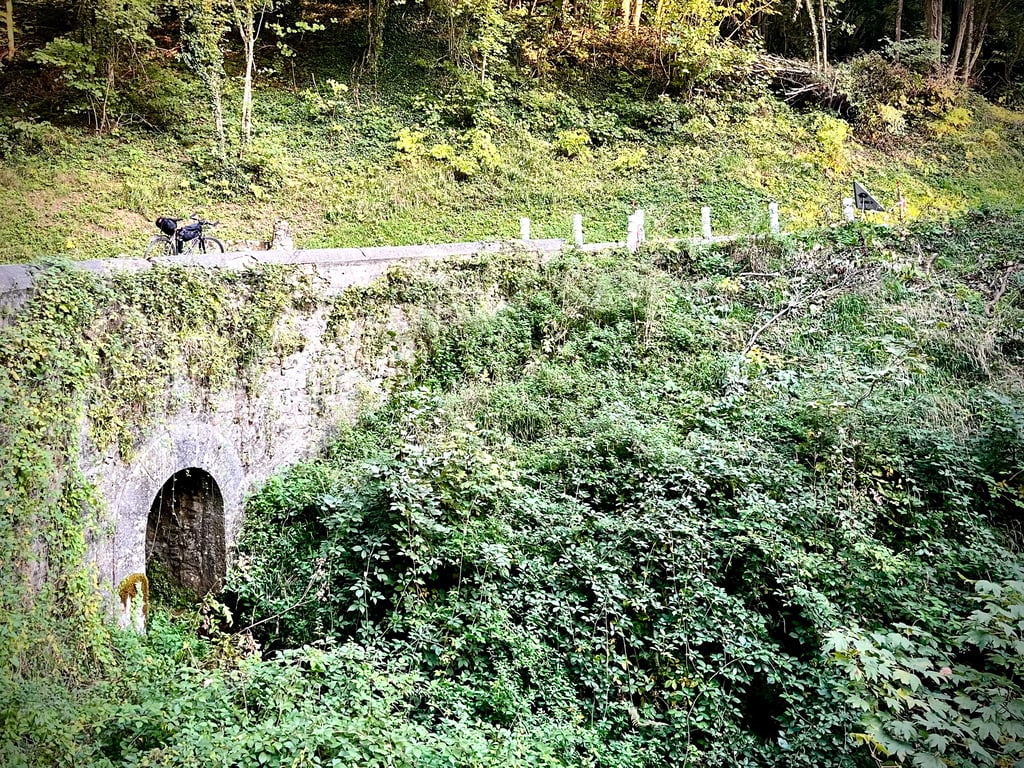
In addition to the relevant information from Cromagnon, it should be noted that from the Col de la Coche it is currently no longer possible to descend to Gières via Venon, due to work on the bridge at the entrance to Gières (the Belledonne rivers have experienced heavy flooding in recent months, leading to a flurry of restoration or prevention work on the bridges concerned).
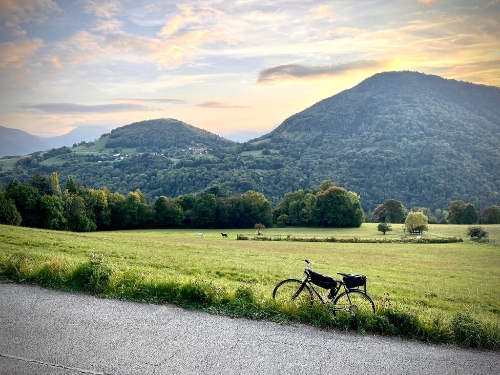
The most natural route is to turn right at the church in Venon towards the Japin, and then descend towards Murianette. You lose a little in terms of the quality of the route, but not in terms of the quality of the views, which are always sublime.
C'est une côte que j'ai grimpée aujourd'hui pour la première fois… du moins selon l'itinéraire indiqué ici, parce qu'en fait je l'ai plusieurs fois grimpée dans ma jeunesse, mais seulement jusqu'au km 3, à Saint-Nizier-d'Uriage, après quoi j'allais toujours vers la droite, en direction du Pinet ou du Faux. J'allais au col de la Coche via d'autres accès que le Sonnant-d'Uriage.
À noter, en plus des informations pertinentes apportées par Cromagnon, que du col de la Coche on ne peut plus descendre actuellement jusqu'à Gières via Venon, en raison de travaux sur le pont à l'entrée de Gière. Les cours d'eau de Belledonne ont connu de très fortes crues ces derniers mois, ce qui a entraîné une floppée de travaux de restauration ou de prévention sur les ponts concernés.
Le plus naturel est, au niveau de l'église de Venon, d'obliquer à droite vers le Japin, et descendre ensuite vers Murianette. On y perd un peu en qualité de route, mais pas en qualité de point de vue, toujours sublime.
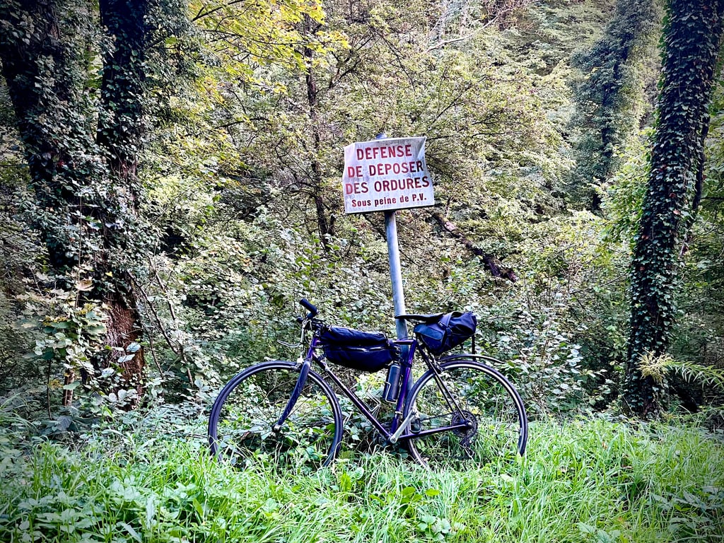
But where is this Col de La Coche? Failing that, I'll show you the way to Les Cochettes... In any case, it's an interesting climb. The beginning is quite tough. The forest is pleasant and the road is closed to cars because it is quite run-down and awaiting work. Two-wheelers are permitted. As you leave the forest, you can see Chamrousse. Stealthily ...
At Nizier, as soon as the climb fades, you turn left towards the Vernon sign.
The descent to Gières is fantastic.
Mais où est donc ce col de La Coche ? À défaut, je vous montre un chemin des Cochettes… En tout cas, cette ascension est intéressante. Le début est assez costaud. La forêt est agréable et la route est interdite aux voitures parce qu’elle est assez dégradée et attend des travaux. On est autorisé à passer en deux roues. Quand on sort de la forêt, on voit Chamrousse. Furtivement …
À Nizier, dès que la montée s’estompe, on tourne à gauche vers la pancarte Vernon.
La descente vers Gières est fantastique.
| 5 mph | 00:34:17 |
| 7 mph | 00:24:16 |
| 9 mph | 00:18:55 |
| 12 mph | 00:14:12 |
This page is better in the app