View on map
© MapLibre | OpenStreetMap contributors
1%
2%
4%
6%
8%
10%
12%
15%
20%

Col de l'Aiguillon

4.3
3 reviews | Elevation profile | 2 photos
Col de l'Aiguillon
Col de l'Aiguillon
transparant thumb
transparant thumb
transparant thumb
transparant thumb
transparant thumb
transparant thumb
Your achievable time
Calculating based on your best performances...
Relaxed
Maximum
W/kg
W/kg
W/kg
Analyze your climbing performance
Detailed insight into your climbing performance & automatically check off climbs
Based on your best performances.
Your best attempt:
Number of attempts:
Elevation profile Col de l'Aiguillon

Statistics

Difficulty points 733
Length 4.7 mi
Average gradient 9%
Steepest segment 15.9%
Total ascent 2238 ft

Short recap

Beautiful scenery
4 hairpin turns
#29 toughest climb of Jura
#65 most elevation gain of Jura
#46 longest climb of Vaud
#27 average steepest climb of Vaud
Feedback about this climb?
Show climbs nearby Export to GPS device

Col de l'Aiguillon is a climb in the region Vaud. It is 4.7 mi long and bridges 2238 ft of vertical ascent with an average gradient of 9%, resulting in a difficulty score of 733. The top of the ascent is located at 4337 ft above sea level. Climbfinder users shared 3 reviews of this climb and uploaded 2 photos.

Road name: Route de la Montagne

4.0 by Daphne88
This is an automatic translation, the original language is: Dutch.
Very gentle ascent through forest with occasional views of the French and Swiss Alps. Road surface in fine condition.... read more

Photos (2)

Col de l'Aiguillon
Col de l'Aiguillon
transparant thumb
transparant thumb
transparant thumb
transparant thumb

Your uploads (max 4)

Welcome! Please activate your account if you would like to share something. Look for the verification email in your inbox.

If you want to upload your photos, you need to create an account. It only takes 1 minute and it's completely free.

  • Receive free climbfinder goodies for your reviews & photos.
  • Create a bucket list and check off conquered climbs.
  • Add missing climbs.
Continue with GoogleContinue with Google Continue with FacebookContinue with Facebook Continue with AppleContinue with Apple Sign up with email
By signing up you agree to our terms of service and confirm that you have read our privacy & content policy.

Reviews (3)

5.0
4.0
3.0
2.0
1.0
Daphne88
2 w 4.0 via the Climbfinder app
This is an automatic translation, the original language is: Dutch. Show original

Very gentle ascent through forest with occasional views of the French and Swiss Alps. Road surface in fine condition.

Zeer rustige beklimming door het bos met af en toe vergezichten op de Franse en Zwitserse Alpen. Wegdek in prima staat.

Col de l'Aiguillon
Col de l'Aiguillon
Dashboard
Krikette
2 y 4.0
This is an automatic translation, the original language is: French. Show original

On an absolutely quiet road (at least when I did it, on 30 December), an intense, steep climb through a wooded landscape with lovely views of the Aiguilles de Baulmes. If you stop and turn around, you'll be treated to a sweeping panorama of the Swiss and French Alps. You can descend over the Col des Etroits via Ste-Croix and return to the starting point on the plain.
It's also worth doing in summer if you're looking for shade and a bit of fresh air.

Sur une route absolument tranquille (en tous cas quand je l'ai faite, à savoir le 30 décembre), une montée intense et raide dans un paysage forestier et avec de jolies vues sur les Aiguilles de Baulmes. Si l'on s'arrête et se retourne, un panorama très étendu des Alpes suisses et françaises s'offre à nos yeux. On peut descendre par le col des Etroits en passant par Ste-Croix pour revenir au point de départ, en plaine.
A faire aussi en été si l'on cherche de l'ombre et un peu de fraîcheur.

Dashboard
jcvd25
2 y 5.0
This is an automatic translation, the original language is: French. Show original

Climbing the Col de l'Aiguillon was a fantastic experience. This pass offers a picturesque climb and breathtaking views for cycling enthusiasts.

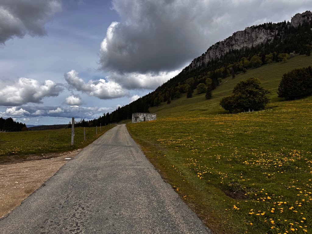
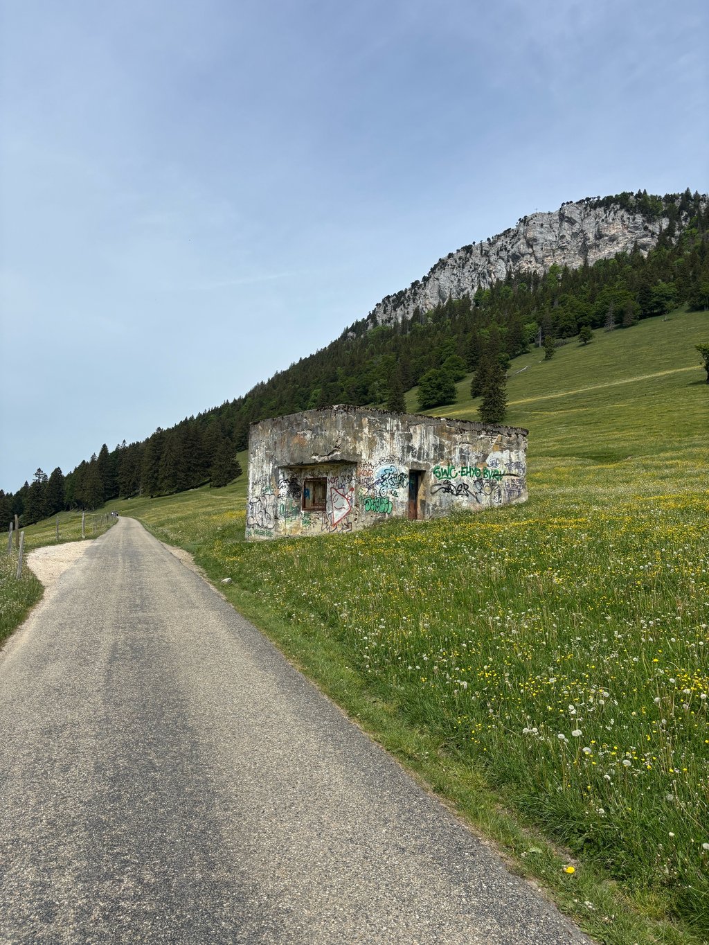
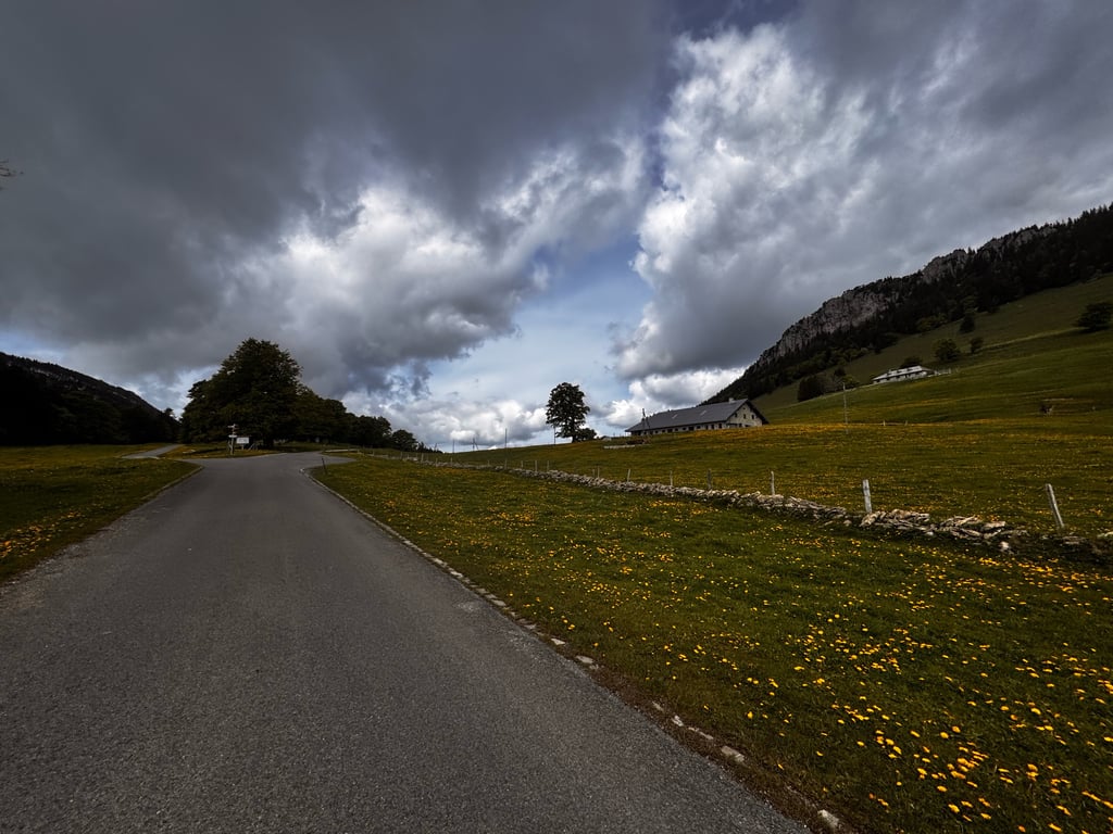
Right from the start, I was captivated by the natural beauty that surrounded me. The rolling countryside, green fields and picturesque villages created a charming atmosphere throughout the climb.

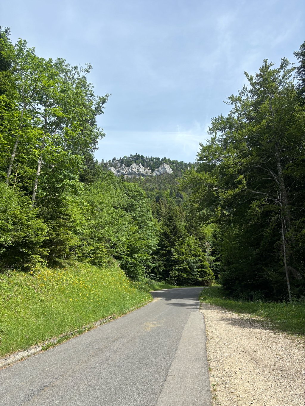
The climb was challenging, with steep climbs and winding bends. I felt an adrenalin rush with every pedal stroke, pushing my physical and mental limits. The satisfaction of overcoming these challenges was indescribable.

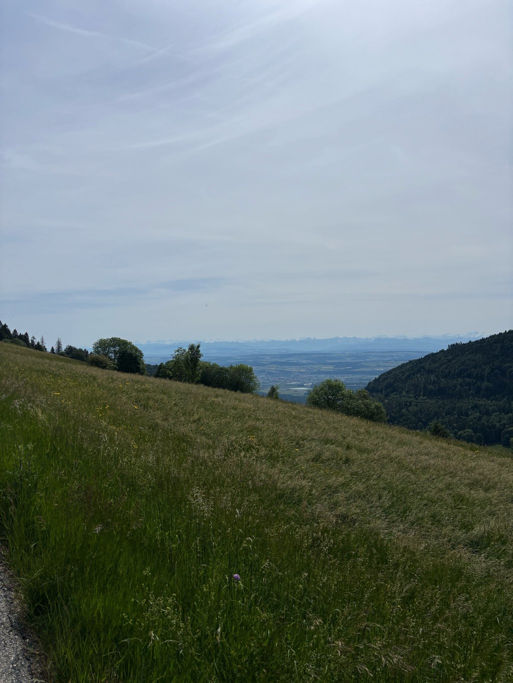
On reaching the summit of the Col de l'Aiguillon, I was rewarded with an incredible panoramic view. The majestic alpine peaks and lush green valleys stretched as far as the eye could see. It was a moment of contemplation and appreciation for the surrounding nature.

In conclusion, climbing the Col de l'Aiguillon is an experience not to be missed by keen cyclists. The picturesque scenery, the stimulating challenges and the reward at the top make it a memorable adventure.

La montée du col de l'Aiguillon a été une expérience fantastique. Ce col offre une ascension pittoresque et des panoramas à couper le souffle pour les amateurs de cyclisme.

Dès le départ, j'ai été captivé par la beauté naturelle qui m'entourait. Les paysages vallonnés, les champs verdoyants et les villages pittoresques ont créé une atmosphère charmante tout au long de l'ascension.

La montée était stimulante, avec des montées raides et des virages sinueux. J'ai ressenti une montée d'adrénaline à chaque coup de pédale, repoussant mes limites physiques et mentales. La satisfaction de surmonter ces défis était indescriptible.

En atteignant le sommet du col de l'Aiguillon, j'ai été récompensé par une vue panoramique incroyable. Les sommets alpins majestueux et les vallées verdoyantes s'étendaient à perte de vue. C'était un moment de contemplation et d'appréciation pour la nature environnante.

En conclusion, l'ascension du col de l'Aiguillon est une expérience à ne pas manquer pour les cyclistes passionnés. Les paysages pittoresques, les défis stimulants et la récompense au sommet en font une aventure mémorable.

Dashboard

Climbing times

5 mph 00:56:35
7 mph 00:40:03
9 mph 00:31:13
12 mph 00:23:27

Road surface condition

100% 0% 0%
Based on 11 votes
Share your knowledge. What was the road condition during your ascent?

Traffic

100% 0% 0%
Based on 11 votes
Your experience counts. How much traffic did you encounter during the climb?

Frequently Asked Questions

Col de l'Aiguillon can be cycled from 2 sides. Col de l'Aiguillon from Baulmes is the most popular side, but the summit can also be reached via Col de l'Aiguillon from L'Auberson.

Col de l'Aiguillon is a challenging ascent. For this type of climbing, we recommend mountain gearing, specifically a compact system. This means a small front chainring of 34 teeth, combined with a rear cassette where, depending on your level, strength, and experience, you choose a sprocket with 30, 32, or even 34 teeth. Remember that a smooth cadence is always more efficient!

Col de l'Aiguillon is a first-category climb: long and tough. Do not underestimate this climb. Many famous Tour de France cols fall into this category. Prepare for a long, challenging ride. Only well-trained riders will reach the top smoothly. Make sure you have a road bike with climbing gears and enough training; otherwise, it will be a struggle.

Col de l'Aiguillon is 4.7 mi long.

The average gradient of Col de l'Aiguillon is 9%.

Col de l'Aiguillon has a steepest segment with an average gradient of 15.9%.

The summit of Col de l'Aiguillon is at 4337 ft.

At a slow pace of 5 mph, it takes about 00:56:35 to climb Col de l'Aiguillon. At 7 mph the time is 00:40:03, and at 9 mph 00:31:13. For the fastest cyclists, 00:23:27 is an achievable time.

Col de l'Aiguillon is located in the region Vaud in Switzerland.

This page is better in the app

Climbfinder app
Climbfinder
(Free)
Open