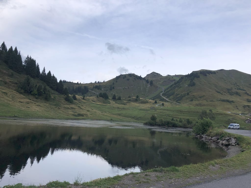
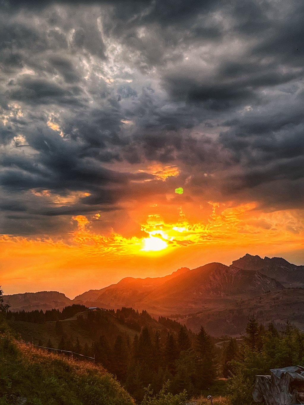
| Beautiful scenery |
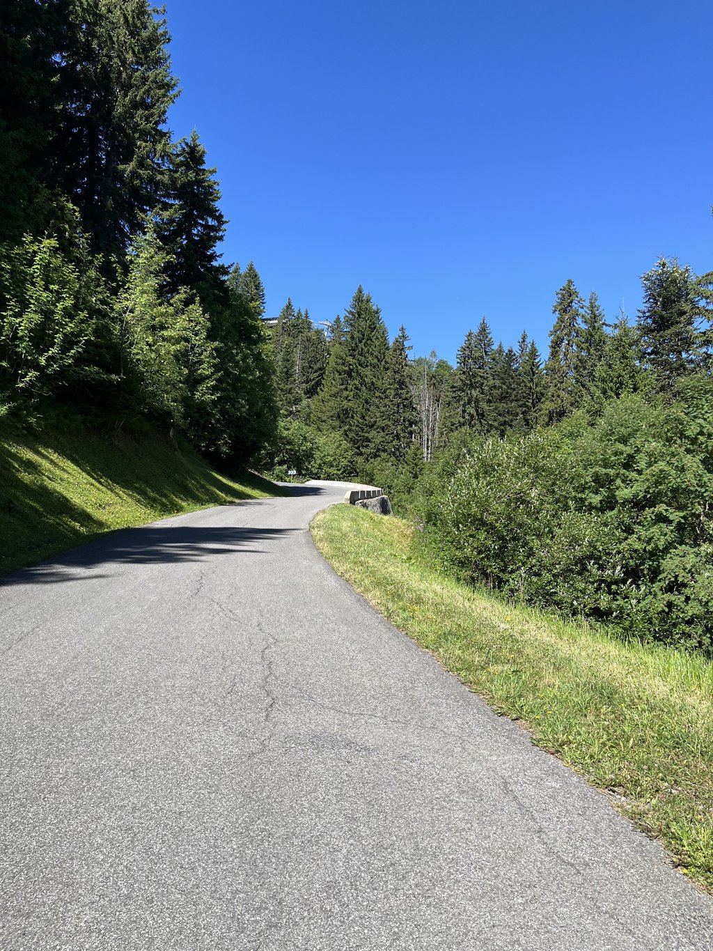
| 11 hairpin turns |
| #39 toughest climb of Haute Savoie |
| #38 most elevation gain of Haute Savoie |
| #55 longest climb of Haute Savoie |
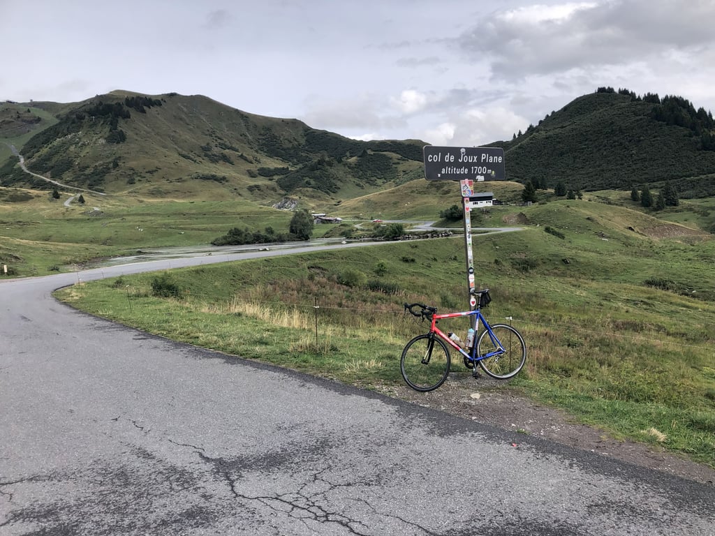
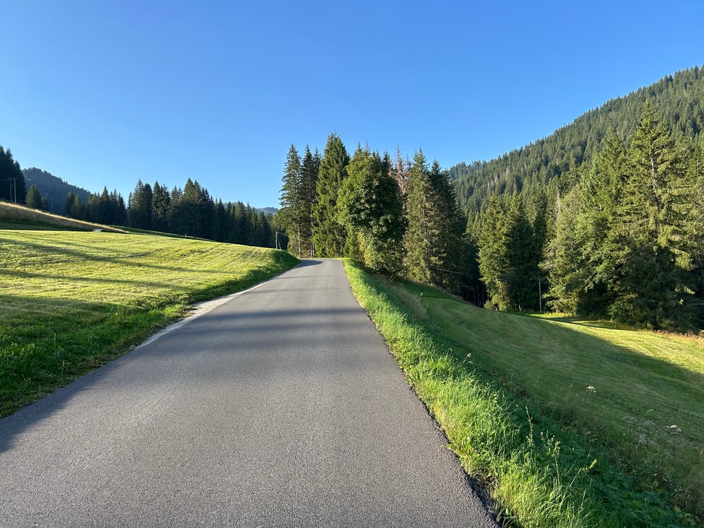
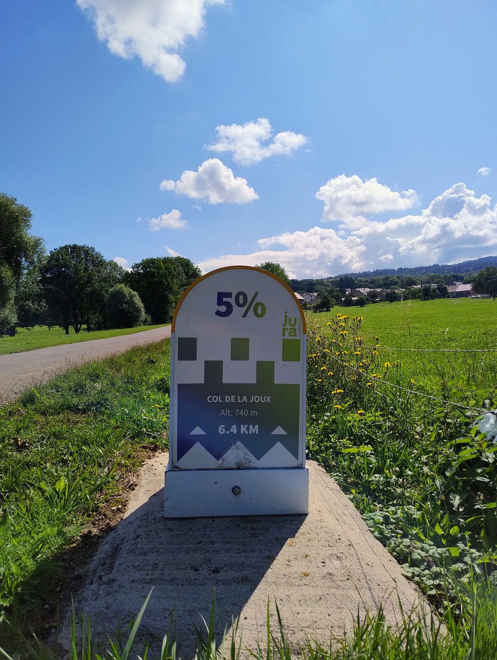
Col de Joux Plane from Morzine is a climb in the region Haute Savoie. It is 6.6 mi long and bridges 2454 ft of vertical ascent with an average gradient of 7.1%, resulting in a difficulty score of 683. The top of the ascent is located at 5541 ft above sea level. Climbfinder users shared 11 reviews of this climb and uploaded 23 photos.
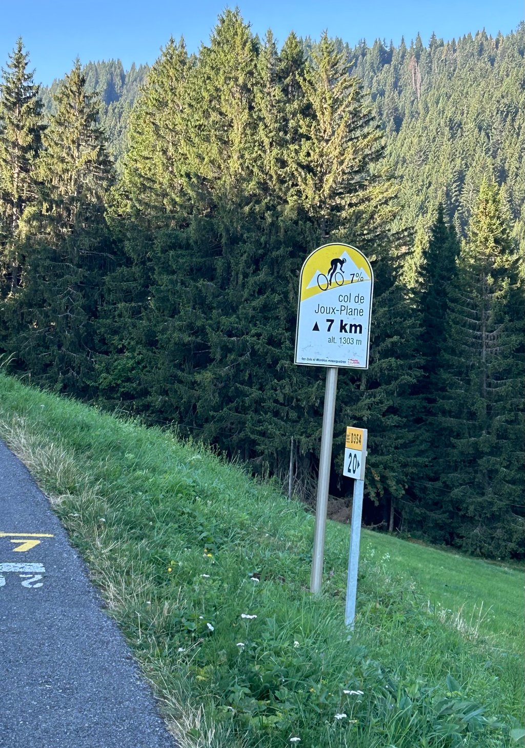
Road name: D534
5.0 by IlFalconeThis is an automatic translation, the original language is: Dutch.It was really tough going up to Ranfolly, but the trails were beautiful—partly shaded in the morning and nice and quiet—and the view from the top was phenomenal.... read more
Welcome! Please activate your account if you would like to share something. Look for the verification email in your inbox.
If you want to upload your photos, you need to create an account. It only takes 1 minute and it's completely free.
It was really tough going up to Ranfolly, but the trails were beautiful—partly shaded in the morning and nice and quiet—and the view from the top was phenomenal.
Echt zwaar tot de Ranfolly, maar erg mooi weggetjes, deels in de schaduw in de ochtend en lekker rustig, bovenop fenomenaal.
I thought it was a beautiful climb, wonderfully quiet road and the view at the top pleased me.
Ik vond het een prachtige klim, heerlijk rustige weg en het uitzicht op de top kon mij wel bekoren.
Enjoyable quiet climb, good road surface and close to town
Start steep then it's a long runner. At the top, a sign awaits but no nice view .
Begin steil daarna is het een lange loper. Bovenop wacht een bordje maar geen mooi uitzicht .
A little easier than on the other side, but it's still a great site.
Be careful not to burn out on the first 3 kilometres, which are really tough!
Un peu plus facile que de l'autre coté, mais ça reste un beau chantier.
Attention à ne pas se cramer sur les 3 premiers kilomètres qui sont vraiment corsés!
Fantastic. The first sector in the resort is a bit rough and not very pleasant, especially if it's hot. After that, it's all good fun, even if you have to pedal quite hard. The summit with its lake is paradise.
Fantastique. Le premier secteur dans la station est un peu rude et pas super sympa, surtout s'il fait chaud. La suite, que du bonheur même s'il faut pédaler assez fort. Le sommet avec son lac, c'est le paradis.
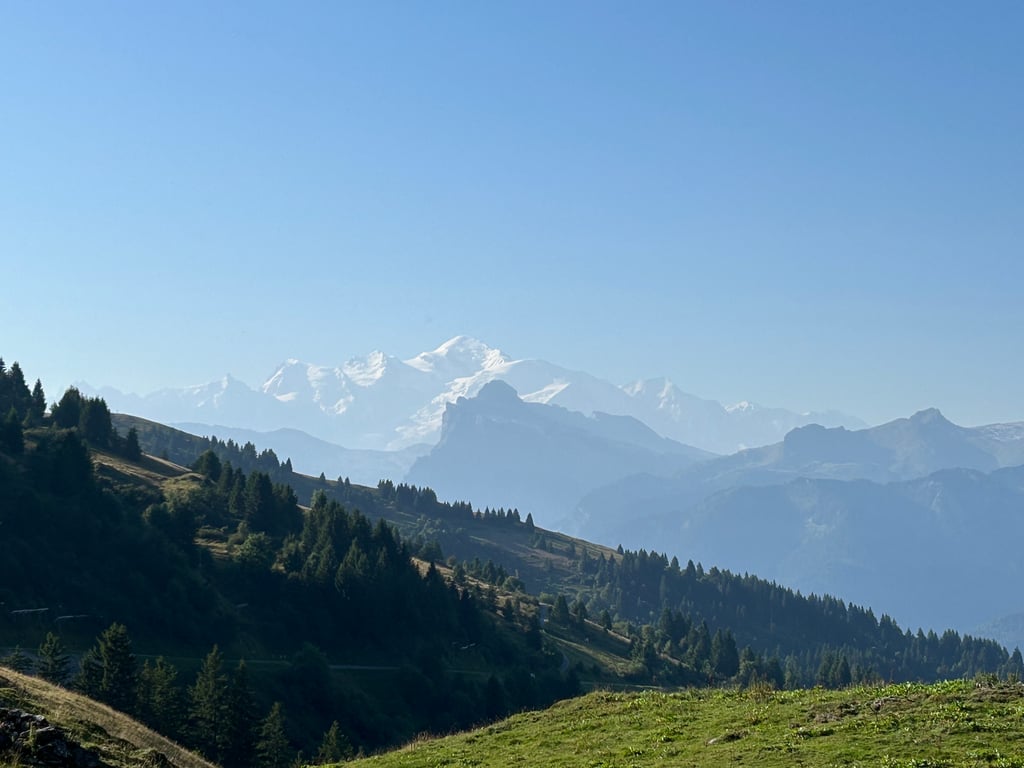
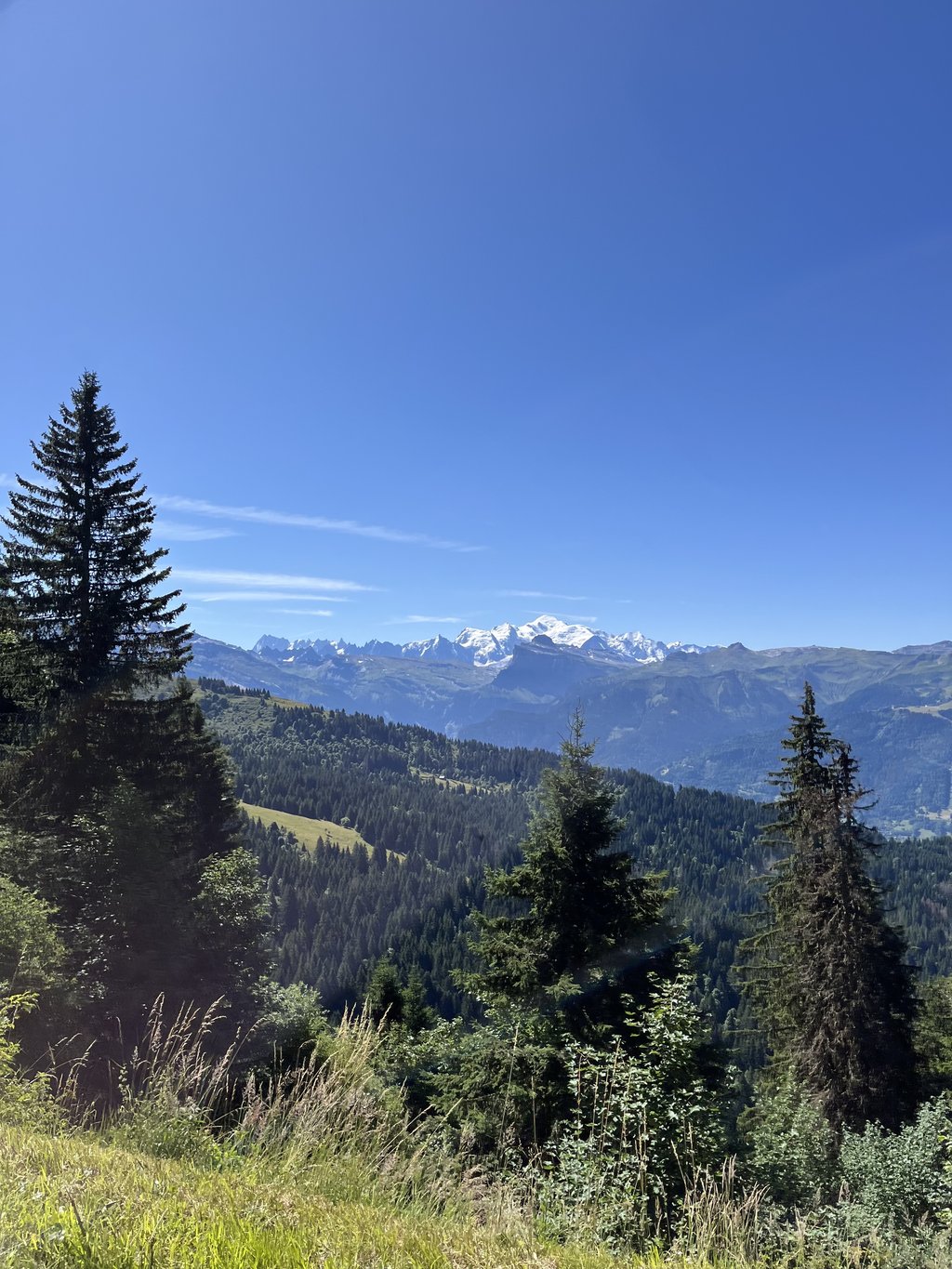
There are those climbs that are so beautiful that they should actually get an extra star. Because of the overwhelming views of Mont Blanc, I think this is such'a climb.
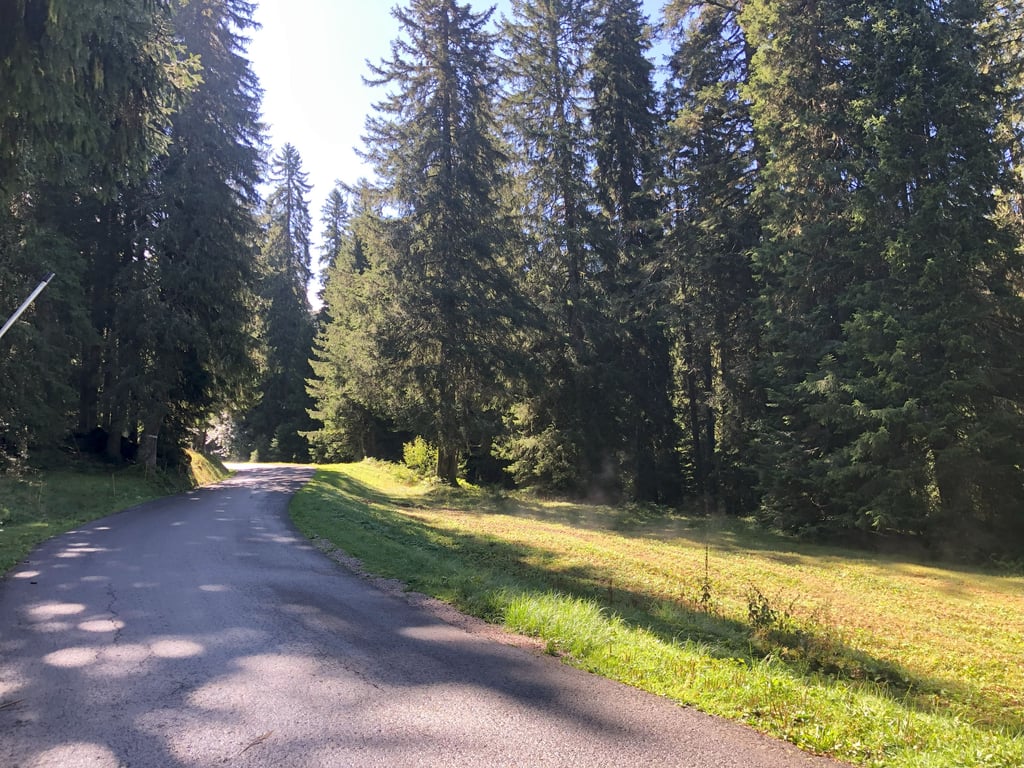
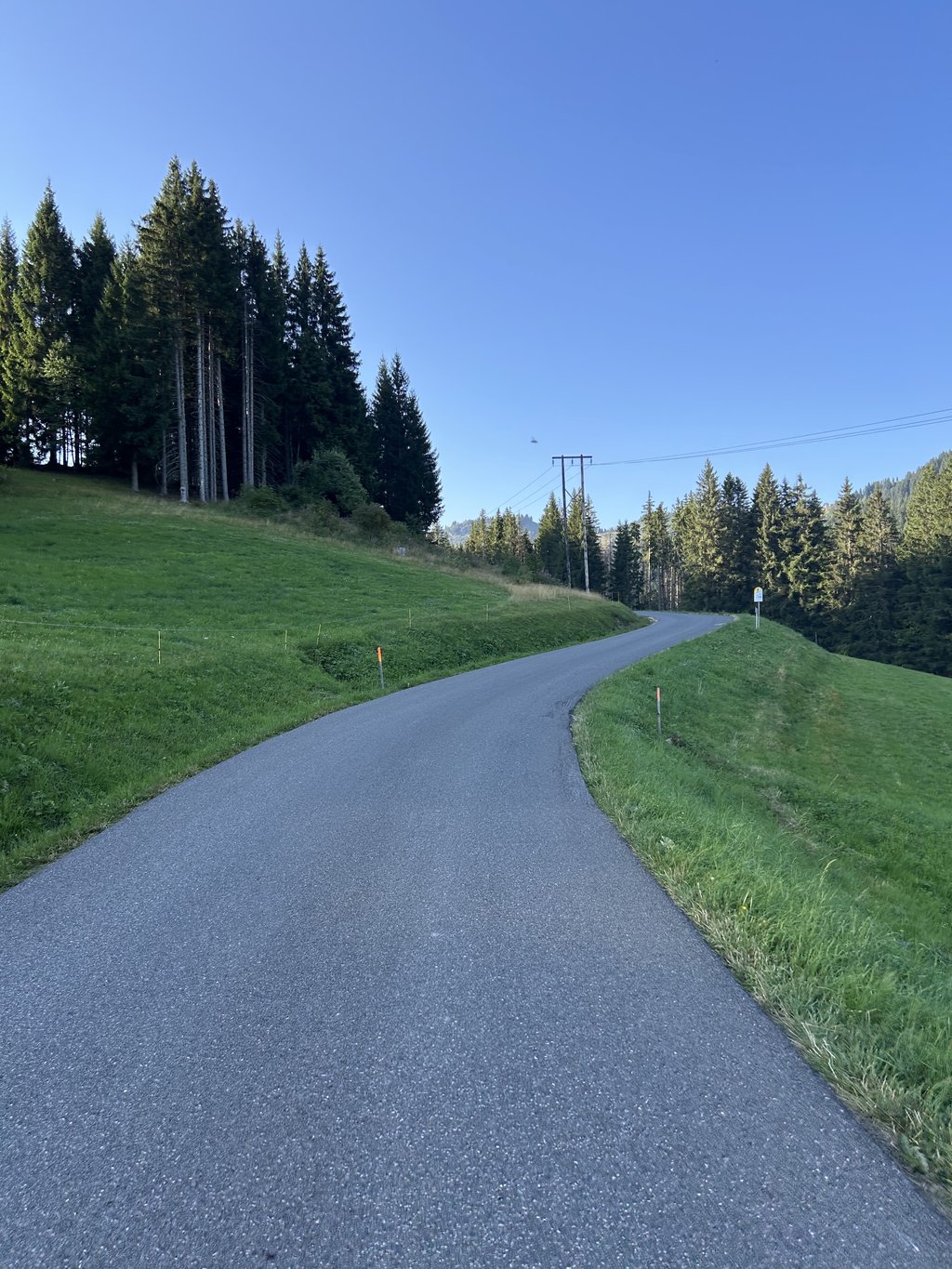
Make no mistake, this is a good tough climb for the first 7 kilometres. In fact, you rake between 8 and 10% from the start. Yet right from the start it is a wonderfully beautiful climb with lots of variety. You ride through a forest for much of the climb. Here you ride not only between the trees, but also between the snow cannons.
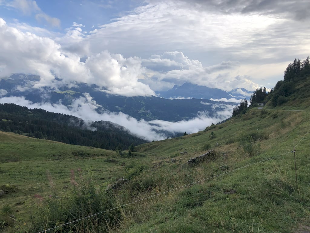
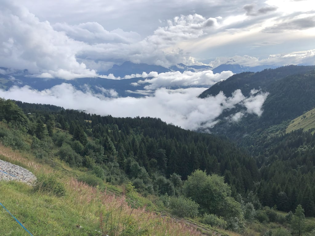
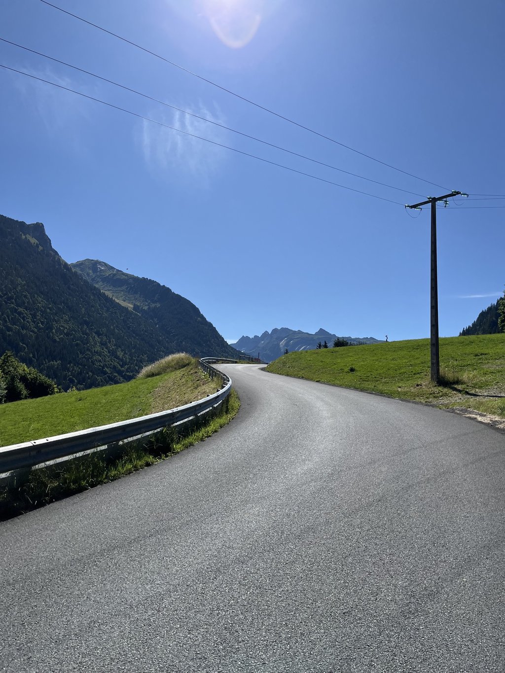
With three kilometres to go, the trees disappear and the climb flattens out to slightly rolling hills. From here, you won't be able to get below the fantastic views. The descent on the other side is also stunning. And with its hairpin turns technically challenging and great fun!
Er zijn van die beklimmingen die zo mooi zijn dat ze eigenlijk een extra ster zouden mogen krijgen. Door het overweldigende uitzicht op de Mont Blanc vind ik dit zo'n klim.
Vergis je niet, dit is de eerste 7 kilometer een goed pittige klim. Eigenlijk hark je vanaf het begin tussen de 8 en 10%. Toch is het al gelijk na de start een prachtig mooie klim met veel afwisseling. Je rijdt een groot gedeelte van de klim door een bos. Hier rij je niet alleen tussen de bomen, maar ook tussen de sneeuwkanonnen.
Met nog drie kilometer te gaan verdwijnen de bomen en vlakt de klim af naar een licht glooiende heuvels. Vanaf hier kom je niet meer onder de fantastische uitzichten uit. Ook de afdaling aan de andere kant is prachtig. En met zijn haarspeldbochten technisch uitdagend en erg leuk!
The climb to Les Gets'let pass' and from Morzine left the Joux Plane attacked (mwah). Immediately outside the town is the price. 3 to 4 kilometres quite steep and demanding (around 10%). Then more around 7%. Magnificent views of Morzine and Avoriaz at high altitude. The ascent alternates regularly between open meadows and closed forests. The shade was frequent and welcome in the warm weather. At the top, the last 3 km's are undulating with views of the ski slopes of Morzine, the valley of Samoëns and finally Mont Blanc.
De beklimming naar Les Gets 'links laten liggen' en vanuit Morzine linksaf de Joux Plane aangevallen (mwah). Meteen buiten het stadje is het prijs. 3 a 4 kilometer behoorlijk steil en veeleisend (rond 10%). Daarna meer rond 7%. Prachtige vergezichten op Morzine en Avoriaz op grote hoogte. De beklimming wisselt regelmatig af tussen open weiden en gesloten bossen. De schaduw was veelvuldig en welkom bij het warme weer. Bovenaan zijn de laatste 3 km's glooiend met zicht op de skipistes van Morzine, het dal van Samoëns en tot slot op de Mont Blanc.
Ok, clear. Next week I'm going to do it and will save the steepness data.
Ok, duidelijk. Volgende week ga ik hem doen en zal de steigingsdata opslaan.
That's because we plot the climb until the last serious rise. We don't let the graphs run on flat. But we are going to measure the graphs!
Dat komt omdat wij de klim intekenen tot de laatste serieuze stijging. We laten de grafieken niet op vlakke doorlopen. Maar we gaan de grafieken nog even nameten!
I'm preparing a trip and see that the ascent of the Col de Joux Plane from Morzine has a different ending point than from Samoens. Does anyone know how that works. With streetview I see no indication of the highest point.
Ik ben een reis aan het voorbereiden en zie dat de beklimming van de Col de Joux Plane vanuit Morzine een ander eindpunt heeft dan vanuit Samoens. Weet iemand hoe dat zit. Met streetview zie ik ook geen hoogstepunt aanduiding.
| 5 mph | 01:19:29 |
| 7 mph | 00:56:16 |
| 9 mph | 00:43:51 |
| 12 mph | 00:32:57 |
This page is better in the app