View on map
© MapLibre | OpenStreetMap contributors
1%
2%
4%
6%
8%
10%
12%
15%
20%

Col de Bannstein from Orschwihr

3.0
2 reviews | Elevation profile | 3 photos
Tips nearby
Col de Bannstein from Orschwihr
transparant thumb
transparant thumb
transparant thumb
transparant thumb
transparant thumb
Your achievable time
Calculating based on your best performances...
Relaxed
Maximum
W/kg
W/kg
W/kg
Analyze your climbing performance
Detailed insight into your climbing performance & automatically check off climbs
Based on your best performances.
Your best attempt:
Number of attempts:
Elevation profile Col de Bannstein from Orschwihr

Statistics

Difficulty points 111
Length 2.8 mi
Average gradient 4.7%
Steepest segment 8.3%
Total ascent 686 ft

Short recap

Hidden gem
#89 longest climb of Upper Rhine
Feedback about this climb?
Show climbs nearby Export to GPS device

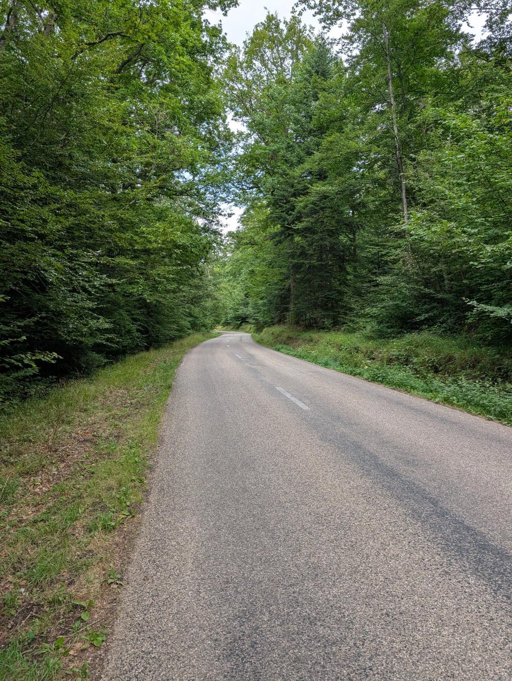
Col de Bannstein from Orschwihr is a climb in the region Upper Rhine. It is 2.8 mi long and bridges 686 ft of vertical ascent with an average gradient of 4.7%, resulting in a difficulty score of 111. The top of the ascent is located at 1585 ft above sea level. Climbfinder users shared 2 reviews of this climb and uploaded 3 photos.

Road names: Rue du Val du Pâtre & D 40

2.0 by Walput
This is an automatic translation, the original language is: Dutch.
Climb of around 4.5 km. Little traffic. First part of the climb the road is not super but doable. Here the percentages are irregular. Once you turn left to the top of the climb, the tarmac is better and the climb is very even. Very doable and running climb. You mainly ride through the forest.... read more

Photos (3)

Col de Bannstein from Orschwihr
transparant thumb
transparant thumb
transparant thumb

Your uploads (max 4)

Welcome! Please activate your account if you would like to share something. Look for the verification email in your inbox.

If you want to upload your photos, you need to create an account. It only takes 1 minute and it's completely free.

  • Receive free climbfinder goodies for your reviews & photos.
  • Create a bucket list and check off conquered climbs.
  • Add missing climbs.
Continue with GoogleContinue with Google Continue with FacebookContinue with Facebook Continue with AppleContinue with Apple Sign up with email
By signing up you agree to our terms of service and confirm that you have read our privacy & content policy.

Reviews (2)

5.0
4.0
3.0
2.0
1.0
Walput
9 Mo 2.0 via the Climbfinder app
This is an automatic translation, the original language is: Dutch. Show original

Climb of around 4.5 km. Little traffic. First part of the climb the road is not super but doable. Here the percentages are irregular. Once you turn left to the top of the climb, the tarmac is better and the climb is very even. Very doable and running climb. You mainly ride through the forest.

Klim van om en bij de 4,5 km. Weinig verkeer. Eerste deel van de klim is de weg niet super maar doenbaar. Hier zijn de percentages onregelmatige. Eens je links afslaat naar de top van de klim is het asfalt beter en is het zeer gelijkmatig klimmen. Zeer doenbare en lopende klim. Je rijdt voornamelijk door het bos.

Dashboard
GerJanssen
10 Mo 4.0
This is an automatic translation, the original language is: Dutch. Show original

Beautiful climb in a wooded area. Very quiet. Asphalt is in reasonable condition. Very little traffic.

Mooie klim in een bosrijk gebied. Erg rustig. Asfalt is in redelijke staat. Heel weinig verkeer.

Dashboard

Climbing times

5 mph 00:33:35
7 mph 00:23:46
9 mph 00:18:31
12 mph 00:13:55

Road surface condition

0% 100% 0%
Based on 1 vote
Share your knowledge. What was the road condition during your ascent?

Traffic

100% 0% 0%
Based on 1 vote
Your experience counts. How much traffic did you encounter during the climb?

Frequently Asked Questions

Col de Bannstein can be cycled from 3 sides. Col du Bannstein from Soultzmatt is the most popular side, but the summit can also be reached via Col du Bannstein from Saint Granolphe & Col de Bannstein from Orschwihr.

You don't need special gearing for Col de Bannstein from Orschwihr. The slope isn't long or steep enough to require much shifting down. You can conquer this climb on power alone. However, a compact gearing system with a smallest front chainring of 34 and largest rear sprocket of 28 or 30 is always nice if you enjoy cycling uphill. This helps maintain a smooth cadence.

Col de Bannstein from Orschwihr is a 4th-category climb. A sprint to the top is usually not an option, and untrained riders will definitely feel it in their legs. For trained cyclists, it is a great training climb.

Col de Bannstein from Orschwihr is 2.8 mi long.

The average gradient of Col de Bannstein from Orschwihr is 4.7%.

Col de Bannstein from Orschwihr has a steepest segment with an average gradient of 8.3%.

The summit of Col de Bannstein from Orschwihr is at 1585 ft.

At a slow pace of 5 mph, it takes about 00:33:35 to climb Col de Bannstein from Orschwihr. At 7 mph the time is 00:23:46, and at 9 mph 00:18:31. For the fastest cyclists, 00:13:55 is an achievable time.

Col de Bannstein from Orschwihr is located in the region Upper Rhine in France.

This page is better in the app

Climbfinder app
Climbfinder
(Free)
Open