Tips nearby


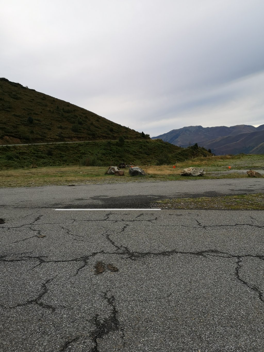
| Beautiful scenery |
| 14 hairpin turns |
| #47 toughest climb of Hautes-Pyrénées |
| #47 most elevation gain of Hautes-Pyrénées |
| #55 longest climb of Hautes-Pyrénées |
| #90 average steepest climb of Hautes-Pyrénées |
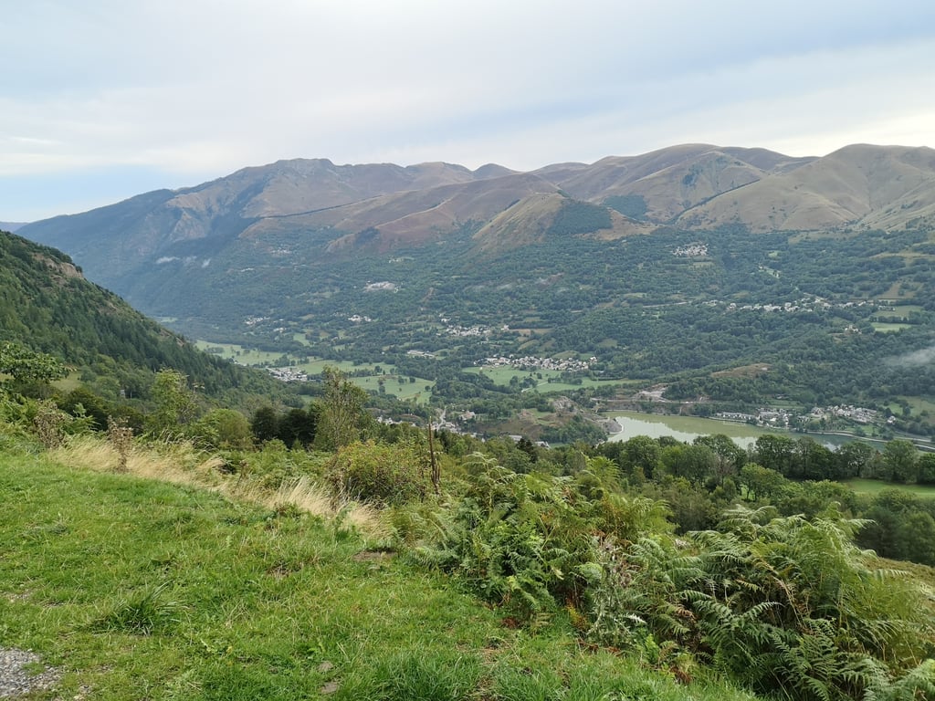
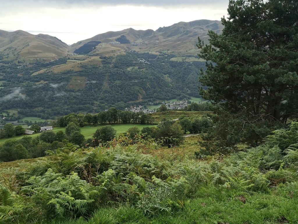
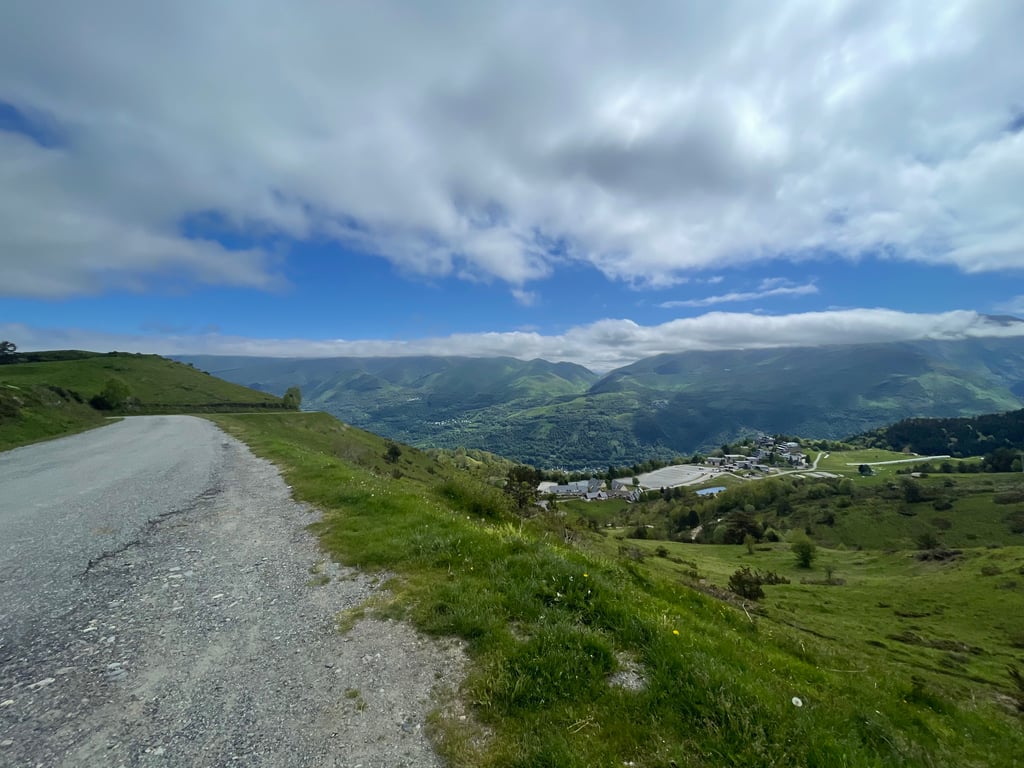
Col d'Azet / Val Louron is a climb in the region Hautes-Pyrénées. It is 4.6 mi long and bridges 2021 ft of vertical ascent with an average gradient of 8.3%, resulting in a difficulty score of 533. The top of the ascent is located at 5184 ft above sea level. Climbfinder users shared 11 reviews of this climb and uploaded 14 photos.
Road names: Coustasses & Nambias
3.0 by HerrWeedThis is an automatic translation, the original language is: English.Steady, short climb. Nice views. Very little traffic. Nice descent on the other side.... read more

Welcome! Please activate your account if you would like to share something. Look for the verification email in your inbox.
If you want to upload your photos, you need to create an account. It only takes 1 minute and it's completely free.
Steady, short climb. Nice views. Very little traffic. Nice descent on the other side.
A nice, steady climb that's not too long. The surface is excellent, the road is wide and not very busy (at 9am, out of season and on weekdays). The scenery is magnificent and the whole climb is punctuated by cows grazing by the roadside 🥰.
Belle montée régulière et pas trop longue. Le revêtement est excellent, la route et large et peu passante (à 9h du mat, hors saison et en semaine) Les paysages sont magnifiques et toute l'ascension est rythmée par les vaches qui paissent en bord de route 🥰.
A magnificent climb, rather short but sustained in a very mountainous environment.
Magnifique montée, plutôt courte mais soutenue dans un environnement très montagne.
I climbed it after a long (on my scale) day of cycling, so it seemed harder than the graph suggests. The start of the col des décourant the view offered as soon as you leave the forest is worth it.
Watch out for the descent (towards St Lary Soulan), which I found dangerous (I'm still not very good at riding my bike downhill).
Montée effectuée après un longue (à mon échelle) journée de cyclisme, elle m'a donc semblée plus dure que ce que le graphique laisse croire. Le début du col des décourageant la vue offerte dès la sortie de la forêt vaut la peine.
Attention à la descente (vers St Lary Soulan) qui ma semblée dangereuse (je ne suis pas encore très habile de mon vélo en descente).
A diverse climb with beautiful views. On the graph it looks tougher than it was in reality, (question is whether the graph is correct?...) If you want to do a Tour de France climb then don't skip this one.
Een diverse beklimming met mooie uitzichten. Op het grafiek lijkt het zwaarder dan het in werkelijkheid was, (vraag is of het grafiek wel klopt?..) Als je een Tour de France beklimming wilt doen dan mag je deze niet overslaan.
The start is steep when you leave Génos. After that it's steady and quite nice. The views over the Louron valley and St Lary at the top are well worth the effort!
Le début est raide d'entrée quand on part de Génos. Après c'est régulier et plutôt sympa. La vue sur la vallée de Louron ou celle de St Lary au sommet vaut le coup de se faire mal!!
Lovely climb to do. The climb is steep but not too long. And especially at the bottom you can really cycle from hairpin to hairpin. At the top you have fantastic views including of the Peyeresourde which we had climbed and descended just before. Absolutely worth the effort.
Heerlijke klim om te doen. De klim is steil maar niet al te lang. En zeker onderin kan je echt van haarspeldbocht naar haarspeldbocht fietsen. Bovenop heb je een fantastisch uitzicht o.a. op de Peyeresourde die we net daarvoor beklommen en afgedaald hadden. Absoluut de moeite waard.
Top climb. Not too long, not too steep but with lots of hairpins and good tarmac. Not to be missed if you are in the area.
Topklim. Niet te lang, niet te steil maar wel met lekker veel haarspeldbochten en goed asfalt. Mag je niet overslaan als je in de buurt bent.
August 2016 cycled up both sides of the col d'Azet when I was staying in St.Lary for a walking & cycling holiday.
The Génos side can count and so it's best to resupply immediately at the start because there's nothing on the way and at the top.
Via 11 hairpin bends you cycle up the open valley slope, while the green-blue lake of Loudenvielle sinks deeper under you. The first kilometers can be counted because before halfway there is a stretch with double climb numbers. The well known cycling information boards keep you up to date about the altitude/distance to the top/rising of each kilometre.
Towards the end the gradient flattens a bit and in the zone around the summit there were stray animals (mainly cows) that like to stand on/in the way of the few cars's and cyclists. Highest point is cycled over via last hairpin bend on the ridge with beautiful 360° panorama on both valleys that connect the col.
To my feeling the best and toughest side of this beautiful Tour climb, especially because there is hardly any traffic.
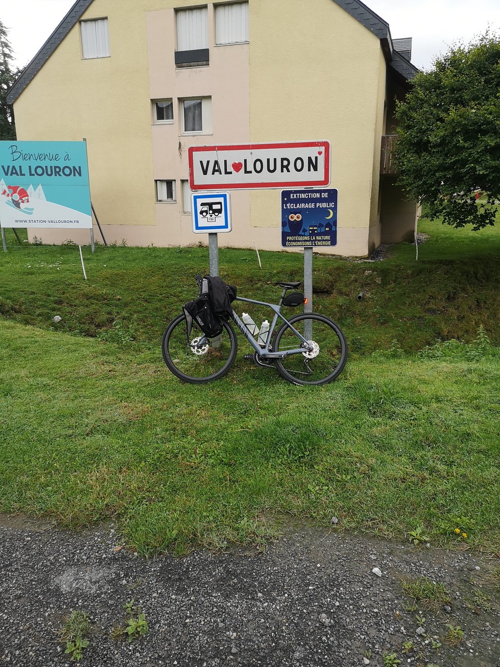
Remark: 1,5 km. before the summit, there is a left turn with a slight descent followed by a final ascent to the parking lot of the summery dead ski resort Val Louron. This is absolutely no added value.
That's why, when the Tour rides this way, this ski resort is included in the name of the climb as
Col deVal Louron-Azet.
Augustus 2016 beide kanten van de col d'Azet op gefietst toen ik voor een wandel & fietsvakantie in St.Lary verbleef.
De Génos zijde kan tellen en het is daarom best om je bij de start direct te bevoorraden want onderweg en op de top is er niets.
Via 11 haarspeldbochten fietst je de open valleiflank naar omhoog, terwijl het groenblauwe meer van Loudenvielle dieper onder je wegzinkt. De aanvangskilometers kunnen tellen want voor halfweg is er een strook met dubbele klimcijfers. De bekende fietsinfobordjes houden U hier van elke kilometer up to date (hoogte/afstand tot top/stijging).
Naar het einde toe vlakt de hellingsgraad enig zins af en in de zone rond de top waren er loslopende dieren (vooral koeien) die graag op/in de weg staan van de weinige auto's en fietsers. Hoogste punt wordt over gefietst via laatste haarspeldbocht over de heuvelrug met prachtig 360° panorama op beide valleien die de col verbindt.
Naar mijn gevoel mooiste en zwaarste zijde van deze prachtige Tour klim,zeker omdat er amper verkeer is.
Opmerking: 1,5 km. voor de top is er een linkse afslag met lichte afdaling gevolgd door slotstijging naar de parking van zomers doodse skioord Val Louron. Dit is absoluut geen meerwaarde.
Vandaar dat als in de Tour deze zijde wordt op gefietst, dit skistation wordt opgenomen in de benaming van de klim als
Col deVal Louron-Azet.
Super nice climb but still fairly heavy
Super mooie klim maar toch redelijk zwaar
| 5 mph | 00:55:32 |
| 7 mph | 00:39:19 |
| 9 mph | 00:30:38 |
| 12 mph | 00:23:01 |
This page is better in the app