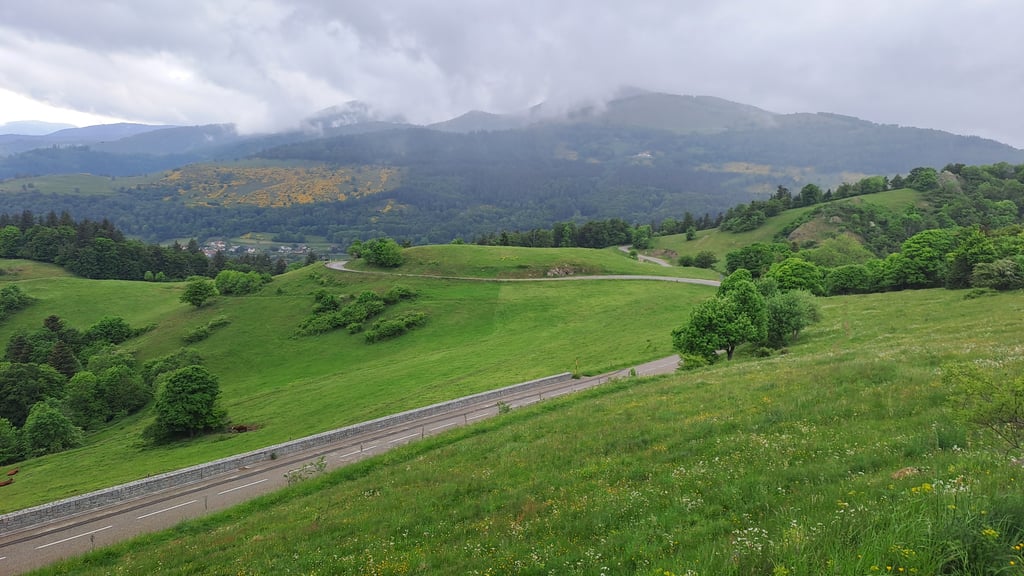
View on map
© MapLibre | OpenStreetMap contributors
1%
2%
4%
6%
8%
10%
12%
15%
20%

Col Amic from Soultz-Haut-Rhin

4.0
7 reviews | Elevation profile | 10 photos
Tips nearby
Col Amic from Soultz-Haut-Rhin
Your achievable time
Calculating based on your best performances...
Relaxed
Maximum
W/kg
W/kg
W/kg
Analyze your climbing performance
Detailed insight into your climbing performance & automatically check off climbs
Based on your best performances.
Your best attempt:
Number of attempts:
Elevation profile Col Amic from Soultz-Haut-Rhin

Statistics

Difficulty points 303
Length 6.9 mi
Average gradient 4.9%
Steepest segment 8.7%
Total ascent 1778 ft

Short recap

Beautiful scenery
6 hairpin turns
#63 toughest climb of Upper Rhine
#57 most elevation gain of Grand Est
#59 longest climb of Grand Est
Feedback about this climb?
Show climbs nearby Export to GPS device

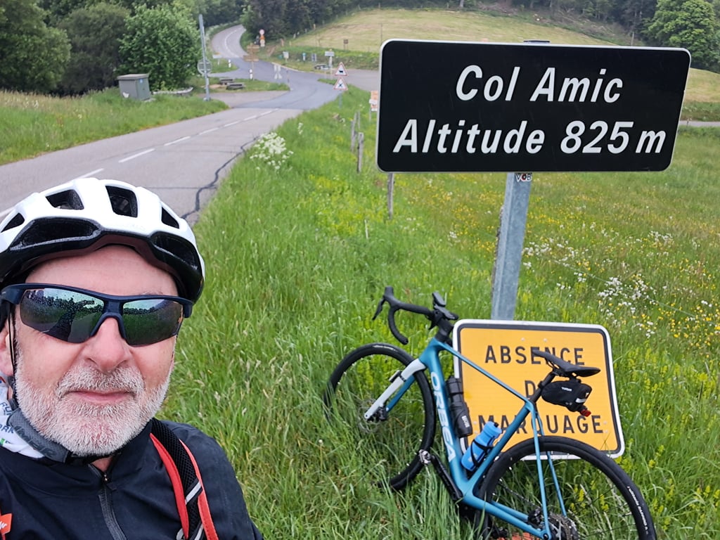
Col Amic from Soultz-Haut-Rhin is a climb in the region Upper Rhine. It is 6.9 mi long and bridges 1778 ft of vertical ascent with an average gradient of 4.9%, resulting in a difficulty score of 303. The top of the ascent is located at 2717 ft above sea level. Climbfinder users shared 7 reviews of this climb and uploaded 10 photos.

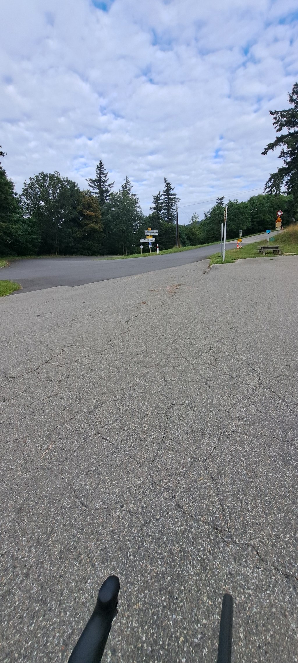
Road names: Route de Jungholtz & Pont Kraemer 1948

This is an automatic translation, the original language is: Dutch.
Very nice climb. Road surface is top, runs nicely and you mainly ride through a shady forest with occasional peeks through the trees. Few cars's encountered, at the end a nice meadow and then at the top you can continue to the Grand Ballon.... read more

Photos (10)

Col Amic from Soultz-Haut-Rhin
transparant thumb
transparant thumb

Your uploads (max 4)

Welcome! Please activate your account if you would like to share something. Look for the verification email in your inbox.

If you want to upload your photos, you need to create an account. It only takes 1 minute and it's completely free.

  • Receive free climbfinder goodies for your reviews & photos.
  • Create a bucket list and check off conquered climbs.
  • Add missing climbs.
Continue with GoogleContinue with Google Continue with FacebookContinue with Facebook Continue with AppleContinue with Apple Sign up with email
By signing up you agree to our terms of service and confirm that you have read our privacy & content policy.

Reviews (7)

5.0
4.0
3.0
2.0
1.0
JorritPaesen
3 Mo 5.0 via the Climbfinder app
This is an automatic translation, the original language is: Dutch. Show original

Actually the easy part on the way to the grand ballon. Very nice and quiet road through the forest that climbs evenly though

Eigenlijk het makkelijke deel op weg naar de grand ballon. Wel heel mooie en rustige weg door het bos die gelijkmatig oploopt

Dashboard
TdB83
7 Mo 5.0
This is an automatic translation, the original language is: Dutch. Show original

Enjoyed it during this climb towards the Grand Ballon! Hardly encountered any other cyclists, beautiful among the forests and winding. At the end of this climb, you can choose to climb further towards the Grand Ballon or descend again towards Cernay or Willer-sur-Thur.

Genoten tijdens deze klim richting de Grand Ballon! Bijna geen andere fietser tegengekomen, mooi tussen de bossen en slingerachtig. Op het einde van deze klim kan je kiezen om verder te klimmen richting de Grand Ballon of weer af te dalen richting Cernay of Willer-sur-Thur.

Dashboard
Dembouz
10 Mo 4.0
This is an automatic translation, the original language is: French. Show original

A very easy and fun climb through the forest! Apart from the surface, which can be average at times, this climb is really enjoyable!

Montée dans la forêt très simple et amusante ! Hormis le revêtement qui peu être des fois moyens cette montée est vraiment agréable !

Col Amic from Soultz-Haut-Rhin
Dashboard
Taaaz1964
1 y 4.0
This is an automatic translation, the original language is: French. Show original

A short mountain road with a good surface and little traffic through the forest to the Col Amic, from where you can continue towards the Col du Grand Ballon.

Petit route de montagne avec un beau revêtement et avec peu de circulation qui traverse la forêt jusqu'au Col Amic, d'où on peut continuer vers les Col du Grand Ballon.

Col Amic from Soultz-Haut-Rhin
Dashboard
Pieter394
1 y 4.0
This is an automatic translation, the original language is: Dutch. Show original

Very fun and pleasant climb - lots of curves, well protected by the trees, long runner, wooded area, good road surface - ideal for warming up before the final section to the Grand Ballon

Zeer leuke en aangename klim - veel bochten, goed beschermd door de bomen, lange loper, bosrijke omgeving, goed wegdek - ideaal om op te warmen voor het laatste gedeelte naar de Grand Ballon

Dashboard
JurneSleddens
2 y 4.0
This is an automatic translation, the original language is: Dutch. Show original

Very nice climb. Road surface is top, runs nicely and you mainly ride through a shady forest with occasional peeks through the trees. Few cars's encountered, at the end a nice meadow and then at the top you can continue to the Grand Ballon.

Heel erg lekkere klim. Wegdek is top, loopt lekker en je rijdt voornamelijk door een schaduwrijk bos met zo af en toe een kijkje door de bomen. Weinig auto's tegengekomen, op het laatst een mooie weide en dan op de top kun je verder naar de Grand Ballon.

Col Amic from Soultz-Haut-Rhin
Dashboard
Fun
2 y 2.0

Very quiet climb on your way up le grand ballon. the surface wasn't always up to standard.

Col Amic from Soultz-Haut-Rhin
Dashboard

Climbing times

5 mph 01:23:15
7 mph 00:58:56
9 mph 00:45:56
12 mph 00:34:30

Road surface condition

100% 0% 0%
Based on 4 votes
Share your knowledge. What was the road condition during your ascent?

Traffic

100% 0% 0%
Based on 4 votes
Your experience counts. How much traffic did you encounter during the climb?

Frequently Asked Questions

Col Amic can be cycled from 2 sides. Col Amic from Soultz-Haut-Rhin is the most popular side, but the summit can also be reached via Col Amic from Willer-sur-Thur.

You don't need special gearing for Col Amic from Soultz-Haut-Rhin. The slope isn't long or steep enough to require much shifting down. You can conquer this climb on power alone. However, a compact gearing system with a smallest front chainring of 34 and largest rear sprocket of 28 or 30 is always nice if you enjoy cycling uphill. This helps maintain a smooth cadence.

Col Amic from Soultz-Haut-Rhin is a serious climb and falls into the 2nd category. With a good basic fitness level, even without much cycling experience, you can complete this climb just fine. However, a bike with climbing gears is a must. Without experience or training, it will be really tough – but that’s part of the challenge!

Col Amic from Soultz-Haut-Rhin is 6.9 mi long.

The average gradient of Col Amic from Soultz-Haut-Rhin is 4.9%.

Col Amic from Soultz-Haut-Rhin has a steepest segment with an average gradient of 8.7%.

The summit of Col Amic from Soultz-Haut-Rhin is at 2717 ft.

At a slow pace of 5 mph, it takes about 01:23:15 to climb Col Amic from Soultz-Haut-Rhin. At 7 mph the time is 00:58:56, and at 9 mph 00:45:56. For the fastest cyclists, 00:34:30 is an achievable time.

Col Amic from Soultz-Haut-Rhin is located in the region Upper Rhine in France.

This page is better in the app

Climbfinder app
Climbfinder
(Free)
Open