View on map
© MapLibre | OpenStreetMap contributors
1%
2%
4%
6%
8%
10%
12%
15%
20%

Cocrai from Havrenne

4.0
3 reviews | Elevation profile | 4 photos
Tips nearby
Cocrai from Havrenne
transparant thumb
transparant thumb
transparant thumb
transparant thumb
Your achievable time
Calculating based on your best performances...
Relaxed
Maximum
W/kg
W/kg
W/kg
Analyze your climbing performance
Detailed insight into your climbing performance & automatically check off climbs
Based on your best performances.
Your best attempt:
Number of attempts:
Elevation profile Cocrai from Havrenne

Statistics

Difficulty points 77
Length 1.4 mi
Average gradient 5%
Steepest segment 10.7%
Total ascent 358 ft
Feedback about this climb?
Show climbs nearby Export to GPS device

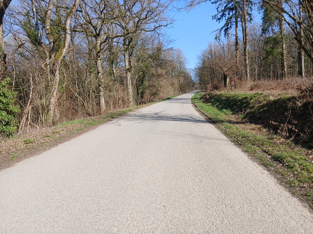
Cocrai from Havrenne is a climb in the region Condroz - Famenne. It is 1.4 mi long and bridges 358 ft of vertical ascent with an average gradient of 5%, resulting in a difficulty score of 77. The top of the ascent is located at 974 ft above sea level. Climbfinder users shared 3 reviews of this climb and uploaded 4 photos.

Road names: Chemin Saint-Remy, Rue de Humain & Rue Louis Banneux
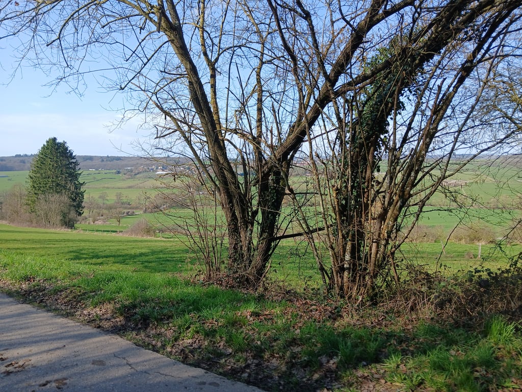
4.0 by gaugau7
This is an automatic translation, the original language is: French.
A very pleasant climb in a superb setting. The foot is already steep, but the rest isn't easy either. Beautiful views of the region from the summit. And it's also one of the cotacols... read more

Photos (4)

Cocrai from Havrenne
transparant thumb
transparant thumb

Your uploads (max 4)

Welcome! Please activate your account if you would like to share something. Look for the verification email in your inbox.

If you want to upload your photos, you need to create an account. It only takes 1 minute and it's completely free.

  • Receive free climbfinder goodies for your reviews & photos.
  • Create a bucket list and check off conquered climbs.
  • Add missing climbs.
Continue with GoogleContinue with Google Continue with FacebookContinue with Facebook Continue with AppleContinue with Apple Sign up with email
By signing up you agree to our terms of service and confirm that you have read our privacy & content policy.

Reviews (3)

5.0
4.0
3.0
2.0
1.0
gaugau7
3 Mo 4.0
This is an automatic translation, the original language is: French. Show original

A very pleasant climb in a superb setting. The foot is already steep, but the rest isn't easy either. Beautiful views of the region from the summit.
And it's also one of the cotacols

Ascension très agréable dans un superbe cadre. Le pied est déjà raide, mais la suite n'est pas des plus faciles non plus. Très belles vues sur la région au sommet.
Et elle fait également partie des cotacols

Dashboard
Maikel1989
1 y 4.0
This is an automatic translation, the original language is: Dutch. Show original

Nice climb if you like quiet country roads. You can see the climb from afar when you arrive. It's fairly steep at the start but fortunately doesn't last very long. Definitely preferable over the main road if you want to cycle to Rochefort.

Mooie klim als je van rustige landwegen houdt. Je ziet de klim al van ver als je aan komt. In het begin gaat het redelijk steil maar duurt gelukkig niet heel lang. Zeker te verkiezen over de hoofdweg als je naar Rochefort wilt fietsen.

Dashboard
Jeroen
4 y 4.0
This is an automatic translation, the original language is: Dutch. Show original

The Côte de Cockrai is a beautiful climb with a tough start. The climb is immediately quite steep and you are treated at the beginning to two beautiful hairpin bends. The climb then continues along the side of the hill giving you a beautiful view to the left. If you turn off at the intersection, the steepness decreases somewhat.
The road surface is fine. I have not seen traffic, very quiet.

De Côte de Cockrai is een prachtige klim met een pittige start. De klim is meteen vrij steil en je wordt aan het begin getrakteerd op twee mooie haarspeldbochten. De klim gaat daarna verder langs de zijkant van de heuvel waardoor je een prachtig uitzicht hebt naar links. Als je afslaat bij het kruispunt neemt de steilte wat af.
Het wegdek is prima. Verkeer heb ik niet gezien, heerlijk rustig.

Cocrai from Havrenne
Dashboard

Climbing times

5 mph 00:16:30
7 mph 00:11:41
9 mph 00:09:06
12 mph 00:06:50

Road surface condition

0% 0% 0%
Based on 0 votes
Share your knowledge. What was the road condition during your ascent?

Traffic

0% 0% 0%
Based on 0 votes
Your experience counts. How much traffic did you encounter during the climb?

Frequently Asked Questions

You don't need special gearing for Cocrai from Havrenne. The slope isn't long or steep enough to require much shifting down. You can conquer this climb on power alone. However, a compact gearing system with a smallest front chainring of 34 and largest rear sprocket of 28 or 30 is always nice if you enjoy cycling uphill. This helps maintain a smooth cadence.

Cocrai from Havrenne is a 4th-category climb. A sprint to the top is usually not an option, and untrained riders will definitely feel it in their legs. For trained cyclists, it is a great training climb.

Cocrai from Havrenne is 1.4 mi long.

The average gradient of Cocrai from Havrenne is 5%.

Cocrai from Havrenne has a steepest segment with an average gradient of 10.7%.

The summit of Cocrai from Havrenne is at 974 ft.

At a slow pace of 5 mph, it takes about 00:16:30 to climb Cocrai from Havrenne. At 7 mph the time is 00:11:41, and at 9 mph 00:09:06. For the fastest cyclists, 00:06:50 is an achievable time.

Cocrai from Havrenne is located in the region Condroz - Famenne in Belgium.

This page is better in the app

Climbfinder app
Climbfinder
(Free)
Open