View on map
© MapLibre | OpenStreetMap contributors
1%
2%
4%
6%
8%
10%
12%
15%
20%

Chez Bardet from Nâves-Parmelan

3.0
2 reviews | Elevation profile | 1 photo
In some places the road surface of this climb is bad, but it can be ridden with a road bike.
Tips nearby
Chez Bardet from Nâves-Parmelan
transparant thumb
transparant thumb
transparant thumb
transparant thumb
transparant thumb
transparant thumb
transparant thumb
Your achievable time
Calculating based on your best performances...
Relaxed
Maximum
W/kg
W/kg
W/kg
Analyze your climbing performance
Detailed insight into your climbing performance & automatically check off climbs
Based on your best performances.
Your best attempt:
Number of attempts:
Elevation profile Chez Bardet from Nâves-Parmelan

Statistics

Difficulty points 145
Length 4.9 mi
Average gradient 3.8%
Steepest segment 8%
Total ascent 978 ft

Short recap

Bad road
#93 longest climb of Haute Savoie
Feedback about this climb?
Show climbs nearby Export to GPS device

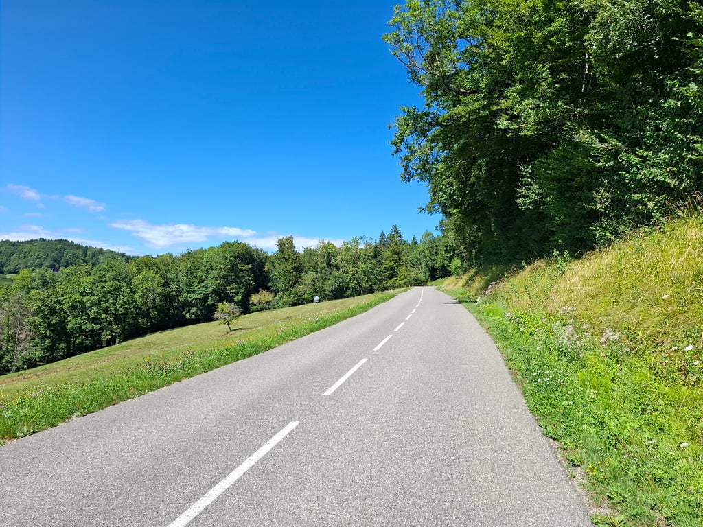
Chez Bardet from Nâves-Parmelan is a climb in the region Annecy. It is 4.9 mi long and bridges 978 ft of vertical ascent with an average gradient of 3.8%, resulting in a difficulty score of 145. The top of the ascent is located at 2539 ft above sea level. Climbfinder users shared 2 reviews of this climb and uploaded 1 photo.

Road names: D 5, Pont de Bange, D 5 & Route d'Aviernoz

3.0 by Jeroen
This is an automatic translation, the original language is: Dutch.
This climb is not difficult, but still traverses the landscape for about eight kilometres. It starts very sweetly with a few hairpin bends and later becomes more of a long runner. The road surface is good and I found it surprisingly quiet in the middle of summer. I did see a lot of cyclists in opposite directions, which is of course totally fun. You are not helped by kikometer signs during the climb and there is nothing at the top either. Still, at the top you are really clearly crossing the edg... read more

Photos (1)

Chez Bardet from Nâves-Parmelan
transparant thumb
transparant thumb
transparant thumb
transparant thumb
transparant thumb

Your uploads (max 4)

Welcome! Please activate your account if you would like to share something. Look for the verification email in your inbox.

If you want to upload your photos, you need to create an account. It only takes 1 minute and it's completely free.

  • Receive free climbfinder goodies for your reviews & photos.
  • Create a bucket list and check off conquered climbs.
  • Add missing climbs.
Continue with GoogleContinue with Google Continue with FacebookContinue with Facebook Continue with AppleContinue with Apple Sign up with email
By signing up you agree to our terms of service and confirm that you have read our privacy & content policy.

Reviews (2)

5.0
4.0
3.0
2.0
1.0
Jeroen
10 Mo 3.0
This is an automatic translation, the original language is: Dutch. Show original

This climb is not difficult, but still traverses the landscape for about eight kilometres. It starts very sweetly with a few hairpin bends and later becomes more of a long runner. The road surface is good and I found it surprisingly quiet in the middle of summer. I did see a lot of cyclists in opposite directions, which is of course totally fun. You are not helped by kikometer signs during the climb and there is nothing at the top either. Still, at the top you are really clearly crossing the edge of the hill. Also great if you want to train blocks because of its evenness.

Deze klim is niet moeilijk, maar loopt toch wel een acht kilometer door het landschap. Ze begint heel liefelijk met een paar haarspelbochten en wordt later meer een lange loper. Het wegdek is goed en ik vond het midden in de zomer verrassend rustig. Ik heb wel veel fietsers in tegengestelde richting gezien, en dat is natuurlijk helemaal leuk. Je wordt gedurende de klim niet geholpen met kikometerbordjes en op de top staat ook niets. Toch ben je boven echt duidelijk de heuvelrand aan het oversteken. Ook prima als je blokjes wil trainen vanwege zijn gelijkmatigheid.

Chez Bardet from Nâves-Parmelan
Dashboard
gusvelo
11 Mo 3.0
This is an automatic translation, the original language is: French. Show original

It's a climb that takes you to the foot of the Col des Glières. It's not difficult in itself, but it's better to know that it's between Annecy and the foot of the pass than to be surprised on the day.

C'est une côte qui permet de se rendre au pied du col des glières. En soi, rien de difficile, mais il faut mieux savoir qu'elle se trouve entre Annecy et le pied du col que d'être surpris le jour J.

Dashboard

Climbing times

5 mph 00:58:44
7 mph 00:41:35
9 mph 00:32:24
12 mph 00:24:20

Road surface condition

100% 0% 0%
Based on 1 vote
Share your knowledge. What was the road condition during your ascent?

Traffic

100% 0% 0%
Based on 1 vote
Your experience counts. How much traffic did you encounter during the climb?

Frequently Asked Questions

You don't need special gearing for Chez Bardet from Nâves-Parmelan. The slope isn't long or steep enough to require much shifting down. You can conquer this climb on power alone. However, a compact gearing system with a smallest front chainring of 34 and largest rear sprocket of 28 or 30 is always nice if you enjoy cycling uphill. This helps maintain a smooth cadence.

Chez Bardet from Nâves-Parmelan is a 4th-category climb. A sprint to the top is usually not an option, and untrained riders will definitely feel it in their legs. For trained cyclists, it is a great training climb.

Chez Bardet from Nâves-Parmelan is 4.9 mi long.

The average gradient of Chez Bardet from Nâves-Parmelan is 3.8%.

Chez Bardet from Nâves-Parmelan has a steepest segment with an average gradient of 8%.

The summit of Chez Bardet from Nâves-Parmelan is at 2539 ft.

At a slow pace of 5 mph, it takes about 00:58:44 to climb Chez Bardet from Nâves-Parmelan. At 7 mph the time is 00:41:35, and at 9 mph 00:32:24. For the fastest cyclists, 00:24:20 is an achievable time.

Chez Bardet from Nâves-Parmelan is located in the region Haute Savoie in France.

This page is better in the app

Climbfinder app
Climbfinder
(Free)
Open