View on map
© MapLibre | OpenStreetMap contributors
1%
2%
4%
6%
8%
10%
12%
15%
20%

Chemin du Lavoir

3.0
1 review/story | Elevation profile | 0 photos
Tips nearby
Your achievable time
Calculating based on your best performances...
Relaxed
Maximum
W/kg
W/kg
W/kg
Analyze your climbing performance
Detailed insight into your climbing performance & automatically check off climbs
Based on your best performances.
Your best attempt:
Number of attempts:
Elevation profile Chemin du Lavoir

Statistics

Difficulty points 20
Length 0.3 mi
Average gradient 6.6%
Steepest segment 9.1%
Total ascent 95 ft
Feedback about this climb?
Show climbs nearby Export to GPS device

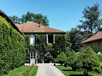
Chemin du Lavoir is a climb in the region Hautes-Pyrénées. It is 0.3 mi long and bridges 95 ft of vertical ascent with an average gradient of 6.6%, resulting in a difficulty score of 20. The top of the ascent is located at 860 ft above sea level. Climbfinder users shared 1 review/story of this climb and uploaded 0 photos.

Road names: Chemin du Lavoir & Route de l'Abbaye

3.0 by LydreT
This is an automatic translation, the original language is: French.
Small rural climb, with a hairpin bend. Perfect for warming up.... read more

Photos (0)

transparant thumb
transparant thumb
transparant thumb
transparant thumb
transparant thumb
transparant thumb

Your uploads (max 4)

Welcome! Please activate your account if you would like to share something. Look for the verification email in your inbox.

If you want to upload your photos, you need to create an account. It only takes 1 minute and it's completely free.

  • Receive free climbfinder goodies for your reviews & photos.
  • Create a bucket list and check off conquered climbs.
  • Add missing climbs.
Continue with GoogleContinue with Google Continue with FacebookContinue with Facebook Continue with AppleContinue with Apple Sign up with email
By signing up you agree to our terms of service and confirm that you have read our privacy & content policy.

Reviews (1)

5.0
4.0
3.0
2.0
1.0
LydreT
2 Mo 3.0 via the Climbfinder app
This is an automatic translation, the original language is: French. Show original

Small rural climb, with a hairpin bend. Perfect for warming up.

Petite montée rurale, avec une petite épingle. Parfait pour se chauffer.

Dashboard

Climbing times

5 mph 00:03:21
7 mph 00:02:22
9 mph 00:01:50
12 mph 00:01:23

Road surface condition

100% 0% 0%
Based on 1 vote
Share your knowledge. What was the road condition during your ascent?

Traffic

100% 0% 0%
Based on 1 vote
Your experience counts. How much traffic did you encounter during the climb?

Frequently Asked Questions

Chemin du Lavoir can be cycled from 4 sides. Chemin du Lavoir is the most popular side, but the summit can also be reached via Route de l'Abbaye, Route de l'Alaric & Chemin de Jacoumet.

You don't need special gearing for Chemin du Lavoir. The slope isn't long or steep enough to require much shifting down. You can conquer this climb on power alone. However, a compact gearing system with a smallest front chainring of 34 and largest rear sprocket of 28 or 30 is always nice if you enjoy cycling uphill. This helps maintain a smooth cadence.

Chemin du Lavoir is not tough enough to be assigned a mountain category. This means that even untrained cyclists can reach the top without any problems on this climb.

Chemin du Lavoir is 0.3 mi long.

The average gradient of Chemin du Lavoir is 6.6%.

Chemin du Lavoir has a steepest segment with an average gradient of 9.1%.

The summit of Chemin du Lavoir is at 860 ft.

At a slow pace of 5 mph, it takes about 00:03:21 to climb Chemin du Lavoir. At 7 mph the time is 00:02:22, and at 9 mph 00:01:50. For the fastest cyclists, 00:01:23 is an achievable time.

Chemin du Lavoir is located in the region Hautes-Pyrénées in France.

This page is better in the app

Climbfinder app
Climbfinder
(Free)
Open