View on map
© MapLibre | OpenStreetMap contributors
1%
2%
4%
6%
8%
10%
12%
15%
20%

Chemin de Favechamps

3.5
2 reviews | Elevation profile | 5 photos
Tips nearby
Chemin de Favechamps
transparant thumb
transparant thumb
transparant thumb
Your achievable time
Calculating based on your best performances...
Relaxed
Maximum
W/kg
W/kg
W/kg
Analyze your climbing performance
Detailed insight into your climbing performance & automatically check off climbs
Based on your best performances.
Your best attempt:
Number of attempts:
Elevation profile Chemin de Favechamps

Statistics

Difficulty points 68
Length 0.4 mi
Average gradient 9.9%
Steepest segment 10.9%
Total ascent 226 ft

Short recap

Hidden gem
#68 average steepest climb of Liège Province
Feedback about this climb?
Show climbs nearby Export to GPS device

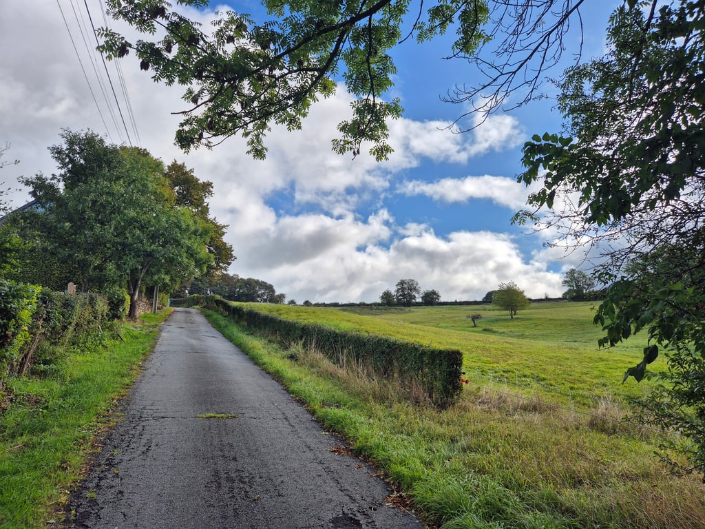
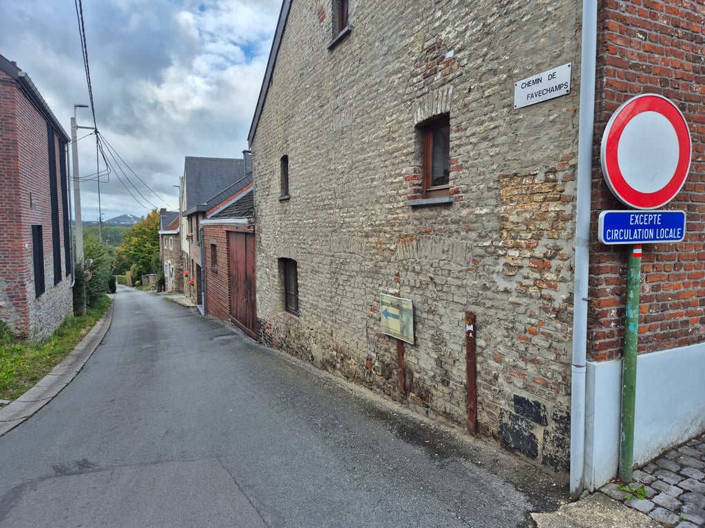
Chemin de Favechamps is a climb in the region Pays de Herve. It is 0.4 mi long and bridges 226 ft of vertical ascent with an average gradient of 9.9%, resulting in a difficulty score of 68. The top of the ascent is located at 761 ft above sea level. Climbfinder users shared 2 reviews of this climb and uploaded 5 photos.

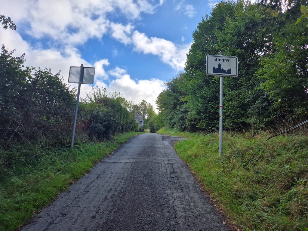
Road name: Chemin de Favechamps
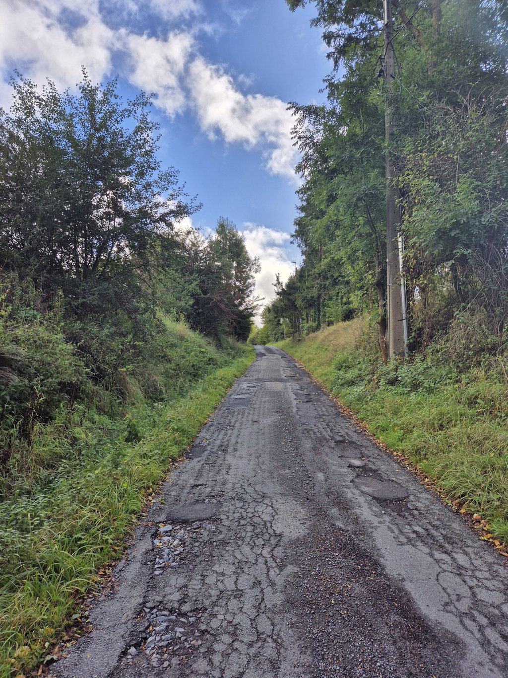
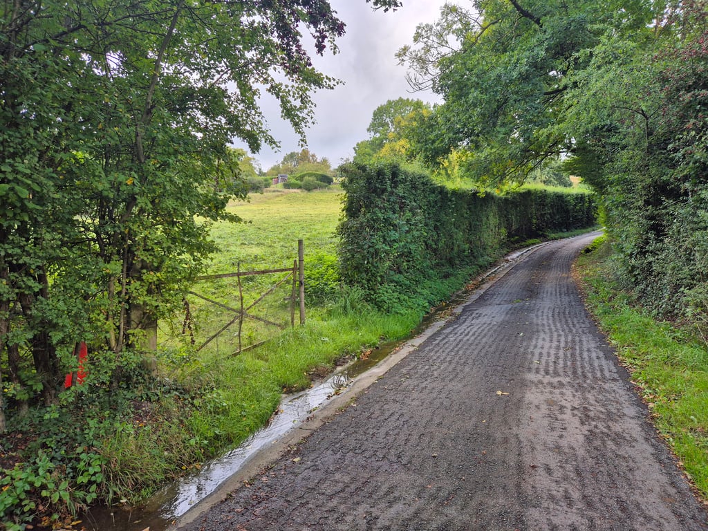
4.0 by Jarin
This is an automatic translation, the original language is: Dutch.
Nice hidden climb listed in Cotacol (no.884). Beautiful wooded area and traffic-free street. Nice tough climb, although the road surface does look really Walloon (read: bad) in some places, so also be careful when descending to the start of the climb.... read more

Photos (5)

Chemin de Favechamps
transparant thumb

Your uploads (max 4)

Welcome! Please activate your account if you would like to share something. Look for the verification email in your inbox.

If you want to upload your photos, you need to create an account. It only takes 1 minute and it's completely free.

  • Receive free climbfinder goodies for your reviews & photos.
  • Create a bucket list and check off conquered climbs.
  • Add missing climbs.
Continue with GoogleContinue with Google Continue with FacebookContinue with Facebook Continue with AppleContinue with Apple Sign up with email
By signing up you agree to our terms of service and confirm that you have read our privacy & content policy.

Reviews (2)

5.0
4.0
3.0
2.0
1.0
Jarin
8 Mo 4.0 via the Climbfinder app
This is an automatic translation, the original language is: Dutch. Show original

Nice hidden climb listed in Cotacol (no.884). Beautiful wooded area and traffic-free street. Nice tough climb, although the road surface does look really Walloon (read: bad) in some places, so also be careful when descending to the start of the climb.

Mooie verborgen klim die in Cotacol vermeld staat (nr.884). Mooie bosrijke omgeving en verkeersluwe straat. Lekker pittige klim, alhoewel het wegdek er op sommige plekken wel echt Waals (lees: slecht) bij ligt, dus pas ook op als je afdaalt naar het begin van de klim.

Dashboard
Tryphon_04
2 y 3.0
This is an automatic translation, the original language is: French. Show original

It's a cul de sac, so you have to go down first to go up. The road is in decent condition, but there is some gravel and mud on it. The gradients are neither too easy nor too hard and the climb is relatively short.

C'est un cul de sac, il faut donc d'abord la descendre pour la monter. La route est dans un état correct, mais il y a des graviers et de la boue dessus. Les pourcentages ne sont ni trop faciles ni trop durs et la montée est relativement courte.

Dashboard

Climbing times

5 mph 00:05:13
7 mph 00:03:41
9 mph 00:02:52
12 mph 00:02:09

Road surface condition

0% 0% 0%
Based on 0 votes
Share your knowledge. What was the road condition during your ascent?

Traffic

0% 0% 0%
Based on 0 votes
Your experience counts. How much traffic did you encounter during the climb?

Frequently Asked Questions

Chemin de Favechamps can be cycled from 7 sides. Côte de Blegny is the most popular side, but the summit can also be reached via Chemin de Favechamps, Barchon-Blégny, Blegny via Rue de la Station, Côte de Blegny via Rue de Booze, Blegny via Rue de la Waide & Blegny via Rue de la Fontaine.

You don't need special gearing for Chemin de Favechamps. The slope isn't long or steep enough to require much shifting down. You can conquer this climb on power alone. However, a compact gearing system with a smallest front chainring of 34 and largest rear sprocket of 28 or 30 is always nice if you enjoy cycling uphill. This helps maintain a smooth cadence.

Chemin de Favechamps falls into the 5th category. With good fitness, you can ride it up with speed and power. If you have less training, shift down and climb smoothly.

Chemin de Favechamps is 0.4 mi long.

The average gradient of Chemin de Favechamps is 9.9%.

Chemin de Favechamps has a steepest segment with an average gradient of 10.9%.

The summit of Chemin de Favechamps is at 761 ft.

At a slow pace of 5 mph, it takes about 00:05:13 to climb Chemin de Favechamps. At 7 mph the time is 00:03:41, and at 9 mph 00:02:52. For the fastest cyclists, 00:02:09 is an achievable time.

Chemin de Favechamps is located in the region Liège Province in Belgium.

This page is better in the app

Climbfinder app
Climbfinder
(Free)
Open