View on map
© MapLibre | OpenStreetMap contributors
1%
2%
4%
6%
8%
10%
12%
15%
20%

Chemin de Cuverville from Wimille

4.0
1 review/story | Elevation profile | 3 photos
Tips nearby
Chemin de Cuverville from Wimille
transparant thumb
transparant thumb
transparant thumb
transparant thumb
transparant thumb
Your achievable time
Calculating based on your best performances...
Relaxed
Maximum
W/kg
W/kg
W/kg
Analyze your climbing performance
Detailed insight into your climbing performance & automatically check off climbs
Based on your best performances.
Your best attempt:
Number of attempts:
Elevation profile Chemin de Cuverville from Wimille

Statistics

Difficulty points 85
Length 0.5 mi
Average gradient 10.4%
Steepest segment 14.5%
Total ascent 253 ft

Short recap

#50 toughest climb of Hauts-de-France
#17 average steepest climb of Hauts-de-France
Feedback about this climb?
Show climbs nearby Export to GPS device

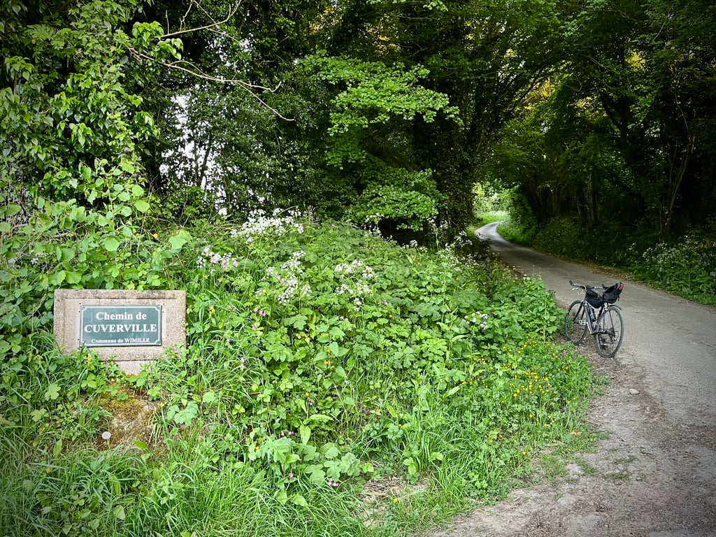
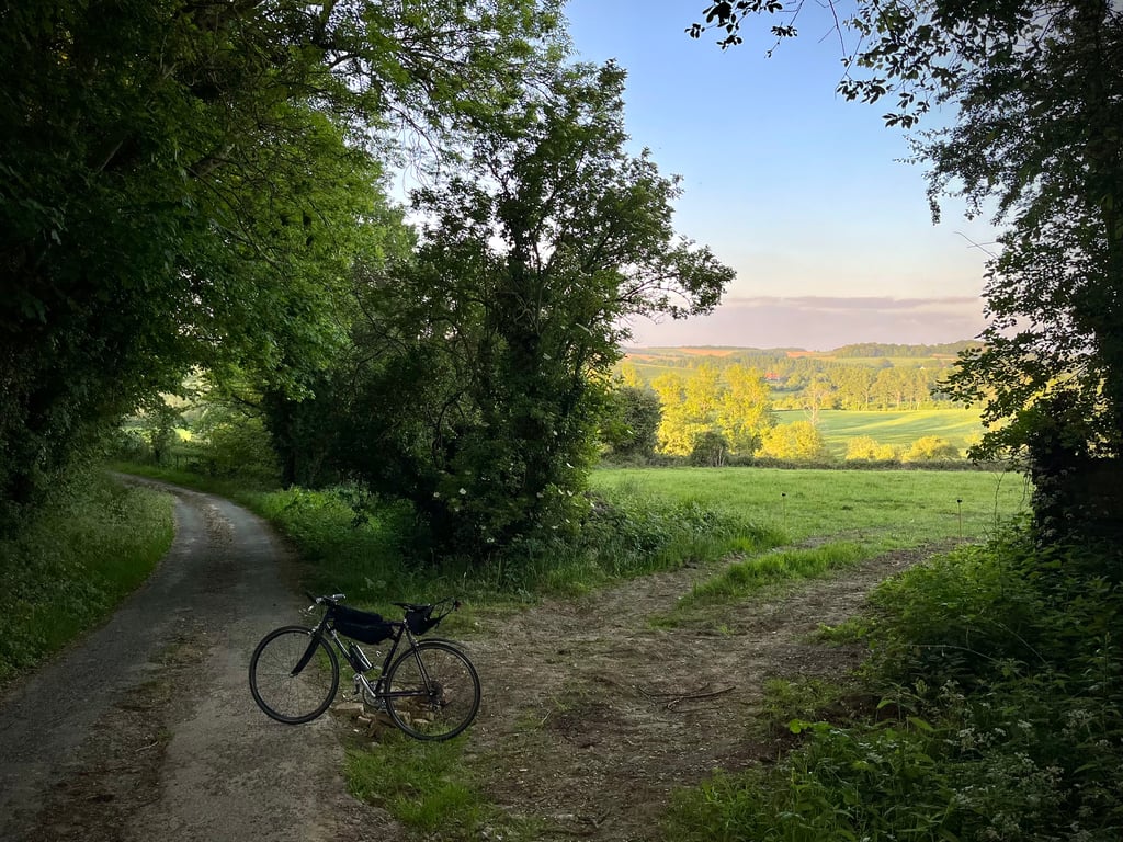
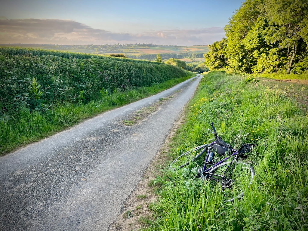
Chemin de Cuverville from Wimille is a climb in the region Caps et Marais d'Opale. It is 0.5 mi long and bridges 253 ft of vertical ascent with an average gradient of 10.4%, resulting in a difficulty score of 85. The top of the ascent is located at 318 ft above sea level. Climbfinder users shared 1 review/story of this climb and uploaded 3 photos.

Road name: Chemin de Cuverville

4.0 by Cromagnon
This is an automatic translation, the original language is: French.
It could well look like a little hidden gem! Yes, really, this short coastline has a lot going for it, and some real arguments in its favour when it comes to being called a "hidden gem". It's well hidden. Even Léon, who has climbed everything here, couldn't find it! It's demanding (10.4% average with a peak at 14.5%). There's something subtle and harmonious about it. Contrary to what the route might suggest, it is not a straight line. It meanders, but with ... read more

Photos (3)

Chemin de Cuverville from Wimille
transparant thumb
transparant thumb
transparant thumb

Your uploads (max 4)

Welcome! Please activate your account if you would like to share something. Look for the verification email in your inbox.

If you want to upload your photos, you need to create an account. It only takes 1 minute and it's completely free.

  • Receive free climbfinder goodies for your reviews & photos.
  • Create a bucket list and check off conquered climbs.
  • Add missing climbs.
Continue with GoogleContinue with Google Continue with FacebookContinue with Facebook Continue with AppleContinue with Apple Sign up with email
By signing up you agree to our terms of service and confirm that you have read our privacy & content policy.

Reviews (1)

5.0
4.0
3.0
2.0
1.0
Cromagnon
1 y 4.0
This is an automatic translation, the original language is: French. Show original

It could well look like a little hidden gem!
Yes, really, this short coastline has a lot going for it, and some real arguments in its favour when it comes to being called a "hidden gem".
It's well hidden. Even Léon, who has climbed everything here, couldn't find it!
It's demanding (10.4% average with a peak at 14.5%).
There's something subtle and harmonious about it. Contrary to what the route might suggest, it is not a straight line. It meanders, but with a delicate touch.
You obviously don't run into anyone.
The surface is from another era. That adds to its charm.
Yes, it's a very pretty little climb.

Ça pourrait bien ressembler à un petit joyau caché !
Oui, cette courte côte a de beaux atours et de vrais arguments pour postuler à la dénomination « joyau caché ».
Cachée, elle l’est, puisque même Léon qui a tout grimpé par ici ne l’a pas trouvée…
Elle est exigeante (10,4% de moyenne avec un pic à 14.5%).
Elle a quelque chose de subtil et d’harmonieux.
Contrairement à ce que le tracé pourrait laisser imaginer, ce n’est pas une ligne droite. Elle serpente, mais tout en délicatesse.
On ne croise évidemment personne.
Son revêtement est d’une autre époque. Ça ajoute à son charme.
Oui, elle est bien coquette, cette petite montée.
4 étoiles = Génial ?
Bon, je concède que c’est un peu surnoté…

Chemin de Cuverville from Wimille
Dashboard

Climbing times

5 mph 00:05:32
7 mph 00:03:55
9 mph 00:03:03
12 mph 00:02:17

Road surface condition

0% 0% 100%
Based on 1 vote
Share your knowledge. What was the road condition during your ascent?

Traffic

100% 0% 0%
Based on 1 vote
Your experience counts. How much traffic did you encounter during the climb?

Frequently Asked Questions

You don't need special gearing for Chemin de Cuverville from Wimille. The slope isn't long or steep enough to require much shifting down. You can conquer this climb on power alone. However, a compact gearing system with a smallest front chainring of 34 and largest rear sprocket of 28 or 30 is always nice if you enjoy cycling uphill. This helps maintain a smooth cadence.

Chemin de Cuverville from Wimille is a 4th-category climb. A sprint to the top is usually not an option, and untrained riders will definitely feel it in their legs. For trained cyclists, it is a great training climb.

Chemin de Cuverville from Wimille is 0.5 mi long.

The average gradient of Chemin de Cuverville from Wimille is 10.4%.

Chemin de Cuverville from Wimille has a steepest segment with an average gradient of 14.5%.

The summit of Chemin de Cuverville from Wimille is at 318 ft.

At a slow pace of 5 mph, it takes about 00:05:32 to climb Chemin de Cuverville from Wimille. At 7 mph the time is 00:03:55, and at 9 mph 00:03:03. For the fastest cyclists, 00:02:17 is an achievable time.

Chemin de Cuverville from Wimille is located in the region Caps et Marais d'Opale in France.

This page is better in the app

Climbfinder app
Climbfinder
(Free)
Open