View on map
© MapLibre | OpenStreetMap contributors
1%
2%
4%
6%
8%
10%
12%
15%
20%

Chemin de Cot de Ger

1.0
1 review/story | Elevation profile | 4 photos
Tips nearby
Chemin de Cot de Ger
transparant thumb
transparant thumb
transparant thumb
transparant thumb
Your achievable time
Calculating based on your best performances...
Relaxed
Maximum
W/kg
W/kg
W/kg
Analyze your climbing performance
Detailed insight into your climbing performance & automatically check off climbs
Based on your best performances.
Your best attempt:
Number of attempts:
Elevation profile Chemin de Cot de Ger

Statistics

Difficulty points 160
Length 1.1 mi
Average gradient 8.8%
Steepest segment 15.9%
Total ascent 522 ft
Feedback about this climb?
Show climbs nearby Export to GPS device

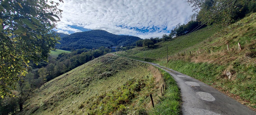
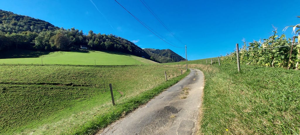
Chemin de Cot de Ger is a climb in the region Hautes-Pyrénées. It is 1.1 mi long and bridges 522 ft of vertical ascent with an average gradient of 8.8%, resulting in a difficulty score of 160. The top of the ascent is located at 2320 ft above sea level. Climbfinder users shared 1 review/story of this climb and uploaded 4 photos.

Road name: Chemin de Cot de Ger

1.0 by HiFolk
This is an automatic translation, the original language is: French.
Small road at the junction towards Labassère .in poor condition, not wide, but no traffic. There are a few flat spots where you can change gear, but there are quite a few sections between 10 and 14 %. At the top there is a lovely unobstructed view of the valley, a few dwellings and farms. Forest road and mountain bike trails. For a warm-up!... read more

Photos (4)

Chemin de Cot de Ger
transparant thumb
transparant thumb

Your uploads (max 4)

Welcome! Please activate your account if you would like to share something. Look for the verification email in your inbox.

If you want to upload your photos, you need to create an account. It only takes 1 minute and it's completely free.

  • Receive free climbfinder goodies for your reviews & photos.
  • Create a bucket list and check off conquered climbs.
  • Add missing climbs.
Continue with GoogleContinue with Google Continue with FacebookContinue with Facebook Continue with AppleContinue with Apple Sign up with email
By signing up you agree to our terms of service and confirm that you have read our privacy & content policy.

Reviews (1)

5.0
4.0
3.0
2.0
1.0
HiFolk
8 Mo 1.0 via the Climbfinder app
This is an automatic translation, the original language is: French. Show original

Small road at the junction towards Labassère .in poor condition, not wide, but no traffic. There are a few flat spots where you can change gear, but there are quite a few sections between 10 and 14 %. At the top there is a lovely unobstructed view of the valley, a few dwellings and farms. Forest road and mountain bike trails. For a warm-up!

Petite route à l'intersection vers Labassère .en mauvais état, pas large, mais aucune circulation. Des petits replats pour changer de braquet,cependant pas mal de passage entre 10 et 14 %. Au sommet jolie vue dégagée sur le vallon, quelques habitations et exploitations. Route forestière et chemins VTT. Pour une mise en jambe!

Dashboard

Climbing times

5 mph 00:13:30
7 mph 00:09:33
9 mph 00:07:26
12 mph 00:05:35

Road surface condition

0% 0% 100%
Based on 1 vote
Share your knowledge. What was the road condition during your ascent?

Traffic

100% 0% 0%
Based on 1 vote
Your experience counts. How much traffic did you encounter during the climb?

Frequently Asked Questions

Chemin de Cot de Ger is a challenging ascent. For this type of climbing, we recommend mountain gearing, specifically a compact system. This means a small front chainring of 34 teeth, combined with a rear cassette where, depending on your level, strength, and experience, you choose a sprocket with 30, 32, or even 34 teeth. Remember that a smooth cadence is always more efficient!

Chemin de Cot de Ger is a 3rd-category climb. Almost anyone can handle this climb, as long as you have a bike with climbing gears. If you have little training, you will probably need to shift down significantly. For experienced riders, Chemin de Cot de Ger is not a problem.

Chemin de Cot de Ger is 1.1 mi long.

The average gradient of Chemin de Cot de Ger is 8.8%.

Chemin de Cot de Ger has a steepest segment with an average gradient of 15.9%.

The summit of Chemin de Cot de Ger is at 2320 ft.

At a slow pace of 5 mph, it takes about 00:13:30 to climb Chemin de Cot de Ger. At 7 mph the time is 00:09:33, and at 9 mph 00:07:26. For the fastest cyclists, 00:05:35 is an achievable time.

Chemin de Cot de Ger is located in the region Hautes-Pyrénées in France.

This page is better in the app

Climbfinder app
Climbfinder
(Free)
Open