View on map
© MapLibre | OpenStreetMap contributors
1%
2%
4%
6%
8%
10%
12%
15%
20%

Château Queyras via Route du Queyras

2.0
1 review/story | Elevation profile | 0 photos
Tips nearby
Your achievable time
Calculating based on your best performances...
Relaxed
Maximum
W/kg
W/kg
W/kg
Analyze your climbing performance
Detailed insight into your climbing performance & automatically check off climbs
Based on your best performances.
Your best attempt:
Number of attempts:
Elevation profile Château Queyras via Route du Queyras

Statistics

Difficulty points 22
Length 0.5 mi
Average gradient 5.2%
Steepest segment 6.8%
Total ascent 131 ft
Feedback about this climb?
Show climbs nearby Export to GPS device

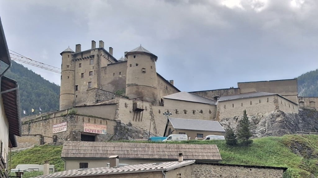
Château Queyras via Route du Queyras is a climb in the region Briançon. It is 0.5 mi long and bridges 131 ft of vertical ascent with an average gradient of 5.2%, resulting in a difficulty score of 22. The top of the ascent is located at 4560 ft above sea level. Climbfinder users shared 1 review/story of this climb and uploaded 0 photos.

Road names: Route du Queyras & Rue du Collet
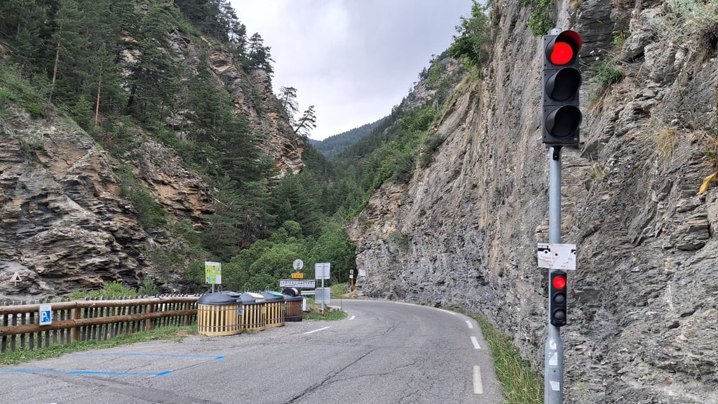
2.0 by gaugau7
This is an automatic translation, the original language is: French.
A short climb up to the village of Château Quyeras, during which we pass the beautiful château that gives the village its name. Unfortunately, there's a lot of traffic, as this is the road that runs along the bottom of the valley. Above all, there is alternating traffic, controlled by a traffic light.... read more

Photos (0)

transparant thumb
transparant thumb
transparant thumb
transparant thumb
transparant thumb
transparant thumb

Your uploads (max 4)

Welcome! Please activate your account if you would like to share something. Look for the verification email in your inbox.

If you want to upload your photos, you need to create an account. It only takes 1 minute and it's completely free.

  • Receive free climbfinder goodies for your reviews & photos.
  • Create a bucket list and check off conquered climbs.
  • Add missing climbs.
Continue with GoogleContinue with Google Continue with FacebookContinue with Facebook Continue with AppleContinue with Apple Sign up with email
By signing up you agree to our terms of service and confirm that you have read our privacy & content policy.

Reviews (1)

5.0
4.0
3.0
2.0
1.0
gaugau7
9 Mo 2.0 via the Climbfinder app
This is an automatic translation, the original language is: French. Show original

A short climb up to the village of Château Quyeras, during which we pass the beautiful château that gives the village its name. Unfortunately, there's a lot of traffic, as this is the road that runs along the bottom of the valley. Above all, there is alternating traffic, controlled by a traffic light.

Petite Ascension dans le village même de Château Quyeras, durant laquelle on passe justement à côté du très beau château qui donne son nom à la commune. Malheureusement il y a beaucoup de trafic, car c'est la route qui passe dans le fond de la vallée. Par dessus tout, il y a une circulation alternée qui est contrôlée par un feu de circulation

Dashboard

Climbing times

5 mph 00:05:44
7 mph 00:04:03
9 mph 00:03:09
12 mph 00:02:22

Road surface condition

0% 0% 0%
Based on 0 votes
Share your knowledge. What was the road condition during your ascent?

Traffic

0% 0% 0%
Based on 0 votes
Your experience counts. How much traffic did you encounter during the climb?

Frequently Asked Questions

You don't need special gearing for Château Queyras via Route du Queyras. The slope isn't long or steep enough to require much shifting down. You can conquer this climb on power alone. However, a compact gearing system with a smallest front chainring of 34 and largest rear sprocket of 28 or 30 is always nice if you enjoy cycling uphill. This helps maintain a smooth cadence.

Château Queyras via Route du Queyras is not tough enough to be assigned a mountain category. This means that even untrained cyclists can reach the top without any problems on this climb.

Château Queyras via Route du Queyras is 0.5 mi long.

The average gradient of Château Queyras via Route du Queyras is 5.2%.

Château Queyras via Route du Queyras has a steepest segment with an average gradient of 6.8%.

The summit of Château Queyras via Route du Queyras is at 4560 ft.

At a slow pace of 5 mph, it takes about 00:05:44 to climb Château Queyras via Route du Queyras. At 7 mph the time is 00:04:03, and at 9 mph 00:03:09. For the fastest cyclists, 00:02:22 is an achievable time.

Château Queyras via Route du Queyras is located in the region Hautes Alpes in France.

This page is better in the app

Climbfinder app
Climbfinder
(Free)
Open