Cergnaule from Montreux is a climb in the region Vaud. It is 7.2 mi long and bridges 2851 ft of vertical ascent with an average gradient of 7.5%, resulting in a difficulty score of 708. The top of the ascent is located at 4190 ft above sea level. Climbfinder users shared 2 reviews of this climb and uploaded 9 photos.
Road name: Avenue de Belmont, Route des Colondalles, Route de Brent, Route de Fontanivent, Route de Fontanivent, Route du Scex-de-Chernex, Rue des Deux-Fontaines, Route de Sonzier, Ruelle de Sonzier, Route de Ch
5.0 by elbowboyThis is an automatic translation, the original language is: French.The most beautiful climb I know. Starting from Lake Geneva in Montreux, I recommend the Avenue des Alpes - Rue de la Gare - Avenue Belmont section. From there, the ascent to Fontanivent is not too complicated. In Vuarennes, it's best to turn left into rue des Colondalles, where there's less traffic than on rue de l'ancien stand and the road is wider. You pass through the pretty village of Chernex towards Sonzier. The 2 km between Sonzier and Chamby are fairly easy. At Chamby, you... read more

Welcome! Please activate your account if you would like to share something. Look for the verification email in your inbox.
If you want to upload your photos, you need to create an account. It only takes 1 minute and it's completely free.
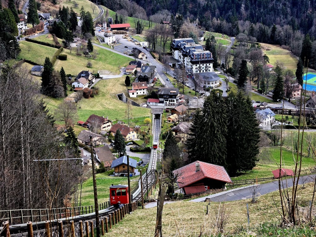
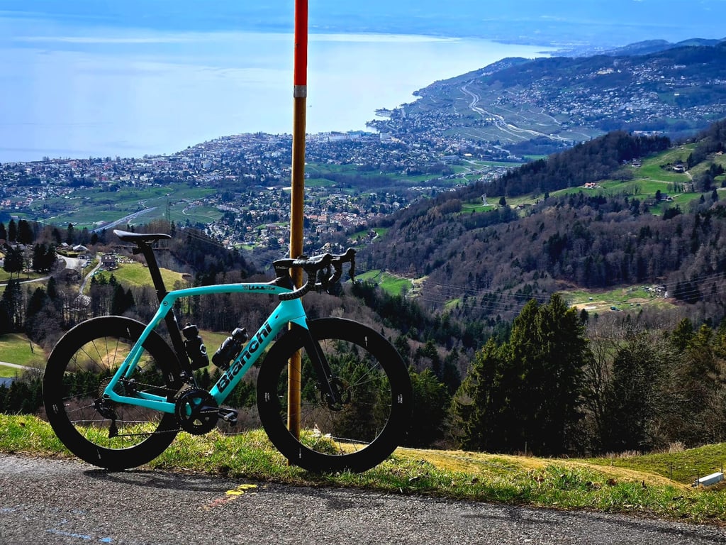
The most beautiful climb I know. Starting from Lake Geneva in Montreux, I recommend the Avenue des Alpes - Rue de la Gare - Avenue Belmont section. From there, the ascent to Fontanivent is not too complicated. In Vuarennes, it's best to turn left into rue des Colondalles, where there's less traffic than on rue de l'ancien stand and the road is wider. You pass through the pretty village of Chernex towards Sonzier. The 2 km between Sonzier and Chamby are fairly easy. At Chamby, you cross the railway tracks and turn right towards Les Avants / Col de Jaman. The 3 km to Les Avants have a gradient of between 10 and 12% which is fairly harmonious. Les Avants is a pretty little village where you have a great view of the Dent de Jaman and Rocher de Naye. From here, you continue at around 11% towards Sonloup, passing under the funicular railway twice with a splendid view of Lake Geneva. Between Sonloup and Cergnaule, the last kilometre is tough, slope up to 15% but it's totally worth it, the view over the Lake is excellent. At the top there is an inn for a short stop. Continuing on the same road you reach Villard sur Chamby to continue to Les Pléiades, also highly recommended! Fontanivent, Chernex, les Avants, Sonloup and Cergnaule have fountains with drinking water. The road is in very good condition and there is very little traffic from Les Avants onwards. A must-do ascent!
La plus belle montée que je connais. En partant du Lac Léman à Montreux je recommande le passage Avenue des Alpes - Rue de la Gare - Avenue Belmont. A partir de là, l'ascension vers Fontanivent n'est pas trop compliquée. A Vuarennes, vaut mieux prendre à gauche dans la rue des Colondalles, il y a moins de trafic que sur la rue de l'ancien stand et la chaussée est plus large. On passe par le joli village de Chernex vers Sonzier. Les 2 km entre Sonzier et Chamby sont plutôt faciles. A Chamby, on croise les voies ferrées et tourne à droite vers Les Avants / Col de Jaman. Les 3 km vers les Avants ont une pente entre 10 et 12% qui est plutôt harmonique. Les Avants est un joli petit village où vous avez une belle vue sur la Dent de Jaman et Rocher de Naye. A partir de là, on continue à environ 11% vers Sonloup, on passe en-dessous du funiculaire deux fois avec une vue splendide sur le lac Léman. Entre Sonloup et Cergnaule, le dernier kilomètre est dur, pente jusqu'à 15% mais ça vaut tout à fait la peine, la vue sur le Lac est excellente. En haut il y a une auberge pour un petit arrêt. En continuant sur la même route on atteint Villard sur Chamby pour continuer vers les Pléiades, également très recommandé ! A Fontanivent, Chernex, les Avants, Sonloup et Cergnaule, il y a des fontaines avec de l'eau potable. L'état de la route est très bien, à partir des Avants il y a très peu de trafic. Montée à faire absolument !
Beautiful climb which isn't too steep coming from Montreux. Connect this with Les Pléiades for a beautiful day out.
When you start from Montreux you can take a "shortcut" over a cobble path called "Pavé Pallens Montreux" on Strava. It is a beautiful but steep little kicker with a maximum gradient of about 30%. Do not take this during mid day or a weekend when it is busy with pedestrians, rather take it early in the morning or in the evening.
The road to Les Avants is buttery smooth and once you reach the train station of Les Avants you will find toilets and a water fountain. After that the road steepens slightly but never over 12%. up to the top of the funiculair. The last couple 100 meters steepens for a last little kick, but you won't notice it with the beautiful views of the lake and Rhône valley.
| 5 mph | 01:26:36 |
| 7 mph | 01:01:19 |
| 9 mph | 00:47:47 |
| 12 mph | 00:35:54 |
This page is better in the app