View on map
© MapLibre | OpenStreetMap contributors
1%
2%
4%
6%
8%
10%
12%
15%
20%

Bockshahn from Blasweihler Bach

5.0
1 review/story | Elevation profile | 3 photos
Tips nearby
Bockshahn from Blasweihler Bach
transparant thumb
transparant thumb
transparant thumb
transparant thumb
transparant thumb
Your achievable time
Calculating based on your best performances...
Relaxed
Maximum
W/kg
W/kg
W/kg
Analyze your climbing performance
Detailed insight into your climbing performance & automatically check off climbs
Based on your best performances.
Your best attempt:
Number of attempts:
Elevation profile Bockshahn from Blasweihler Bach

Statistics

Difficulty points 160
Length 3.2 mi
Average gradient 5%
Steepest segment 10.5%
Total ascent 837 ft

Short recap

1 hairpin turn
#88 most elevation gain of Eifel
Feedback about this climb?
Show climbs nearby Export to GPS device

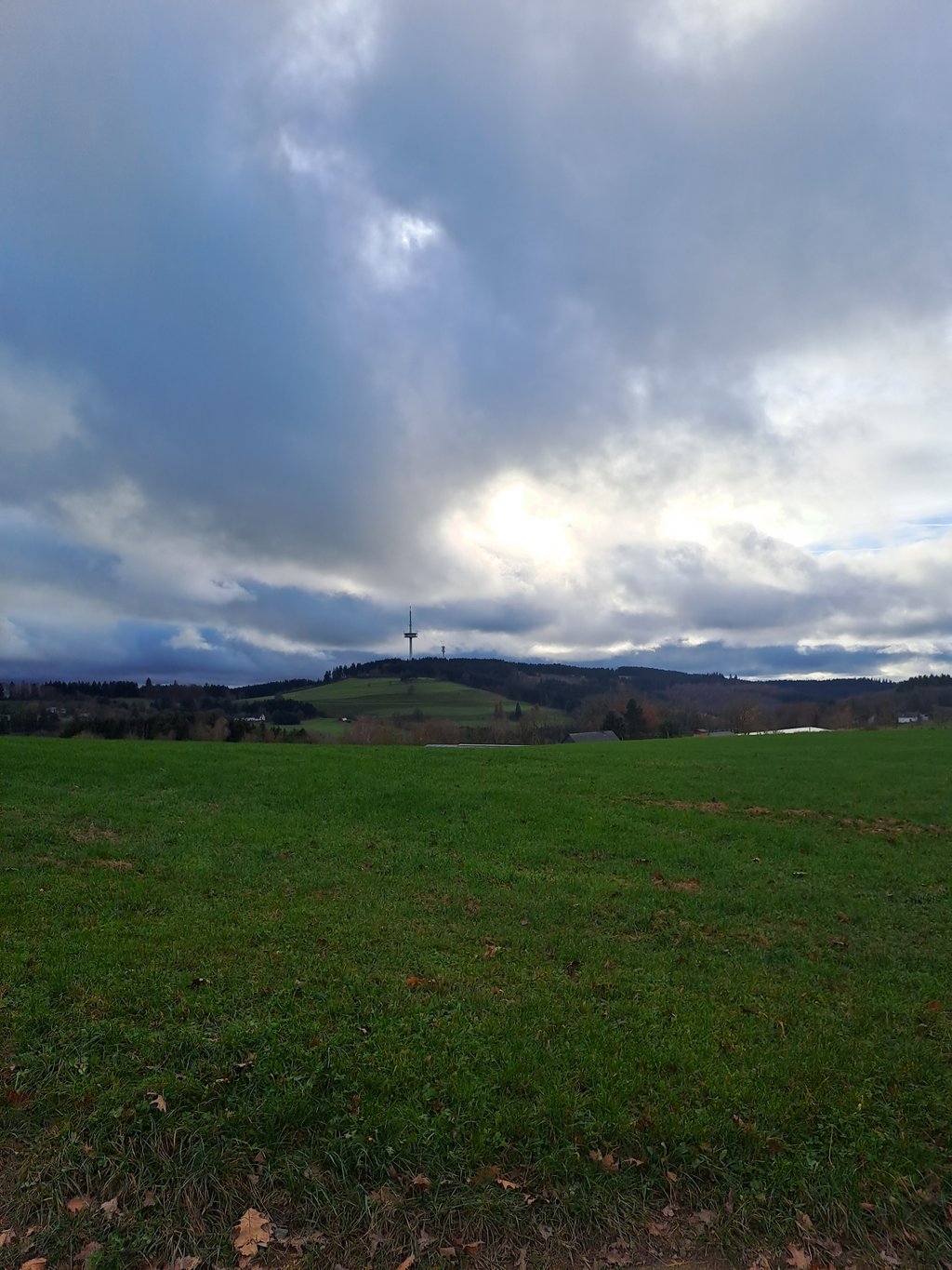
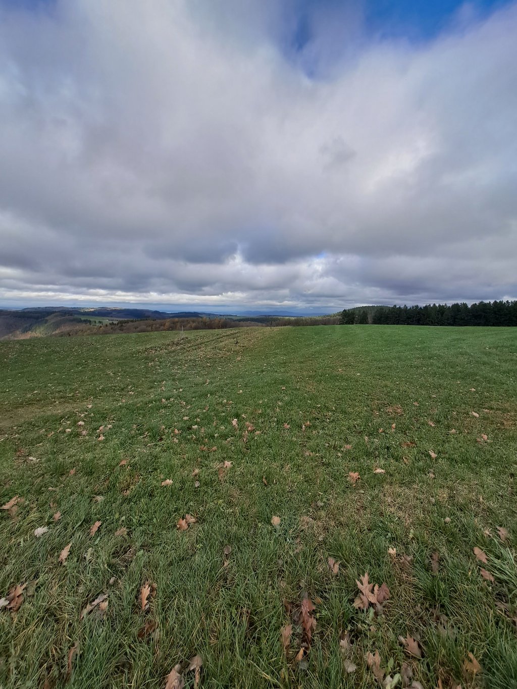
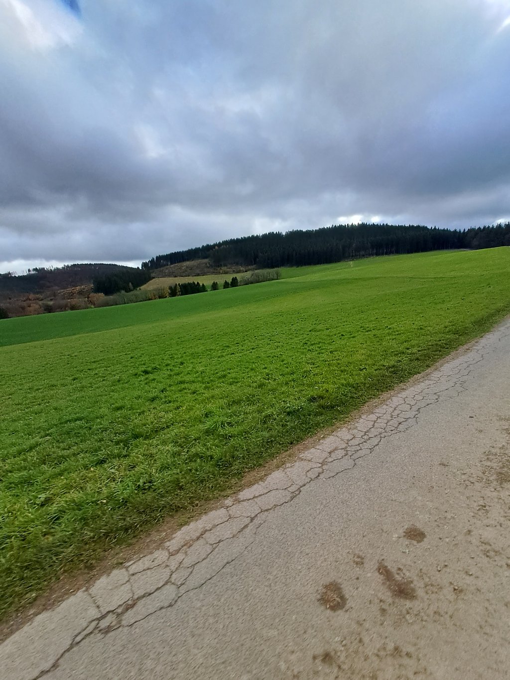
Bockshahn from Blasweihler Bach is a climb in the region Eifel. It is 3.2 mi long and bridges 837 ft of vertical ascent with an average gradient of 5%, resulting in a difficulty score of 160. The top of the ascent is located at 2001 ft above sea level. Climbfinder users shared 1 review/story of this climb and uploaded 3 photos.

Road name: L 85

This is an automatic translation, the original language is: German.
A great climb. First a sharp bend out of the stream valley that you can let yourself fall into, then a constant percentage. Up to the junction, good tarmac throughout and virtually no traffic. Once you have entered the dirt track, the profile changes abruptly - it feels like the percentages change every metre. Unfortunately, the average values given here are therefore not very meaningful. The path remains good and is deserted. While the first part of the route runs through forest throughout, the... read more

Photos (3)

Bockshahn from Blasweihler Bach
transparant thumb
transparant thumb
transparant thumb

Your uploads (max 4)

Welcome! Please activate your account if you would like to share something. Look for the verification email in your inbox.

If you want to upload your photos, you need to create an account. It only takes 1 minute and it's completely free.

  • Receive free climbfinder goodies for your reviews & photos.
  • Create a bucket list and check off conquered climbs.
  • Add missing climbs.
Continue with GoogleContinue with Google Continue with FacebookContinue with Facebook Continue with AppleContinue with Apple Sign up with email
By signing up you agree to our terms of service and confirm that you have read our privacy & content policy.

Reviews (1)

5.0
4.0
3.0
2.0
1.0
XaviElSchwalbo
6 Mo 5.0
This is an automatic translation, the original language is: German. Show original

A great climb. First a sharp bend out of the stream valley that you can let yourself fall into, then a constant percentage. Up to the junction, good tarmac throughout and virtually no traffic. Once you have entered the dirt track, the profile changes abruptly - it feels like the percentages change every metre. Unfortunately, the average values given here are therefore not very meaningful. The path remains good and is deserted. While the first part of the route runs through forest throughout, the ascent opens up a little in the second part, but for the most part you are in the forest there too. At the summit, you have a great view of the Hohe Acht on the left and the Rhine plain on the right.
An absolute recommendation.

Toller Anstieg. Zunächst eine scharfe Kurve aus dem Bachtal in die man sich reinfallen lassen kann, anschließend konstante Prozente. Bis zur Abzweigung durchgehend guter Aspahlt und so gut wie kein Verkehr. Nachdem man in den Feldweg eingezogen ist ändert sich das Profil schlagartig gefühlt jeden Meter ändern sich die Prozentsätze. Leider sind die hier angegeben Durchschnitswerte deswegen wenig aussagekräftig. Der Weg bleibt gut und ist menschenleer. Während man im ersten Teil durchgehend durch Wald fährt, öffnet sich der Anstieg im zweiten Teil ein wenig, größtenteils fährt man aber auch dort im Wald. Auf dem Gipfel hat man eine tolle Aussicht auf die Hohe Acht auf der linken und die Rheinebene auf der rechten Seite.
Absolute Empfehlung.

Dashboard

Climbing times

5 mph 00:38:18
7 mph 00:27:07
9 mph 00:21:08
12 mph 00:15:52

Road surface condition

0% 0% 0%
Based on 0 votes
Share your knowledge. What was the road condition during your ascent?

Traffic

0% 0% 0%
Based on 0 votes
Your experience counts. How much traffic did you encounter during the climb?

Frequently Asked Questions

You don't need special gearing for Bockshahn from Blasweihler Bach. The slope isn't long or steep enough to require much shifting down. You can conquer this climb on power alone. However, a compact gearing system with a smallest front chainring of 34 and largest rear sprocket of 28 or 30 is always nice if you enjoy cycling uphill. This helps maintain a smooth cadence.

Bockshahn from Blasweihler Bach is a 3rd-category climb. Almost anyone can handle this climb, as long as you have a bike with climbing gears. If you have little training, you will probably need to shift down significantly. For experienced riders, Bockshahn from Blasweihler Bach is not a problem.

Bockshahn from Blasweihler Bach is 3.2 mi long.

The average gradient of Bockshahn from Blasweihler Bach is 5%.

Bockshahn from Blasweihler Bach has a steepest segment with an average gradient of 10.5%.

The summit of Bockshahn from Blasweihler Bach is at 2001 ft.

At a slow pace of 5 mph, it takes about 00:38:18 to climb Bockshahn from Blasweihler Bach. At 7 mph the time is 00:27:07, and at 9 mph 00:21:08. For the fastest cyclists, 00:15:52 is an achievable time.

Bockshahn from Blasweihler Bach is located in the region Rhineland-Palatinate in Germany.

This page is better in the app

Climbfinder app
Climbfinder
(Free)
Open