View on map
© MapLibre | OpenStreetMap contributors
1%
2%
4%
6%
8%
10%
12%
15%
20%

Binzberg from Gänsbrunnen

4.0
1 review/story | Elevation profile | 0 photos
Tips nearby
Your achievable time
Calculating based on your best performances...
Relaxed
Maximum
W/kg
W/kg
W/kg
Analyze your climbing performance
Detailed insight into your climbing performance & automatically check off climbs
Based on your best performances.
Your best attempt:
Number of attempts:
Elevation profile Binzberg from Gänsbrunnen

Statistics

Difficulty points 261
Length 1.9 mi
Average gradient 9%
Steepest segment 13.1%
Total ascent 909 ft
Feedback about this climb?
Show climbs nearby Export to GPS device

Binzberg from Gänsbrunnen is a climb in the region Solothurn. It is 1.9 mi long and bridges 909 ft of vertical ascent with an average gradient of 9%, resulting in a difficulty score of 261. The top of the ascent is located at 3323 ft above sea level. Climbfinder users shared 1 review/story of this climb and uploaded 0 photos.

Road name: Binzstrasse
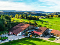
4.0 by Kagamino
This is an automatic translation, the original language is: French.
A good part of the climb is under the trees. The summit isn't very well defined, and the road flattens out slowly until it descends a little before the restaurant/hut. There are few people, and the view from the top is good as you pass into the next valley.... read more

Photos (0)

transparant thumb
transparant thumb
transparant thumb
transparant thumb
transparant thumb
transparant thumb

Your uploads (max 4)

Welcome! Please activate your account if you would like to share something. Look for the verification email in your inbox.

If you want to upload your photos, you need to create an account. It only takes 1 minute and it's completely free.

  • Receive free climbfinder goodies for your reviews & photos.
  • Create a bucket list and check off conquered climbs.
  • Add missing climbs.
Continue with GoogleContinue with Google Continue with FacebookContinue with Facebook Continue with AppleContinue with Apple Sign up with email
By signing up you agree to our terms of service and confirm that you have read our privacy & content policy.

Reviews (1)

5.0
4.0
3.0
2.0
1.0
Kagamino
2 y 4.0 00:25:00 (4.6 mph)
This is an automatic translation, the original language is: French. Show original

A good part of the climb is under the trees. The summit isn't very well defined, and the road flattens out slowly until it descends a little before the restaurant/hut. There are few people, and the view from the top is good as you pass into the next valley.

Un bonne partie de la montée est sous les arbres. Le sommet n'est pas très bien défini, la route s’aplatit lentement jusqu'à redescendre un peu avant le restaurant / refuge. Il y a peu de monde, et la vue est belle au sommet en passant dans la vallée suivante.

Dashboard

Climbing times

5 mph 00:23:06
7 mph 00:16:21
9 mph 00:12:44
12 mph 00:09:34

Road surface condition

100% 0% 0%
Based on 1 vote
Share your knowledge. What was the road condition during your ascent?

Traffic

100% 0% 0%
Based on 1 vote
Your experience counts. How much traffic did you encounter during the climb?

Frequently Asked Questions

Binzberg can be cycled from 2 sides. Binzberg from Gänsbrunnen is the most popular side, but the summit can also be reached via Binzberg from Moutier.

Binzberg from Gänsbrunnen is a challenging ascent. For this type of climbing, we recommend mountain gearing, specifically a compact system. This means a small front chainring of 34 teeth, combined with a rear cassette where, depending on your level, strength, and experience, you choose a sprocket with 30, 32, or even 34 teeth. Remember that a smooth cadence is always more efficient!

Binzberg from Gänsbrunnen is a 3rd-category climb. Almost anyone can handle this climb, as long as you have a bike with climbing gears. If you have little training, you will probably need to shift down significantly. For experienced riders, Binzberg from Gänsbrunnen is not a problem.

Binzberg from Gänsbrunnen is 1.9 mi long.

The average gradient of Binzberg from Gänsbrunnen is 9%.

Binzberg from Gänsbrunnen has a steepest segment with an average gradient of 13.1%.

The summit of Binzberg from Gänsbrunnen is at 3323 ft.

At a slow pace of 5 mph, it takes about 00:23:06 to climb Binzberg from Gänsbrunnen. At 7 mph the time is 00:16:21, and at 9 mph 00:12:44. For the fastest cyclists, 00:09:34 is an achievable time.

Binzberg from Gänsbrunnen is located in the region Solothurn in Switzerland.

This page is better in the app

Climbfinder app
Climbfinder
(Free)
Open