View on map
© MapLibre | OpenStreetMap contributors
1%
2%
4%
6%
8%
10%
12%
15%
20%

Binkelstraat & Tommenstraat from Neerrepen

3.0
2 reviews | Elevation profile | 9 photos
Tips nearby
Binkelstraat & Tommenstraat from Neerrepen
Your achievable time
Calculating based on your best performances...
Relaxed
Maximum
W/kg
W/kg
W/kg
Analyze your climbing performance
Detailed insight into your climbing performance & automatically check off climbs
Based on your best performances.
Your best attempt:
Number of attempts:
Elevation profile Binkelstraat & Tommenstraat from Neerrepen

Statistics

Difficulty points 18
Length 0.8 mi
Average gradient 3.5%
Steepest segment 6.3%
Total ascent 148 ft

Short recap

Hidden gem
#68 toughest climb of Belgium Limburg
#66 most elevation gain of Belgium Limburg
Feedback about this climb?
Show climbs nearby Export to GPS device

Binkelstraat & Tommenstraat from Neerrepen is a climb in the region Haspengouw. It is 0.8 mi long and bridges 148 ft of vertical ascent with an average gradient of 3.5%, resulting in a difficulty score of 18. The top of the ascent is located at 374 ft above sea level. Climbfinder users shared 2 reviews of this climb and uploaded 9 photos.

Road names: Binkelstraat & Tommenstraat
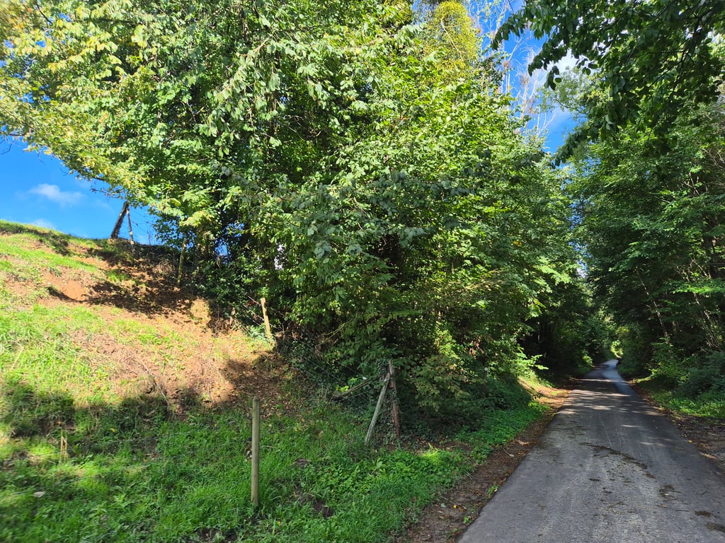
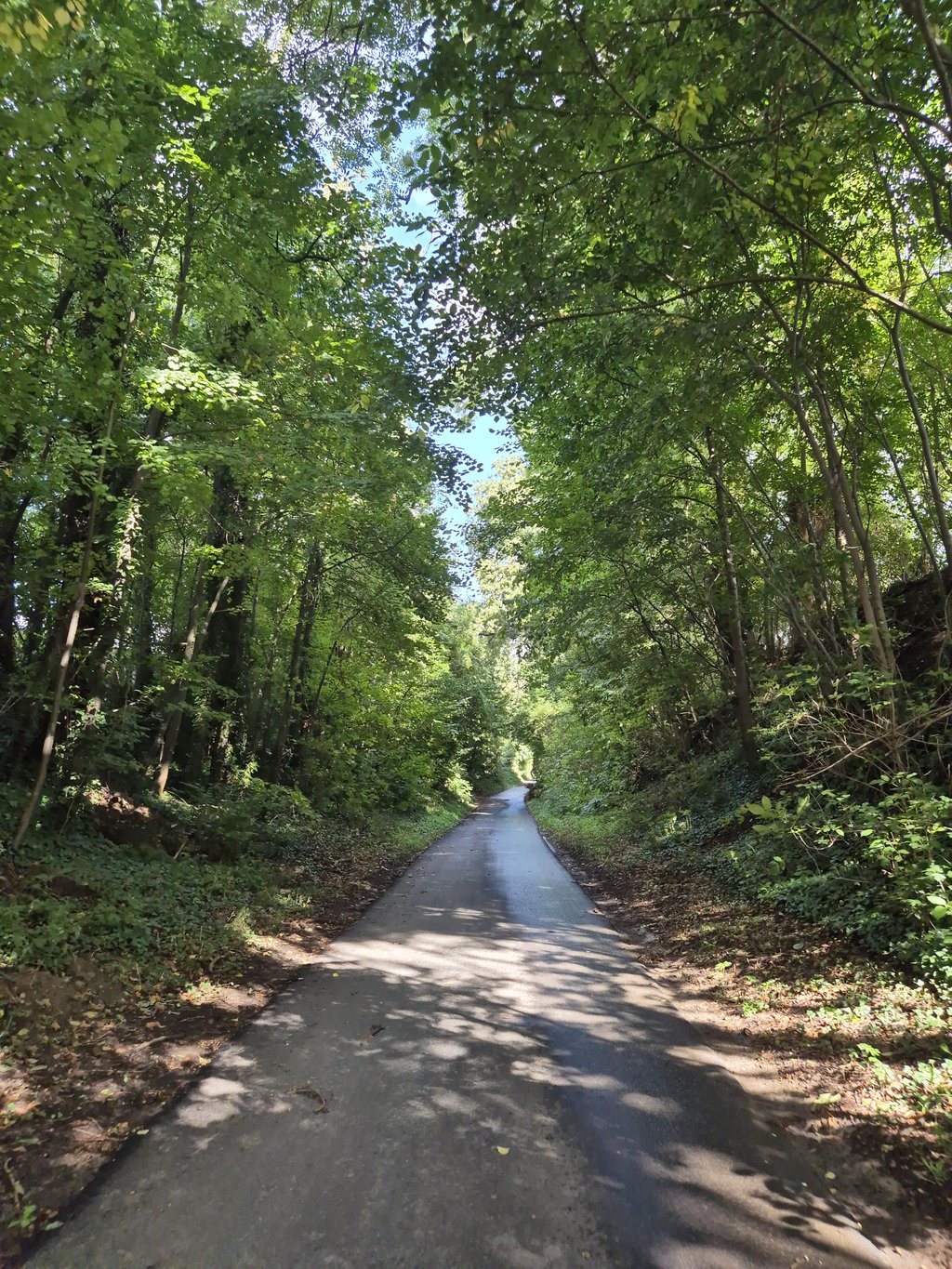
3.0 by Fedor
This is an automatic translation, the original language is: Dutch.
Nice climb where the devil is in the beginning. The steepest part is in the hollow road, which is not too steep but the concrete is quite bumpy, making it harder. Further on, it becomes a regular concrete road which is otherwise fine cycling. Beautiful green surroundings.... read more

Photos (9)

Binkelstraat & Tommenstraat from Neerrepen
transparant thumb
transparant thumb
transparant thumb

Your uploads (max 4)

Welcome! Please activate your account if you would like to share something. Look for the verification email in your inbox.

If you want to upload your photos, you need to create an account. It only takes 1 minute and it's completely free.

  • Receive free climbfinder goodies for your reviews & photos.
  • Create a bucket list and check off conquered climbs.
  • Add missing climbs.
Continue with GoogleContinue with Google Continue with FacebookContinue with Facebook Continue with AppleContinue with Apple Sign up with email
By signing up you agree to our terms of service and confirm that you have read our privacy & content policy.

Reviews (2)

5.0
4.0
3.0
2.0
1.0
Fedor
3 y 3.0
This is an automatic translation, the original language is: Dutch. Show original

Nice climb where the devil is in the beginning. The steepest part is in the hollow road, which is not too steep but the concrete is quite bumpy, making it harder. Further on, it becomes a regular concrete road which is otherwise fine cycling. Beautiful green surroundings.

Leuke klim waarbij het venijn in het begin zit. Hier zit in de holle weg het steilste deel wat qua steilte wel meevalt maar het beton is behoorlijk hobbelig wat het zwaarder maakt. Verderop wordt het een regulier betonweggetje wat verder prima fietst. Mooie groene omgeving.

Binkelstraat & Tommenstraat from Neerrepen
Dashboard
ChefVanDePeleton
3 y 3.0

Very beautiful climb! The first part is a hollow way but unfortunattely has some bad concrete where you almost get some cobblestone vibes. The second part is on good concrete between the fields. Because of the first part I would only recommend to ride it in summer. In other seasons the hollow way is often wet and covered in dirt.

Dashboard

Climbing times

5 mph 00:09:37
7 mph 00:06:48
9 mph 00:05:18
12 mph 00:03:59

Road surface condition

0% 0% 100%
Based on 1 vote
Share your knowledge. What was the road condition during your ascent?

Traffic

100% 0% 0%
Based on 1 vote
Your experience counts. How much traffic did you encounter during the climb?

Frequently Asked Questions

Binkelstraat & Tommenstraat can be cycled from 3 sides. Binkelstraat & Tommenstraat from Neerrepen is the most popular side, but the summit can also be reached via Schabosweg via Bieskuilstraat & Herenstraat & Tommenstraat from Sint-Huibrechts-Hern.

You don't need special gearing for Binkelstraat & Tommenstraat from Neerrepen. The slope isn't long or steep enough to require much shifting down. You can conquer this climb on power alone. However, a compact gearing system with a smallest front chainring of 34 and largest rear sprocket of 28 or 30 is always nice if you enjoy cycling uphill. This helps maintain a smooth cadence.

Binkelstraat & Tommenstraat from Neerrepen is not tough enough to be assigned a mountain category. This means that even untrained cyclists can reach the top without any problems on this climb.

Binkelstraat & Tommenstraat from Neerrepen is 0.8 mi long.

The average gradient of Binkelstraat & Tommenstraat from Neerrepen is 3.5%.

Binkelstraat & Tommenstraat from Neerrepen has a steepest segment with an average gradient of 6.3%.

The summit of Binkelstraat & Tommenstraat from Neerrepen is at 374 ft.

At a slow pace of 5 mph, it takes about 00:09:37 to climb Binkelstraat & Tommenstraat from Neerrepen. At 7 mph the time is 00:06:48, and at 9 mph 00:05:18. For the fastest cyclists, 00:03:59 is an achievable time.

Binkelstraat & Tommenstraat from Neerrepen is located in the region Belgium Limburg in Belgium.

This page is better in the app

Climbfinder app
Climbfinder
(Free)
Open