View on map
© MapLibre | OpenStreetMap contributors
1%
2%
4%
6%
8%
10%
12%
15%
20%

Barrière Mathieu via Laneuville-au-Bois

3.0
2 reviews | Elevation profile | 1 photo
Tips nearby
Barrière Mathieu via Laneuville-au-Bois
transparant thumb
transparant thumb
transparant thumb
transparant thumb
transparant thumb
transparant thumb
transparant thumb
Your achievable time
Calculating based on your best performances...
Relaxed
Maximum
W/kg
W/kg
W/kg
Analyze your climbing performance
Detailed insight into your climbing performance & automatically check off climbs
Based on your best performances.
Your best attempt:
Number of attempts:
Elevation profile Barrière Mathieu via Laneuville-au-Bois

Statistics

Difficulty points 72
Length 2.5 mi
Average gradient 3.7%
Steepest segment 9.6%
Total ascent 486 ft
Feedback about this climb?
Show climbs nearby Export to GPS device

Barrière Mathieu via Laneuville-au-Bois is a climb in the region Forest of Saint-Hubert. It is 2.5 mi long and bridges 486 ft of vertical ascent with an average gradient of 3.7%, resulting in a difficulty score of 72. The top of the ascent is located at 1791 ft above sea level. Climbfinder users shared 2 reviews of this climb and uploaded 1 photo.

Road names: Rue du Golet, Laneuville-au-Bois & Route de Freyr

3.0 by N_M
This is an automatic translation, the original language is: Dutch.
Cotacol starting from the forest. So by gravel bike, you can get through the forest from Saint-Hubert; however, by road bike, you have to descend from the village of Laneuville to the start of the climb. It is a nice climb through wooded area that ends on a large national track. You can cross it, but beware: the cars're driving the speed of a motorway there.... read more

Photos (1)

Barrière Mathieu via Laneuville-au-Bois
transparant thumb
transparant thumb
transparant thumb
transparant thumb
transparant thumb

Your uploads (max 4)

Welcome! Please activate your account if you would like to share something. Look for the verification email in your inbox.

If you want to upload your photos, you need to create an account. It only takes 1 minute and it's completely free.

  • Receive free climbfinder goodies for your reviews & photos.
  • Create a bucket list and check off conquered climbs.
  • Add missing climbs.
Continue with GoogleContinue with Google Continue with FacebookContinue with Facebook Continue with AppleContinue with Apple Sign up with email
By signing up you agree to our terms of service and confirm that you have read our privacy & content policy.

Reviews (2)

5.0
4.0
3.0
2.0
1.0
Michaelvdb
6 Mo 3.0 via the Climbfinder app
This is an automatic translation, the original language is: Dutch. Show original

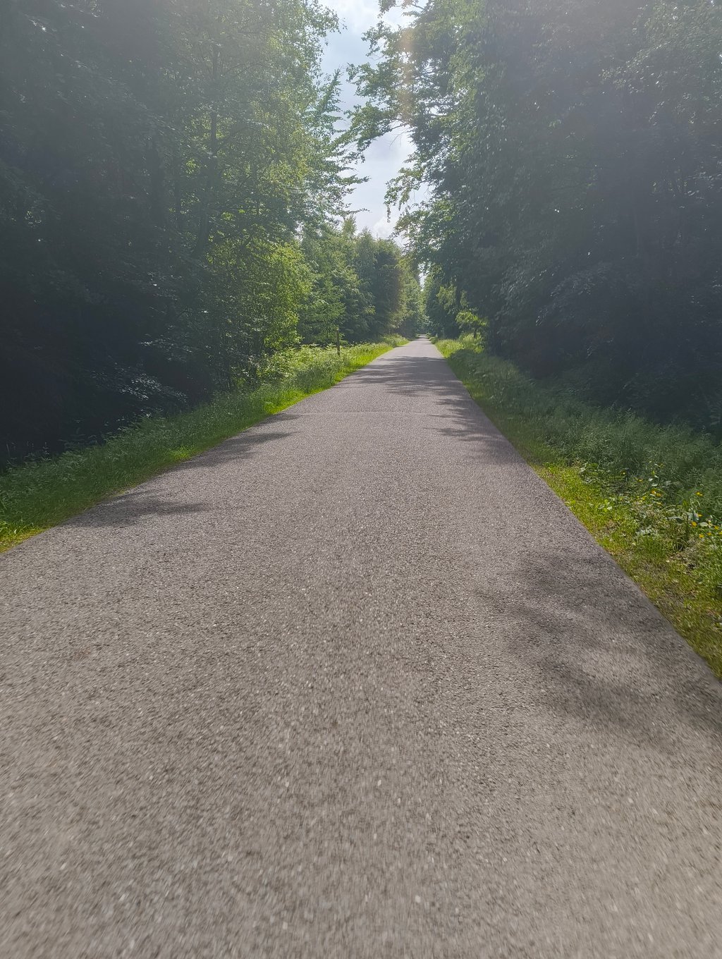
Left the forest on the gravel bike and took the descent towards the village , nice gentle climb . Not too difficult , piece of road with beautiful forest as a backdrop

Met de gravelbike uit het bos gekomen en de afdaling richting het dorp genomen , mooie rustige klim . Niet te lastig , stukje weg met mooie bebossing als decor

Dashboard
N_M
12 Mo 3.0 via the Climbfinder app
This is an automatic translation, the original language is: Dutch. Show original

Cotacol starting from the forest. So by gravel bike, you can get through the forest from Saint-Hubert; however, by road bike, you have to descend from the village of Laneuville to the start of the climb. It is a nice climb through wooded area that ends on a large national track. You can cross it, but beware: the cars're driving the speed of a motorway there.

Cotacol die begint vanuit het bos. Met de gravelfiets kan je dus door het bos vanuit Saint-Hubert komen; echter met de wegfiets moet je vanuit het dorp Laneuville afdalen naar de start van de beklimming. Het is een mooie beklimming door bebost gebied die eindigt op een grote nationale baan. Je kan er oversteken, maar opgelet: de auto's rijden er de snelheid van een autosnelweg.

Dashboard

Climbing times

5 mph 00:29:39
7 mph 00:21:00
9 mph 00:16:21
12 mph 00:12:17

Road surface condition

0% 0% 0%
Based on 0 votes
Share your knowledge. What was the road condition during your ascent?

Traffic

0% 0% 0%
Based on 0 votes
Your experience counts. How much traffic did you encounter during the climb?

Frequently Asked Questions

Barrière Mathieu can be cycled from 3 sides. Barrière Mathieu from Ortheuville is the most popular side, but the summit can also be reached via Barrière Mathieu via Laneuville-au-Bois & Barrière Mathieu from Mochamps.

You don't need special gearing for Barrière Mathieu via Laneuville-au-Bois. The slope isn't long or steep enough to require much shifting down. You can conquer this climb on power alone. However, a compact gearing system with a smallest front chainring of 34 and largest rear sprocket of 28 or 30 is always nice if you enjoy cycling uphill. This helps maintain a smooth cadence.

Barrière Mathieu via Laneuville-au-Bois falls into the 5th category. With good fitness, you can ride it up with speed and power. If you have less training, shift down and climb smoothly.

Barrière Mathieu via Laneuville-au-Bois is 2.5 mi long.

The average gradient of Barrière Mathieu via Laneuville-au-Bois is 3.7%.

Barrière Mathieu via Laneuville-au-Bois has a steepest segment with an average gradient of 9.6%.

The summit of Barrière Mathieu via Laneuville-au-Bois is at 1791 ft.

At a slow pace of 5 mph, it takes about 00:29:39 to climb Barrière Mathieu via Laneuville-au-Bois. At 7 mph the time is 00:21:00, and at 9 mph 00:16:21. For the fastest cyclists, 00:12:17 is an achievable time.

Barrière Mathieu via Laneuville-au-Bois is located in the region Forest of Saint-Hubert in Belgium.

This page is better in the app

Climbfinder app
Climbfinder
(Free)
Open