View on map
© MapLibre | OpenStreetMap contributors
1%
2%
4%
6%
8%
10%
12%
15%
20%

Angelsberg

2.0
2 reviews | Elevation profile | 4 photos
Tips nearby
Angelsberg
Angelsberg
Angelsberg
Angelsberg
transparant thumb
transparant thumb
transparant thumb
transparant thumb
Your achievable time
Calculating based on your best performances...
Relaxed
Maximum
W/kg
W/kg
W/kg
Analyze your climbing performance
Detailed insight into your climbing performance & automatically check off climbs
Based on your best performances.
Your best attempt:
Number of attempts:
Elevation profile Angelsberg

Statistics

Difficulty points 75
Length 2.5 mi
Average gradient 4.2%
Steepest segment 6.5%
Total ascent 558 ft

Short recap

#58 toughest climb of Gutland
#14 most elevation gain of Gutland
#77 longest climb of Luxembourg
#30 average steepest climb of Valleys of the Mamer and Eisch / Valley of the Seven Castles
Feedback about this climb?
Show climbs nearby Export to GPS device

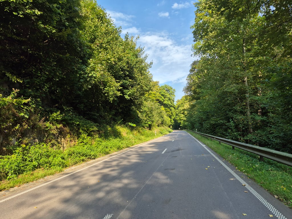
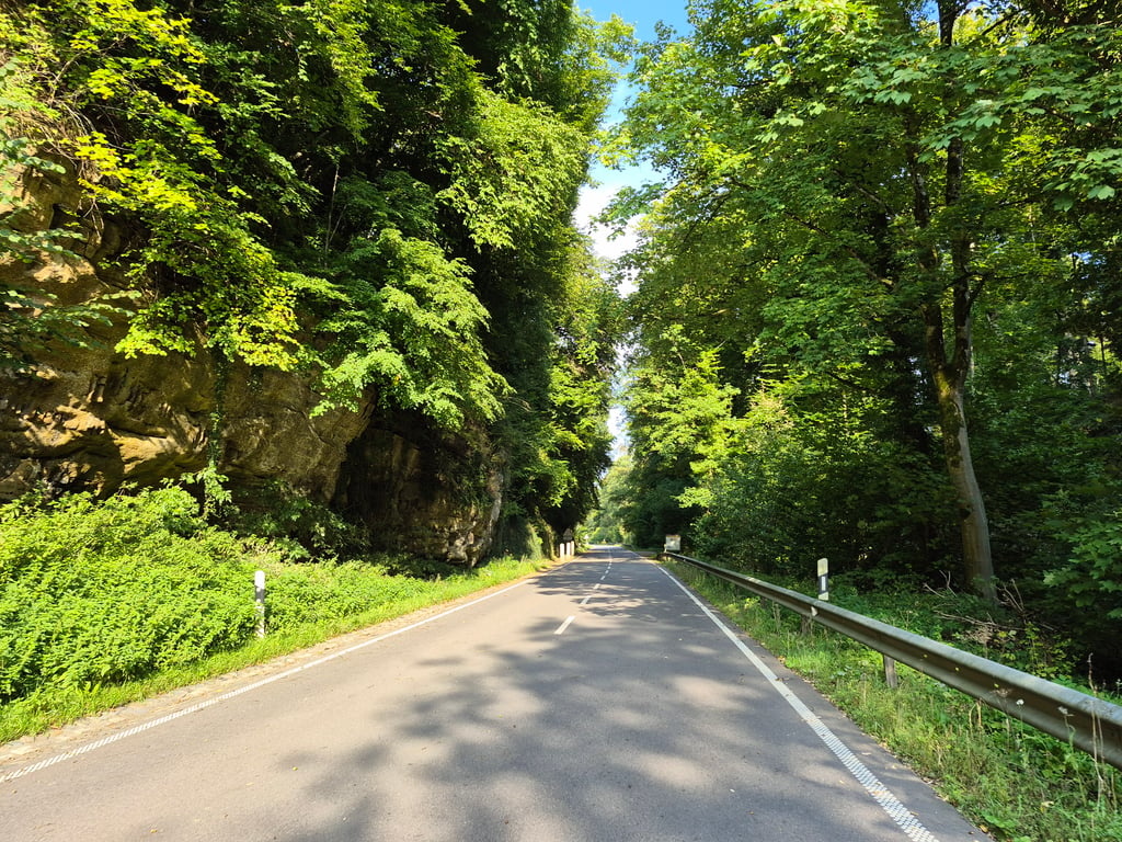
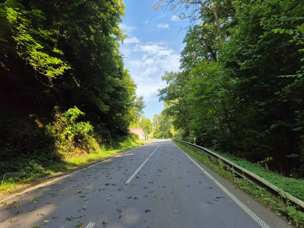
Angelsberg is a climb in the region Valleys of the Mamer and Eisch / Valley of the Seven Castles. It is 2.5 mi long and bridges 558 ft of vertical ascent with an average gradient of 4.2%, resulting in a difficulty score of 75. The top of the ascent is located at 1286 ft above sea level. Climbfinder users shared 2 reviews of this climb and uploaded 4 photos.

Road names: Rue de Larochette & Binzrath
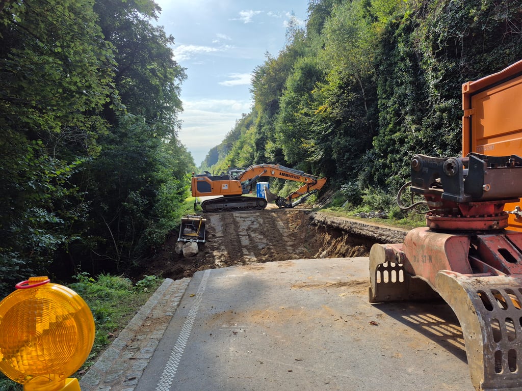
2.0 by elbowboy
This is an automatic translation, the original language is: French.
Not bad for the descent from Noumerbierg but not too interesting for the ascent. Lots of traffic, no specific views. Please note that the road is currently completely blocked due to a landslide (September 2025).... read more

Photos (4)

Angelsberg
Angelsberg
Angelsberg
Angelsberg
transparant thumb
transparant thumb

Your uploads (max 4)

Welcome! Please activate your account if you would like to share something. Look for the verification email in your inbox.

If you want to upload your photos, you need to create an account. It only takes 1 minute and it's completely free.

  • Receive free climbfinder goodies for your reviews & photos.
  • Create a bucket list and check off conquered climbs.
  • Add missing climbs.
Continue with GoogleContinue with Google Continue with FacebookContinue with Facebook Continue with AppleContinue with Apple Sign up with email
By signing up you agree to our terms of service and confirm that you have read our privacy & content policy.

Reviews (2)

5.0
4.0
3.0
2.0
1.0
elbowboy
8 Mo 2.0 via the Climbfinder app
This is an automatic translation, the original language is: French. Show original

Not bad for the descent from Noumerbierg but not too interesting for the ascent. Lots of traffic, no specific views. Please note that the road is currently completely blocked due to a landslide (September 2025).

Pas mal pour la descente depuis Noumerbierg mais pas trop intéressant pour monter. Beaucoup de trafic, aucune vue spécifique. Attention, actuellement la route est barrée complètement à cause d'un glissement de terrain (septembre 2025).

Angelsberg
Angelsberg
Angelsberg
Angelsberg
Dashboard
YordiZ
2 y 2.0
This is an automatic translation, the original language is: Dutch. Show original

Not really a worthwhile climb. Think of it purely as a major link road from Larochette to Christnach. No particularly nice views or scenery along the way. No tricky gradient.

Niet echt een beklimming die de moeite waard is. Zie het puur als een grote verbindingsweg vanuit Larochette naar Christnach. Geen bijzonder mooie uitzichten of omgeving langs de weg. Geen lastige helling.

Dashboard

Climbing times

5 mph 00:30:28
7 mph 00:21:34
9 mph 00:16:48
12 mph 00:12:37

Road surface condition

100% 0% 0%
Based on 1 vote
Share your knowledge. What was the road condition during your ascent?

Traffic

0% 100% 0%
Based on 1 vote
Your experience counts. How much traffic did you encounter during the climb?

Frequently Asked Questions

Angelsberg can be cycled from 2 sides. Angelsberg from Beschbach is the most popular side, but the summit can also be reached via Beringerberg from Gladbach.

You don't need special gearing for Angelsberg. The slope isn't long or steep enough to require much shifting down. You can conquer this climb on power alone. However, a compact gearing system with a smallest front chainring of 34 and largest rear sprocket of 28 or 30 is always nice if you enjoy cycling uphill. This helps maintain a smooth cadence.

Angelsberg is a 4th-category climb. A sprint to the top is usually not an option, and untrained riders will definitely feel it in their legs. For trained cyclists, it is a great training climb.

Angelsberg is 2.5 mi long.

The average gradient of Angelsberg is 4.2%.

Angelsberg has a steepest segment with an average gradient of 6.5%.

The summit of Angelsberg is at 1286 ft.

At a slow pace of 5 mph, it takes about 00:30:28 to climb Angelsberg. At 7 mph the time is 00:21:34, and at 9 mph 00:16:48. For the fastest cyclists, 00:12:37 is an achievable time.

This page is better in the app

Climbfinder app
Climbfinder
(Free)
Open