View on map
© MapLibre | OpenStreetMap contributors
1%
2%
4%
6%
8%
10%
12%
15%
20%

Am Bierig from Oberwampach

4.0
1 review/story | Elevation profile | 4 photos
Tips nearby
Am Bierig from Oberwampach
transparant thumb
transparant thumb
transparant thumb
transparant thumb
Your achievable time
Calculating based on your best performances...
Relaxed
Maximum
W/kg
W/kg
W/kg
Analyze your climbing performance
Detailed insight into your climbing performance & automatically check off climbs
Based on your best performances.
Your best attempt:
Number of attempts:
Elevation profile Am Bierig from Oberwampach

Statistics

Difficulty points 96
Length 0.8 mi
Average gradient 7.9%
Steepest segment 15.5%
Total ascent 325 ft
Feedback about this climb?
Show climbs nearby Export to GPS device

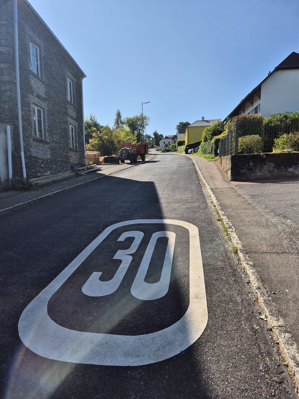
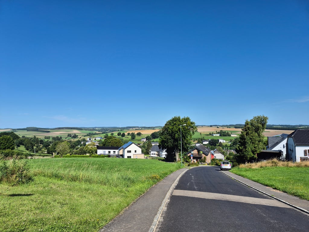
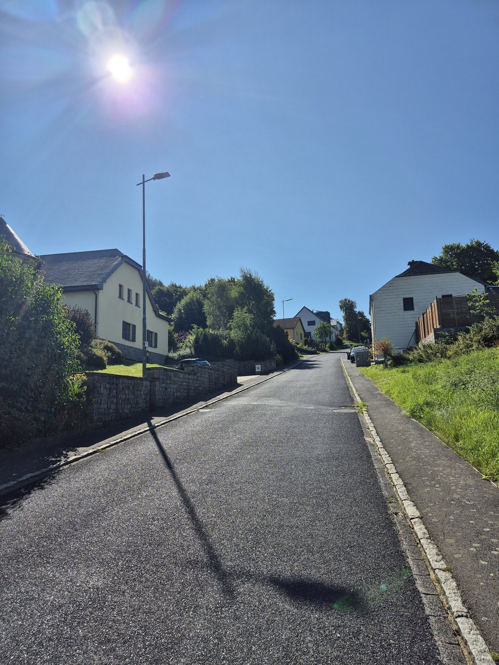
Am Bierig from Oberwampach is a climb in the region Nature Park Our. It is 0.8 mi long and bridges 325 ft of vertical ascent with an average gradient of 7.9%, resulting in a difficulty score of 96. The top of the ascent is located at 1670 ft above sea level. Climbfinder users shared 1 review/story of this climb and uploaded 4 photos.

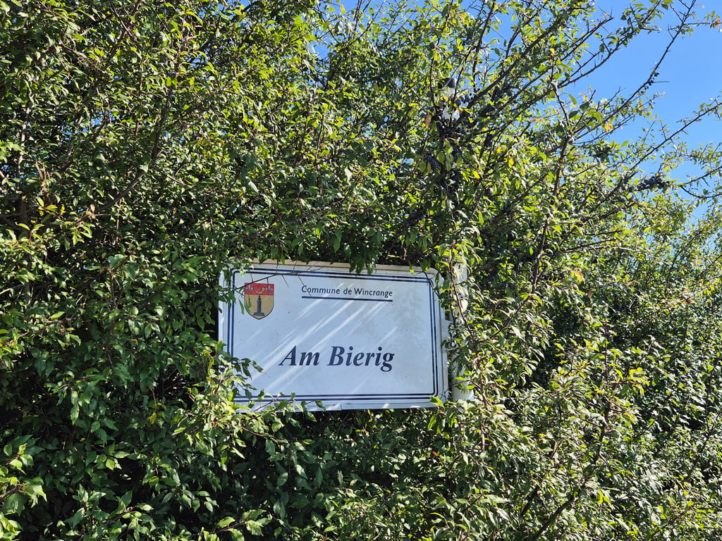
Road names: Duerefstrooss & Am Bierig

4.0 by Jarin
This is an automatic translation, the original language is: Dutch.
Unexpectedly tough climb that reminds me of the Saint-Roch in Houffalize. From the moment you turn right into the road 'Am Bierig'--what's in name!- you cycle against a wall inside the built-up area. The climb drags on awfully long and remains steep as you cycle out of the village. The climb only flattens out once you have passed the last house on the left. The next few kilometres you will really have to recover from this climb, which will therefore stay with you!... read more

Photos (4)

Am Bierig from Oberwampach
transparant thumb
transparant thumb

Your uploads (max 4)

Welcome! Please activate your account if you would like to share something. Look for the verification email in your inbox.

If you want to upload your photos, you need to create an account. It only takes 1 minute and it's completely free.

  • Receive free climbfinder goodies for your reviews & photos.
  • Create a bucket list and check off conquered climbs.
  • Add missing climbs.
Continue with GoogleContinue with Google Continue with FacebookContinue with Facebook Continue with AppleContinue with Apple Sign up with email
By signing up you agree to our terms of service and confirm that you have read our privacy & content policy.

Reviews (1)

5.0
4.0
3.0
2.0
1.0
Jarin
10 Mo 4.0 via the Climbfinder app
This is an automatic translation, the original language is: Dutch. Show original

Unexpectedly tough climb that reminds me of the Saint-Roch in Houffalize. From the moment you turn right into the road 'Am Bierig'--what's in name!- you cycle against a wall inside the built-up area. The climb drags on awfully long and remains steep as you cycle out of the village. The climb only flattens out once you have passed the last house on the left. The next few kilometres you will really have to recover from this climb, which will therefore stay with you!

Onverwachts pittige klim die me doet denken aan de Saint-Roch in Houffalize. Vanaf het moment dat je rechts de weg 'Am Bierig'--what's in name!- indraait fiets je tegen een muur aan binnen de bebouwde kom. De klim trekt akelig lang door en blijft steil wanneer je het dorp uit fietst. De klim vlakt pas af zodra je verderop het laatste huis aan de linkerkant bent gepasseerd. De aankomende kilometers zul je echt even moeten bijkomen van deze klim, die je daardoor dus wel echt bijblijft!

Dashboard

Climbing times

5 mph 00:09:24
7 mph 00:06:39
9 mph 00:05:11
12 mph 00:03:53

Road surface condition

0% 0% 0%
Based on 0 votes
Share your knowledge. What was the road condition during your ascent?

Traffic

0% 0% 0%
Based on 0 votes
Your experience counts. How much traffic did you encounter during the climb?

Frequently Asked Questions

Am Bierig can be cycled from 3 sides. Am Bierig from Oberwampach is the most popular side, but the summit can also be reached via Am Bierig via Viischt Huerkels & Am Bierig via Hënnischt Huerkels.

You don't need special gearing for Am Bierig from Oberwampach. The slope isn't long or steep enough to require much shifting down. You can conquer this climb on power alone. However, a compact gearing system with a smallest front chainring of 34 and largest rear sprocket of 28 or 30 is always nice if you enjoy cycling uphill. This helps maintain a smooth cadence.

Am Bierig from Oberwampach is a 4th-category climb. A sprint to the top is usually not an option, and untrained riders will definitely feel it in their legs. For trained cyclists, it is a great training climb.

Am Bierig from Oberwampach is 0.8 mi long.

The average gradient of Am Bierig from Oberwampach is 7.9%.

Am Bierig from Oberwampach has a steepest segment with an average gradient of 15.5%.

The summit of Am Bierig from Oberwampach is at 1670 ft.

At a slow pace of 5 mph, it takes about 00:09:24 to climb Am Bierig from Oberwampach. At 7 mph the time is 00:06:39, and at 9 mph 00:05:11. For the fastest cyclists, 00:03:53 is an achievable time.

Am Bierig from Oberwampach is located in the region Nature Park Our in Luxembourg.

This page is better in the app

Climbfinder app
Climbfinder
(Free)
Open