View on map
© MapLibre | OpenStreetMap contributors
1%
2%
4%
6%
8%
10%
12%
15%
20%

Alerberg from Burg-Reuland

5.0
1 review/story | Elevation profile | 2 photos
Tips nearby
Alerberg from Burg-Reuland
transparant thumb
transparant thumb
transparant thumb
transparant thumb
transparant thumb
transparant thumb
Your achievable time
Calculating based on your best performances...
Relaxed
Maximum
W/kg
W/kg
W/kg
Analyze your climbing performance
Detailed insight into your climbing performance & automatically check off climbs
Based on your best performances.
Your best attempt:
Number of attempts:
Elevation profile Alerberg from Burg-Reuland

Statistics

Difficulty points 162
Length 1.1 mi
Average gradient 8.6%
Steepest segment 14.8%
Total ascent 505 ft
Feedback about this climb?
Show climbs nearby Export to GPS device

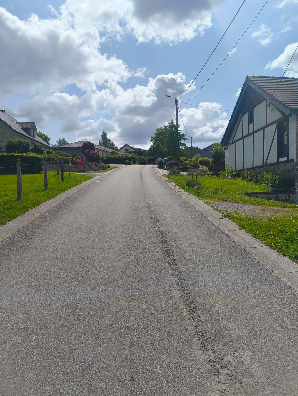
Alerberg from Burg-Reuland is a climb in the region High Fens & East Cantons. It is 1.1 mi long and bridges 505 ft of vertical ascent with an average gradient of 8.6%, resulting in a difficulty score of 162. The top of the ascent is located at 1690 ft above sea level. Climbfinder users shared 1 review/story of this climb and uploaded 2 photos.

Road name: Eichenbuschstraße
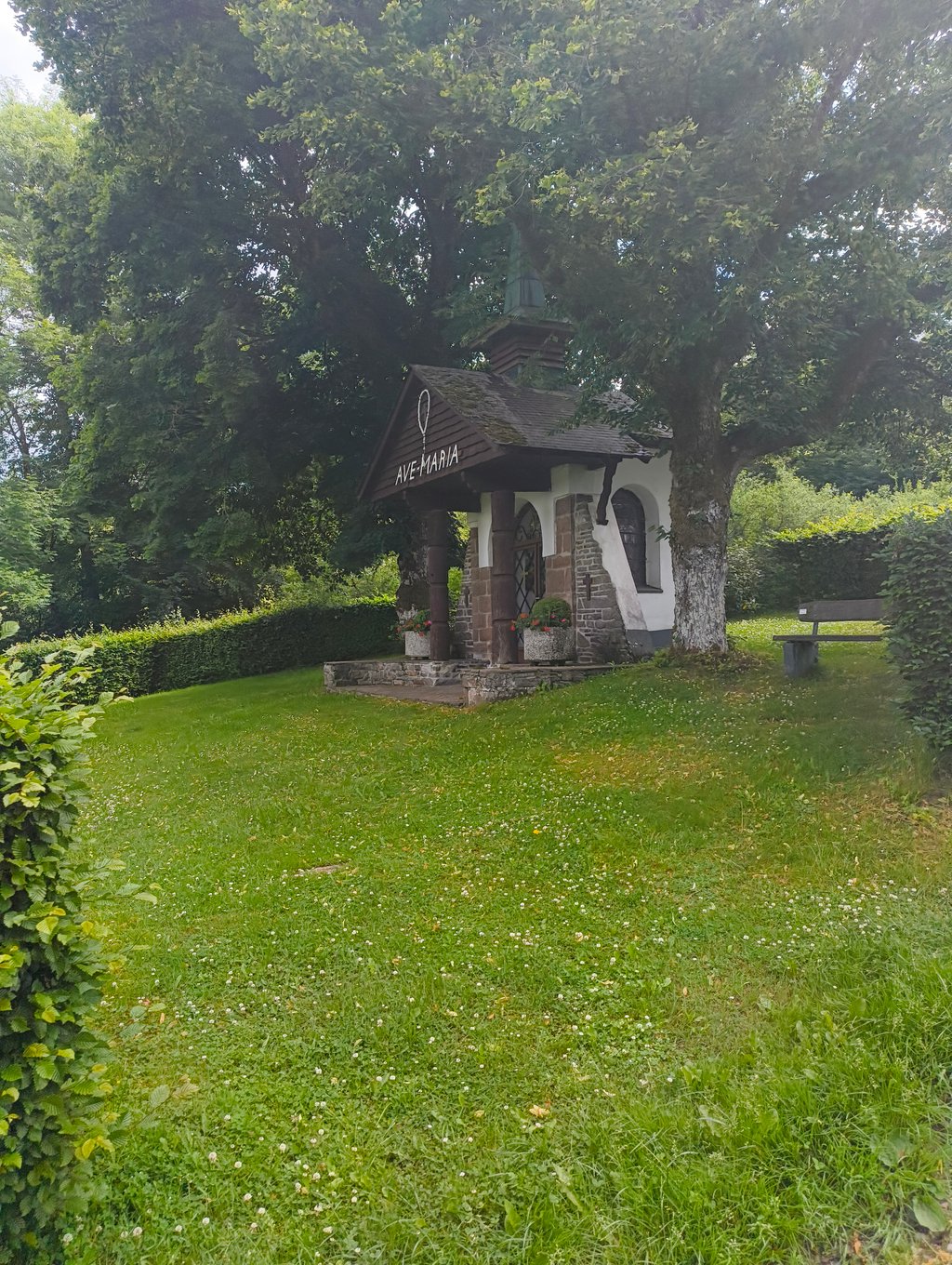
5.0 by Jba13
This is an automatic translation, the original language is: Dutch.
In the village you immediately climb with steep percentages. Then you think you have had the hardest part, but after the chapel (ave maria) the climb continues irregularly and the steep percentages continue to challenge your legs now and then. Besides the difficulty, the scenery makes the climb more than worth it. You climb through a very beautiful area, with nice views. There were also a lot of birds to spot in the meadows on the last stretch. As icing on the cake, it is also a very remote ro... read more

Photos (2)

Alerberg from Burg-Reuland
transparant thumb
transparant thumb
transparant thumb
transparant thumb

Your uploads (max 4)

Welcome! Please activate your account if you would like to share something. Look for the verification email in your inbox.

If you want to upload your photos, you need to create an account. It only takes 1 minute and it's completely free.

  • Receive free climbfinder goodies for your reviews & photos.
  • Create a bucket list and check off conquered climbs.
  • Add missing climbs.
Continue with GoogleContinue with Google Continue with FacebookContinue with Facebook Continue with AppleContinue with Apple Sign up with email
By signing up you agree to our terms of service and confirm that you have read our privacy & content policy.

Reviews (1)

5.0
4.0
3.0
2.0
1.0
Jba13
3 y 5.0
This is an automatic translation, the original language is: Dutch. Show original

In the village you immediately climb with steep percentages. Then you think you have had the hardest part, but after the chapel (ave maria) the climb continues irregularly and the steep percentages continue to challenge your legs now and then.
Besides the difficulty, the scenery makes the climb more than worth it. You climb through a very beautiful area, with nice views. There were also a lot of birds to spot in the meadows on the last stretch.
As icing on the cake, it is also a very remote road without any traffic. The tarmac gets a little less as the climb progresses, but the road surface is still manageable.

In het dorp klim je gelijk met stevige percentages omhoog. Daarna denk je het zwaarste gehad te hebben, maar na het kapelletje (ave maria) wordt onregelmatig verder geklommen en blijven de stevige percentages af en toe je benen tergen.
Naast de moeilijkheidsgraad maakt ook de omgeving zonder meer de klim meer dan waard. Je klimt door een erg mooi gebied, met mooie uitzichten. Ook waren er in de weiden van het laatste stuk erg veel vogels te spotten.
Als kers op de taart is het ook nog eens een erg afgelegen weg zonder enig verkeer. Het asfalt wordt naarmate de klim vordert iets minder, maar het wegdek blijft nog steeds goed te doen.

Dashboard

Climbing times

5 mph 00:13:26
7 mph 00:09:30
9 mph 00:07:24
12 mph 00:05:34

Road surface condition

100% 0% 0%
Based on 1 vote
Share your knowledge. What was the road condition during your ascent?

Traffic

100% 0% 0%
Based on 1 vote
Your experience counts. How much traffic did you encounter during the climb?

Frequently Asked Questions

Alerberg from Burg-Reuland is a challenging ascent. For this type of climbing, we recommend mountain gearing, specifically a compact system. This means a small front chainring of 34 teeth, combined with a rear cassette where, depending on your level, strength, and experience, you choose a sprocket with 30, 32, or even 34 teeth. Remember that a smooth cadence is always more efficient!

Alerberg from Burg-Reuland is a 3rd-category climb. Almost anyone can handle this climb, as long as you have a bike with climbing gears. If you have little training, you will probably need to shift down significantly. For experienced riders, Alerberg from Burg-Reuland is not a problem.

Alerberg from Burg-Reuland is 1.1 mi long.

The average gradient of Alerberg from Burg-Reuland is 8.6%.

Alerberg from Burg-Reuland has a steepest segment with an average gradient of 14.8%.

The summit of Alerberg from Burg-Reuland is at 1690 ft.

At a slow pace of 5 mph, it takes about 00:13:26 to climb Alerberg from Burg-Reuland. At 7 mph the time is 00:09:30, and at 9 mph 00:07:24. For the fastest cyclists, 00:05:34 is an achievable time.

Alerberg from Burg-Reuland is located in the region High Fens & East Cantons in Belgium.

This page is better in the app

Climbfinder app
Climbfinder
(Free)
Open