
16 mythical cols, one legendary place!
The Maurienne welcomes you with its 16 mythical Alpine cols and 60 over cycling routes! More info!
Belgian Ardennes: 1678 climbs
(65-694m)
easiest
easier
tougher
toughest
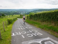
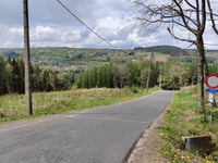
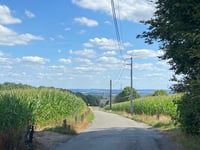
In the region Belgian Ardennes cyclists can find 1678 interesting climbs between 65 and 694 meters above sea level. Col de Haussire is the toughest ascent with a difficulty score of 345. Climbs have an average length of 2.2km and 104 meters of total ascent.
Best time to cycle
J
F
M
A
M
J
J
A
S
O
N
D
Ranking list Belgian Ardennes
Name | Length | Gradient | Difficulty points | ||
---|---|---|---|---|---|
![]() |
Col de Haussire
26
famous
|
4km 7.7% |
7.7% | 345 |
|
![]() |
Col de Haussire Southwest
7
|
4km 7.5% |
7.5% | 299 |
|
![]() |
Stockeu
29
famous
|
2.3km 9.8% |
9.8% | 247 |
|
![]() 4
|
Haussire Southwest via Rue Champs-du-Prévôt
|
4.5km 6.4% |
6.4% | 243 |
|
![]() 5
|
Thier de Coo
10
beautiful hidden
|
2.6km 8.3% |
8.3% | 230 |
|
![]() 6
|
Tier de la Cognée via Côte des Hézalles
|
3.9km 6.1% |
6.1% | 229 |
|
![]() 7
|
Côte de Saint-Jacques via Côte des Hézalles
|
4.6km 5.2% |
5.2% | 218 |
|
![]() 8
|
Col de Haussire South
2
|
3.8km 7.1% |
7.1% | 217 |
|
![]() 9
|
Roche aux Faucons
7
famous
|
4.4km 5.4% |
5.4% | 216 |
|
![]() 10
|
Roche aux Faucons from Méry
|
4.5km 5.3% |
5.3% | 214 |
|
Name | Length | Gradient | Difficulty points | ||
---|---|---|---|---|---|
![]() |
Chemin de Livremont from Malmedy
2
hidden
|
0.6km 14.9% |
14.9% | 131 |
|
![]() |
Les Communes
5
hidden
|
0.5km 14.7% |
14.7% | 108 |
|
![]() |
Tienne Calbalasse from Malonne
|
0.7km 14.2% |
14.2% | 156 |
|
![]() 4
|
La Cornette
|
0.6km 13.8% |
13.8% | 109 |
|
![]() 5
|
Les Enclaves
3
hidden
|
1.1km 13.4% |
13.4% | 208 |
|
![]() 6
|
Tier de Liège from Malmedy
|
0.6km 13.3% |
13.3% | 105 |
|
![]() 7
|
Route de Saint-Vith
4
hidden
|
0.9km 13% |
13% | 161 |
|
![]() 8
|
Bois de Wagne from Heer-Agimont
gravel
|
0.9km 12.8% |
12.8% | 197 |
|
![]() 9
|
Rue du Jeu de Paume
hidden gravel
|
0.8km 12.5% |
12.5% | 164 |
|
![]() 10
|
State from Marchin
hidden
|
0.7km 12.5% |
12.5% | 111 |
|
Name | Length | Gradient | Difficulty points | ||
---|---|---|---|---|---|
![]() |
Le Stockay / Route de l'Ancienne Douane from Spa
|
14.9km 2.8% |
2.8% | 208 |
|
![]() |
Route du Tracé from Pont d'Érezée
beautiful
|
14.9km 2.4% |
2.4% | 135 |
|
![]() |
Baraque Michel
12
famous
|
14.1km 3% |
3% | 173 |
|
![]() 4
|
Côte de Samrée
|
14km 3% |
3% | 166 |
|
![]() 5
|
Baraque Michel via Chemin de Henseberg & Hestreux
5
hidden
|
13.4km 3.4% |
3.4% | 212 |
|
![]() 6
|
Mützenich from Eupen via Wesertalsperre
17
beautiful
|
13.1km 2.8% |
2.8% | 156 |
|
![]() 7
|
Côte de Werbomont from Aywaille
|
12.8km 2.7% |
2.7% | 128 |
|
![]() 8
|
Mützenich from Eupen via Ternell
1
|
12.3km 3.1% |
3.1% | 163 |
|
![]() 9
|
Chabrehez from Achouffe
1
beautiful
|
11.6km 3.4% |
3.4% | 205 |
|
![]() 10
|
Samrée from Pont d'Érezée
1
beautiful
|
11.5km 2.4% |
2.4% | 96 |
|
Name | Length | Gradient | Difficulty points | ||
---|---|---|---|---|---|
![]() |
Baraque Michel via Chemin de Henseberg & Hestreux
5
hidden
|
13.4km 3.4% |
3.4% | 212 |
|
![]() |
Baraque Michel
12
famous
|
14.1km 3% |
3% | 173 |
|
![]() |
Côte de Samrée
|
14km 3% |
3% | 166 |
|
![]() 4
|
Le Stockay / Route de l'Ancienne Douane from Spa
|
14.9km 2.8% |
2.8% | 208 |
|
![]() 5
|
Chabrehez from Achouffe
1
beautiful
|
11.6km 3.4% |
3.4% | 205 |
|
![]() 6
|
Baraque Michel from Lac de la Gileppe
13
beautiful hidden
|
10.1km 3.8% |
3.8% | 185 |
|
![]() 7
|
Mützenich from Eupen via Ternell
1
|
12.3km 3.1% |
3.1% | 163 |
|
![]() 8
|
Baraque Michel via Trou Malbrouk
|
10.7km 3.5% |
3.5% | 187 |
|
![]() 9
|
Mützenich from Eupen via Wesertalsperre
17
beautiful
|
13.1km 2.8% |
2.8% | 156 |
|
![]() 10
|
Côte de Dochamps
1
beautiful hidden
|
9.6km 3.8% |
3.8% | 200 |
|
Name | Length | Gradient | Difficulty points | ||
---|---|---|---|---|---|
![]() |
Col de Haussire
26
famous
|
4km 7.7% |
7.7% | 345 |
|
![]() |
Côte de la Redoute
58
famous
|
2km 8.8% |
8.8% | 177 |
|
![]() |
Mur de Huy
17
famous
|
1.4km 9.7% |
9.7% | 154 |
|
![]() 4
|
Stockeu
29
famous
|
2.3km 9.8% |
9.8% | 247 |
|
![]() 5
|
Col du Rosier
11
famous beautiful
|
4.4km 5.8% |
5.8% | 160 |
|
![]() 6
|
Roche aux Faucons
7
famous
|
4.4km 5.4% |
5.4% | 216 |
|
![]() 7
|
Côte de Wanne
9
famous
|
3.6km 6.1% |
6.1% | 186 |
|
![]() 8
|
Thier de Coo
10
beautiful hidden
|
2.6km 8.3% |
8.3% | 230 |
|
![]() 9
|
Ferme Libert
10
famous
|
1.3km 12.1% |
12.1% | 193 |
|
![]() 10
|
Baraque Michel
12
famous
|
14.1km 3% |
3% | 173 |
|
Wall of Fame
Belgian Ardennes


Best
Steepest
Highest
Most elevation gained
Most popular
Check out the Wall of Fame
Cycling routes Belgian Ardennes
Personally mapped out and verified by climbfinder!
Name | Distance | Total ascent | Climbs | |
---|---|---|---|---|
![]() |
The marathon of the French Ardennes
|
176.3km | 3192m | 13 |
![]() |
Tri-country Tour of Belgium, France and Luxembourg
|
158km | 2525m | 23 |
![]() |
Liège-Bastogne-Liège
|
141km | 2774m | 15 |
![]() |
The dirty slopes of industrial Wallonia
|
132.1km | 2456m | 24 |
![]() |
The big tour of Bouillon
|
131.5km | 2526m | 14 |
![]() |
The Hell of Herve
|
130.4km | 1981m | 17 |
![]() |
La Flèche Wallonne
|
129.3km | 2045m | 22 |
![]() |
The beautiful tour of Barrage du Ry de Rome
|
128.7km | 2104m | 15 |
![]() |
Hidden gems of Givet
|
126.7km | 1892m | 8 |
![]() |
The walls of the Ardennes
|
119km | 2516m | 16 |
Regions
Belgian Luxembourg | 127-636m | 345 |
Heart of the Ardennes | 134-636m | 345 |
Valleys of the Vesdre, de l'Amblève et de l'Ourthe | 68-679m | 247 |
Liège Province | 55-694m | 247 |
Haute Ardenne | 249-620m | 229 |
Forest of Saint-Hubert | 177-570m | 208 |
Semois Valley | 169-505m | 208 |
Namur Province | 73-505m | 206 |
Valleys of the Meuse, Sambre and Orneau | 72-289m | 206 |
Condroz - Famenne | 86-341m | 199 |
Fagne & Lakes of l'Eau d'Heure | 99-385m | 197 |
High Fens & East Cantons | 173-694m | 193 |
Pays de Liège | 61-271m | 182 |
Gaume | 192-478m | 170 |
Belgian Lorraine | 192-505m | 170 |
Lesse Valley | 96-503m | 167 |
Land of Arlon | 265-505m | 163 |
Hainaut Province | 12-366m | 151 |
Pays de Charleroi | 92-221m | 111 |
Sambre-Orneau | 85-250m | 105 |
Haute-Sûre Forêt d'Anlier | 352-532m | 100 |
Thudinie | 106-221m | 75 |
Regions nearby
Average climb
Difficulty points
70
Gradient
5.4%
Length
2.2km
Total ascent
104m
Road surface condition
57%
32%
10%
Based on 995 votes
These are average ratings of all reviews on the road surface condition of the climbs in this region.
Traffic
74%
19%
7%
Based on 992 votes
These are average ratings of all reviews about the traffic density of the climbs in this region.
Popular
Accommodations
Users with most climbs
Name | Climbs | Ranking list |
---|---|---|
![]() |
|
|
![]() |
|
|
![]() |
|
|
![]() |
|
4
|
![]() |
|
5
|
![]() |
|
6
|
![]() |
|
7
|
|
|
8
|
![]() |
|
9
|
|
|
10
|
Reviews/stories (0)
Add my review/story
If you want to share something you need to create an account. It only takes 1 minute and it's completely free.
- Get a reward for sharing reviews and photos
- Share your experience on all ascents you've climbed
- Submit your favorite climbs