Analyse your climb times with the Climbfinder App
Discover
Map
Regions
Ranking
Analytics
Premium
Climbs
No results found
Regions
No results found
Places
No results found
EN
English
English (US units)
Nederlands
Français
Deutsch
Italiano
Español
Polski
Dashboard
My routes
My climbs
Climbfinder goodies
Settings
Log out
Continue with Google
Continue with Facebook
Continue with Apple
or
Log in
Sign up
Home
Ranking
Most popular climbs - California
The ultimate climbing rankings
Most popular
Most popular
Hardest
Steepest
Longest
Elevation gain
Highest
Hairpins
Best rated
California
Regions
No results found
Places
No results found
My location
Retrieving location...
Browser location not shared
Remove current selection
All
Bucket list
646
climbs
0.0
% ridden
Previous
Next
Loading...
No climbs found
426
Your best attempt:
Climbed
Bucket list climb
Not yet climbed
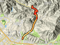
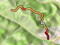
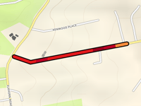
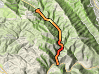
Dillion Divide from Lake View Terrace
10.4 km
4.7%
308
493 m
836 m
2
2
427
Your best attempt:
Climbed
Bucket list climb
Not yet climbed
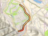
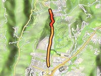
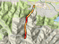
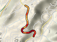
Monterra Summit from Del Rey Oaks
2.1 km
6.4%
123
132 m
177 m
4
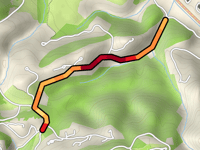
428
Your best attempt:
Climbed
Bucket list climb
Not yet climbed
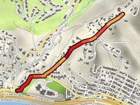
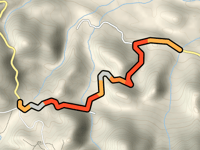
Collier Canyon Road from Livermore
7.1 km
1.8%
32
130 m
264 m
5
429
Your best attempt:
Climbed
Bucket list climb
Not yet climbed
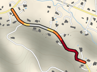
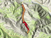
Longview Avenue via Wadsworth Avenue
1.6 km
10.1%
196
164 m
188 m
3
430
Your best attempt:
Climbed
Bucket list climb
Not yet climbed
School Road from Anzar Road
3.2 km
4.2%
100
136 m
195 m
2
4
431
Your best attempt:
Climbed
Bucket list climb
Not yet climbed
West Ruby Hill Drive East
2.7 km
3.3%
40
90 m
222 m
5
432
Your best attempt:
Climbed
Bucket list climb
Not yet climbed
Ortega Ridge Road from Montecito
1.7 km
6.5%
82
113 m
141 m
4
433
Your best attempt:
Climbed
Bucket list climb
Not yet climbed
San Gabriel Road from Santa Lucia Road
0.8 km
6.2%
48
49 m
332 m
5
434
Your best attempt:
Climbed
Bucket list climb
Not yet climbed
Valencia School Road from Trout Gulch Road
1.1 km
8.2%
99
93 m
172 m
2
4
435
Your best attempt:
Climbed
Bucket list climb
Not yet climbed
Glenwood Drive from Scotts Valley
1.9 km
3.8%
33
73 m
264 m
5
436
Your best attempt:
Climbed
Bucket list climb
Not yet climbed
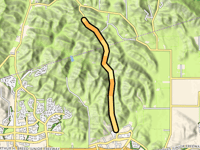
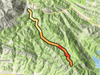
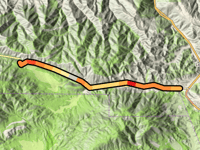
Morgan Territory Road from Clayton
13.6 km
3.4%
239
455 m
648 m
3
3
437
Your best attempt:
Climbed
Bucket list climb
Not yet climbed
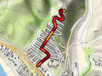
Zander Drive from Glorietta Boulevard
1.8 km
6.4%
111
118 m
308 m
4
438
Your best attempt:
Climbed
Bucket list climb
Not yet climbed
Bear Creek Road from Orinda
3.9 km
5.2%
140
202 m
290 m
4
439
Your best attempt:
Climbed
Bucket list climb
Not yet climbed
Bayview Road from Elkhorn Road
0.5 km
9.4%
46
47 m
85 m
5
440
Your best attempt:
Climbed
Bucket list climb
Not yet climbed
Somersville Road from Antioch
3.6 km
4.7%
126
168 m
232 m
4
441
Your best attempt:
Climbed
Bucket list climb
Not yet climbed
Pine Canyon Summit from Three Points
3 km
4.8%
96
145 m
1223 m
4
442
Your best attempt:
Climbed
Bucket list climb
Not yet climbed
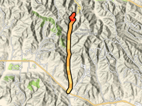
Robinson Canyon Summit from Rancho Tierra Grande
6.5 km
6.7%
385
435 m
476 m
2
2
443
Your best attempt:
Climbed
Bucket list climb
Not yet climbed
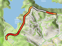
Spyglass Hill
0.8 km
7.0%
48
58 m
69 m
5
444
Your best attempt:
Climbed
Bucket list climb
Not yet climbed
Lewis Road from San Miguel Canyon Road
1.4 km
6.7%
84
94 m
127 m
4
445
Your best attempt:
Climbed
Bucket list climb
Not yet climbed
Bailey Road from Concord
2.6 km
6.0%
122
155 m
216 m
4
446
Your best attempt:
Climbed
Bucket list climb
Not yet climbed
Scenic Drive via Overhill Road
1.1 km
9.8%
114
106 m
257 m
4
447
Your best attempt:
Climbed
Bucket list climb
Not yet climbed
Palomares Road from Fremont
7.4 km
4.5%
196
331 m
372 m
3
448
Your best attempt:
Climbed
Bucket list climb
Not yet climbed
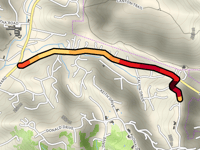
Pinos Summit via Frazier Park
19 km
3.6%
369
683 m
1833 m
2
449
Your best attempt:
Climbed
Bucket list climb
Not yet climbed
Encino Drive from Creek Road
1.7 km
6.9%
109
117 m
254 m
4
450
Your best attempt:
Climbed
Bucket list climb
Not yet climbed
Drum Canyon Summit from Buellton
9.9 km
3.0%
142
300 m
426 m
4
Previous
Next
Your best attempt:
Climbed
Bucket list climb
Not yet climbed
a
This page is better in the app
Climbfinder
(Free)
Open