View on map
© MapLibre | OpenStreetMap contributors
1%
2%
4%
6%
8%
10%
12%
15%
20%

Wolfsheide via Kesselweg

3.0
2 reviews | Elevation profile | 6 photos
Tips nearby
Wolfsheide via Kesselweg
transparant thumb
transparant thumb
Your achievable time
Calculating based on your best performances...
Relaxed
Maximum
W/kg
W/kg
W/kg
Analyse your climbing performance
Detailed insight into your climbing performance & automatically check off climbs
Based on your best performances.
Your best attempt:
Number of attempts:
Elevation profile Wolfsheide via Kesselweg

Statistics

Difficulty points 47
Length 1.4 km
Average gradient 5.1%
Steepest 100 metres 10.7%
Total ascent 70 m
Feedback about this climb?
Show climbs nearby Export to GPS device

Wolfsheide via Kesselweg is a climb in the region Cologne. It is 1.4 km long and bridges 70 m of vertical ascent with an average gradient of 5.1%, resulting in a difficulty score of 47. The top of the ascent is located at 287 m above sea level. Climbfinder users shared 2 reviews of this climb and uploaded 6 photos.

Road names: Kesselweg & Atherstraße
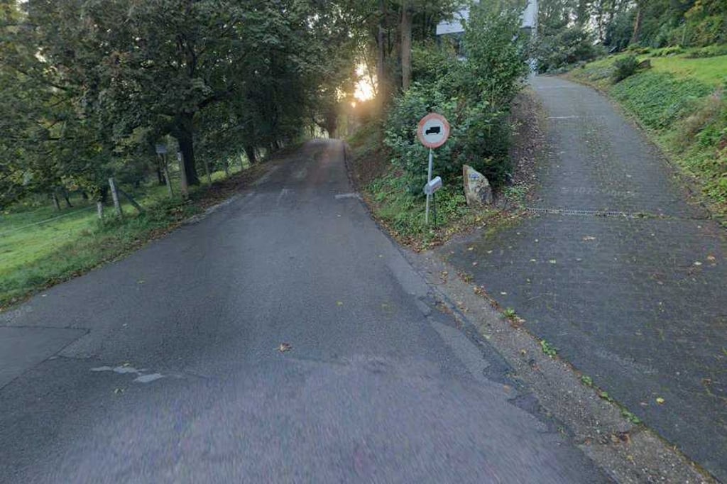
3.0 by BikerJohan
This is an automatic translation, the original language is: Dutch.
Beautiful and winding climb in the area on the north side of Hergenrath. The climb starts on the Hergenratherweg (B/D border) and goes up with a fluctuating gradient until halfway. This is followed by a false flat/descending section. When it starts going up again you enter the double digits in terms of gradient and only towards the top it flattens out.... read more

Photos (6)

Wolfsheide via Kesselweg

Your uploads (max 4)

Welcome! Please activate your account if you would like to share something. Look for the verification email in your inbox.

If you want to upload your photos, you need to create an account. It only takes 1 minute and it's completely free.

  • Receive free climbfinder goodies for your reviews & photos.
  • Create a bucket list and check off conquered climbs.
  • Add missing climbs.
Continue with GoogleContinue with Google Continue with FacebookContinue with Facebook Continue with AppleContinue with Apple Sign up with email
By signing up you agree to our terms of service and confirm that you have read our privacy & content policy.

Reviews (2)

5.0
4.0
3.0
2.0
1.0
BikerJohan
10 Mo 3.0
This is an automatic translation, the original language is: Dutch. Show original

Beautiful and winding climb in the area on the north side of Hergenrath. The climb starts on the Hergenratherweg (B/D border) and goes up with a fluctuating gradient until halfway. This is followed by a false flat/descending section. When it starts going up again you enter the double digits in terms of gradient and only towards the top it flattens out.

Mooie en slingerende klim in het gebied aan de noordkant van Hergenrath. De klim start op de Hergenratherweg (grens B/D) en loopt tot halfverwege met een fluctuerend stijgingspercentage omhoog. Hierna volgt een vals plat/dalend stuk. Als het weer gaat oplopen ga je v.w.b. het stijgingspercentage de dubbele cijfers in en pas richting top vlakt het af.

Dashboard
Fedor
4 y 3.0
This is an automatic translation, the original language is: Dutch. Show original

A nice climb on a winding road in a nice environment and occasionally nice views. From Germany you ride along a meadow and through a tunnel under a railway line into Belgium. Then it climbs a bit steeper. After having turned left a slight descent (with nice views) follows the steepest part of the climb. The last part is a dead end tarmac road (the road to the left from the highest point is a good gravel road that descends quite a bit).

Een mooie klim over een slingerende weg in een leuk omgeving en het zo nu en dan fraaie uitzichten. vanuit Duitsland rij je langs een weiland en via een tunneltje onder een spoorlijn België in. Daarna klimt het even wat steiler. Na linksaf te zijn gegaan een lichte afdaling (met mooi uitzicht) waarna het steilste deel van de klim volgt. Het laatste stukje is een doodlopende asfaltweg (de weg naar links vanaf het hoogste punt is een goede gravelweg die behoorlijk daalt).

Wolfsheide via Kesselweg
Dashboard

Climbing times

7 km/h 00:11:40
11 km/h 00:07:26
15 km/h 00:05:27
19 km/h 00:04:18

Road surface condition

0% 0% 0%
Based on 0 votes
Share your knowledge. What was the road condition during your ascent?

Traffic

0% 0% 0%
Based on 0 votes
Your experience counts. How much traffic did you encounter during the climb?

Frequently Asked Questions

Wolfsheide can be cycled from 5 sides. Marienheide from Kelmis is the most popular side, but the summit can also be reached via Wolfsheide via Kesselweg, Buschstrasse via Kesselweg, Buchstrasse via Atherstrasse & Wolfsheide via Siepstrasse.

You don't need special gearing for Wolfsheide via Kesselweg. The slope isn't long or steep enough to require much shifting down. You can conquer this climb on power alone. However, a compact gearing system with a smallest front chainring of 34 and largest rear sprocket of 28 or 30 is always nice if you enjoy cycling uphill. This helps maintain a smooth cadence.

Wolfsheide via Kesselweg falls into the 5th category. With good fitness, you can ride it up with speed and power. If you have less training, shift down and climb smoothly.

Wolfsheide via Kesselweg is 1.4 km long.

The average gradient of Wolfsheide via Kesselweg is 5.1%.

Wolfsheide via Kesselweg has a steepest segment with an average gradient of 10.7%.

The summit of Wolfsheide via Kesselweg is at 287 m.

At a slow pace of 7 km/h, it takes about 00:11:40 to climb Wolfsheide via Kesselweg. At 11 km/h the time is 00:07:26, and at 15 km/h 00:05:27. For the fastest cyclists, 00:04:18 is an achievable time.

Wolfsheide via Kesselweg is located in the region Cologne in Germany.

This page is better in the app

Climbfinder app
Climbfinder
(Free)
Open