View on map
© MapLibre | OpenStreetMap contributors
1%
2%
4%
6%
8%
10%
12%
15%
20%

Weissenstein from Solothurn

4.0
2 reviews | Elevation profile | 3 photos
Tips nearby
Weissenstein from Solothurn
transparant thumb
transparant thumb
transparant thumb
transparant thumb
transparant thumb
Your achievable time
Calculating based on your best performances...
Relaxed
Maximum
W/kg
W/kg
W/kg
Analyse your climbing performance
Detailed insight into your climbing performance & automatically check off climbs
Based on your best performances.
Your best attempt:
Number of attempts:
Elevation profile Weissenstein from Solothurn

Statistics

Difficulty points 1016
Length 8.9 km
Average gradient 9.3%
Steepest 100 metres 20.7%
Total ascent 836 m

Short recap

5 hairpin turns
#14 toughest climb of Jura
#30 most elevation gain of Jura
#4 longest climb of Solothurn
#33 average steepest climb of Solothurn
Feedback about this climb?
Show climbs nearby Export to GPS device

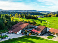
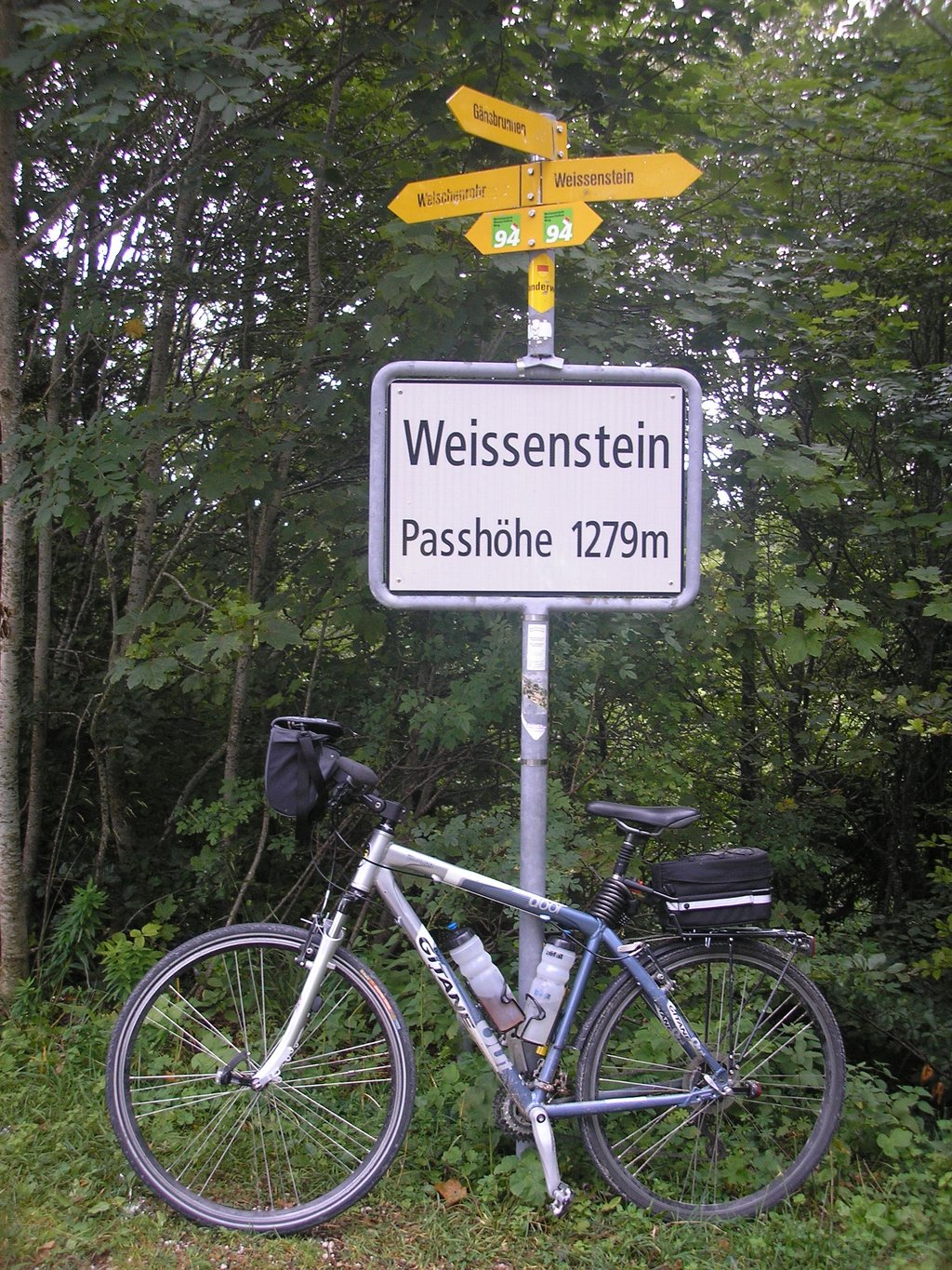
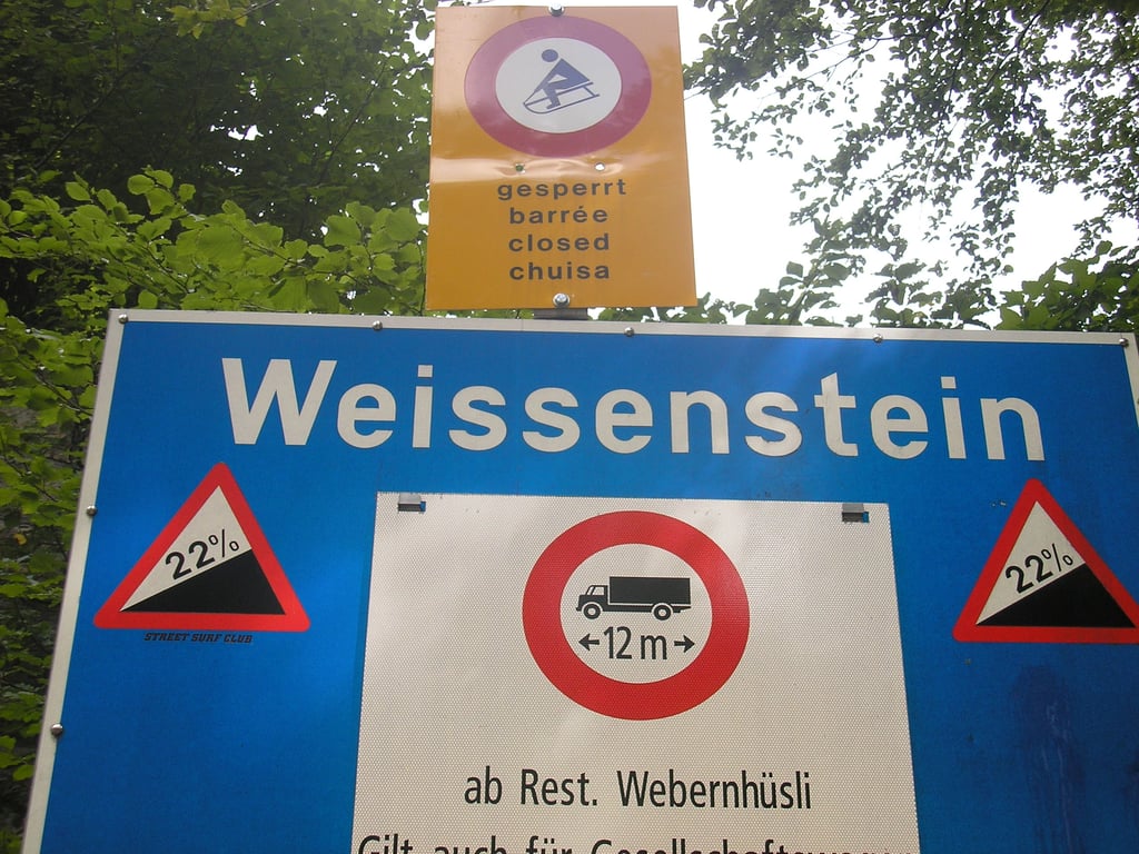
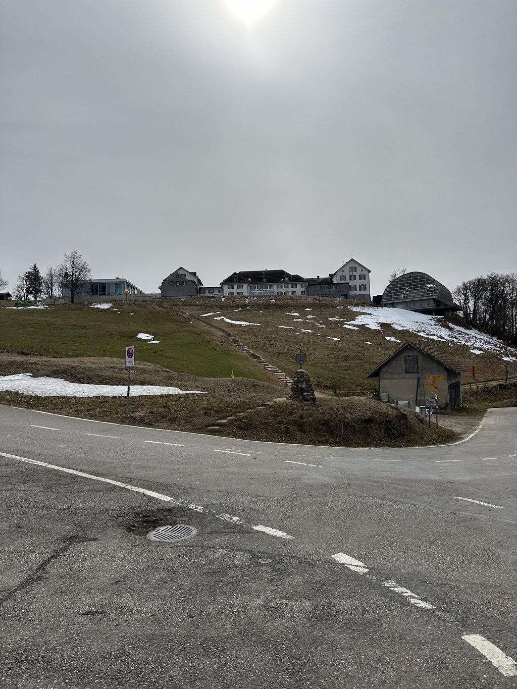
Weissenstein from Solothurn is a climb in the region Solothurn. It is 8.9 km long and bridges 836 m of vertical ascent with an average gradient of 9.3%, resulting in a difficulty score of 1016. The top of the ascent is located at 1278 m above sea level. Climbfinder users shared 2 reviews of this climb and uploaded 3 photos.

Road name: Weissensteinstrasse

5.0 by John Doe
This is an automatic translation, the original language is: German.
A must for spinners and those who want burning thighs! Depending on the gear ratio and power, you won't get anywhere! :) It was very strenuous but well worth it. You have to be careful going downhill as there are occasional fallen rocks on the road. Good brakes are recommended as you have to brake a lot on the sharp bends.... read more

Photos (3)

Weissenstein from Solothurn
transparant thumb
transparant thumb
transparant thumb

Your uploads (max 4)

Welcome! Please activate your account if you would like to share something. Look for the verification email in your inbox.

If you want to upload your photos, you need to create an account. It only takes 1 minute and it's completely free.

  • Receive free climbfinder goodies for your reviews & photos.
  • Create a bucket list and check off conquered climbs.
  • Add missing climbs.
Continue with GoogleContinue with Google Continue with FacebookContinue with Facebook Continue with AppleContinue with Apple Sign up with email
By signing up you agree to our terms of service and confirm that you have read our privacy & content policy.

Reviews (2)

5.0
4.0
3.0
2.0
1.0
NL
3 w 3.0
This is an automatic translation, the original language is: German. Show original

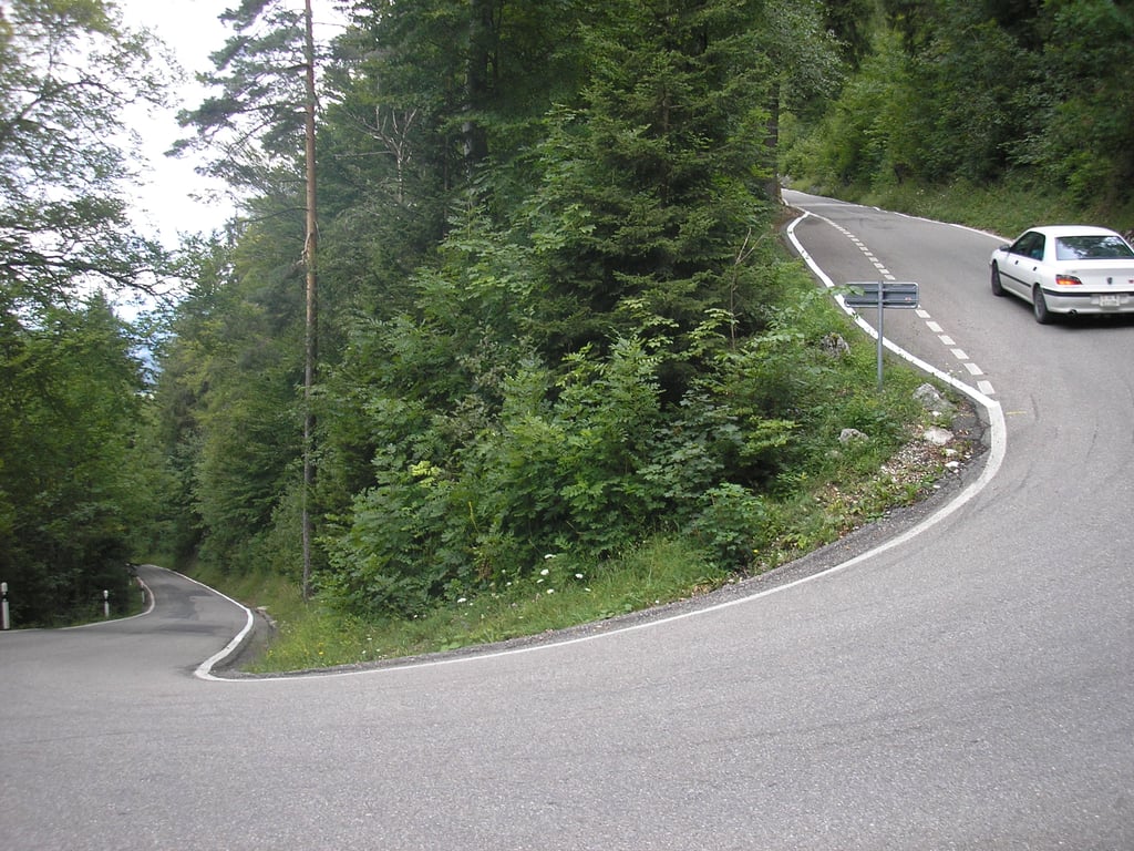
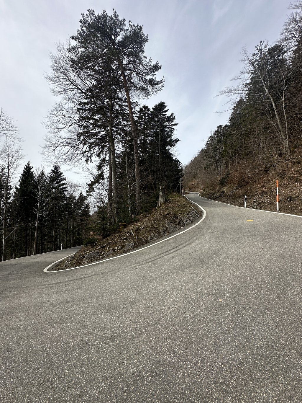
As described above, this climb is short and extremely tough. Not recommended for beginners in cycling, as technical handling is also essential (clipping in hardly possible in places, steep descent...). I only recommend the climb on Sundays, as it is closed to traffic, which means you can ride in a serpentine line.

Dieser Anstieg ist wie viel beschrieben kurz und extrem hart. Nicht zu empfehlen für Beginner im Radsport, da auch technisches Handling zwingend nötig ist (Einclippen teilweise kaum möglich, steile Abfahrt...). Ich empfehle den Anstieg nur Sonntags, da für Verkehr gesperrt, dadurch ist eine Schlangenlinienfahren möglich.

Dashboard
Random
John Doe
1 y 5.0 via the Climbfinder app
This is an automatic translation, the original language is: German. Show original

A must for spinners and those who want burning thighs! Depending on the gear ratio and power, you won't get anywhere! :) It was very strenuous but well worth it. You have to be careful going downhill as there are occasional fallen rocks on the road. Good brakes are recommended as you have to brake a lot on the sharp bends.

Für Spinner und solche die brennende Oberschenkel wollen ein muss! Je nach Übersetzung und Kraft kommt man gar nicht vorwärts! :) Es wahr sehr anstrengend hat sich aber gelohnt. Beim runterfahren muss man vorsichtig sein denn es hat gelegentlich heruntergefallene Steine auf der Strasse. Hierfür sind gute Bremsen empfehlenswert da man durchaus viel bremsen muss bei den scharfen Kurven.

Weissenstein from Solothurn
Dashboard

Climbing times

7 km/h 01:16:40
11 km/h 00:48:47
15 km/h 00:35:46
19 km/h 00:28:14

Road surface condition

83% 17% 0%
Based on 6 votes
Share your knowledge. What was the road condition during your ascent?

Traffic

80% 20% 0%
Based on 5 votes
Your experience counts. How much traffic did you encounter during the climb?

Frequently Asked Questions

Weissenstein from Solothurn is a challenging ascent. For this type of climbing, we recommend mountain gearing, specifically a compact system. This means a small front chainring of 34 teeth, combined with a rear cassette where, depending on your level, strength, and experience, you choose a sprocket with 30, 32, or even 34 teeth. Remember that a smooth cadence is always more efficient!

Weissenstein from Solothurn belongs to the Hors Catégorie, the top category. These are legendary and very tough climbs. A solid cycling condition, experience, and a good climbing gear ratio are essential to maintain a smooth cadence and complete the climb comfortably.

Weissenstein from Solothurn is 8.9 km long.

The average gradient of Weissenstein from Solothurn is 9.3%.

Weissenstein from Solothurn has a steepest segment with an average gradient of 20.7%.

The summit of Weissenstein from Solothurn is at 1278 m.

At a slow pace of 7 km/h, it takes about 01:16:40 to climb Weissenstein from Solothurn. At 11 km/h the time is 00:48:47, and at 15 km/h 00:35:46. For the fastest cyclists, 00:28:14 is an achievable time.

Weissenstein from Solothurn is located in the region Solothurn in Switzerland.

This page is better in the app

Climbfinder app
Climbfinder
(Free)
Open