View on map
© MapLibre | OpenStreetMap contributors
1%
2%
4%
6%
8%
10%
12%
15%
20%

Toeristische weg

4.5
2 reviews | Elevation profile | 3 photos
Tips nearby
Toeristische weg
Toeristische weg
Toeristische weg
transparant thumb
transparant thumb
transparant thumb
transparant thumb
transparant thumb
Your achievable time
Calculating based on your best performances...
Relaxed
Maximum
W/kg
W/kg
W/kg
Analyse your climbing performance
Detailed insight into your climbing performance & automatically check off climbs
Based on your best performances.
Your best attempt:
Number of attempts:
Elevation profile Toeristische weg

Statistics

Difficulty points 5
Length 2.3 km
Average gradient 1%
Steepest 100 metres 3.5%
Total ascent 24 m

Short recap

Beautiful scenery
#36 most elevation gain of Kempens Plateau
#29 longest climb of Belgium Limburg
Feedback about this climb?
Show climbs nearby Export to GPS device

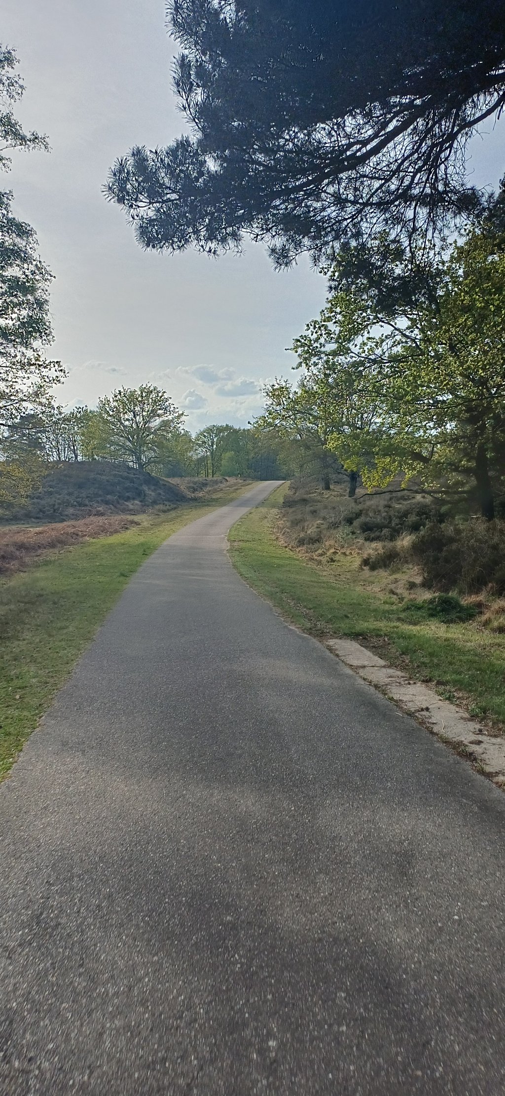
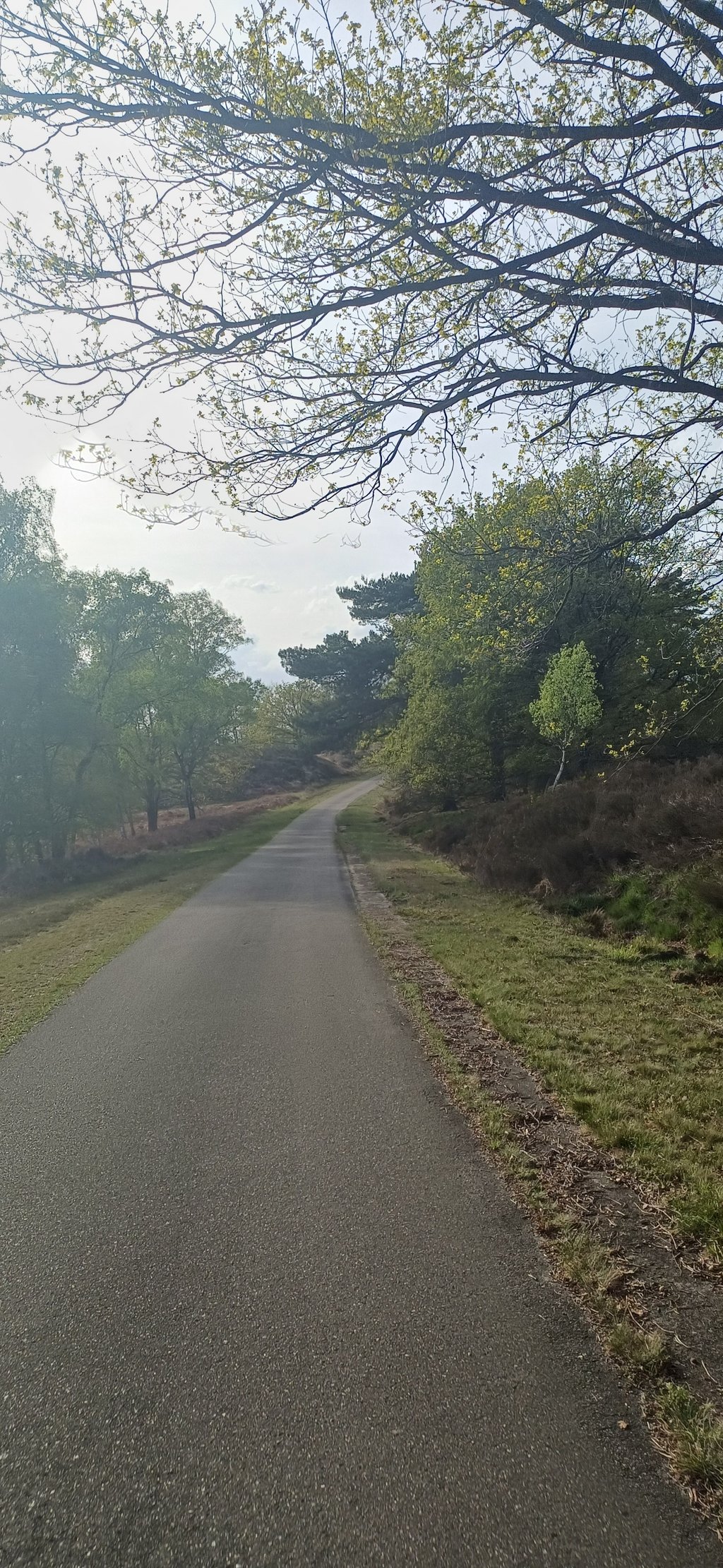
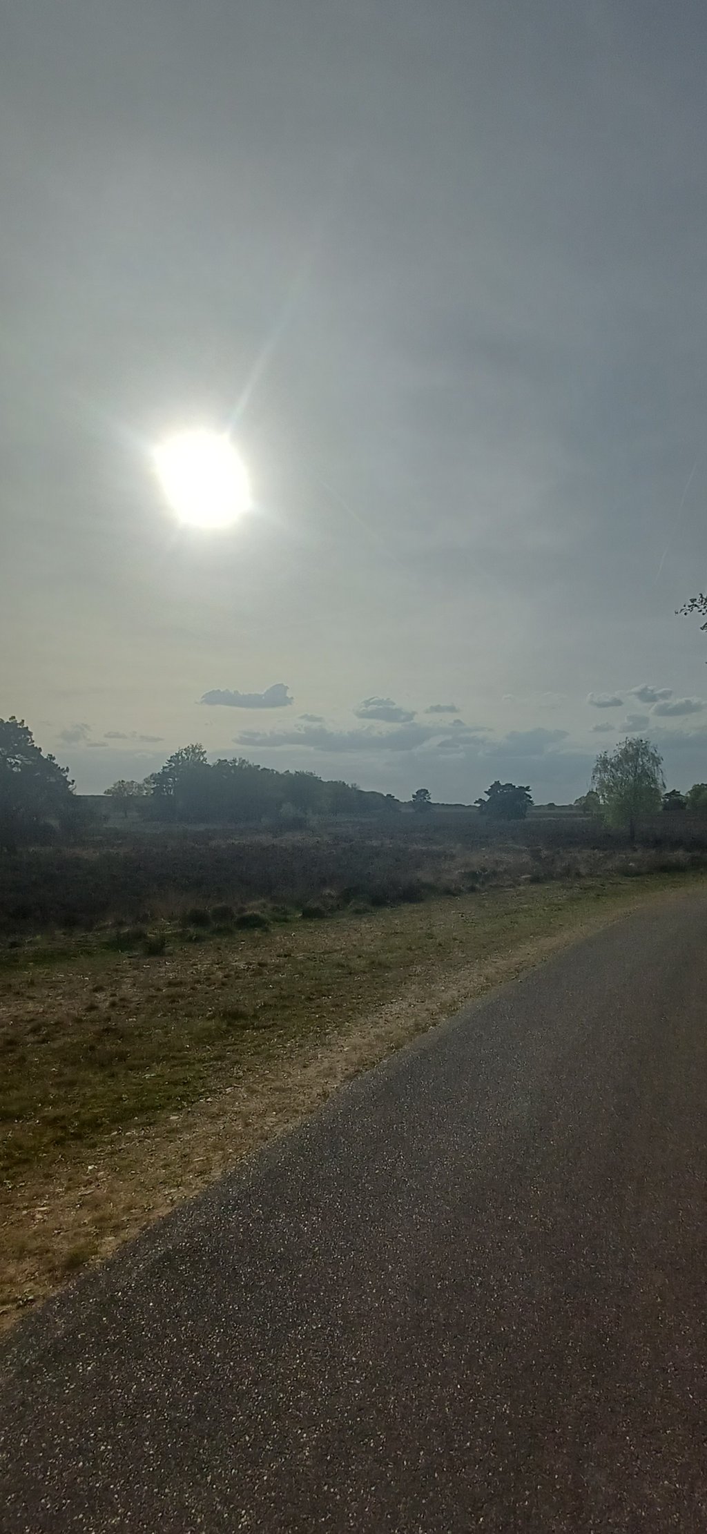
Toeristische weg is a climb in the region Kempens Plateau. It is 2.3 km long and bridges 24 m of vertical ascent with an average gradient of 1%, resulting in a difficulty score of 5. The top of the ascent is located at 86 m above sea level. Climbfinder users shared 2 reviews of this climb and uploaded 3 photos.

Road name: Toeristische weg

This is an automatic translation, the original language is: Dutch.
It's not really a climb, but a long undulating cycle path. You cycle through the moors here, for the scenery it's worth it though... read more

Photos (3)

Toeristische weg
Toeristische weg
Toeristische weg
transparant thumb
transparant thumb
transparant thumb

Your uploads (max 4)

Welcome! Please activate your account if you would like to share something. Look for the verification email in your inbox.

If you want to upload your photos, you need to create an account. It only takes 1 minute and it's completely free.

  • Receive free climbfinder goodies for your reviews & photos.
  • Create a bucket list and check off conquered climbs.
  • Add missing climbs.
Continue with GoogleContinue with Google Continue with FacebookContinue with Facebook Continue with AppleContinue with Apple Sign up with email
By signing up you agree to our terms of service and confirm that you have read our privacy & content policy.

Reviews (2)

5.0
4.0
3.0
2.0
1.0
JorritPaesen
1 Mo 4.0
This is an automatic translation, the original language is: Dutch. Show original

It's not really a climb, but a long undulating cycle path. You cycle through the moors here, for the scenery it's worth it though

Echt een klim is het niet, wel een lang golvend fietspad. Je fietst hier door de heide, voor de omgeving is het wel de moeite

Toeristische weg
Toeristische weg
Toeristische weg
Dashboard
depolle
1 y 5.0
This is an automatic translation, the original language is: Dutch. Show original

Undoubtedly one of the most beautiful parts of Limburg. Consequently, this undulating road runs right through the nature and heathland area of Ten Haagdoornheide. The grazing flock of sheep add an extra accent to the scene. Without climbing anywhere really noticeable, perhaps the steepest bit in this driving direction is even in a descending line, this beautiful piece of nature certainly has its place on this climbing site. For many years in the past, this location was the setting for training riders during group training sessions.

Ongetwijfeld een van de mooiste stukjes van Limburg. Deze golvende weg loopt dan ook midden door het natuur- en heidegebied Ten Haagdoornheide. De grazende kudde schapen geven het geheel nog een extra accent. Zonder ergens echt opvallend te klimmen, wellicht is het steilste stukje in deze rijrichting zelfs in dalende lijn, heeft dit prachtig stukje natuur zeker zijn plaats op deze klimsite. In het verleden vormde deze locatie vele jaren het decor van trainende renners tijdens groepstrainingen.

Dashboard

Climbing times

7 km/h 00:19:26
11 km/h 00:12:22
15 km/h 00:09:04
19 km/h 00:07:09

Road surface condition

0% 0% 0%
Based on 0 votes
Share your knowledge. What was the road condition during your ascent?

Traffic

0% 0% 0%
Based on 0 votes
Your experience counts. How much traffic did you encounter during the climb?

Frequently Asked Questions

You don't need special gearing for Toeristische weg. The slope isn't long or steep enough to require much shifting down. You can conquer this climb on power alone. However, a compact gearing system with a smallest front chainring of 34 and largest rear sprocket of 28 or 30 is always nice if you enjoy cycling uphill. This helps maintain a smooth cadence.

Toeristische weg is not tough enough to be assigned a mountain category. This means that even untrained cyclists can reach the top without any problems on this climb.

Toeristische weg is 2.3 km long.

The average gradient of Toeristische weg is 1%.

Toeristische weg has a steepest segment with an average gradient of 3.5%.

The summit of Toeristische weg is at 86 m.

At a slow pace of 7 km/h, it takes about 00:19:26 to climb Toeristische weg. At 11 km/h the time is 00:12:22, and at 15 km/h 00:09:04. For the fastest cyclists, 00:07:09 is an achievable time.

Toeristische weg is located in the region Belgium Limburg in Belgium.

This page is better in the app

Climbfinder app
Climbfinder
(Free)
Open