Thommerberg from Bracht via Wommesweg

Elevation profile Thommerberg from Bracht via Wommesweg
106
difficulty points
5.1%
avg. gradient
15.4%
steepest 100 meters
2.9km
length
149m
total ascent

Share this climb

10149

Feedback about this climb?
Show climbs nearby

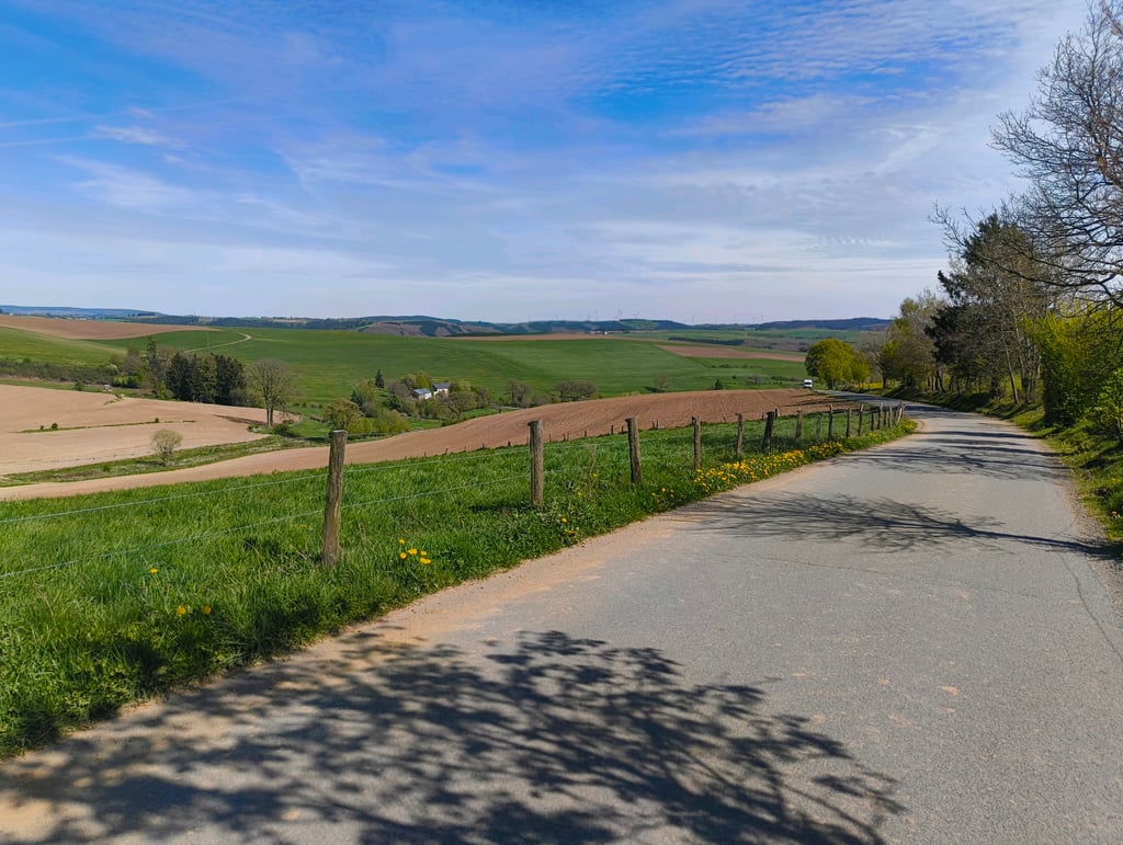
Thommerberg from Bracht via Wommesweg is a climb in the region High Fens & East Cantons. It is 2.9km long and bridges 149 vertical meters with an average gradient of 5.1%, resulting in a difficulty score of 106. The top of the ascent is located at 507 meters above sea level. Climbfinder users shared 0 reviews/stories of this climb and uploaded 0 photos.

Road names: Bracht, von-Montigny-Straße & Wommesweg

1%
2%
4%
6%
8%
10%
12%
15%
20%
Click on the climb for street view
Show climbs nearby

Photos (0)

If you want to upload your photos, you need to create an account. It only takes 1 minute and it's completely free.

  • Add photos of your conquered climbs.
  • Share your experience on all ascents you've climbed
  • Submit your favorite climbs
Sign up

Already have an account?

Statistics

Thommerberg from Bracht via Wommesweg
This climb
High Fens & East Cantons
399 climbs
Liège Province
1665 climbs
Belgian Ardennes
2765 climbs
Ardennes
3340 climbs
Wallonia
4893 climbs
Belgium
7532 climbs
Europe
32373 climbs
Difficulty points
106
4
rank
51
50% easier than
Ferme Libert
rank
281
67% easier than
Super Stockeu from Stavelot
rank
420
69% easier than
Col de Haussire
rank
558
69% easier than
Col de Haussire
rank
475
69% easier than
Col de Haussire
rank
485
69% easier than
Col de Haussire
rank
13720
Average gradient
5.1%
rank
141
70% less steep than
Edelstrasse from Eupen
rank
741
70% less steep than
Edelstrasse from Eupen
rank
1122
71% less steep than
La Goulette from Olloy-sur-Viroin
rank
1373
78% less steep than
Kuesselt from Welscheid
rank
1791
71% less steep than
La Goulette from Olloy-sur-Viroin
rank
2306
71% less steep than
La Goulette from Olloy-sur-Viroin
rank
15570
83% less steep than
Calçada do Rêgo Lameiro
Length
2.9km
rank
78
82% shorter than
Pannensterzkopf via Ternell
rank
302
82% shorter than
Pannensterzkopf via Ternell
rank
598
82% shorter than
Pannensterzkopf via Ternell
rank
765
82% shorter than
Pannensterzkopf via Ternell
rank
728
82% shorter than
Pannensterzkopf via Ternell
rank
779
82% shorter than
Pannensterzkopf via Ternell
rank
13719
Total ascent
149m
rank
55
68% less ascent than
Pannensterzkopf via Ternell
rank
271
69% less ascent than
Signal de Botrange from Membach
rank
480
69% less ascent than
Signal de Botrange from Membach
rank
635
69% less ascent than
Signal de Botrange from Membach
rank
515
69% less ascent than
Signal de Botrange from Membach
rank
514
69% less ascent than
Signal de Botrange from Membach
rank
13684

Classification

Famous climb
Beautiful scenery
Hidden gem
0 hairpin turns

Road surface condition

0% 0% 0%
Based on 0 votes
Share your knowledge. What was the road condition during your ascent?

Traffic

0% 0% 0%
Based on 0 votes
Your experience counts. How much traffic did you encounter during the climb?

Climbing times

7 km/h 00:25:04
11 km/h 00:15:57
15 km/h 00:11:42
19 km/h 00:09:14

Popular

Reviews/stories (0)

Add my review/story

If you want to share something you need to create an account. It only takes 1 minute and it's completely free.

  • Add photos of your conquered climbs.
  • Share your experience on all ascents you've climbed
  • Submit your favorite climbs
Sign up

Already have an account?