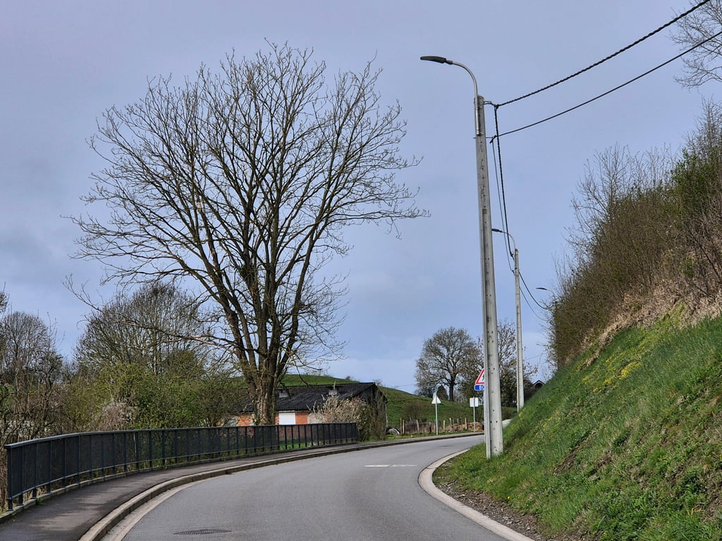
Thier de Villers from Limbourg is a climb in the region Pays de Herve. It is 1.3 km long and bridges 70 m of vertical ascent with an average gradient of 5.2%, resulting in a difficulty score of 40. The top of the ascent is located at 271 m above sea level. Climbfinder users shared 8 reviews of this climb and uploaded 9 photos.
Road names: Rue Moulin en Rhuff & Thier de Villers
1.0 by BikerJohanThis is an automatic translation, the original language is: Dutch.There has been hard work at this location over the past month. The tunnel under the railway line is now open to all traffic again.... read more

Welcome! Please activate your account if you would like to share something. Look for the verification email in your inbox.
If you want to upload your photos, you need to create an account. It only takes 1 minute and it's completely free.
There has been hard work at this location over the past month. The tunnel under the railway line is now open to all traffic again.
Er is op deze locatie de afgelopen maand hard doorgewerkt. Het tunneltje onder de spoorlijn is inmiddels weer open voor alle verkeer.
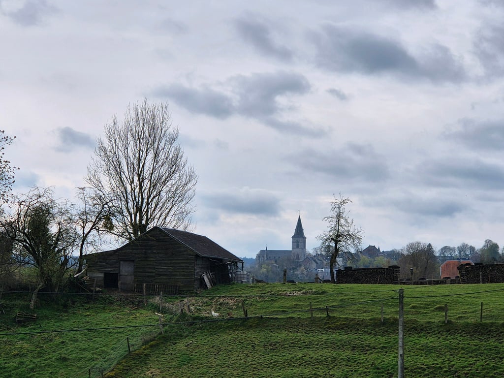
Seen from Dolhain, the little tunnel under the railway line at the start of the climb is closed to all traffic for a long time. To get to the other side of the railway line as a cyclist, there is the following diversions: on Rue de la Fontaine, turn right onto the dead-end Rue du Vinical. You ride over fine cobblestones until you reach the train station's P-plot. There you turn left onto the concrete path and drive under the station via the small tunnel. You can then continue the climb on the other side of the railway line.
Vanuit Dolhain gezien is het tunneltje onder de spoorlijn aan het begin van de klim voor langere tijd afgesloten voor alle verkeer. Om als fietser aan de andere kant van de spoorlijn te komen is er de volgende omleiding: op Rue de la Fontaine ga je rechtsaf de doodlopende Rue du Vinical op. Je rijdt over prima liggende kasseien tot aan de P-plaats van het treinstation. Daar ga je linksaf het betonpad op en via een tunneltje rij je onder het station door. Aan de andere zijde van de spoorlijn kan je de klim dan vervolgen.
Runs well, excellent road surface but in terms of environment and traffic it could be better.
Loopt goed, prima wegdek maar qua omgeving en verkeersdrukte kan het wel beter.
Not a nice climb, not a difficult one either. Is just a climb you have to cross when passing from the High Fens back to Flanders.
Geen mooie klim, ook geen moeilijke klim. Is gewoon een klim die je over moet als je passeert van de Hoge Venen terug naar Vlaanderen.
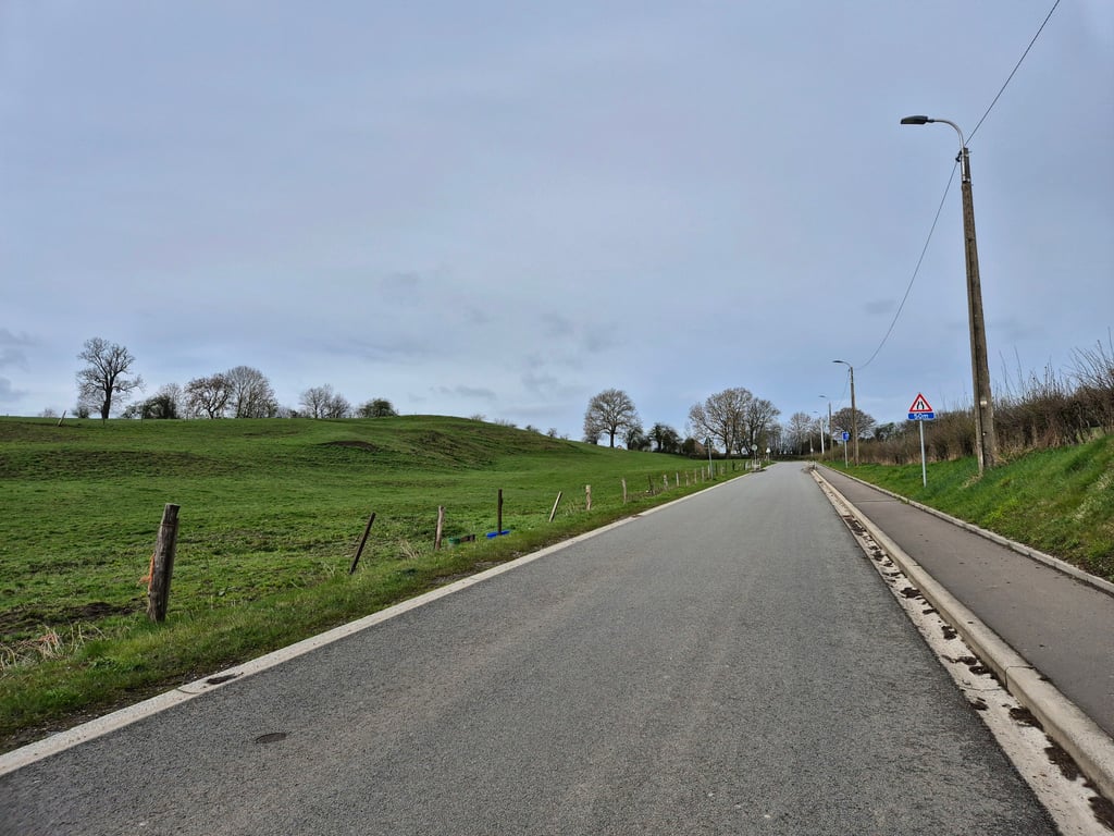
Fine running climb of over 1 kilometre from Limbourg to Bilstain. The climb starts even before the railway tunnel at the same point where the Polenterie climb starts. The first 300 metres is false flat. Then it goes in a reasonably tight gradient towards the top.
Prima lopende klim van ruim 1 kilometer vanuit Limbourg naar Bilstain. De klim start al voor het spoortunneltje op hetzelfde punt waar de klim van Polenterie begint. De eerste 300 meter is vals plat. Daarna gaat het in een redelijk strak stijgingspercentage richting de top.
Nice runner from the village of Limbourg, sometimes there is some traffic but it's all pretty neat. The climb itself is not too difficult. At the top, you are at the foot of the Voer region. If you look behind you, you can see the Ardennes.
Mooie loper vanuit het dorpje Limbourg, soms is er wel wat verkeer maar dat is vrij netjes allemaal. De klim zelf is niet al te lastig. Bovenop sta je aan de voet van de Voerstreek. Kijk je achter je, dan zie je de Ardennen.
Just a nice climb over excellent tarmac towards Bilstain. Starts relaxed but after the wide hairpin turn at the station the percentage goes up and follows a reasonable runner through greenery. You follow a valley so there are not many views in the second part.
Gewoon een lekkere klim over uitstekend asfalt richting Bilstain. Begint relaxed maar na de ruime haarspeldbocht bij het station gaat het percentage omhoog en volgt een redelijke loper door het groen. Je volgt een dalletje dus veel uitzicht is er in het tweede gedeelte niet.
Nice climb from the center of Dolhain to the north. First a bit of searching between the houses and then the climb starts under the railway tunnel. Nice is the hairpin in the first part. Then a steeper part and the spur. Much easier than the Rue Joseph Wauters.
Leuke klim vanuit het centrum van Dolhain naar het noorden. Eerst wat zoeken tussen de huizen door en dan start de klim onder het spoorwegtunneltje. Mooi is de haarspeld in het eerste deel. Dan een wat steiler stuk en de uitloper. Veel makkelijker dan de buur Rue Joseph Wauters.
| 7 km/h | 00:11:32 |
| 11 km/h | 00:07:20 |
| 15 km/h | 00:05:23 |
| 19 km/h | 00:04:15 |
This page is better in the app